Memphis, TN
Weather Forecast Office
2011 Flood Extent of the Mississippi River
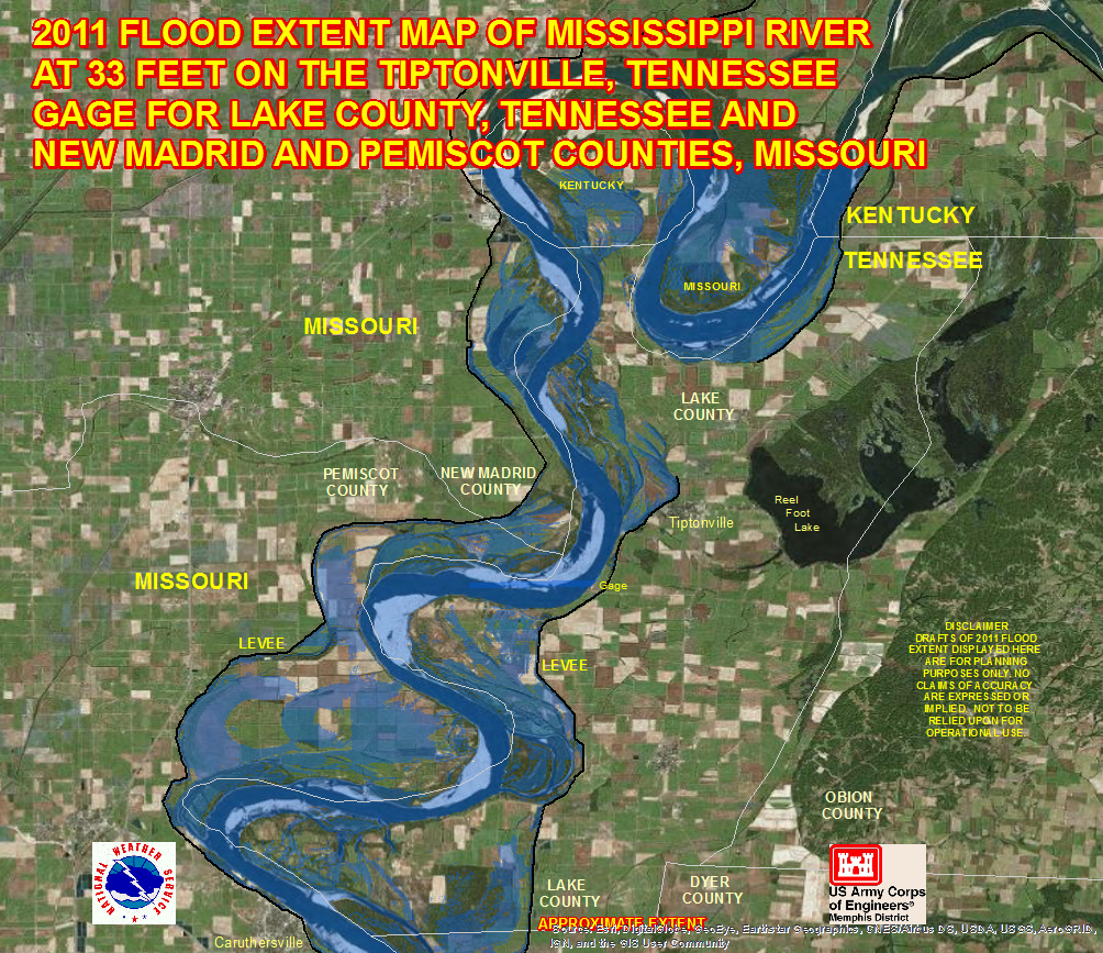
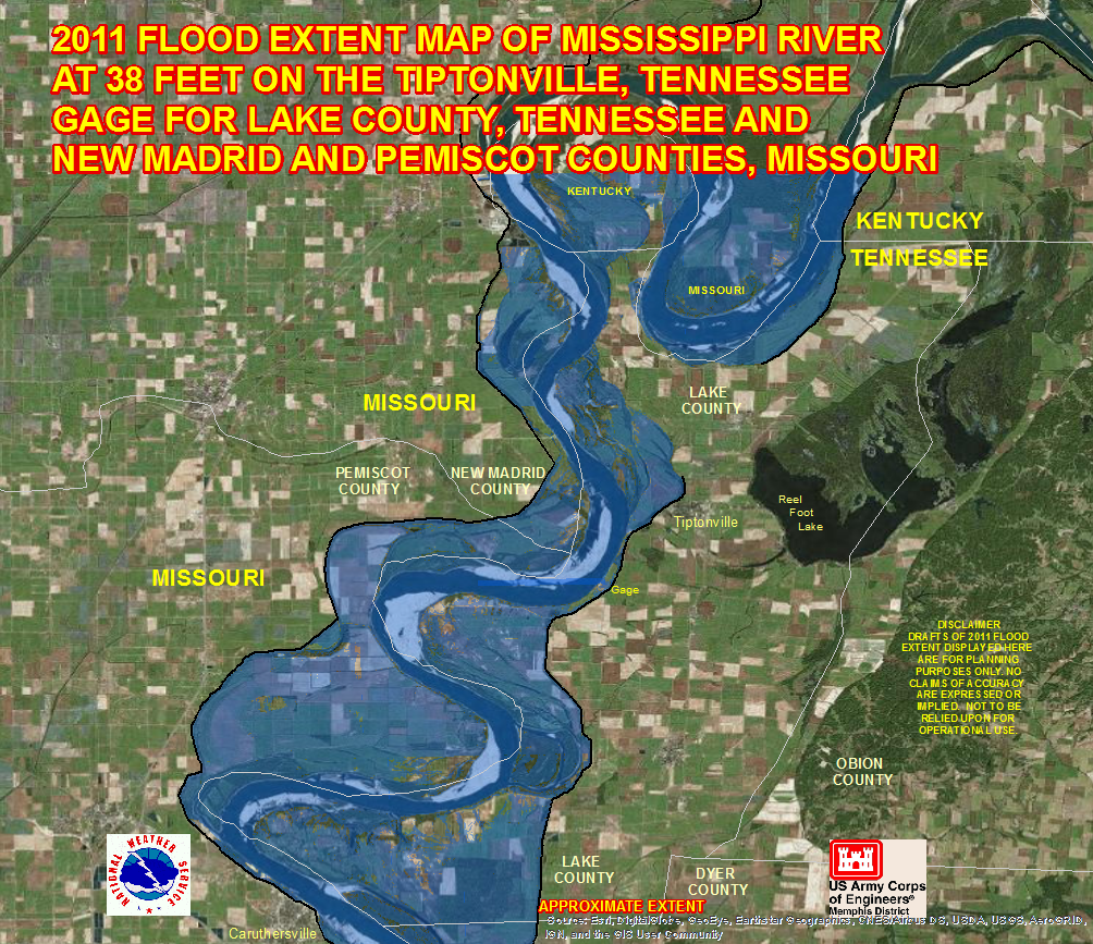
Tiptonville Gage - Pemiscot Co, MO and Lake Co, TN Area: 33ft 38ft
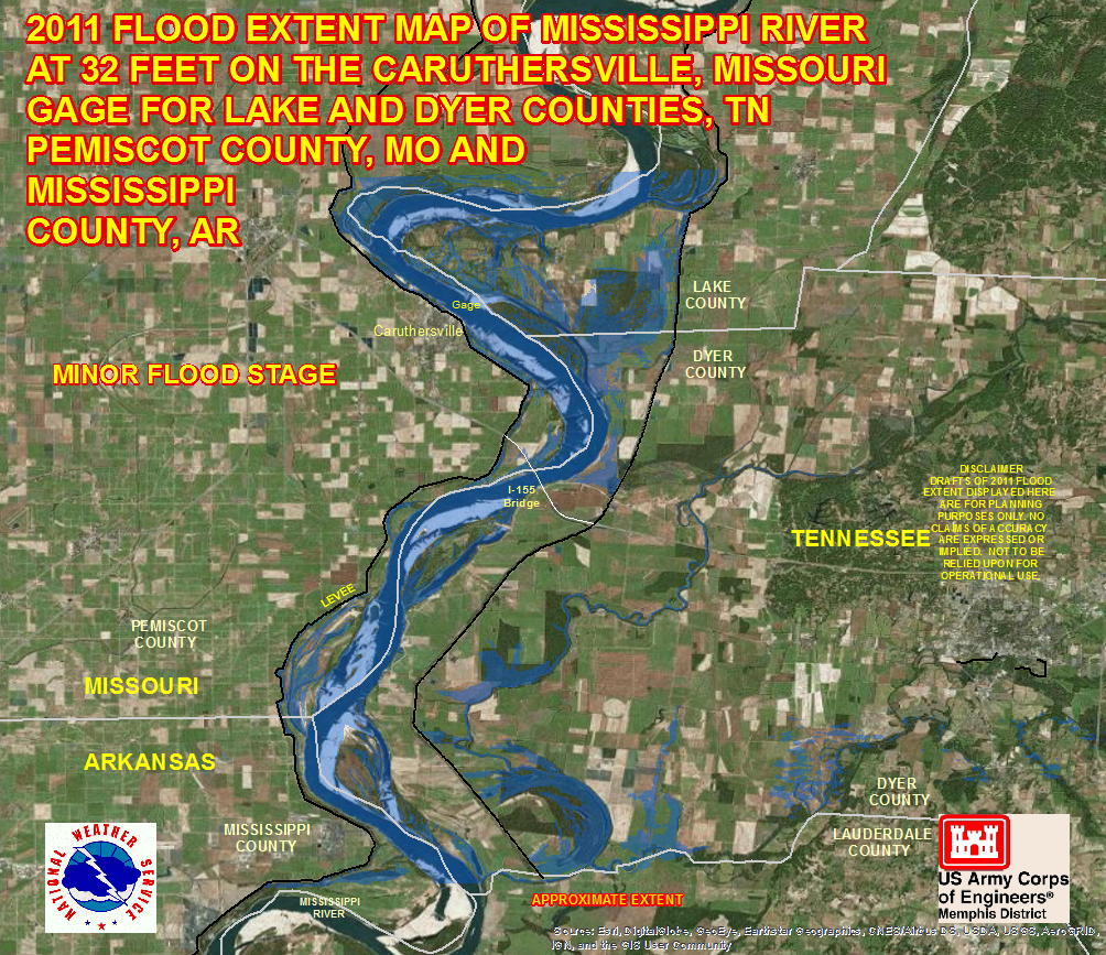
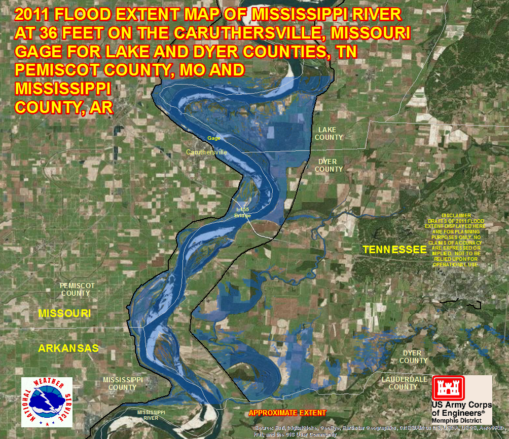
Caruthersville Gage - Pemiscot Co, MO, Southern Lake Co, TN and Dyer Co, TN Area: 32ft 36ft
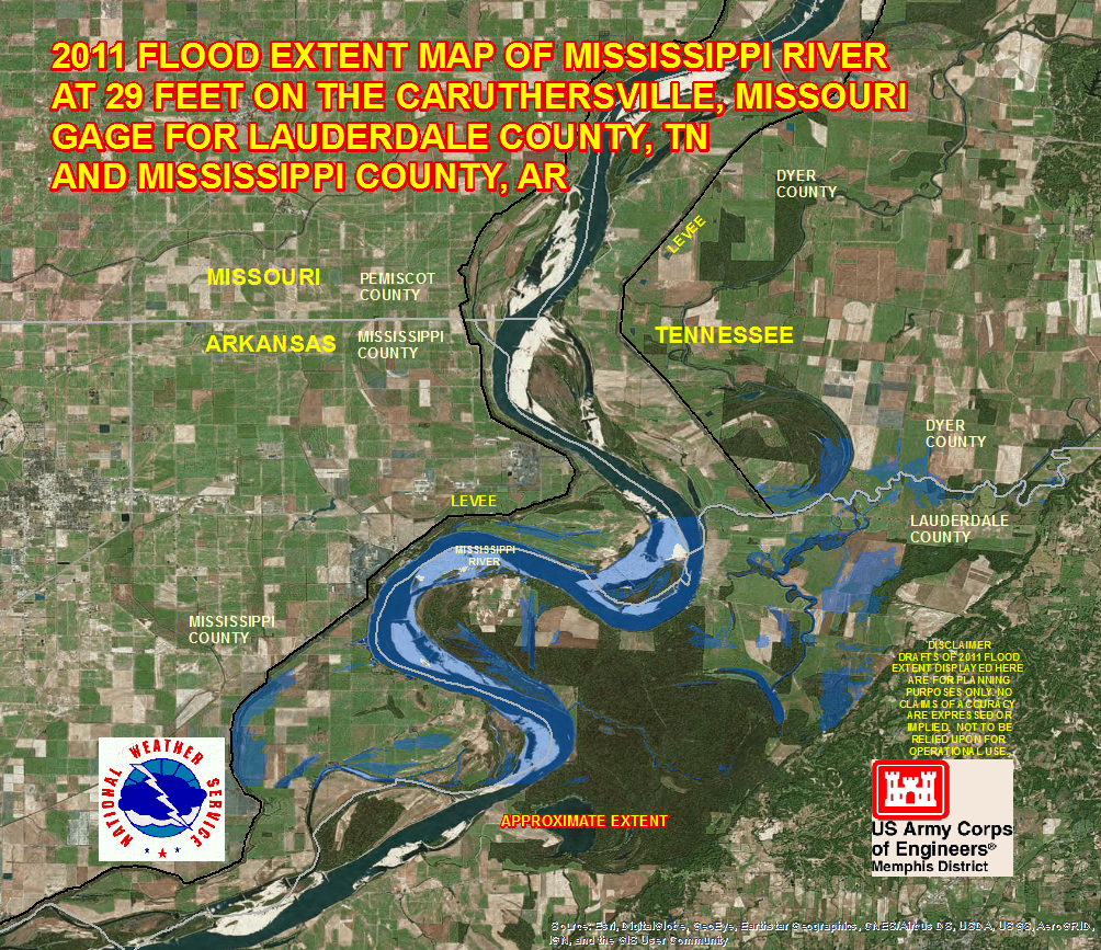
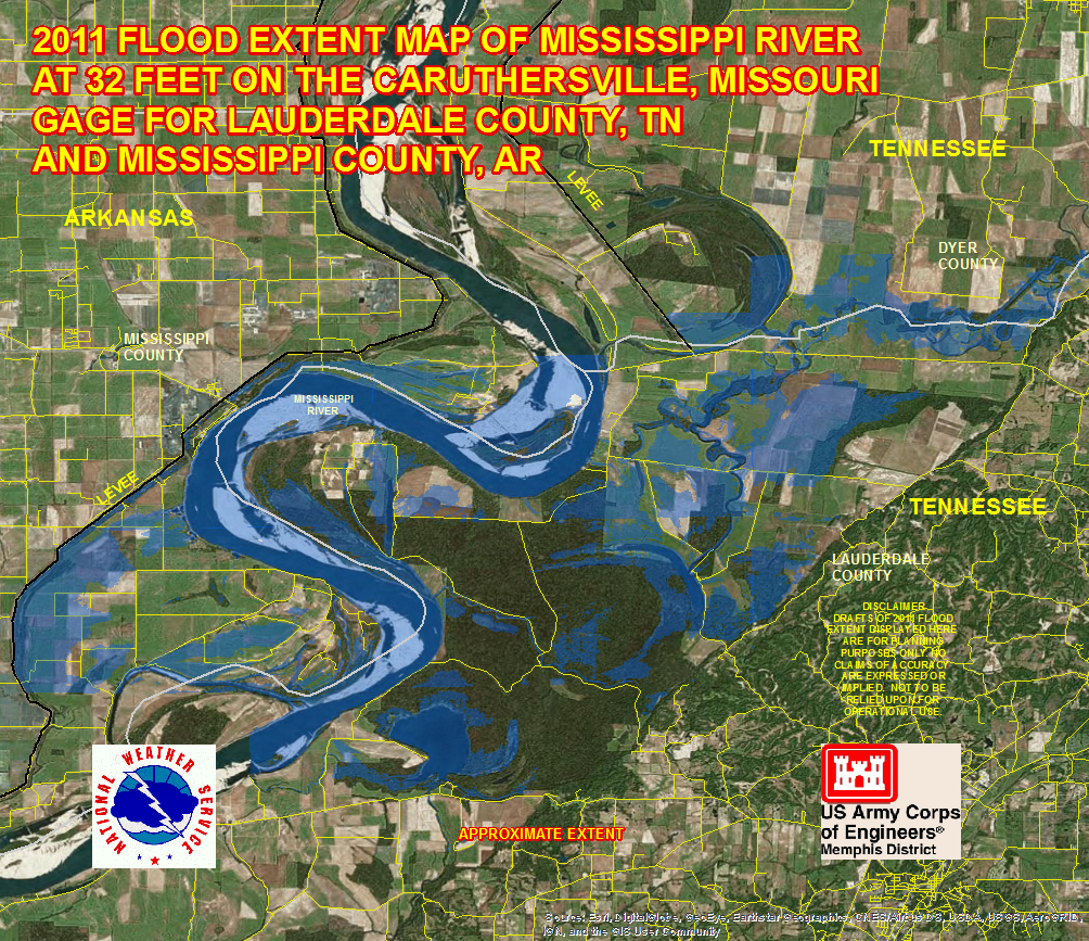
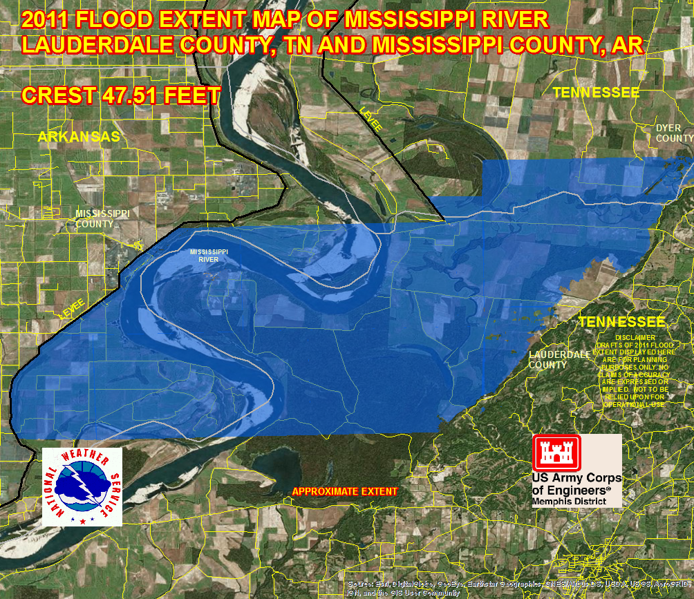
Caruthersville Gage - Lauderdale Co, TN Area: 29ft 32ft 47.51ft
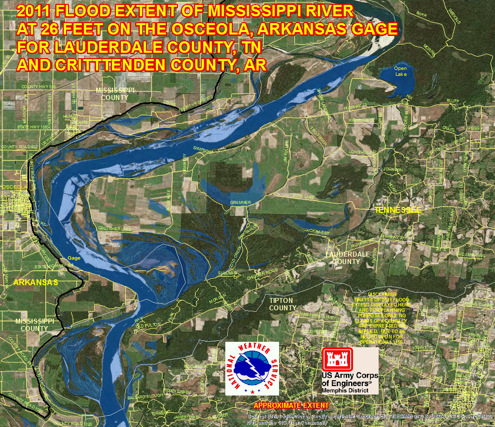
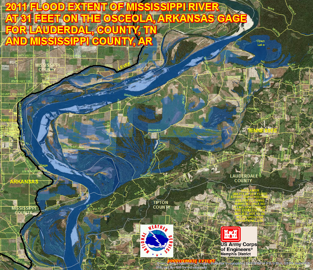
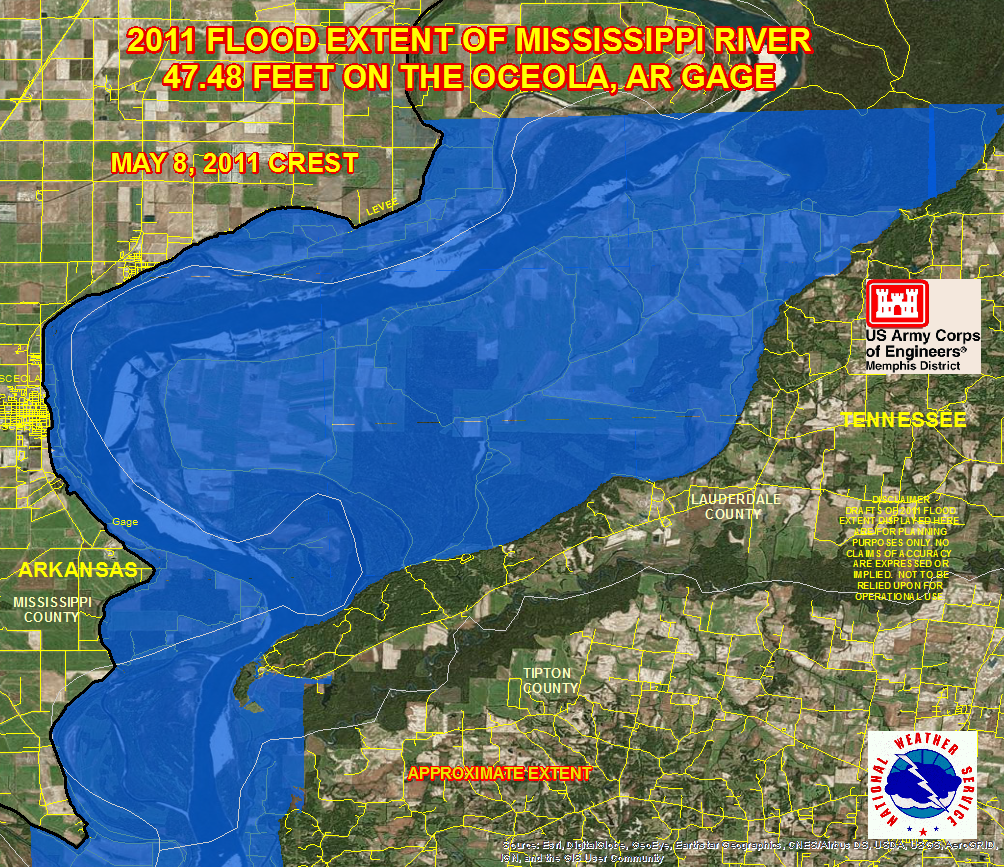
Osceola Gage - Mississippi Co, AR and South Bottom Lauderdale Co, TN Area: 26ft 31ft 47.48ft
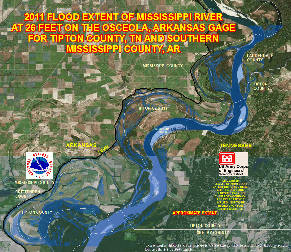
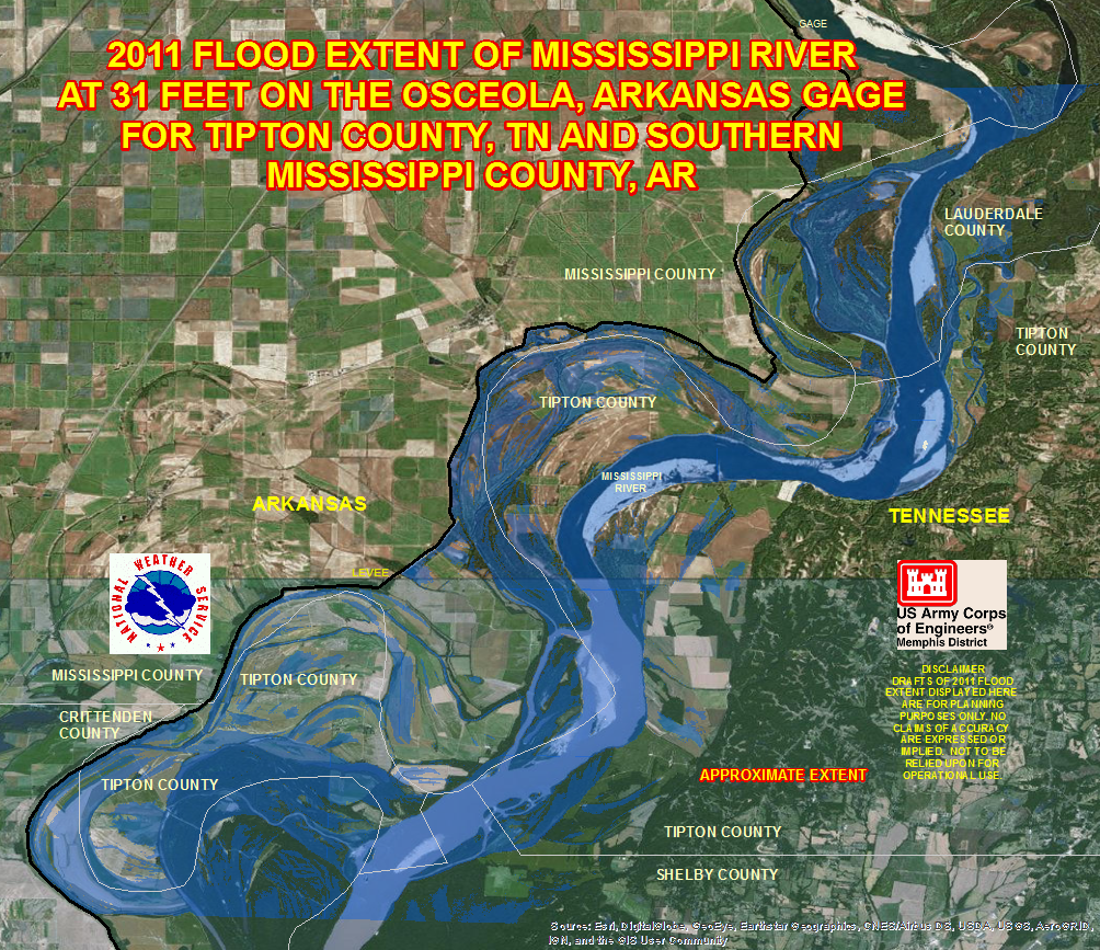
Osceola Gage - Tipton Co, TN and South Mississippi Co, AR Area: 26ft 31ft
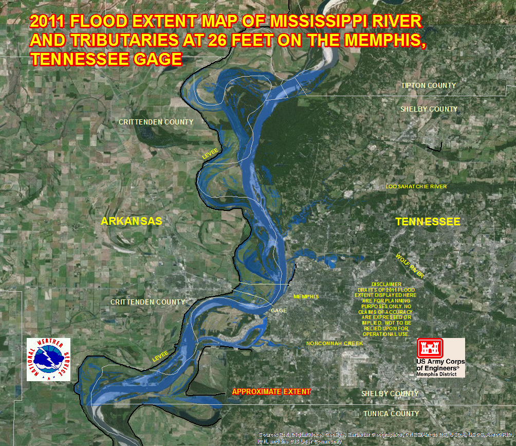
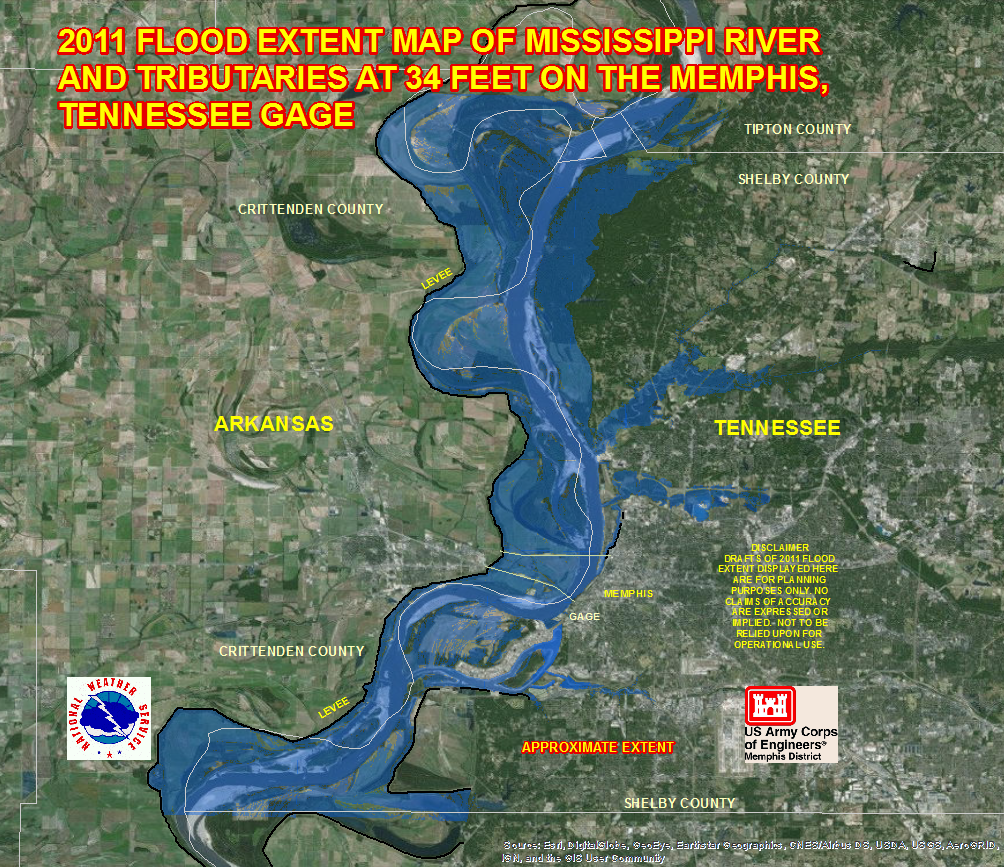
Memphis Gage - Shelby Co, TN and Crittenden Co, AR Area: 26ft 34ft
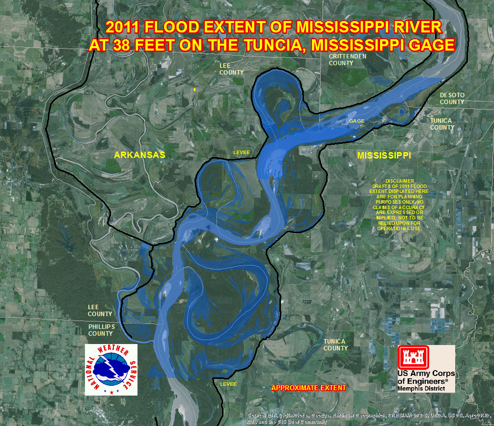
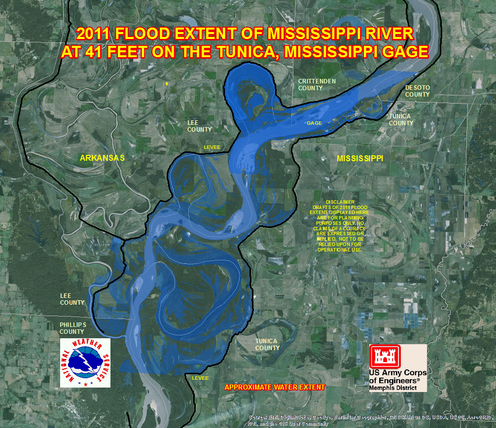
Tunica Riverpark Gage - Tunica Co, MS and Lee Co, AR Area: 38ft 41ft
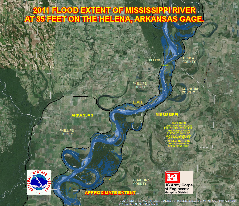
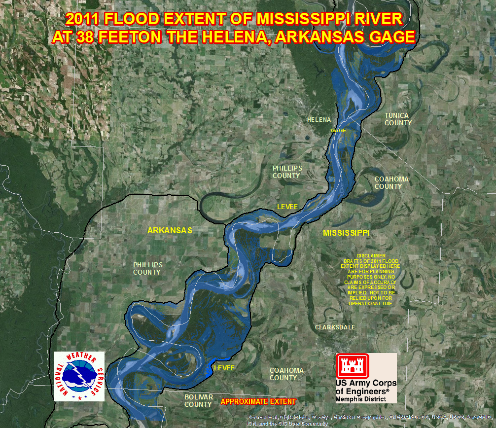
Helena Gage - Coahoma Co, MS, Southern Tunica Co, MS, and Phillips Co, AR Area: 35ft 38ft
CURRENT HAZARDS
Briefing Page
Outlooks
Submit a Storm Report
Submit a Storm Photo
View Storm Report
Spot Forecast Request
Hazard Outlook
FORECASTS
Local
Graphical
Probabilistic
Precipitation
Aviation
Fire
Severe Weather
Winter Weather
Tropical Weather
Air Quality
US Dept of Commerce
National Oceanic and Atmospheric Administration
National Weather Service
Memphis, TN
7777 Walnut Grove Road, OM1
Memphis, TN 38120
(901) 544-0399
Comments? Questions? Please Contact Us.

