Memphis, TN
Weather Forecast Office
Current Weather
|
Observation Products
|
|
| Hourly Observations (RWR): Midsouth, TN, MS, AR, and MO |
|
| Local Storm Reports (LSR) | Daily Cocorahs Observations (LCO) |
| Snowfall reports (24hrs) | Daily River Stages (RVA) |
|
Current Weather Maps
|
||
Satellite Images |
Radar Images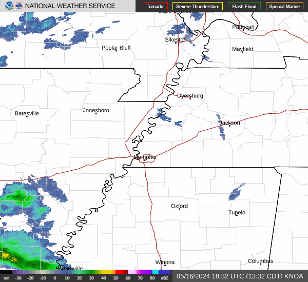 |
Daily Observation GIS Maps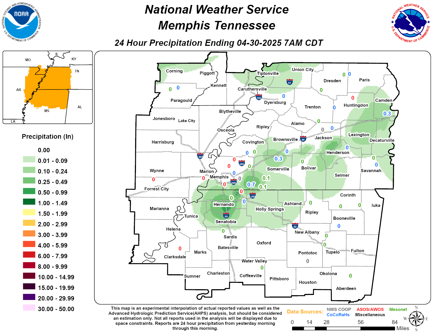 |
Current Weather Map |
Surface Analysis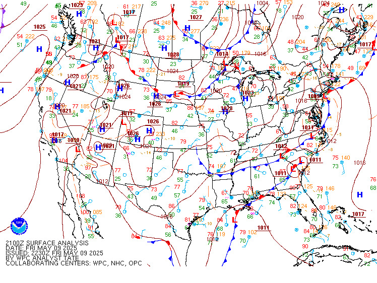 |
Surface Weather Plots |
Current Weather Observations... | |||||||||||||||||||||||||||||||||||||||||||||||||||||||||||||||||||||||||||||||||||||||||||||||||||||
|
CURRENT HAZARDS
Briefing Page
Outlooks
Submit a Storm Report
Submit a Storm Photo
View Storm Report
Spot Forecast Request
Hazard Outlook
FORECASTS
Local
Graphical
Probabilistic
Precipitation
Aviation
Fire
Severe Weather
Winter Weather
Tropical Weather
Air Quality
US Dept of Commerce
National Oceanic and Atmospheric Administration
National Weather Service
Memphis, TN
7777 Walnut Grove Road, OM1
Memphis, TN 38120
(901) 544-0399
Comments? Questions? Please Contact Us.

