Memphis, TN
Weather Forecast Office
Severe Weather
|
Relevant Links to Severe Weather
|
|
Local Hazards: Warnings and Advisories Storm Prediction Center Home Page |
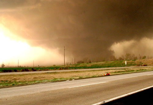
Tornado near Caruthersville, Missouri. Photo by Scott McCord. |
|
Current Conditions - Radar and Satellite Imagery, Surface Observations
|
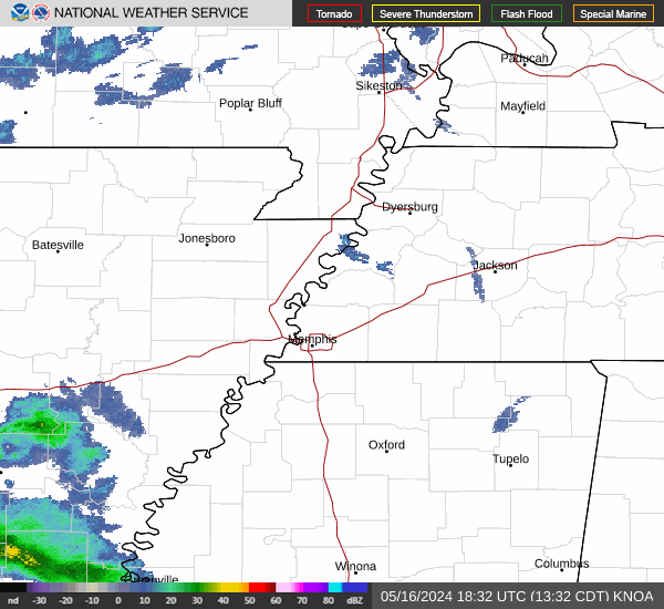
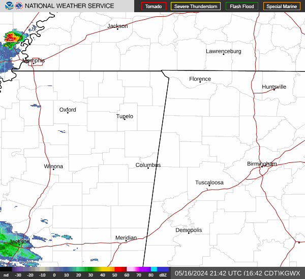
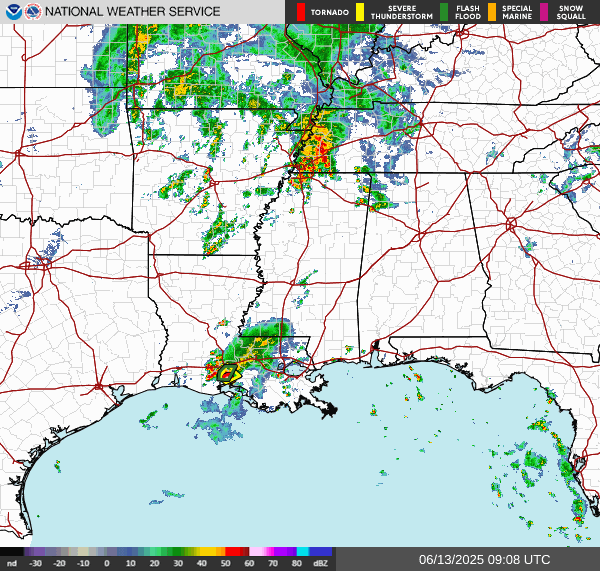
| Millington, TN Radar | Columbus, MS Radar | Regional Radar |
 |
 |
 |
| Recent Surface Observations | Visible Satellite | Infrared Satellite |
 |
 |
 |
|
Severe Weather Watches and Mesoscale Discussions
|
| Watches | Mesoscale Discussions |
 |
 |
|
National Severe Weather Convective Outlooks
|
| Day 1 Outlook | Day 2 Outlook | Day 3 Outlook |
 |
 |
 |
|
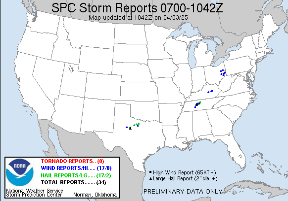
Recent Storm Reports
|
| Today's Storm Reports | Storm Reports - Last 3 Hours | Yesterday's Storm Reports |
 |
 |
 |
|
Additional Information
|
| Text Products | Additional Links |
|
Storm Prediction Center Mesoanalysis |
CURRENT HAZARDS
Briefing Page
Outlooks
Submit a Storm Report
Submit a Storm Photo
View Storm Report
Spot Forecast Request
Hazard Outlook
FORECASTS
Local
Graphical
Probabilistic
Precipitation
Aviation
Fire
Severe Weather
Winter Weather
Tropical Weather
Air Quality
US Dept of Commerce
National Oceanic and Atmospheric Administration
National Weather Service
Memphis, TN
7777 Walnut Grove Road, OM1
Memphis, TN 38120
(901) 544-0399
Comments? Questions? Please Contact Us.

