Memphis, TN
Weather Forecast Office
Radar Images:
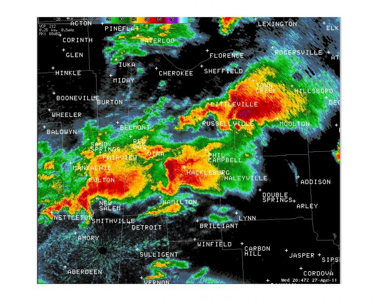
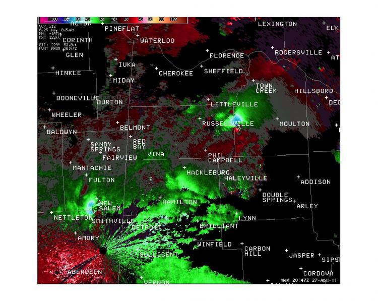
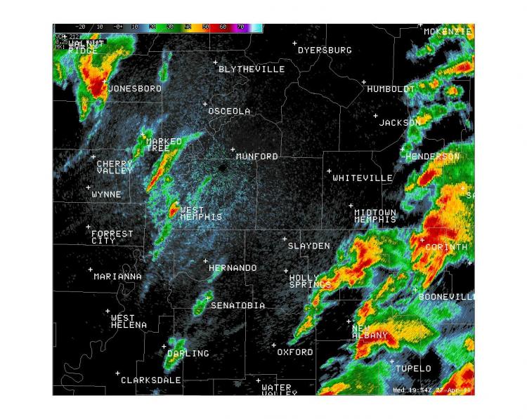
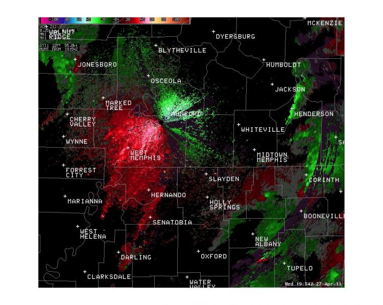
Here are two interesting sets of radar images. The first row of images displays two storms that were producing EF-5 tornadoes simultaneously. The second row of images displays three separate storms that were producing tornadoes simultaneously.
 |
 |
 |
 |
Satellite Images:
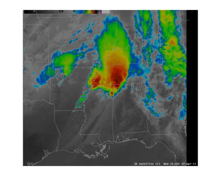
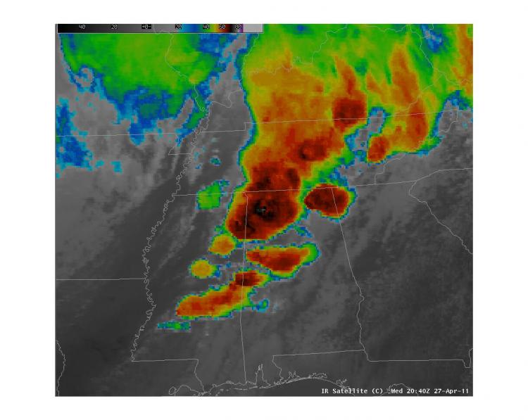
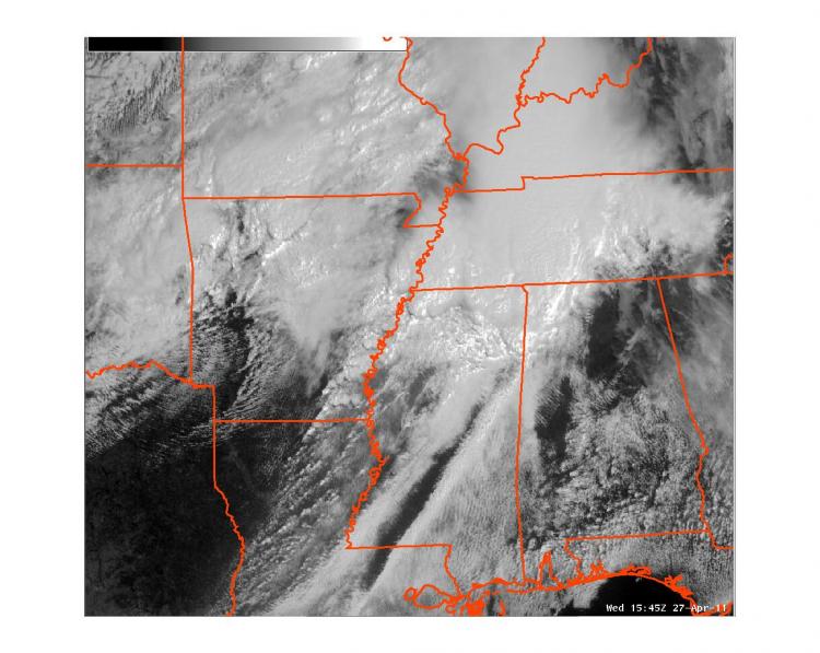
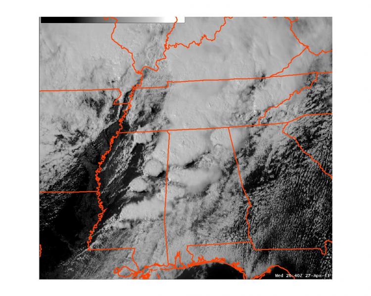
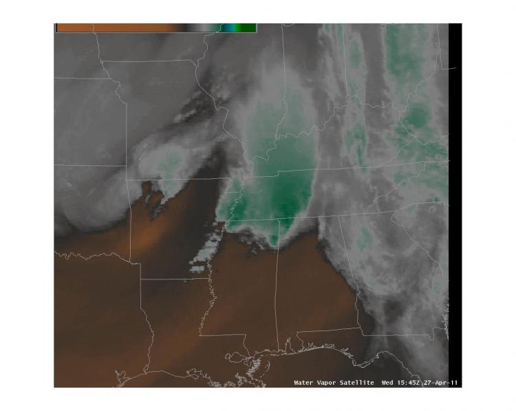
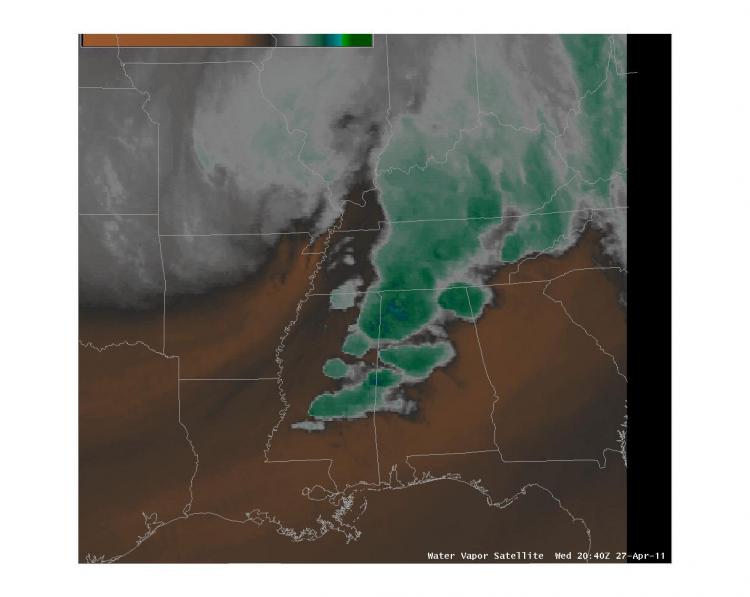
Here are a few satellite images from the tornado outbreak. The top row of images are infrared satellite images, the middle row of images are visible satellite images, and the bottom row of images are water vapor images. The three images in the left column show the first supercells beginning to develop near the Mississippi River. These storms developed along a dryline and ahead of a strong upper level disturbance. The images in the right column show the tornado outbreak in progress. In the images on the right, you can see the storms that produced the Smithville EF-5 tornado (over Northeastern Mississippi), the storm that produced the Hackelburg and Phil Cambpell EF-5 Tornado (over Northern Alabama), and the storm that eventually produced the Tuscaloosa and Birmingham EF-4 Tornado (developing over east central Mississippi). You can also see numerous other supercell thunderstorms that produced other tornadoes as well.
 |
 |
 |
 |
 |
 |
CURRENT HAZARDS
Briefing Page
Outlooks
Submit a Storm Report
Submit a Storm Photo
View Storm Report
Spot Forecast Request
Hazard Outlook
FORECASTS
Local
Graphical
Probabilistic
Precipitation
Aviation
Fire
Severe Weather
Winter Weather
Tropical Weather
Air Quality
US Dept of Commerce
National Oceanic and Atmospheric Administration
National Weather Service
Memphis, TN
7777 Walnut Grove Road, OM1
Memphis, TN 38120
(901) 544-0399
Comments? Questions? Please Contact Us.

