National Weather Service United States Department of Commerce

Another Round of Heavy Rain and Mountain Snow in California; Snow in the Great Lakes and Northeast

Another round of heavy rainfall will renew concerns for additional flash flooding and landslides in southern California around burn scars and coastal mountain ranges. A low pressure system is bringing enhanced snowfall downwind from the lower Great Lakes into the Northeast mountain ranges. Above average temperatures will challenge or break daily record high temperatures across the southern Plains. Read More >

June Precipitation Highlights:
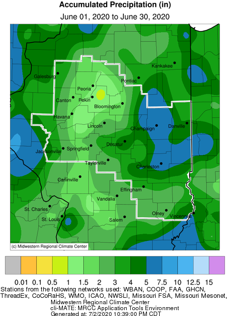
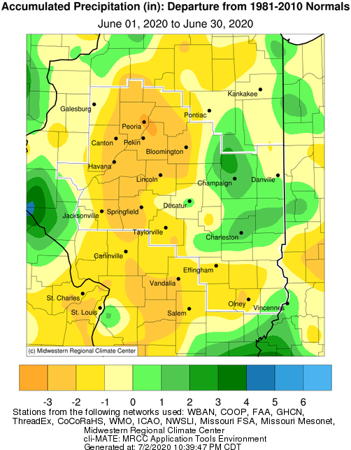
  • June was a dry month for most of central and southeast Illinois.  The driest conditions were centered near Peoria, Bloomington, and Springfield, where monthly totals under 2" were common.  This pushed monthly deficits to 2-3" in several locations.  The exception to the dryness was over parts of east central IL.  Areas from Champaign south to Charleston and east to Paris saw totals of 5-6", or around 2" above normal.


June Temperature Highlights:

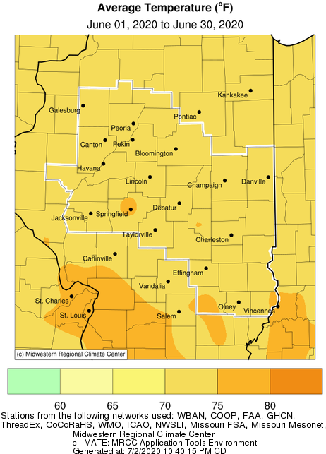
  • June was a warm month across the area.  While no major heat waves were observed, most days saw readings near to a few degrees above normal.  This resulted in monthly average temperatures 1-2 degrees above normal for much of the region.


June Climate Data:

Site

Precipitation
 

Departure from Normal Average Temperature
 
Departure from Normal

Charleston

6.18" +1.83" 74.1 +1.0
Danville

3.49"

-0.94" 73.0 +0.9
Decatur

5.28"

+0.78" 74.2 +0.9
Effingham

2.84"

-1.39" N/A N/A

Flora

2.96" -1.22" 75.6 +1.5
Galesburg 3.67" -0.63" 73.1 +2.0

Havana

1.61" -2.75" N/A N/A

Jacksonville

2.17" -2.41" 73.9 +2.7
Lincoln 2.28" -2.04" 74.3 +2.2

Normal

1.32"

-2.59" 73.2 +1.8

Olney

1.76" -2.43" 73.5 +0.1

Paris

5.77" +1.42" 71.7 -0.8
Peoria

1.64"

-1.89" 74.1 +2.3
Springfield 2.45" -2.01" 75.5 +3.0

Tuscola

7.90" +0.46" 74.2 +1.4
Urbana

5.86"

+1.52" 73.5 +1.3


The following links are the monthly and seasonal climate summaries for area cities. Only the summaries for Peoria, Springfield, and Lincoln are considered "official", meaning they are the station of record for their respective locations. The other summaries are "supplemental", meaning another location in the area is the official climate station for the city.

  • Peoria -- Peoria International Airport
  • Springfield -- Abraham Lincoln Capital Airport
  • Lincoln -- NWS Office
  • Champaign -- University of Illinois-Willard Airport
  • Decatur -- Decatur Airport
  • Lawrenceville -- Lawrenceville-Vincennes International Airport
  • Mattoon -- Coles County Memorial Airport

Climate data for other cities is available at http://w2.weather.gov/climate/xmacis.php?wfo=ilx
 

July Look Ahead:
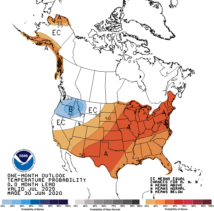
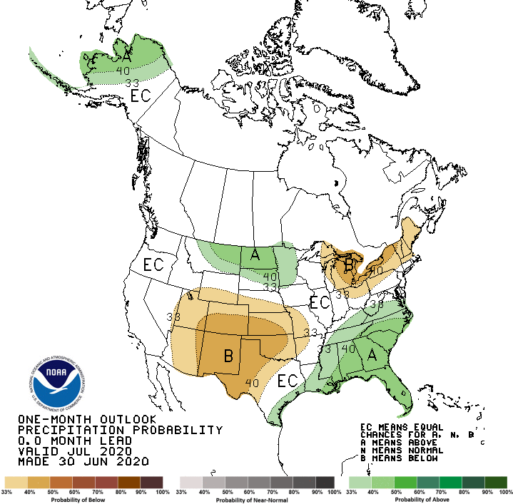
  • Official outlooks from NOAA's Climate Predication center show above normal temperatures favored, and no predictable trends for rainfall.