Isolated severe storms capable of hail and gusty winds are possible mainly this evening across portions of the mid-Mississippi Valley. Clusters of thunderstorms may produce isolated flash flooding in the Florida peninsula. Elevated fire weather risk is possible in the Northern Plains into western Minnesota. Read More >
High/Low Temperatures, Precipitation, Snowfall, Snowdepth maps
Questions or comments may be directed to the webmaster
Latest Text Products
| Aviation Products | |
| Terminal Forecast: Dodge City KS | |
| Terminal Forecast: Garden City KS | |
| Terminal Forecast: Hays KS | |
| Transcribed Weather Broadcast (ICT-GCK) | |
| Transcribed Weather Broadcast (GCK-GLD) | |
| Fire Weather | |
| Fire Weather Forecast | |
| Fire Weather Spot Forecast | |
| Fire Weather Watch/Red Flag Warning | |
| Forecast | |
| Area Forecast Discussion | |
| Coded Cities Forecast | |
| Point Forecast Matrix | |
| Regional Weather Summary | |
| Short Term Forecast | |
| Zone Forecast Product | |
| Miscellaneous | |
| Civil Emergency Message | |
| Earthquake Report | |
| Public Information Statement | |
| Radar Status Message | |
| Record Event Report | |
|
|
|
|
|
|
|
|
|
|
|
|
|
|
|
|
|
|
|
|
Preparedness and Safety Resources
Several .pdf files - Download Adobe Reader
In times of hazardous events and disasters, too often people are not prepared resulting in an even larger disaster. There are some steps you can take to be better prepared in case a hazardous event or disaster occurs in your region. Take the time to visit some of the following resources and get you and your family ready for the next major storm. The FEMA "Are You Ready" book is a comprehensive guide on being prepared. You can order your own copy by calling 1-800-480-2520 and selecting option 1.
Preparedness:
Winter Storms:
Severe Thunderstorms:
Lightning:
Extreme Heat:
Extreme Cold:
Flooding and Flash Flooding:
Drought:
Ultraviolet Radiation:
Resources for Children:
Other Resources:
NOAA WEATHER RADIO
“The Voice of the National Weather Service”
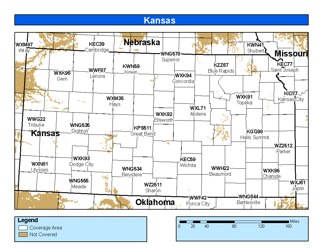
NOAA Weather Radio is the fastest and most reliable way to receive severe weather watches, warnings and advisories. Weather Radio is broadcast direct from each National Weather Service office serving
The All Hazards feature of the radio means that critical information such as evacuations, chemical spills, nuclear releases, toxic fumes etc from local county emergency management, law enforcement and others will be relayed on NOAA Weather Radio. In 2004, NOAA Weather Radio began relaying AMBER Alerts, a child abduction recovery program, issued by the Kansas Bureau of Investigation.
The main NOAA Weather Radio page can be found here.
The map below shows the latest NOAA Weather Radio coverage in

Training and Safety Information
These links are courtesy of the National Weather Service Office in Norman, OK.
National Products
|
NWS Spot Forecasts: Click here to view current/recent spot forecasts or to request a new one
Wildland Fire Assessment System
United States Fish and Wildlife Service (Fire Management Page)
United States Forest Service
Storm Prediction Center Fire Weather Page
Quivira National Wildlife Refuge
Rocky Mountain Area Annual Operating Plan
Dodge City Weather Activity Planner
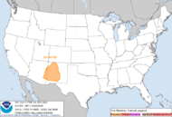
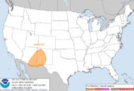
SPC Day 1 Fire Outlook |
SPC Day 2 Fire Outlook |
SPC Experimental Day 3-8 Outlook |
Printer Friendly Version of Fire Weather Outlooks Map and Discussion
Please note: these products are issued by the NWS Storm Prediction Center and are not updated routinely.
Today's Weather Trivia
Today's Date is Wednesday May 6, 2026...\n ON... May 6, 1900 A tornado moved south, passing 5 miles west of Jetmore. This tornado picked up a small home and smashed it to the ground, killing a woman. Cattle were carried 200 yards. At least 15, perhaps over 25, tornadoes touched down in Kansas this day which the press called the day of the cyclones. IN 1939...A tornado moved east-northeast from 10 miles southwest of Jetmore. Barns were swept away. Damage was $10,000. IN 1975...A massive tornado hit Omaha Nebraska killing three persons, injuring 133 others, and causing 150 million dollars damage. This was the most costly tornado in U.S. history at that time.
| JAN | FEB | MAR | APR | MAY | JUN |
| JUL | AUG | SEP | OCT | NOV | DEC |
|
OTHER USEFUL LINKS
 Chart #1: Surface-based Moisture Convergence, Warm Theta Advection, Theta-E |
Mouseover links to view previous hours
|
 Chart #2: Surface-based CAPE, Low Level Lapse Rate (0-2.5km AGL) |
See anything missing? Let us know and we might add it.
Please e-mail our webmaster for questions or comments
City |
Goodland | Hastings | Topeka | Wichita | Amarillo | Pueblo |
National Centers
| SPC | WPC | Fire | Aviation |
|
Chaser Weather! Latest Text Products Model Data Still can't find what your looking for? Feel free to email our webmaster who will redirect you to the page you are looking for! |