Gusty winds and dry conditions will continue to bring elevated to critical fire weather conditions to the southern Plains and Southeast early this week. A Pacific storm system will bring low elevation rain and heavy high elevation mountain snow to northern and central California through early week, expanding into the Pacific Northwest, Great Basin, and southern California on Tuesday. Read More >
Dodge City, KS
Weather Forecast Office
NWS Spot Forecasts: Click here to view current/recent spot forecasts or to request a new one
Wildland Fire Assessment System
United States Fish and Wildlife Service (Fire Management Page)
United States Forest Service
Storm Prediction Center Fire Weather Page
Quivira National Wildlife Refuge
Rocky Mountain Area Annual Operating Plan
Dodge City Weather Activity Planner
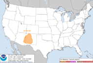
SPC Day 1 Fire Outlook |
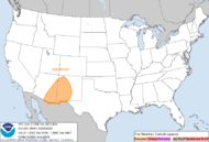
SPC Day 2 Fire Outlook |
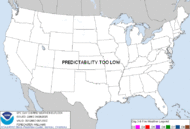
SPC Experimental Day 3-8 Outlook |
Printer Friendly Version of Fire Weather Outlooks Map and Discussion
Please note: these products are issued by the NWS Storm Prediction Center and are not updated routinely.
US Dept of Commerce
National Oceanic and Atmospheric Administration
National Weather Service
Dodge City, KS
104 Airport Road
Dodge City, KS 67801-9351
620-225-6514
Comments? Questions? Please Contact Us.

