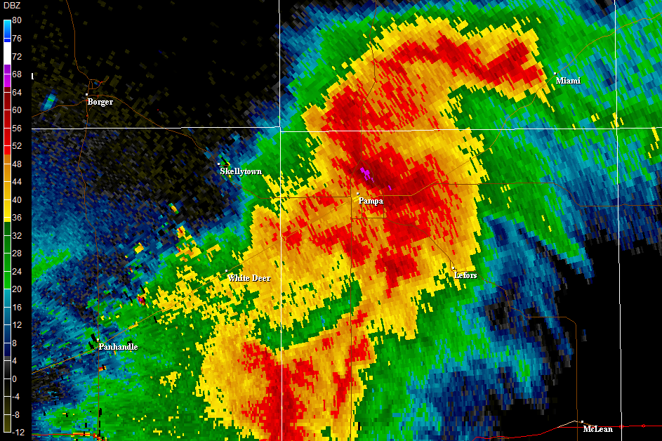
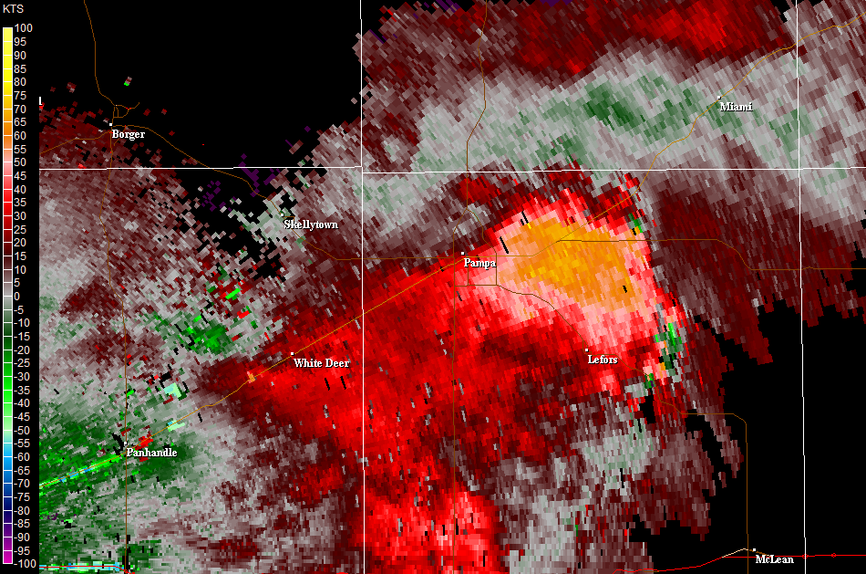
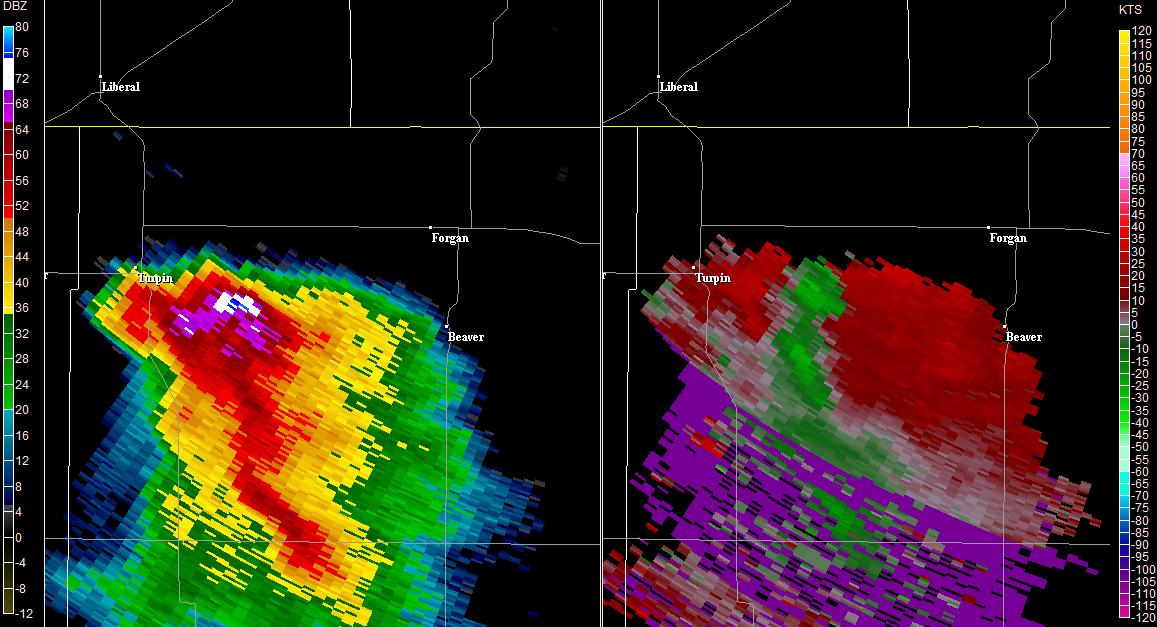
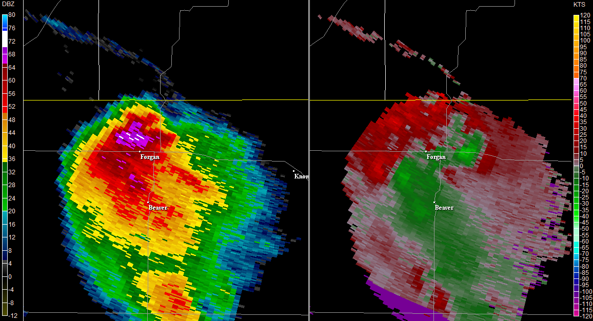
Tropical Depression Two is expected to gradually strengthen and could bring tropical storm conditions to the Florida Panhandle beginning late Monday. Areas of flash flooding will be possible through Thursday along the eastern and central Gulf Coast. Severe thunderstorms will develop and move along a cold front crossing the Upper Midwest Monday, and through the Ohio Valley/Mid-Atlantic on Tuesday. Read More >
Amarillo, TX
Weather Forecast Office
|
|
||||||||||||||||||||||||||||||||
US Dept of Commerce
National Oceanic and Atmospheric Administration
National Weather Service
Amarillo, TX
1900 English Road
Amarillo, TX 79108
(806) 335-1121
Comments? Questions? Please Contact Us.