


|
|
 |
|
|
 |
|
|
 |
|
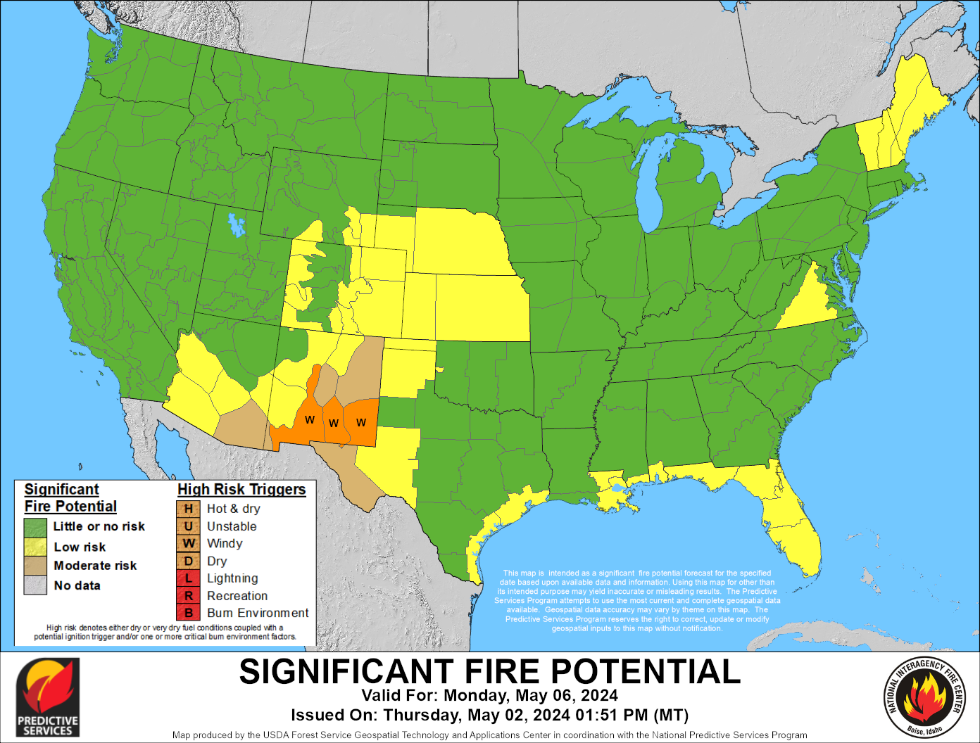
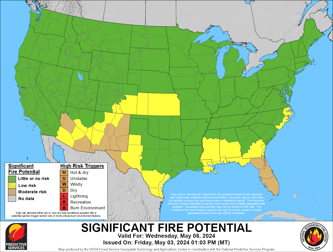
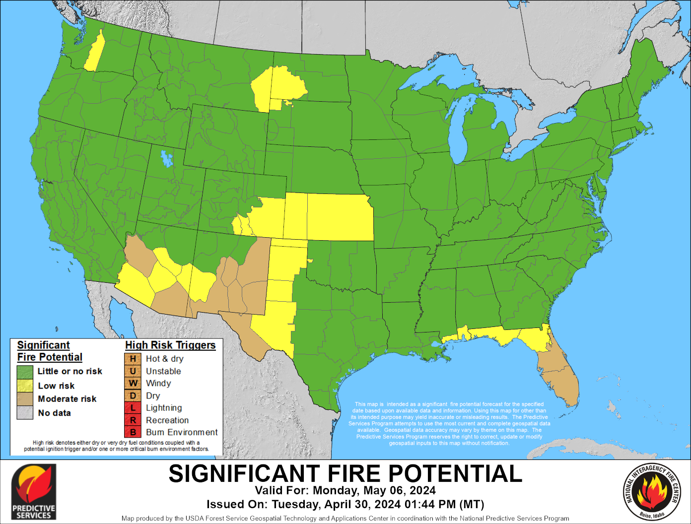
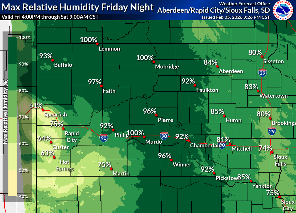
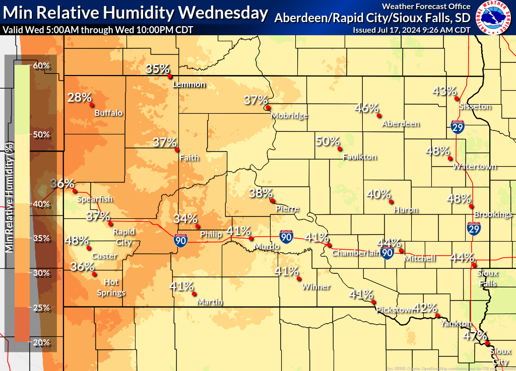
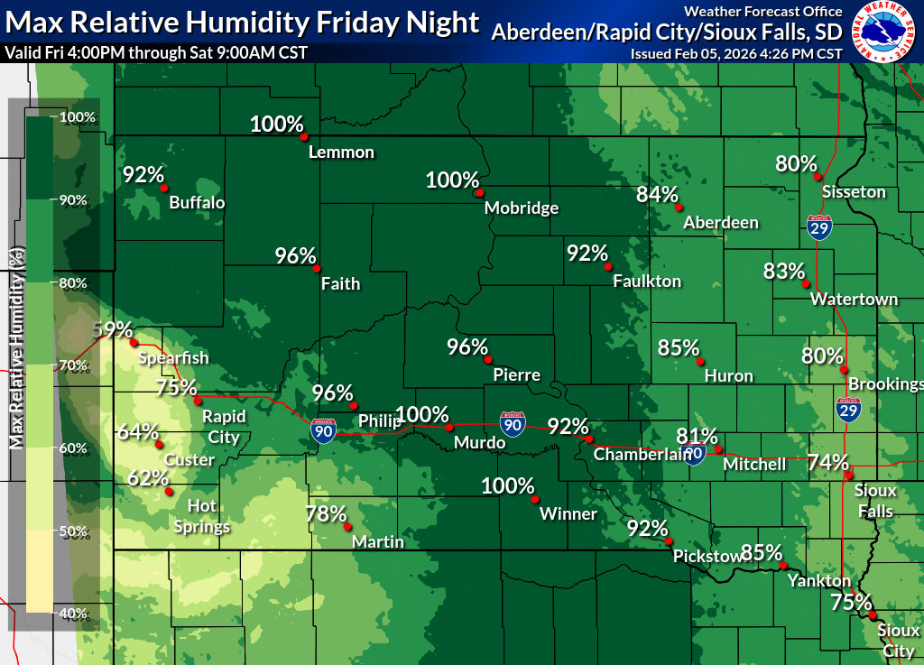
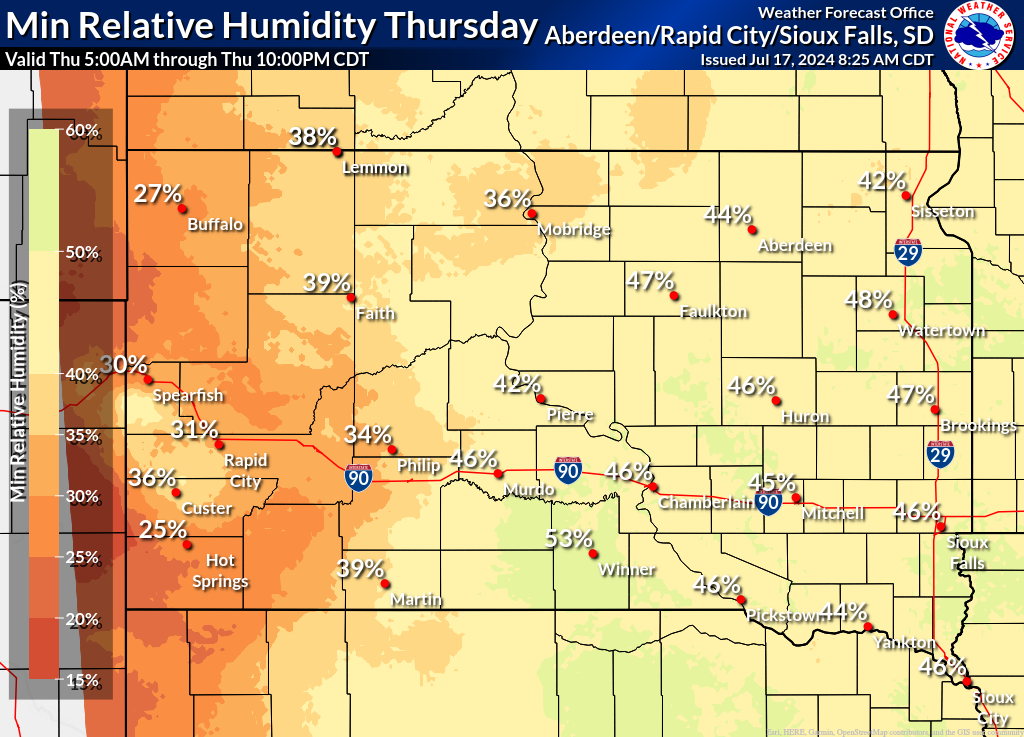
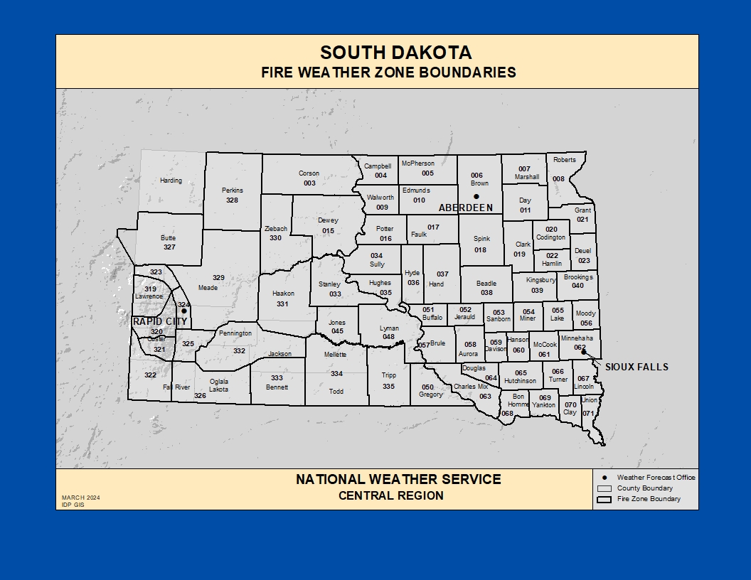
Fire Weather
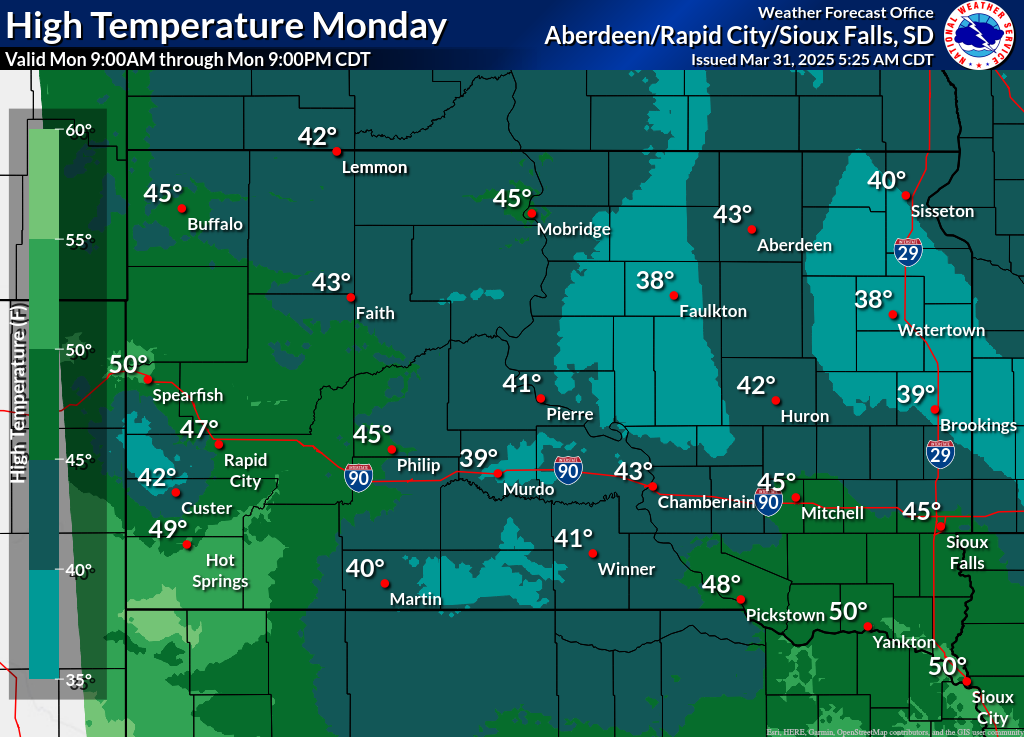
Click on the county for the localized Fire Weather Forecast for central to northeastern South Dakota and west-central Minnesota (or view the entire Fire Weather Forecast) |
|
|
|
|
 |
 |
 |
|
|
|
|
 |
 |
 |
|
|
 |
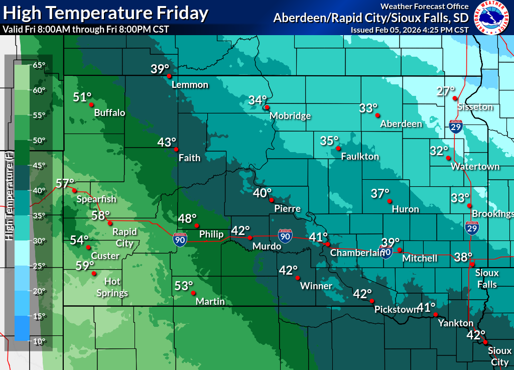
| Day 1 | |
 |
 |
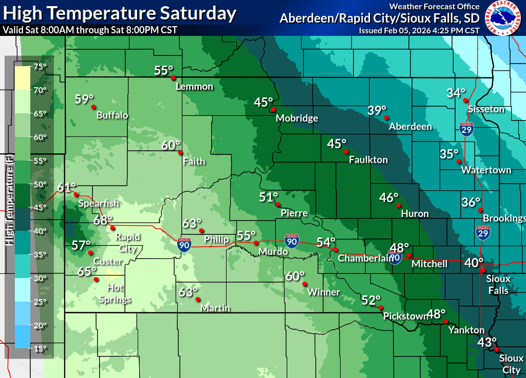
| Day 2 | |
 |
 |
| Day 3 | |
 |
 |
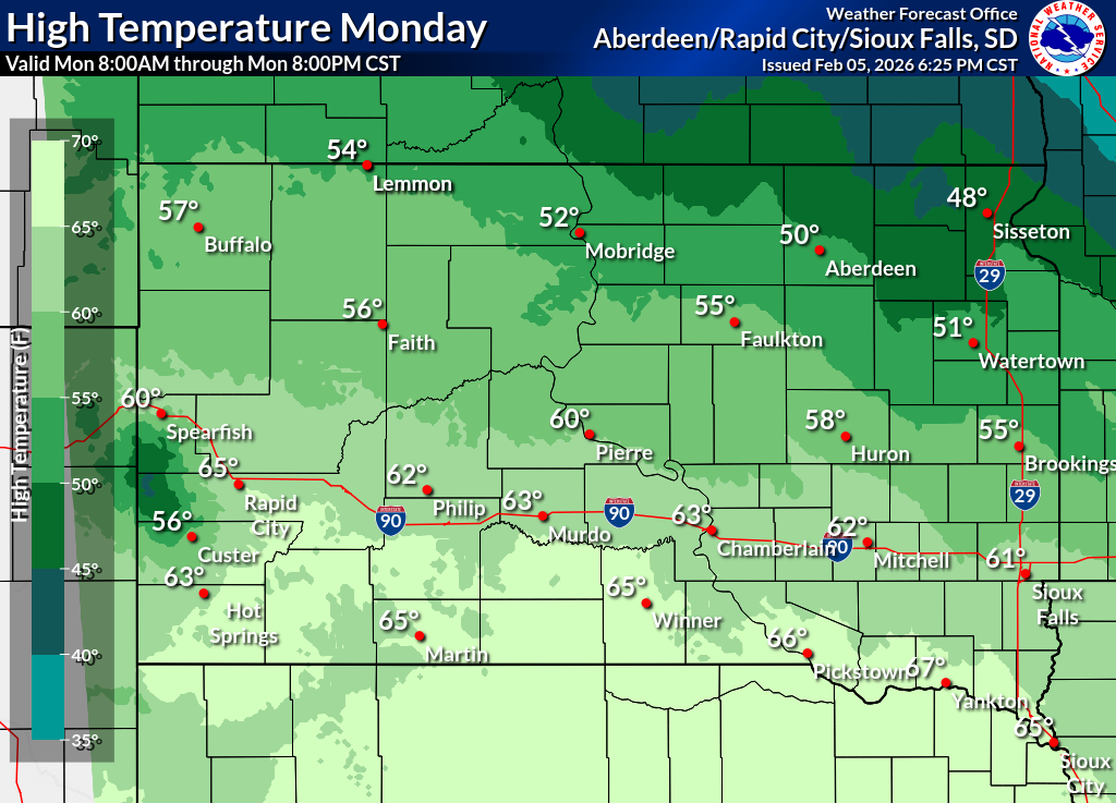
| Day 4 | |
 |
 |
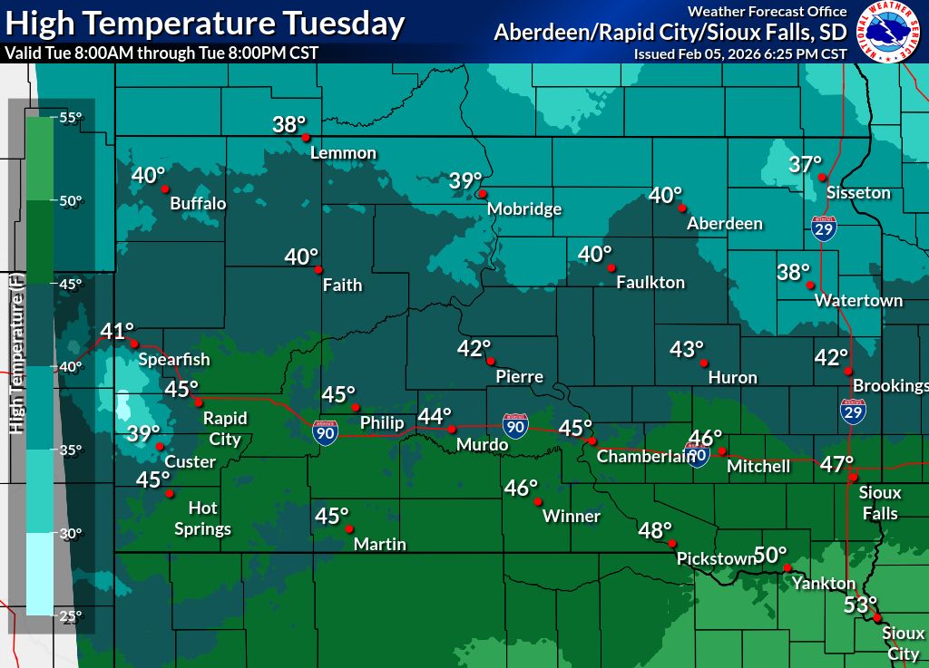
| Day 5 | |
 |
 |
| Day 1 | |
 |
 |
| Day 2 | |
 |
 |
| Day 3 | |
 |
 |
| Day 4 | |
 |
 |
| Day 5 | |
 |
 |
| Day 1 | |
 |
 |
| Day 2 | |
 |
 |
| Day 3 | |
 |
 |
| Day 4 | |
 |
 |
| Day 5 | |
 |
 |
| Day 1 | |
|
|
|
| Day 2 | |
|
|
|
| Day 1 | |||
 |
 |
||
 |
 |
||
| Day 2 | |||
 |
 |
||
 |
 |
||
| Day 3 | |||
 |
 |
||
 |
 |
||
| Day 4 | |||
 |
 |
||
 |
 |
||
| Day 5 | |||
 |
 |
||
| Day 1 | |
 |
 |
| Day 2 | |
 |
 |
| Day 3 | |
 |
 |
| Day 4 | |
 |
 |
| Day 5 | |
 |
 |
| GEOCOLOR | VISIBLE |
 |
 |
| Small | Loop | Large | Small | Loop | Large |
| IR/Hot Spot | Water Vapor |
 |
 |
| Small | Loop | Large | Small | Loop | Large |
 |
 |
| Temperature | Precipitation |
 |
 |
| Temperature | Precipitation |
 |
 |
| Temperature | Precipitation |
 |
 |
| Temperature | Precipitation |
|
|
 |
|
|
 |
| Past 7 Days | Past 14 Days | Past 30 Days |
 |
 |
 |
| Past 7 Days | Past 14 Days | Past 30 Days |
 |
 |
 |
| Past 7 Days | Past 14 Days | Past 30 Days |
 |
 |
 |

