Record setting heat is expected over the next several days from the Intermountain West through the northern Plains. Furthermore, fire weather concerns increase with dry and breezy conditions. Meanwhile, heavy rainfall and severe thunderstorm threats for the Ohio/Tennessee Valleys, central Appalachians and Southeast today. The threat shifts to central Gulf Coast and across central Texas this week. Read More >
Overview
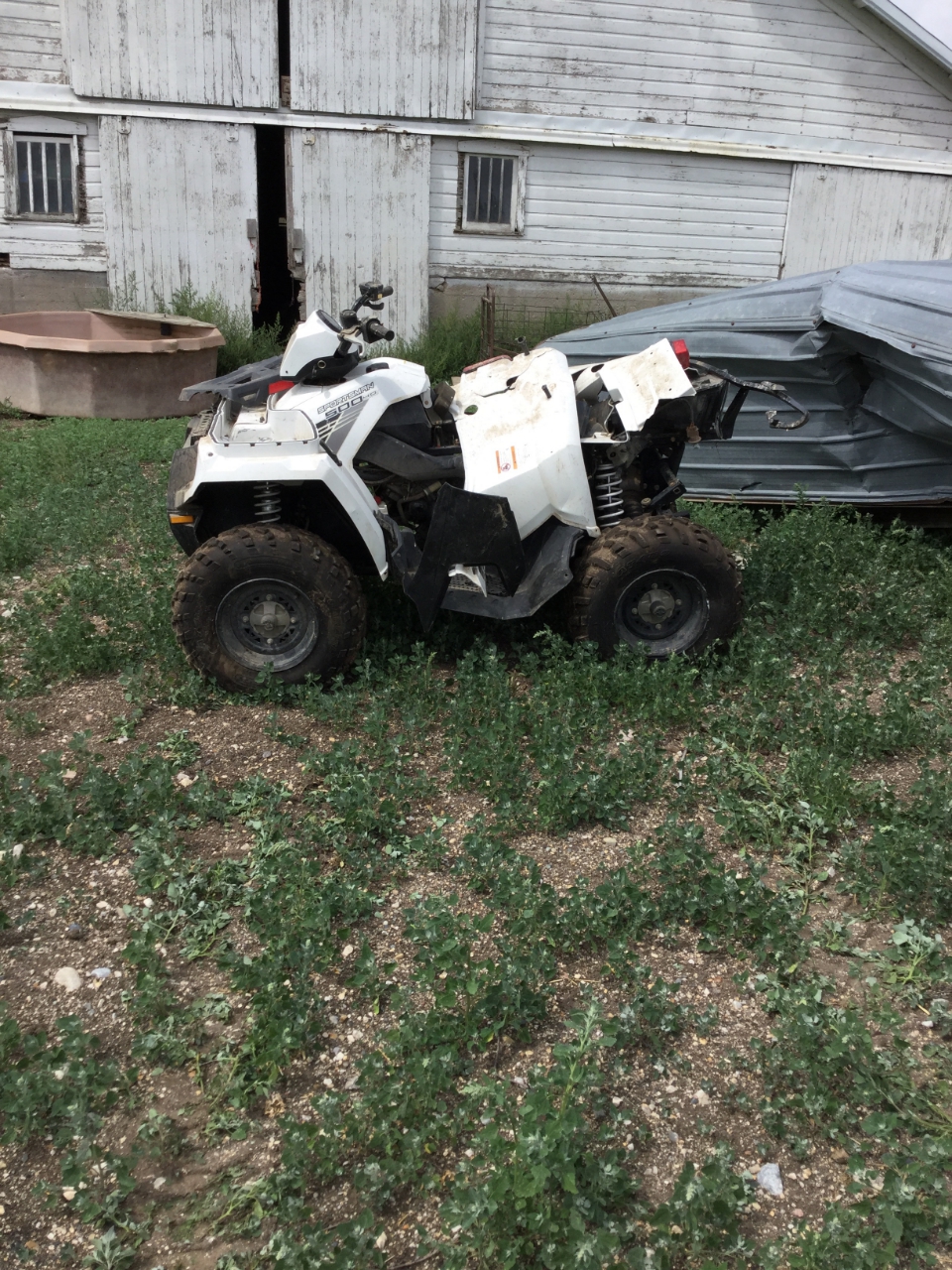
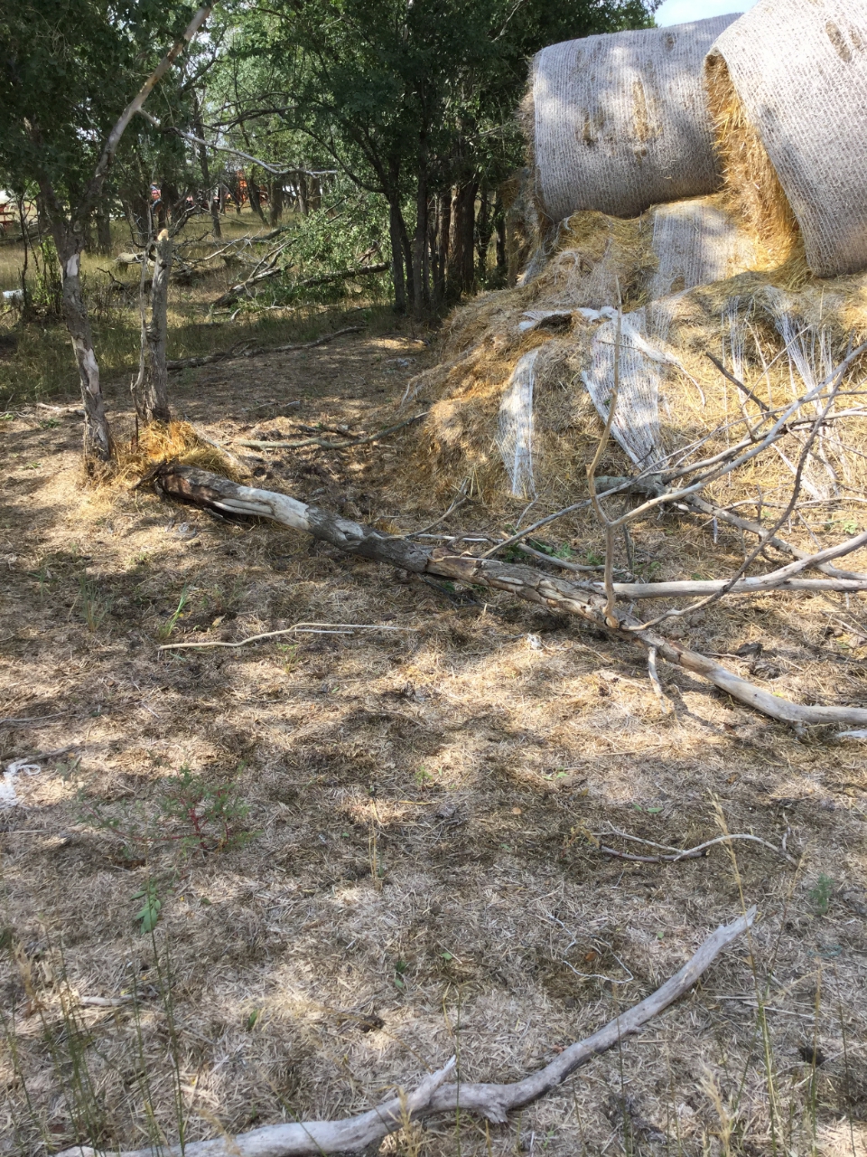
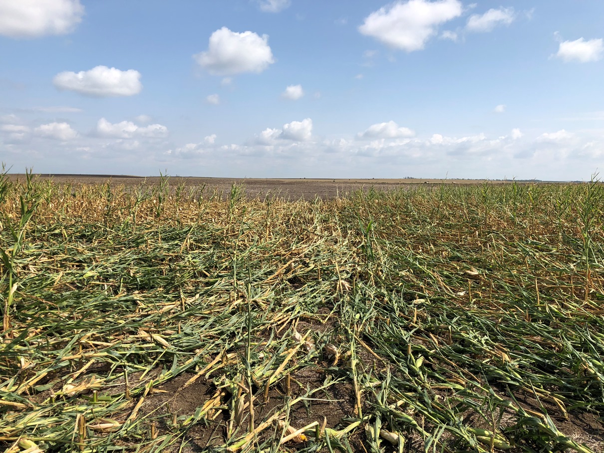
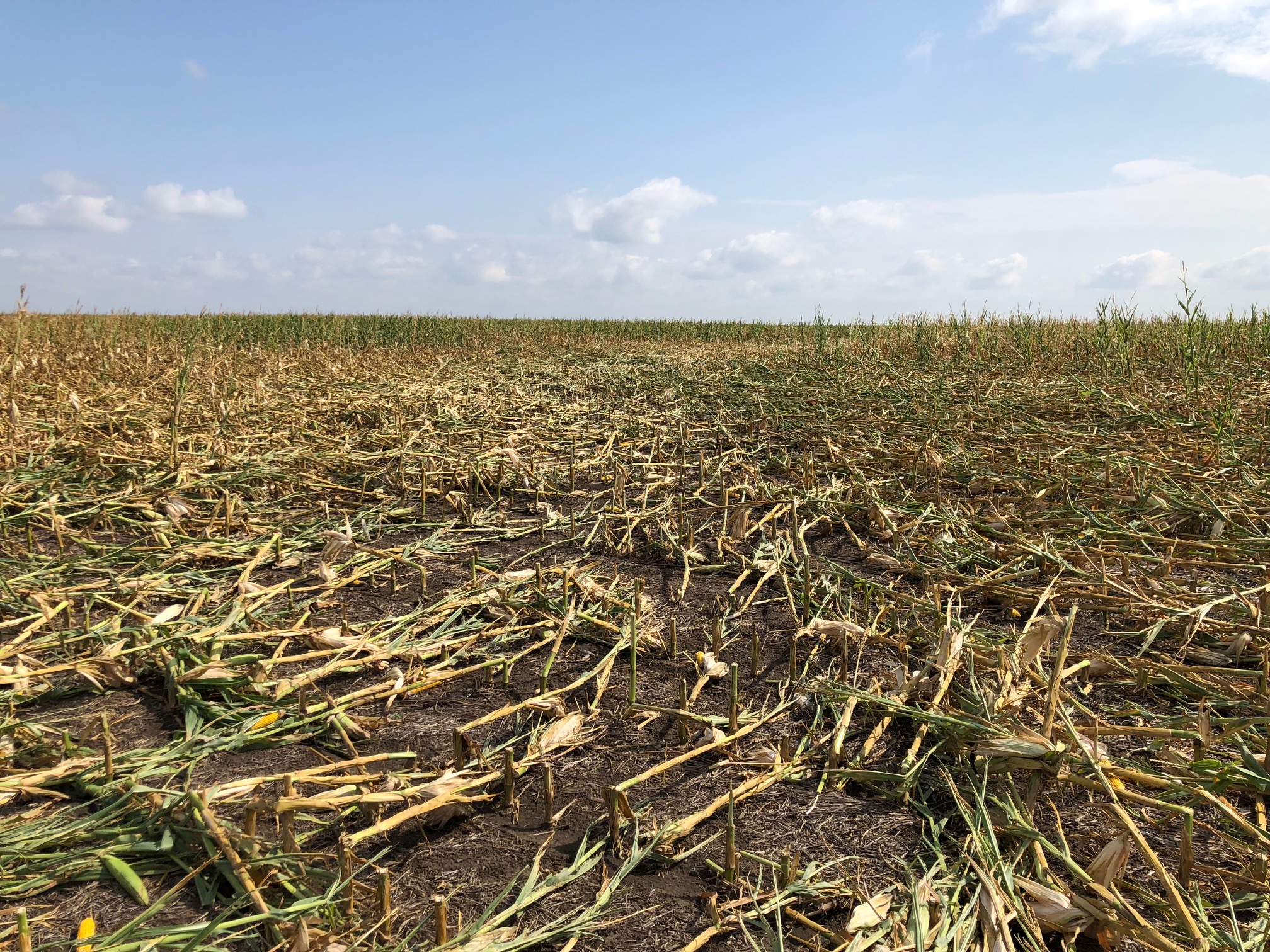
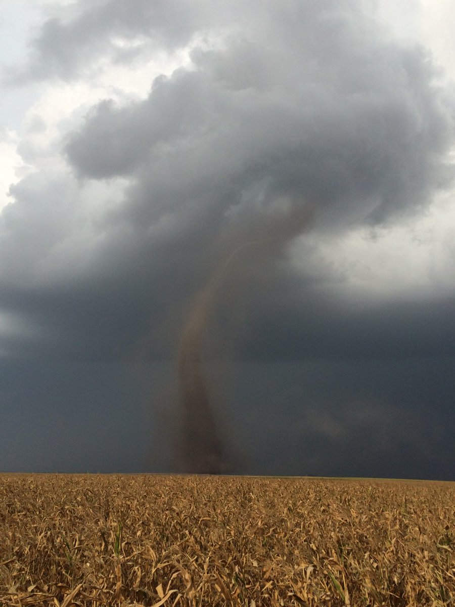
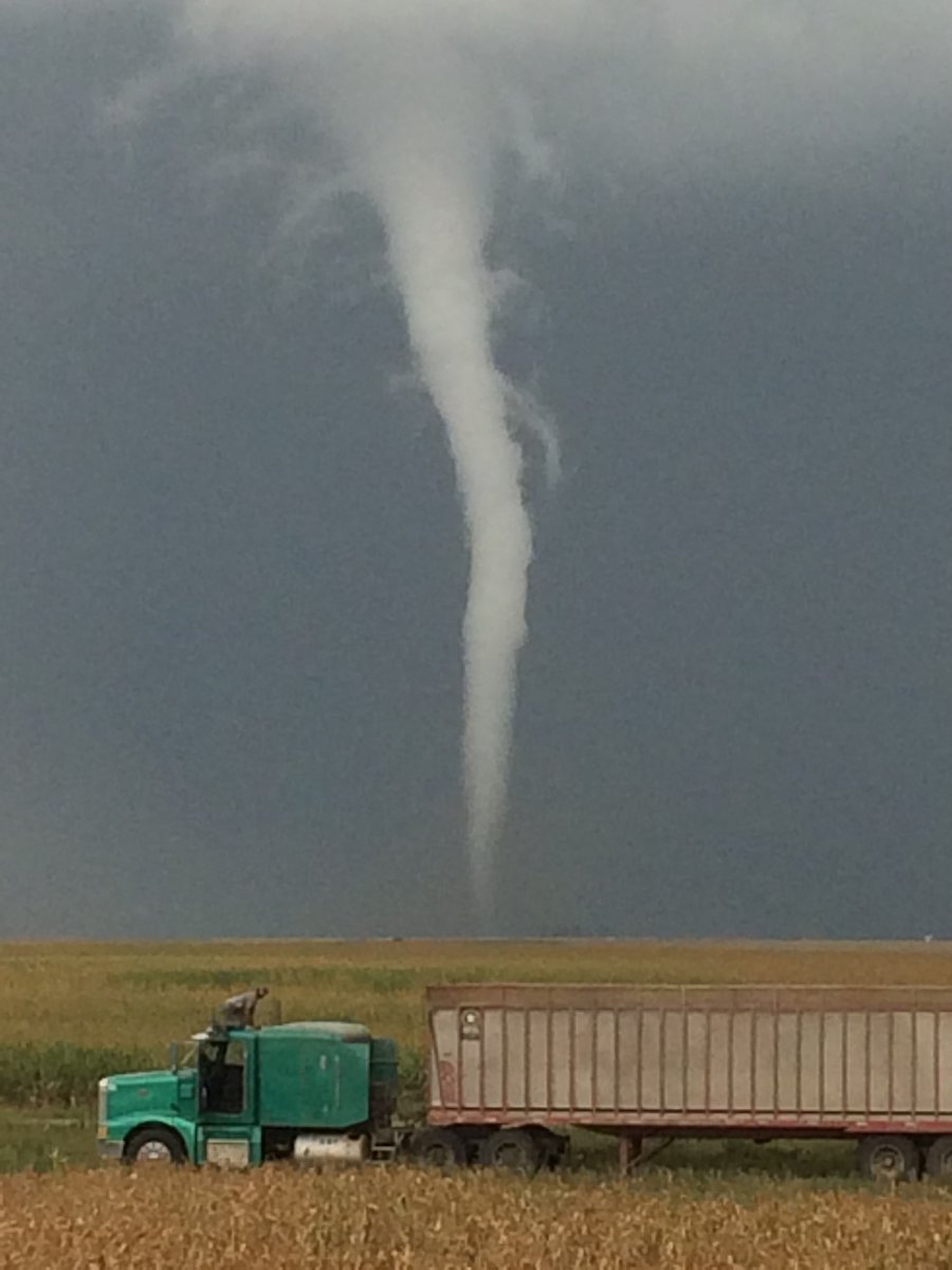
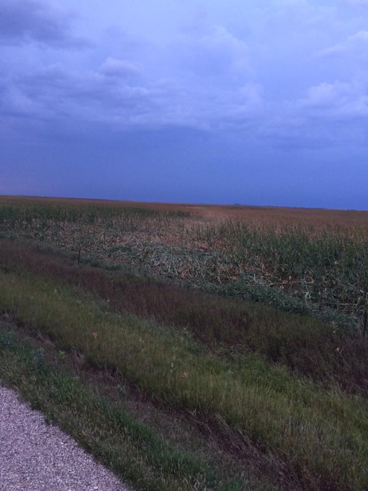
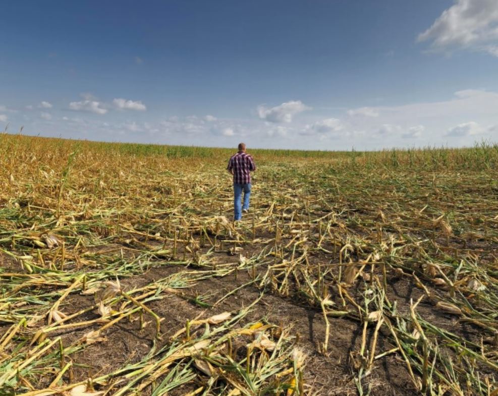
Low pressure moved across the region triggering storms shortly before 5 PM CDT. Some of these storms became severe and produced two confirmed EF-0 tornadoes, as well as hail larger than tea cups (3"). One of the tornadoes lasted for nine minutes and caused minor damage to the west side of a ranch 18.4 miles NNW of Highmore. The tornado also flattened about a half mile of corn stalks with a maximum path width of 50 yards.
Tornadoes:
|
Tornado - 18.4 miles NNW of Highmore
Track Map 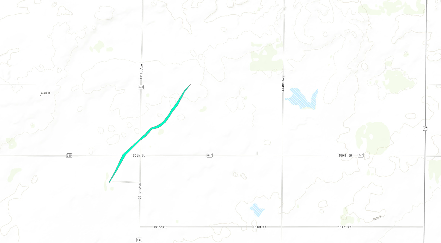 
|
||||||||||||||||
|
||||||||||||||||
|
Tornado - 19.0 miles N of Highmore, SD
Track Map 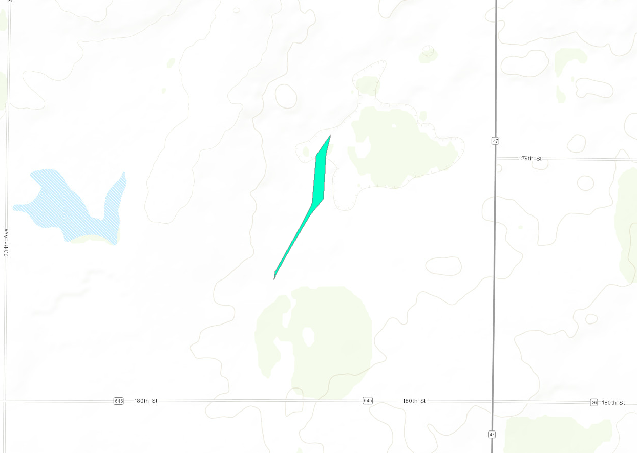 |
||||||||||||||||
The Enhanced Fujita (EF) Scale classifies tornadoes into the following categories:
| EF0 Weak 65-85 mph |
EF1 Moderate 86-110 mph |
EF2 Significant 111-135 mph |
EF3 Severe 136-165 mph |
EF4 Extreme 166-200 mph |
EF5 Catastrophic 200+ mph |
 |
|||||
Photos & Video:
 |
 |
 |
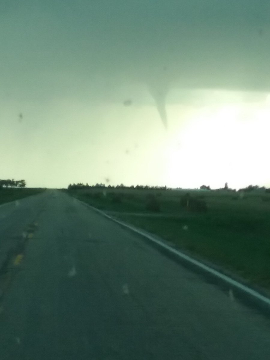 |
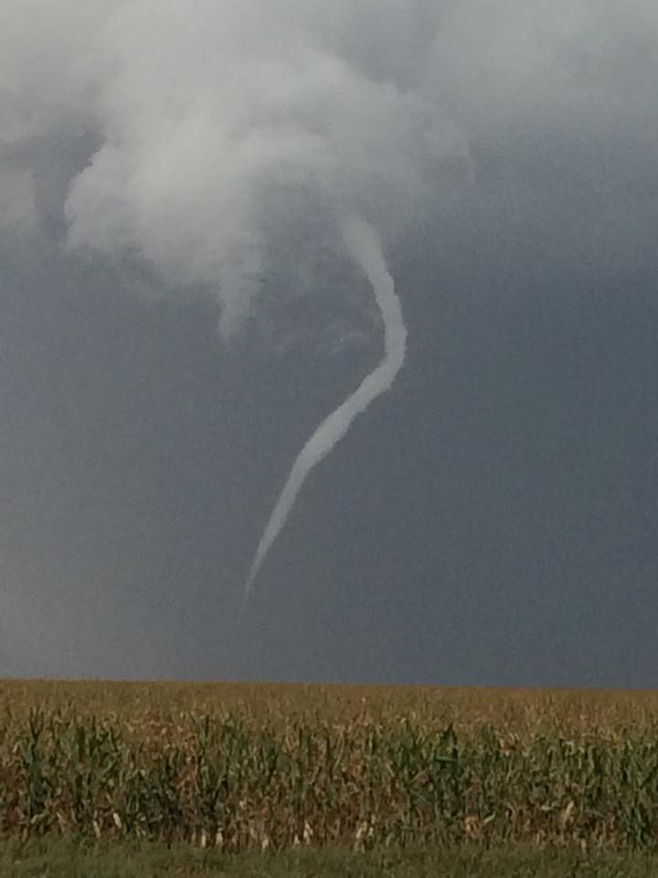
| Tornado over northern Hyde County, courtesy of Staci and Oliver Aesoph | Tornado over northern Hyde County, courtesy of Staci and Oliver Aesoph | Tornado over northern Hyde County, courtesy of Staci and Oliver Aesoph | Funnel cloud captured by a Northern Hyde resident |
 |
 |
 |
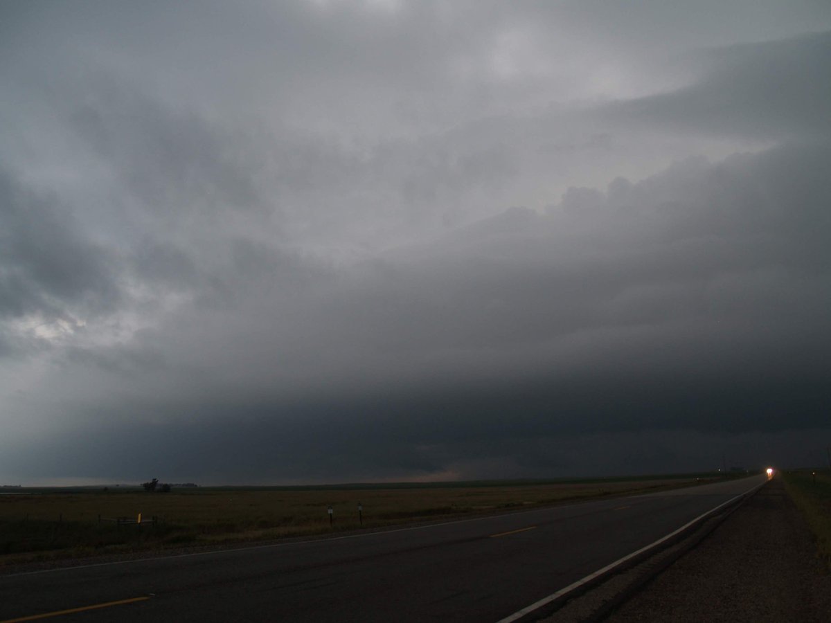 |
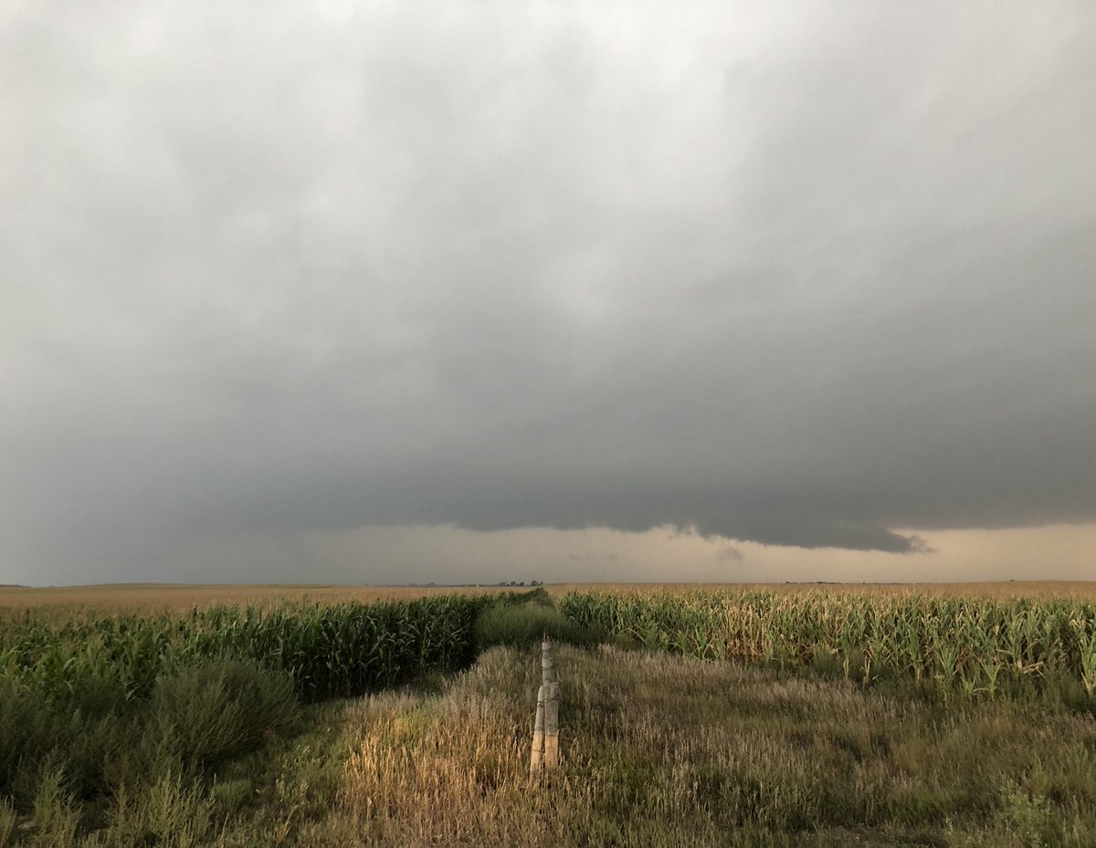
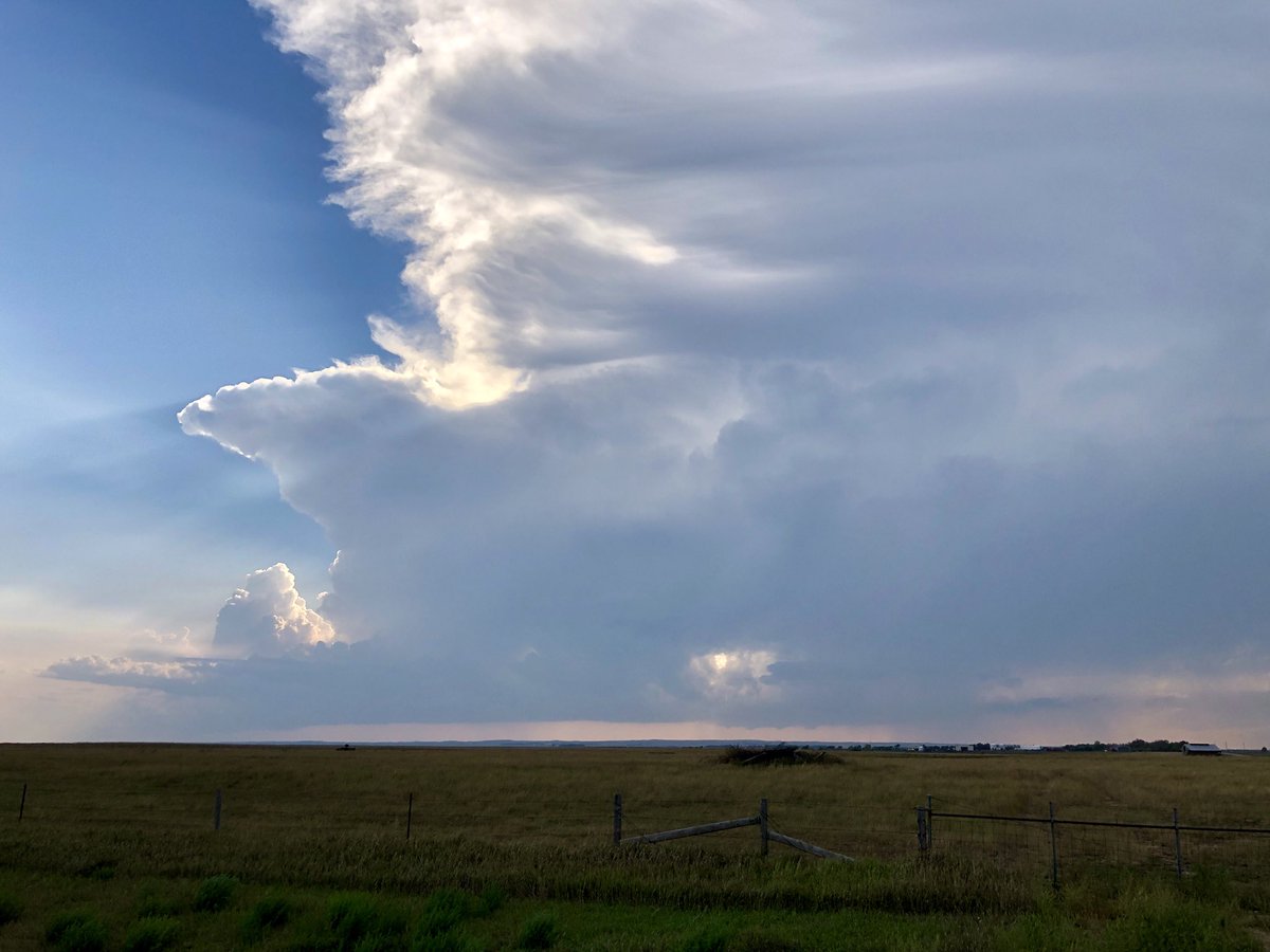
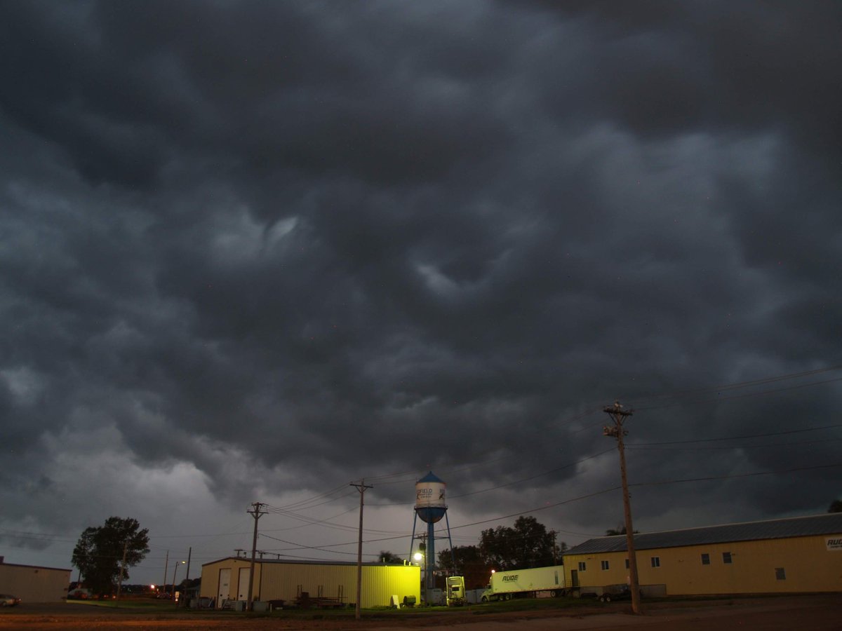
| Tornado path through a corn field in northern Hyde County, courtesy of Staci and Oliver Aesoph | Wall cloud near Orient, courtesy of Derek Thompson | Cumulonimbus cloud south of Seneca, courtesy of Derek Thompson | Shelf cloud near Redfield, courtesy of Alex Resel |
 |
 |
 |
 |
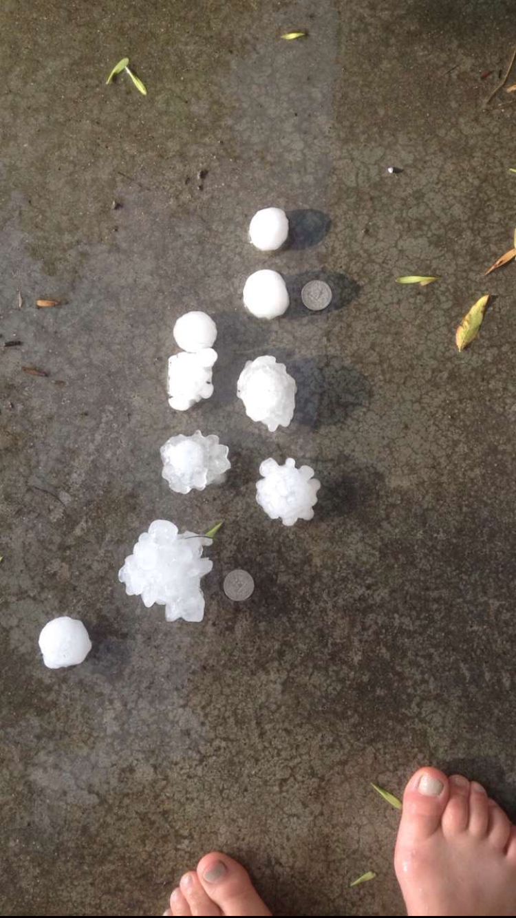
| Tornado path through a corn field in northern Hyde County, with person for size perspective | Thunderstorm over Redfield, courtesy of Alex Resel | Very large hail observed 4 miles NW of Hoven, courtesy of Derek Rausch | Very large hail observed 4 miles NW of Hoven, courtesy of Derek Rausch |
Radar:
 |
 |
 |
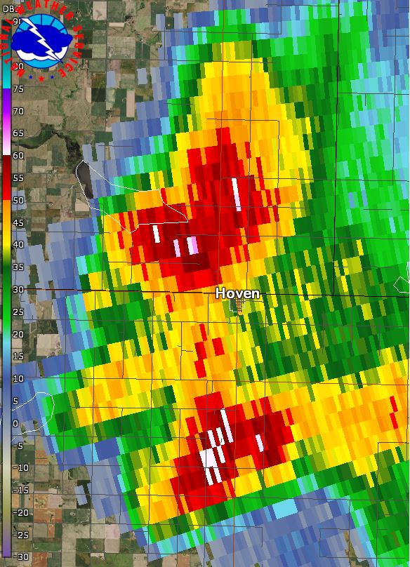 |
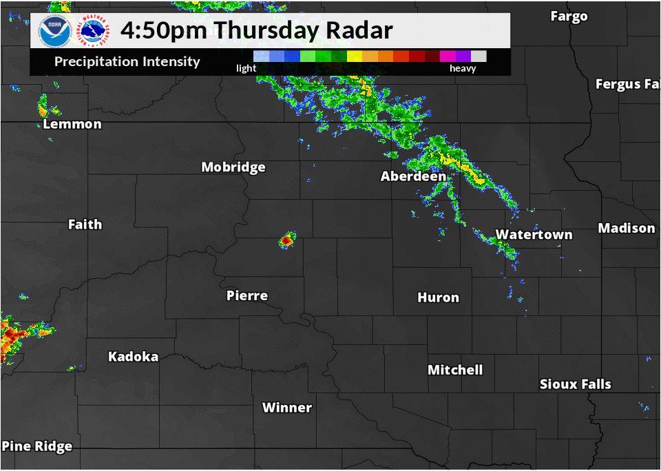
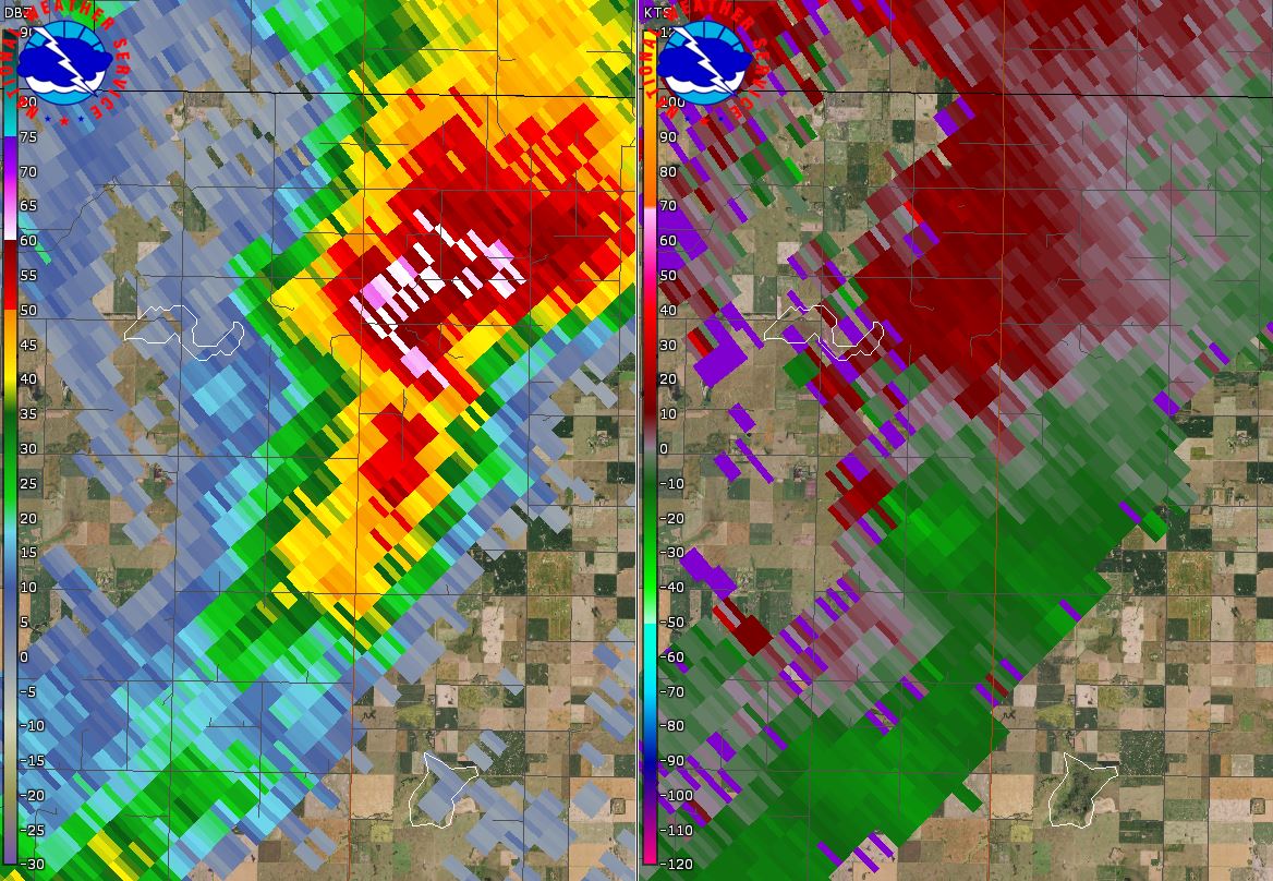
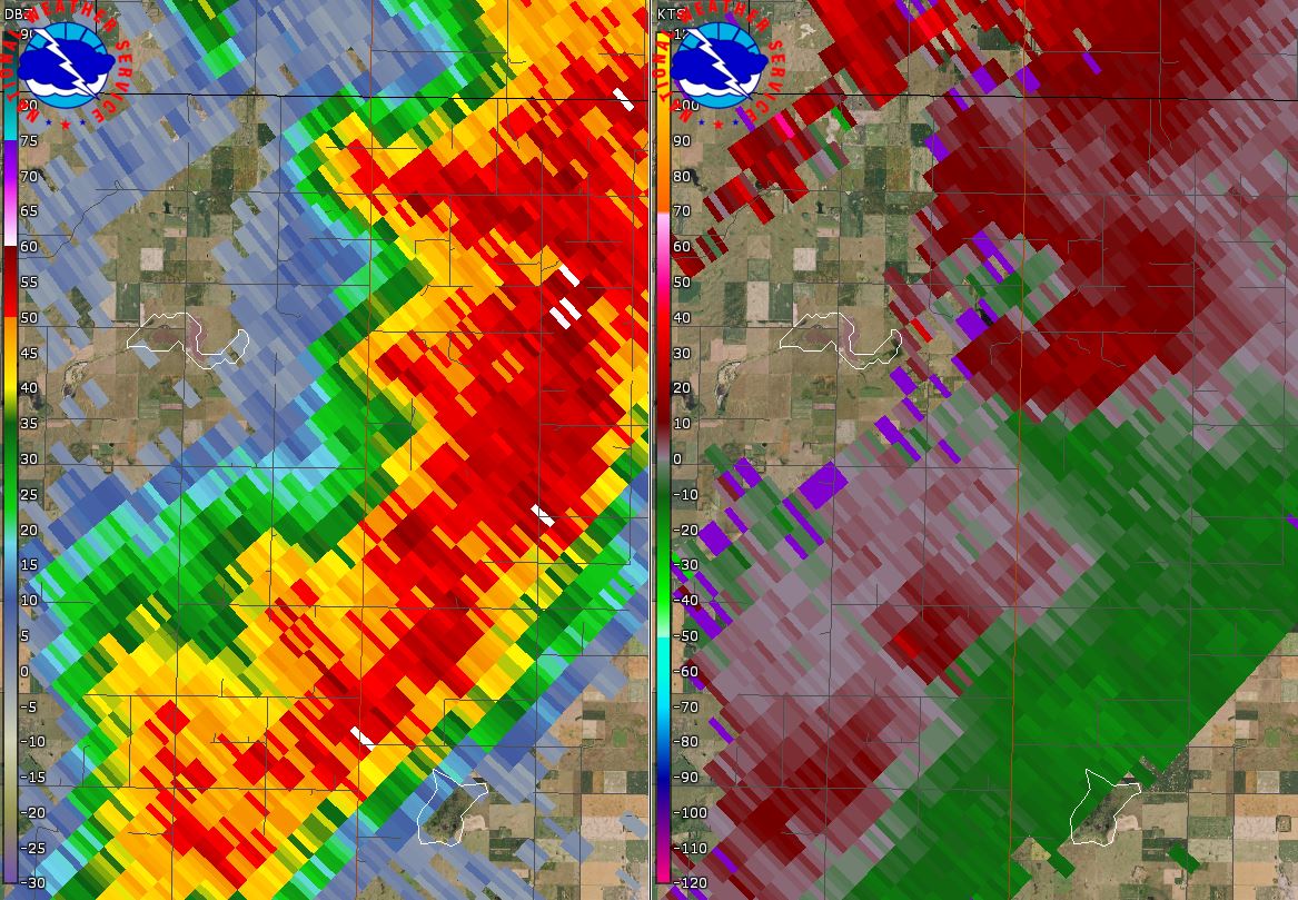
| Radar reflectivity event overview from 4:50 to 10:00 PM | Radar reflectivity/storm relative velocity at 6:18 pm, at the start of the tornado 18.4 mi NNW of Highmore | Radar reflectivity/storm relative velocity at 6:29 pm during the time of the tornado 19.2 mi N of Highmore | Radar reflectivity of the 3" hail-producing left-splitting supercell 4 mi NW of Hoven at 6:03 pm |
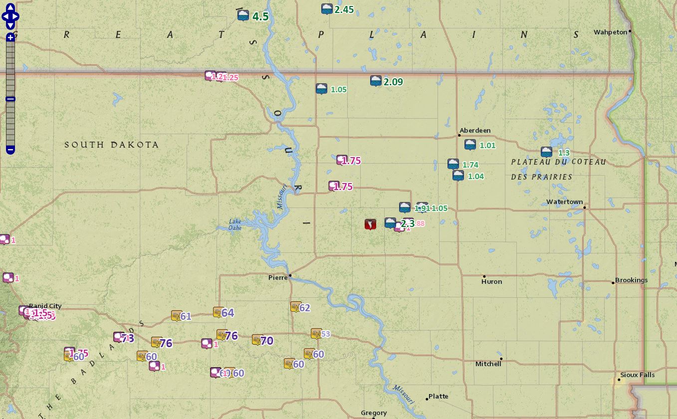
Rainfall, Storm Reports
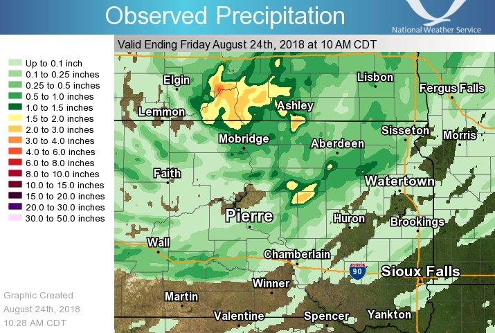
Radar estimated rainfall totals
Rainfall Reports
LOCATION                     AMOUNT    TIME/DATE
POLO 7 W                     2.30 IN   0817 PM 08/23
EUREKA 13 ENE                2.09 IN   1215 PM 08/24
ORIENT                       1.91 IN   0800 AM 08/24
MANSFIELD                    1.74 IN   0700 AM 08/24
WEBSTER                      1.30 IN   0800 AM 08/24
WALKER 1 W                   1.20 IN   0800 AM 08/24
HERREID 3 ESE                1.05 IN   0700 AM 08/24
4 W ROCKHAM                  1.05 IN   0700 AM 08/24
MELLETTE                     1.04 IN   1000 AM 08/24
BATH 5 SSW                   1.01 IN   0700 AM 08/24
MOBRIDGE 8 NNW               0.92 IN   0800 AM 08/24
EUREKA 11 WSW                0.87 IN   0700 AM 08/24
FAULKTON 1 NW                0.87 IN   0800 AM 08/24
GROTON                       0.78 IN   1241 PM 08/24
LEOLA 9 W                    0.74 IN   1205 PM 08/24
HIGHMORE 12 N                0.72 IN   0700 AM 08/24
2 SE ROSLYN                  0.66 IN   0600 AM 08/24
ROSCOE 6 W                   0.65 IN   0800 AM 08/24
1 NE ABERDEEN                0.62 IN   0700 AM 08/24
MOBRIDGE                     0.61 IN   0800 AM 08/24
SELBY                        0.60 IN   1250 PM 08/24
ABERDEEN 1 WSW               0.60 IN   0700 AM 08/24
LILY 6 ENE                   0.55 IN   0700 AM 08/24
EUREKA 0.5 S                 0.54 IN   1254 PM 08/24
BATH 1 NE                    0.54 IN   0800 AM 08/24
EUREKA                       0.53 IN   0800 AM 08/24
LEOLA                        0.53 IN   0700 AM 08/24
EUREKA                       0.53 IN   0800 AM 08/24
GRENVILLE 6 ENE              0.51 IN   0800 AM 08/24
HECLA 5 NE                   0.50 IN   0700 AM 08/24
GRENVILLE 7 ENE              0.48 IN   0800 AM 08/24
BRITTON                      0.46 IN   0700 AM 08/24
MOBRIDGE MUNI AP             0.46 IN   0652 AM 08/24
EUREKA                       0.44 IN   1250 PM 08/24
SISSETON 3 W                 0.44 IN   0700 AM 08/24
SISSETON 3 W                 0.44 IN   0700 AM 08/24
SELBY 4 W                    0.43 IN   0800 AM 08/24
ANDOVER                      0.40 IN   1200 PM 08/24
ABERDEEN 1 SSW               0.38 IN   0700 AM 08/24
ABERDEEN RGNL AP             0.36 IN   0653 AM 08/24
SISSETON MUNI AP             0.36 IN   0656 AM 08/24
OKATON 3 NW                  0.35 IN   0730 AM 08/24
LAKE CITY 4 SE               0.34 IN   0700 AM 08/24
BROWNS VALLEY 6 N            0.33 IN   0700 AM 08/24
HIGHMORE 19 NNW              0.33 IN   0700 AM 08/24
MILLER                       0.32 IN   0721 AM 08/24
EUREKA 15 SE                 0.31 IN   0900 AM 08/24
1 ESE ABERDEEN               0.31 IN   0700 AM 08/24
KIDDER                       0.30 IN   0700 AM 08/24
CLAREMONT 2 SSE              0.29 IN   0600 AM 08/24
ASHTON                       0.29 IN   1245 PM 08/24
ABERDEEN 0.5 SE              0.28 IN   1247 PM 08/24
SELBY                        0.27 IN   0700 AM 08/24
ABERDEEN 6.5 W               0.27 IN   1245 PM 08/24
BATH 4 WNW                   0.27 IN   0700 AM 08/24
ABERDEEN 0.5 NW              0.26 IN   1252 PM 08/24
HIGHMORE 17 N                0.26 IN   0800 AM 08/24
PRESHO 7 N                   0.26 IN   0800 AM 08/24
VIVIAN 7 NW                  0.26 IN   1105 AM 08/24
MINA 7 S                     0.25 IN   0800 AM 08/24
ROSCOE                       0.25 IN   0700 AM 08/24
FREDERICK 9 W                0.24 IN   1230 PM 08/24
LOYALTON 5 NE                0.23 IN   1255 PM 08/24
WESTOVER 2 SSW               0.23 IN   0900 AM 08/24
VEBLEN 8 W                   0.22 IN   0700 AM 08/24
LITTLE EAGLE 1 SW            0.20 IN   1215 PM 08/24
ABERDEEN 0.5 E               0.20 IN   1245 PM 08/24
ABERDEEN 7.5 NNE             0.19 IN   0700 AM 08/24
LOYALTON 5 NE                0.19 IN   0700 AM 08/24
CHELSEA 1 S                  0.17 IN   0700 AM 08/24
WESTPORT 2 NW                0.15 IN   0600 AM 08/24
FREDERICK 8 SW               0.14 IN   0700 AM 08/24
MINA 2 NE                    0.14 IN   0600 AM 08/24
VIVIAN 5 SSW                 0.14 IN   0800 AM 08/24
BARNARD 5 W                  0.13 IN   1252 PM 08/24
VIVIAN 4 N                   0.13 IN   0800 AM 08/24
HILLHEAD 3 WSW               0.13 IN   1159 AM 08/24
GANN VALLEY                  0.12 IN   0800 AM 08/24
HECLA 7 WNW                  0.11 IN   0800 AM 08/24
MINA                         0.10 IN   0800 AM 08/24
PIERRE MUNI AP               0.03 IN   0653 AM 08/24
Storm Reports: https://www.spc.noaa.gov/climo/gmf.php?rpt=180823_rpts_filtered
Listing of Reports
..TIME...   ...EVENT...      ...CITY LOCATION...     ...LAT.LON...
..DATE...   ....MAG....      ..COUNTY LOCATION..ST.. ...SOURCE....
            ..REMARKS..

0603 PM     HAIL             3 NW HOVEN              45.28N 99.83W
08/23/2018  M3.00 INCH       WALWORTH           SD   PUBLIC

            REPORT WITH PHOTOS. RADAR ESTIMATED TIME.

0601 PM     HAIL             2 N HOVEN               45.27N 99.78W
08/23/2018  E1.75 INCH       WALWORTH           SD   PUBLIC

            MOST HAILSTONES WERE AROUND NICKLE SIZED,
            BUT A COUPLE TO GOLF BALL DIAMETER WERE ALSO
            OBSERVED. RADAR ESTIMATED TIME.

0531 PM     HAIL             5 W LEBANON             45.07N 99.87W
08/23/2018  E1.75 INCH       POTTER             SD   PUBLIC

0716 PM     HAIL             1 W WALKER              45.91N 101.11W
08/23/2018  E1.25 INCH       CORSON             SD   TRAINED SPOTTER

            MOSTLY SMALLER WITH A FEW HAILSTONES TO HALF
            DOLLAR SIZE, 1.20 INCHES OF RAIN. RADAR
            ESTIMATED TIME.

0700 PM     HAIL             6 E MCINTOSH            45.92N 101.23W
08/23/2018  E1.25 INCH       CORSON             SD   PUBLIC

0747 PM     HAIL             3 SW POLO               44.75N 99.15W
08/23/2018  E1.00 INCH       HAND               SD   TRAINED SPOTTER

            2.50 INCHES OF RAIN AND CROP DAMAGE AS WELL.

0817 PM     HEAVY RAIN       7 W POLO                44.78N 99.25W
08/23/2018  M2.30 INCH       HAND               SD   LAW ENFORCEMENT

0815 AM     HEAVY RAIN       EUREKA 13 ENE           45.88N 99.41W
08/24/2018  M2.09 INCH       MCPHERSON          SD   MESONET

            MESONET STATION LLKS2, EUREKA 13 ENE.

0800 AM     HEAVY RAIN       ORIENT                  44.90N 99.09W
08/24/2018  M1.91 INCH       FAULK              SD   PUBLIC

0700 AM     HEAVY RAIN       MANSFIELD               45.24N 98.56W
08/24/2018  M1.74 INCH       BROWN              SD   COCORAHS

            COCORAHS STATION SD-BR-12, MANSFIELD.

0800 AM     HEAVY RAIN       WEBSTER                 45.33N 97.53W
08/24/2018  M1.30 INCH       DAY                SD   CO-OP OBSERVER

            CO-OP OBSERVER STATION WBRS2, WEBSTER.

0700 AM     HEAVY RAIN       HERREID 3 ESE           45.82N 100.01W
08/24/2018  M1.05 INCH       CAMPBELL           SD   COCORAHS

            COCORAHS STATION SD-CP-6, HERREID 3 ESE.

0700 AM     HEAVY RAIN       4 W ROCKHAM             44.90N 98.90W
08/24/2018  M1.05 INCH       FAULK              SD   COCORAHS

            COCORAHS STATION SD-FK-3, 4 W ROCKHAM.

1000 AM     HEAVY RAIN       MELLETTE                45.15N 98.50W
08/24/2018  M1.04 INCH       SPINK              SD   PUBLIC

            RELAYED VIA SOCIAL MEDIA.

0700 AM     HEAVY RAIN       BATH 5 SSW              45.39N 98.37W
08/24/2018  M1.01 INCH       BROWN              SD   COCORAHS

            COCORAHS STATION SD-BR-23, BATH 5 SSW.

0629 PM     TORNADO          19 S SENECA             44.79N 99.50W
08/23/2018                   HYDE               SD   NWS STORM SURVEY

            A BRIEF TORNADO OCCURRED IN AN OPEN FIELD ON
            THE NORTH SIDE OF 180TH STREET. NO DAMAGE
            FOUND.

0618 PM     TORNADO          18 N HOLABIRD           44.77N 99.54W
08/23/2018                   HYDE               SD   NWS STORM SURVEY

            TORNADO STARTED ON WEST SIDE OF A RANCH,
            CAUSING MINOR DAMAGE. IT TRACKED TO THE
            NORTHEAST FOR 1.82 MILES AND HAD A MAXIMUM
            PATH WIDTH OF 50 YARDS. CORN STALKS WERE
            FLATTENED FOR A HALF MILE BEFORE THE TORNADO
            DISSIPATED IN A OPEN FIELD.

            RADAR ESTIMATED TIME.

0651 PM     TSTM WND GST     2 S MURDO               43.86N 100.71W
08/23/2018  M70 MPH          JONES              SD   MESONET

            UPDATES PREVIOUS TSTM WND GST REPORT FROM 2
            S MURDO.

0735 PM     TSTM WND GST     13 N VIVIAN             44.12N 100.29W
08/23/2018  M62 MPH          LYMAN              SD   MESONET

            RADAR ESTIMATED TIME.

0743 PM     TSTM WND GST     11 SSW PRESHO           43.75N 100.14W
08/23/2018  E60 MPH          LYMAN              SD   TRAINED SPOTTER

            50-60 MPH WIND GUST. RADAR ESTIMATED TIME.
 |
Media use of NWS Web News Stories is encouraged! Please acknowledge the NWS as the source of any news information accessed from this site. |
|