Record setting heat is expected over the next several days from the Intermountain West through the northern Plains. Furthermore, fire weather concerns increase with dry and breezy conditions. Meanwhile, heavy rainfall and severe thunderstorm threats for the Ohio/Tennessee Valleys, central Appalachians and Southeast today. The threat shifts to central Gulf Coast and across central Texas this week. Read More >
Overview
|
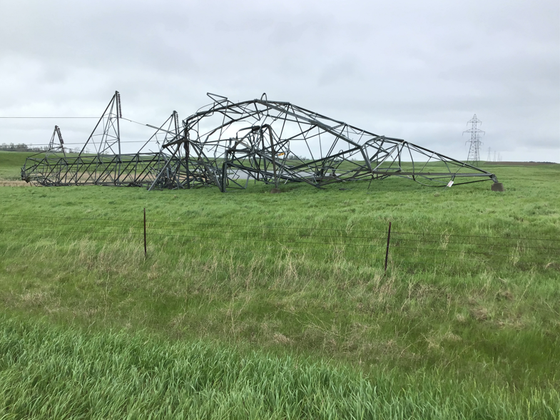
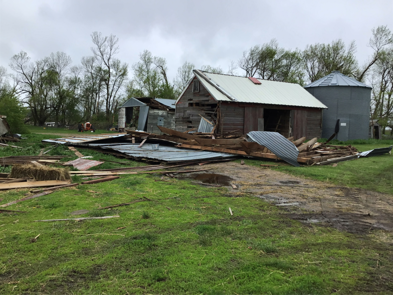
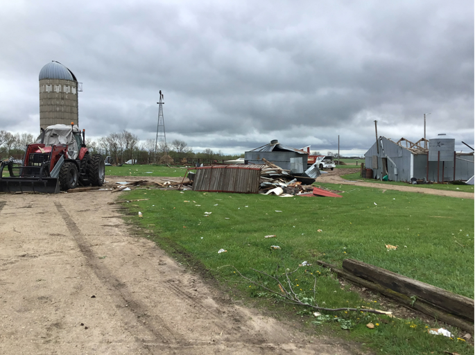
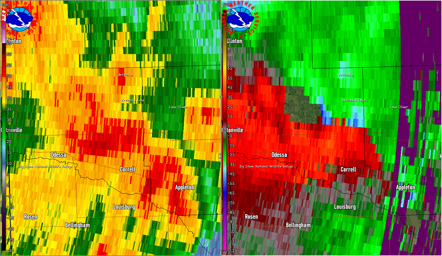
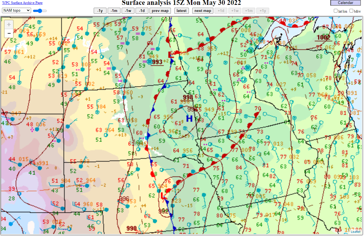
A strong low pressure system tracked from Nebraska northward into eastern South Dakota during the morning and afternoon on Memorial Day, Monday May 30th, 2022. An intense line of severe thunderstorms developed across eastern South Dakota in response, and then tracked northeast into western Minnesota. In addition to damaging straight-line winds and large hail, several fast-moving and/or rain-wrapped tornadoes were produced. The strongest tornado was rated an EF3 in Deuel County with an estimated peak wind speed of 140 mph after it destroyed a transmission tower. Additionally, heavy rains fell on already saturated soils across northeastern South Dakota and west central Minnesota. Significant property and tree damage, power outages, river and overland flooding including across many county and secondary roads, and other impacts resulted across the same area that was hit hard by a derecho and tornadoes just two and a half weeks earlier on May 12th. |
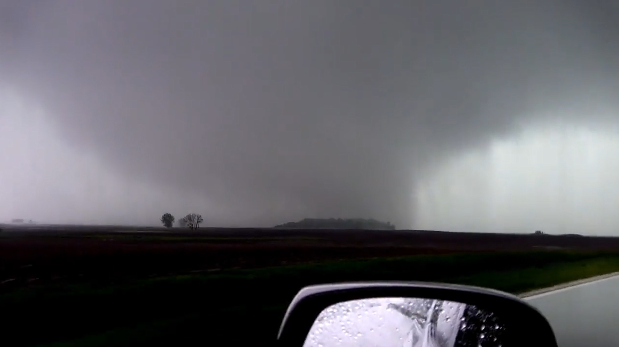 A tornado south of Artichoke, MN Monday afternoon. Image courtesy of Jason Bednar |
Preliminary Tornadoes:
|
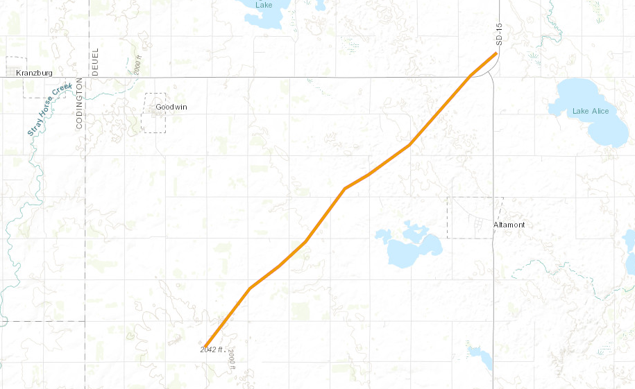
Tornado #1 - From 5 miles south of Goodwin, SD to 1 mile north of Tunerville, SD
Track Map
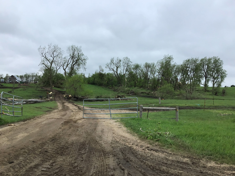
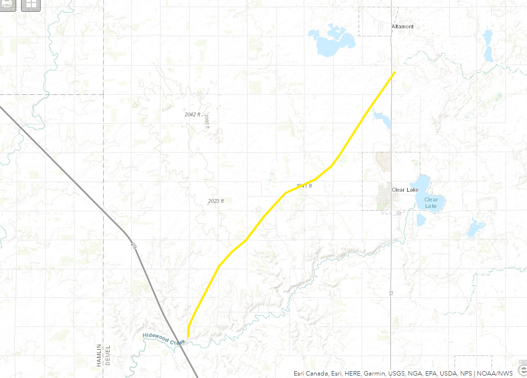
Tornado #2 - From 8 miles NNE of Estelline, SD to 2 miles SSE of Altamont, SD
Track Map
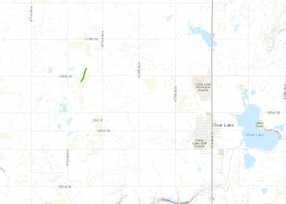
Tornado #3 - 3 miles WNW of Clear Lake, SD
Track Map
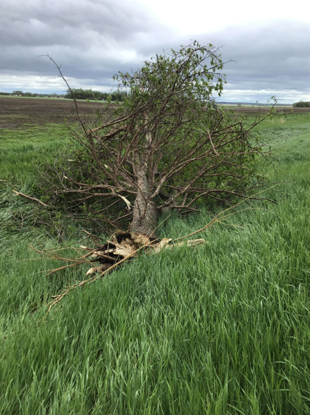
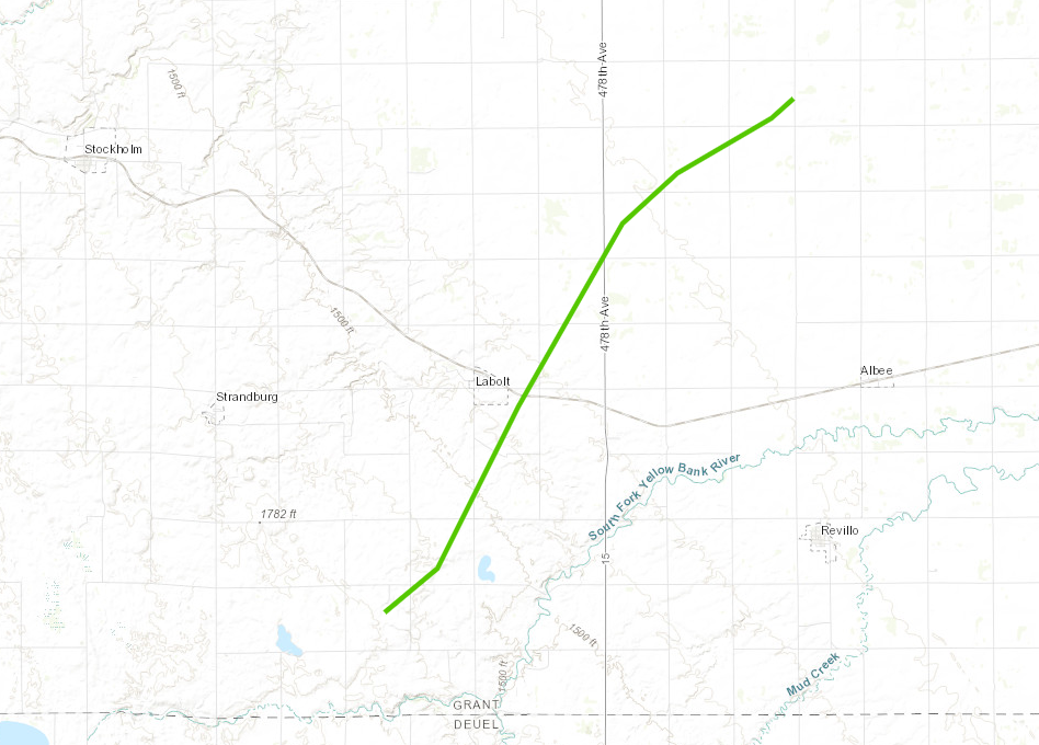
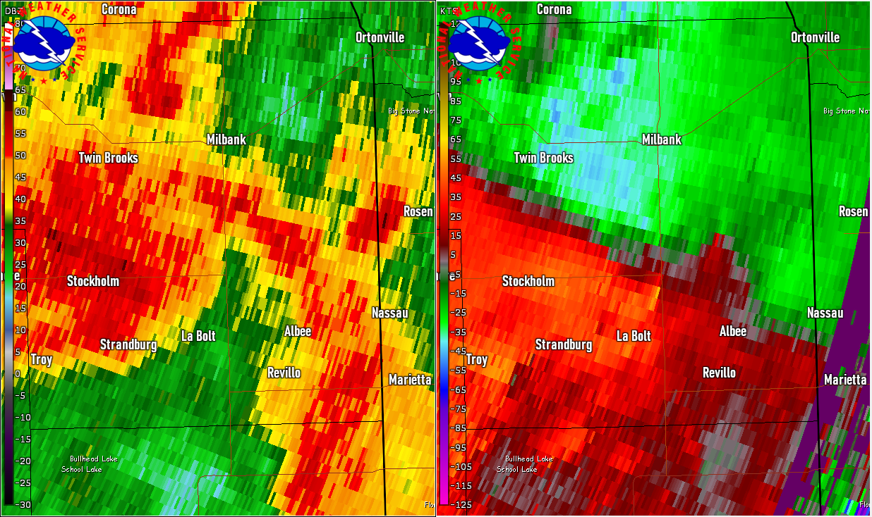
Tornado #4 - From 4 miles SSW of La Bolt, SD to 4 miles NNW of Albee, SD
Track Map
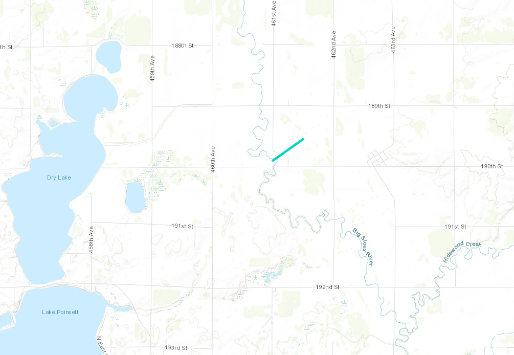
Tornado #5 - 4 miles ENE of of Stone Bridge, SD
Track Map
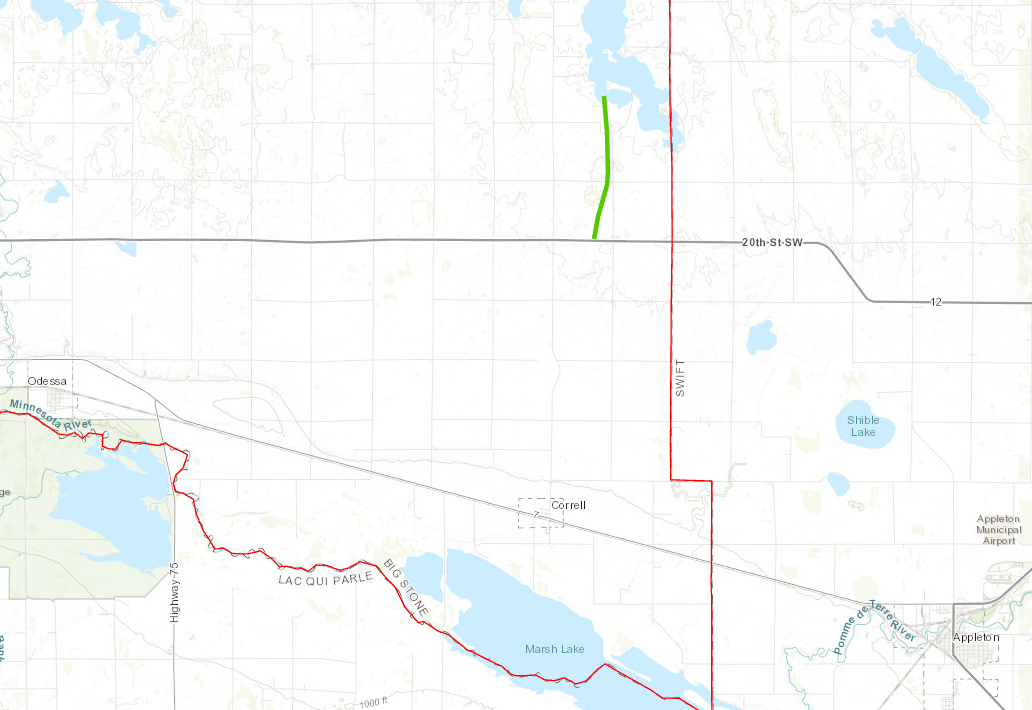
Tornado #6 - 4 miles south of Artichoke, MN
Track Map
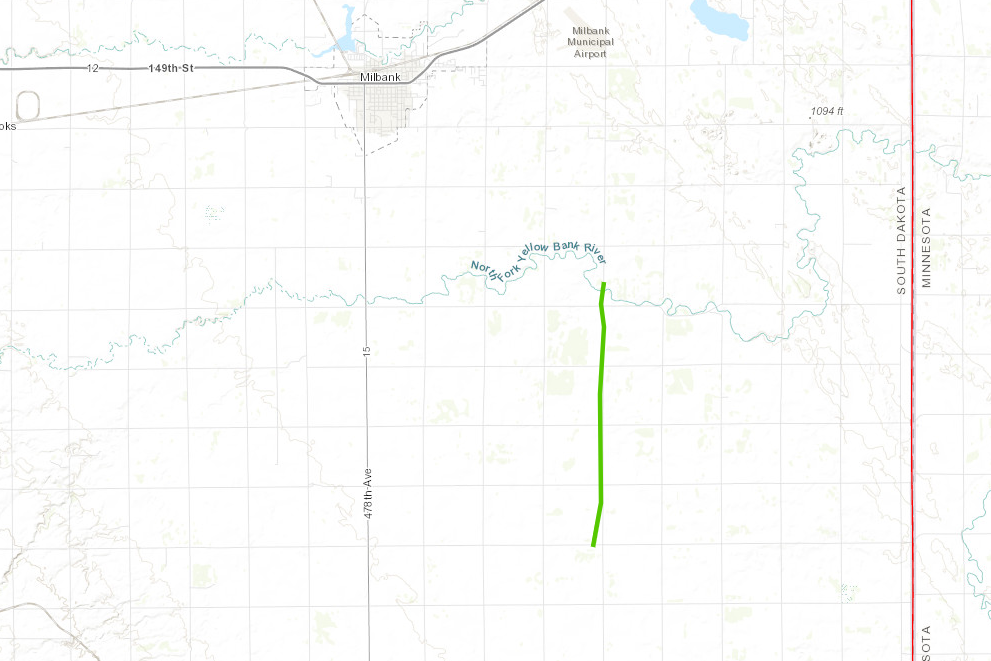
Tornado #7 - From 4 miles north of Albee, SD to 5 miles SE of Milbank, SD
Track Map
|
||||||||||||||||||||||||||||||||||||||||||||||||||||||||||||||||||||||||||||||||||||||||||||||||||||||||||||||||||||||||||||||||||||||||||||||||||||||||||||||||||||||||
The Enhanced Fujita (EF) Scale classifies tornadoes into the following categories:
| EF0 Weak 65-85 mph |
EF1 Moderate 86-110 mph |
EF2 Significant 111-135 mph |
EF3 Severe 136-165 mph |
EF4 Extreme 166-200 mph |
EF5 Catastrophic 200+ mph |
 |
|||||
Photos, Video
 |
 |
 |
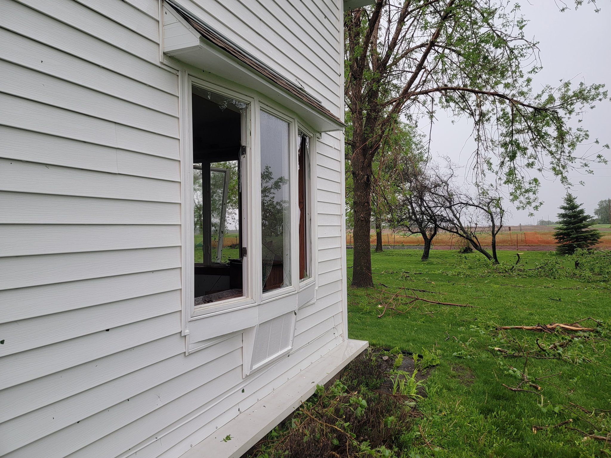 |
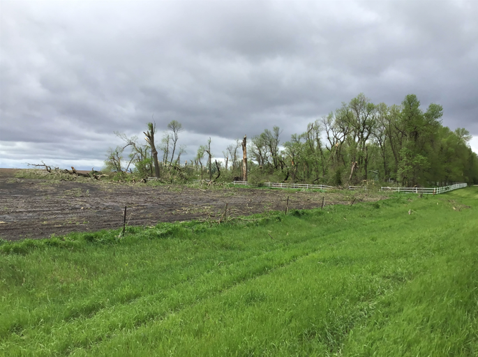
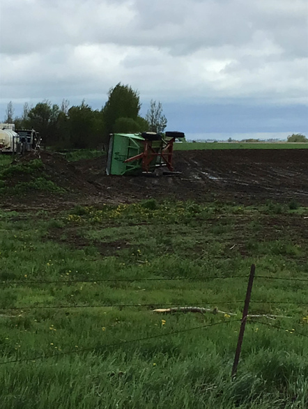
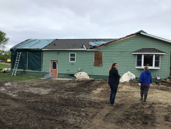
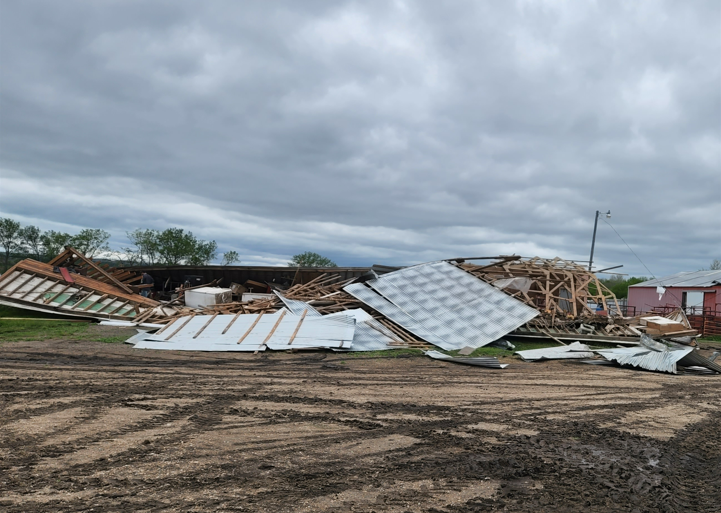
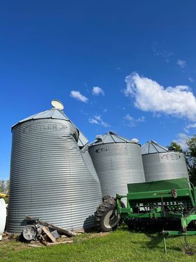
| Damage west of Clear Lake. Photo courtesy of the Deuel County Emergency Manager. | Damage west of Clear Lake. Photo courtesy of the Deuel County Emergency Manager. | Damage west of Clear Lake. Photo courtesy of the Deuel County Emergency Manager. | Damage south of Artichoke Lake. Image courtesy of Jason Bednar |
 |
 |
 |
 |
| Damage south of Artichoke Lake. Image courtesy of Jason Bednar | Damage south of Artichoke Lake. Image courtesy of Jason Bednar | Damage about 7 miles southeast of Milbank. Photo courtesy of Jackie Loeschke | Damage about 7 miles southeast of Milbank. Photo courtesy of Jackie Loeschke |
 |
 |
 |
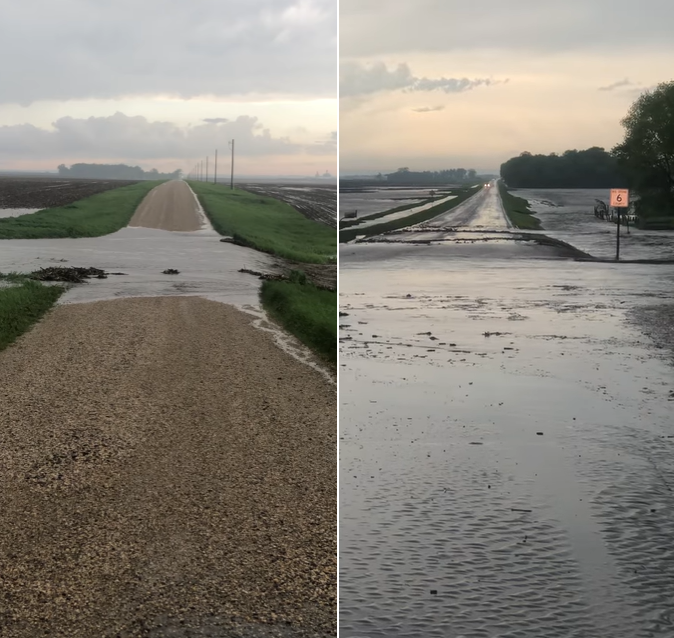 |
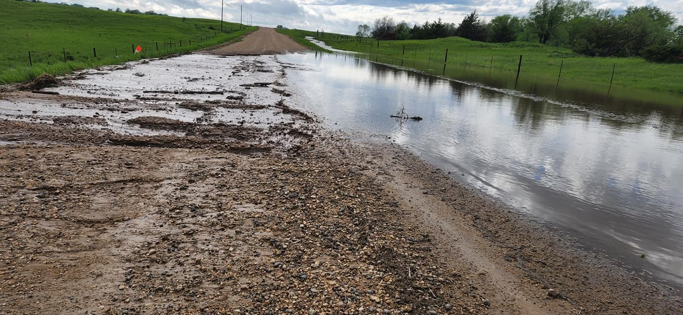
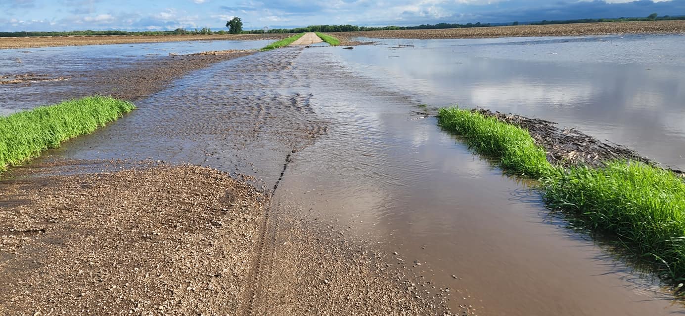
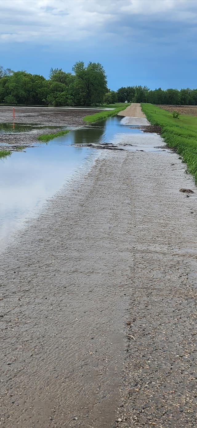
| County and secondary roads under water or washed out across Grant County. Photo from the Emergency Manager. | County and secondary roads under water or washed out across Grant County. Photo from the Emergency Manager. | County and secondary roads under water or washed out across Grant County. Photo from the Emergency Manager. | A couple examples of flooded roads across Big Stone County. Photo courtesy of the Emergency Manager |
 |
 |
 |
 |
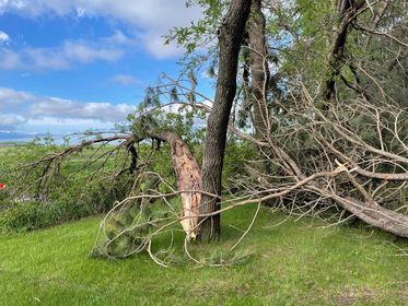
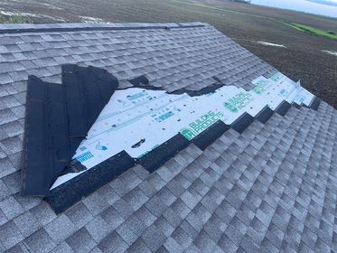
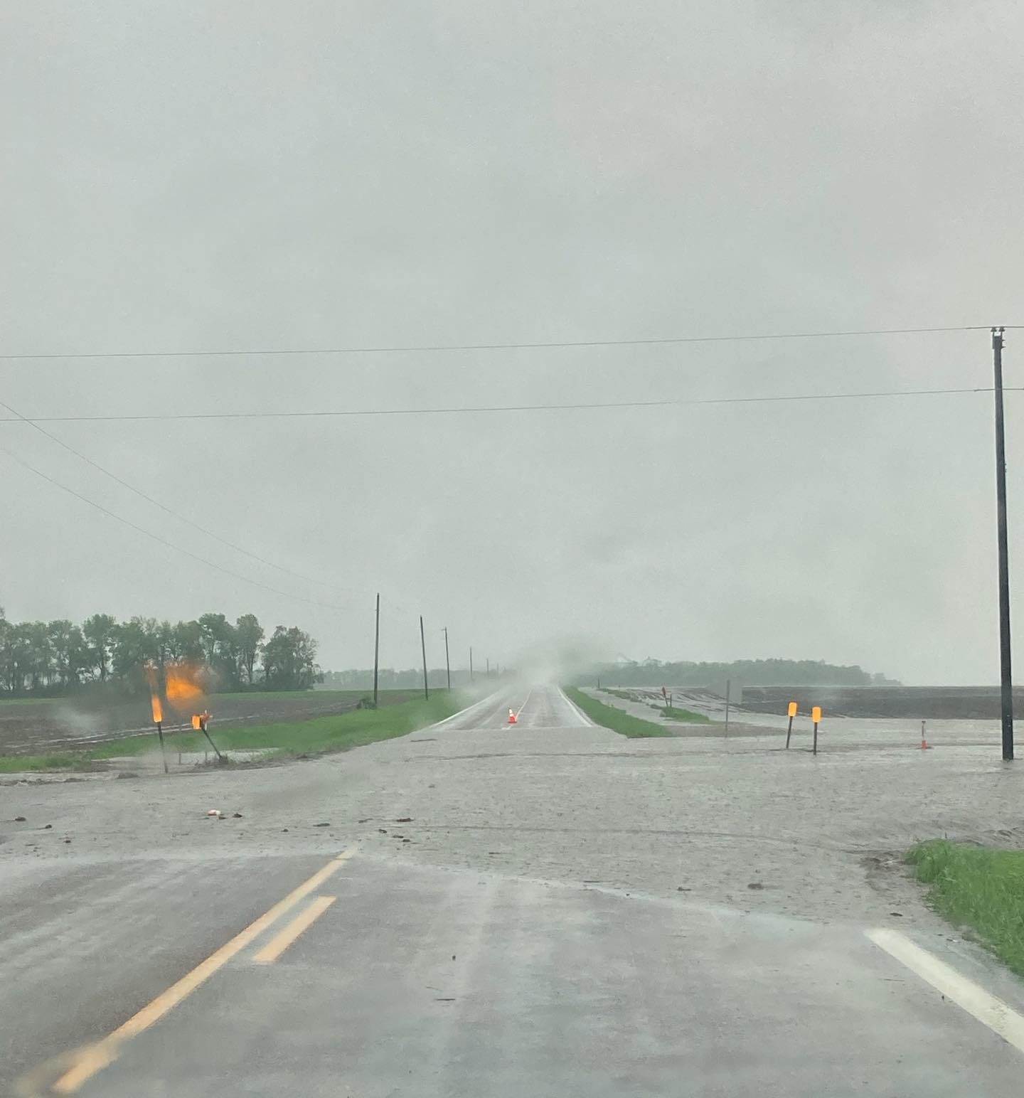
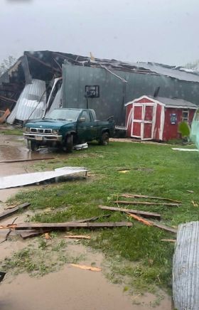
| One example of flooded roadways, this one near Wilmot around 4pm on the 30th. Photo from the SD Highway Patrol. | Tree damage about 9 miles southeast of Milbank. Photo courtesy of Aj Kolb | Tree damage about 9 miles southeast of Milbank. Photo courtesy of Aj Kolb | Tornado damage south of LaBolt. Photo courtesy of Dakota Wollschlager |
 |
 |
 |
 |
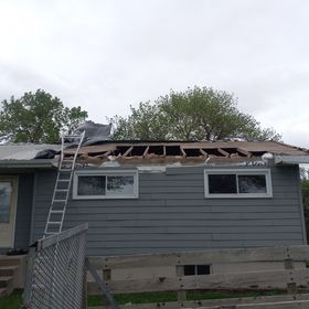
| Tornado damage south of LaBolt. Photo courtesy of Dakota Wollschlager | Tornado damage south of LaBolt. Photo courtesy of Dakota Wollschlager | Tornado damage south of LaBolt. Photo courtesy of Dakota Wollschlager | Tornado damage ~5 miles SE of Milbank. Photo courtesy of Amy Torgerson |
 |
 |
||
| Tornado damage ~5 miles SE of Milbank. Photo courtesy of Amy Torgerson | Tornado damage ~5 miles SE of Milbank. Photo courtesy of Amy Torgerson |
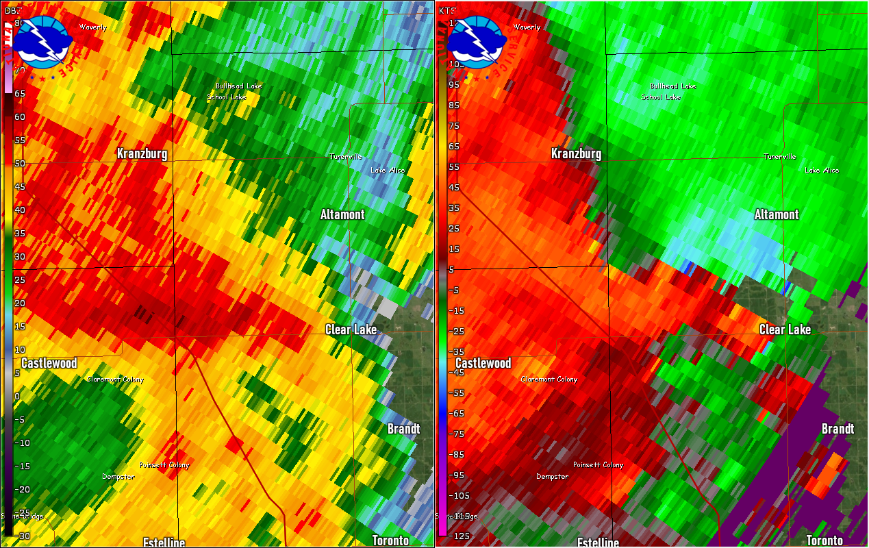
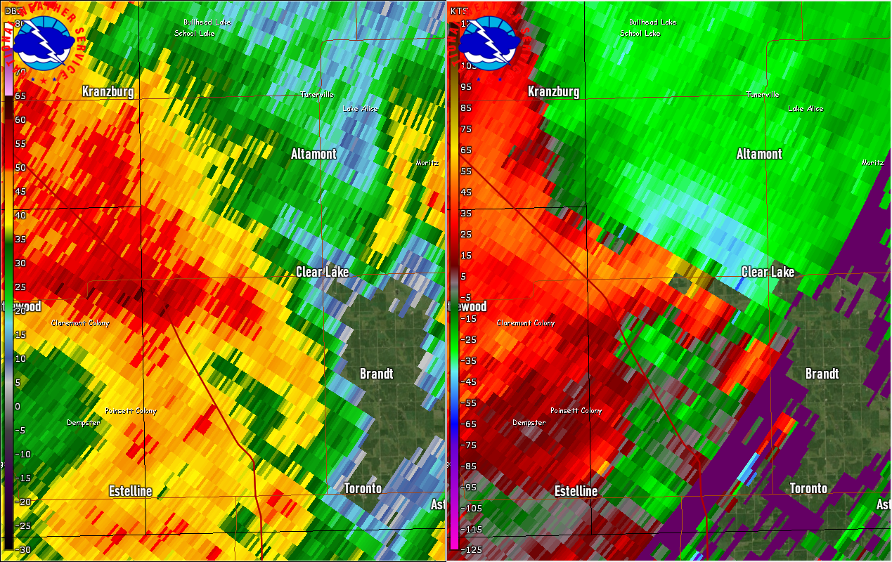
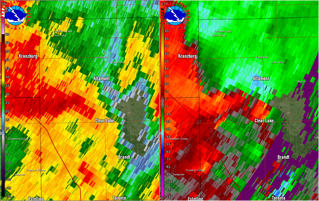
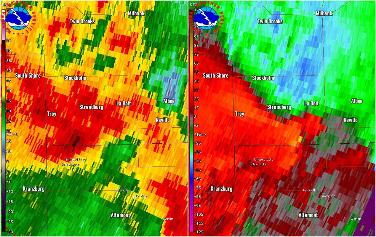
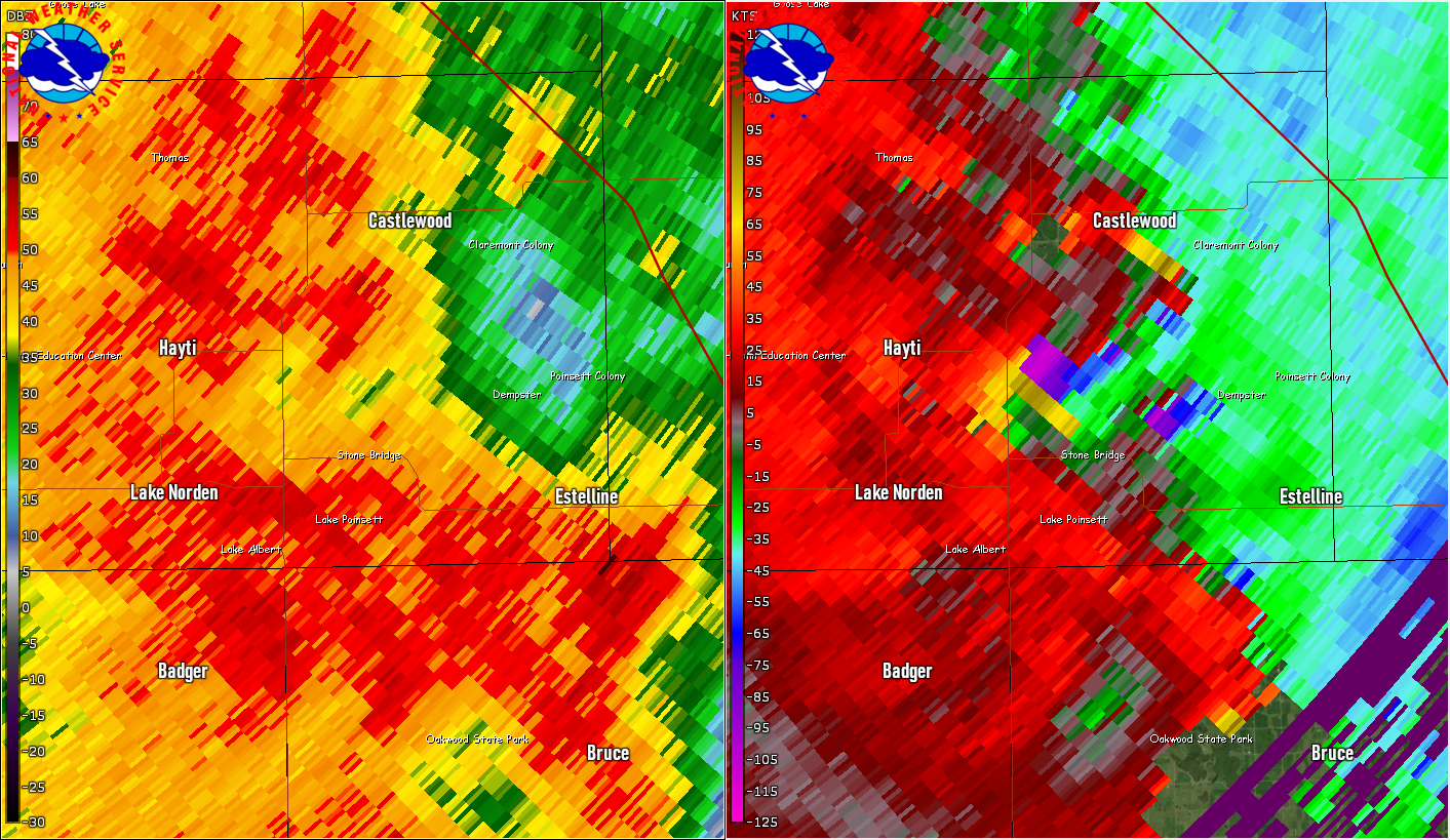
Radar, Satellite
| Radar reflectivity from noon to 8pm on Monday, May 30th, 2022 |
| Visible satellite imagery from 1030am to 815pm on Monday, May 30th, 2022 |
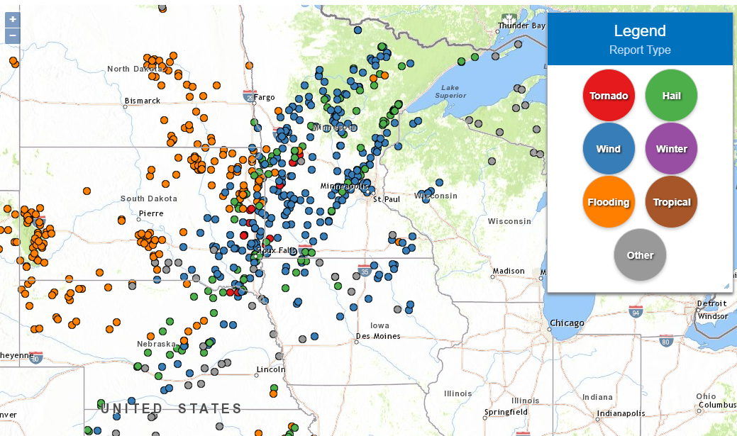
Storm Reports
Locations of preliminary reports of severe weather across the area, including damaging straight-line winds, large hail, heavy rain and tornadoes. Find the latest reports and information for each one at this updated interactive map.
Rainfall, Flooding
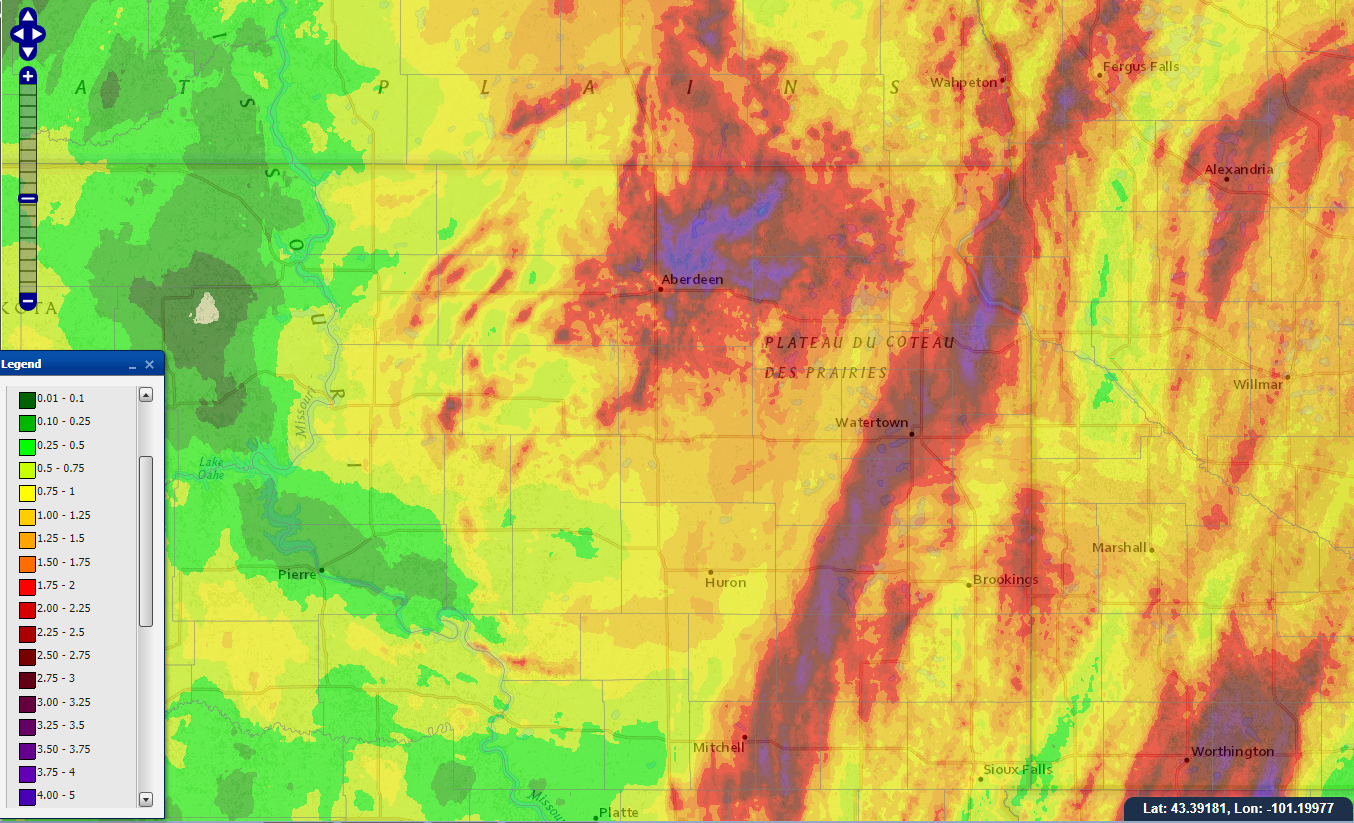
24 hour radar-estimated rainfall totals during the calendar day on Monday, May 30th. Red and purple colors represent values of 2 to 4+ inches.
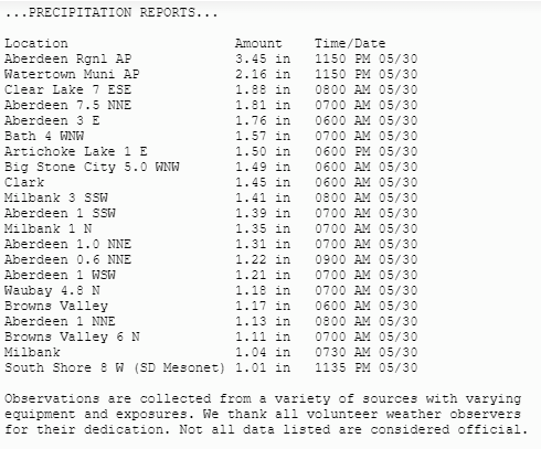
A few preliminary measured rainfall totals from May 30th. Aberdeen and Watertown set daily rainfall records for May 30th with 3.45" and 2.16" of rain respectively.
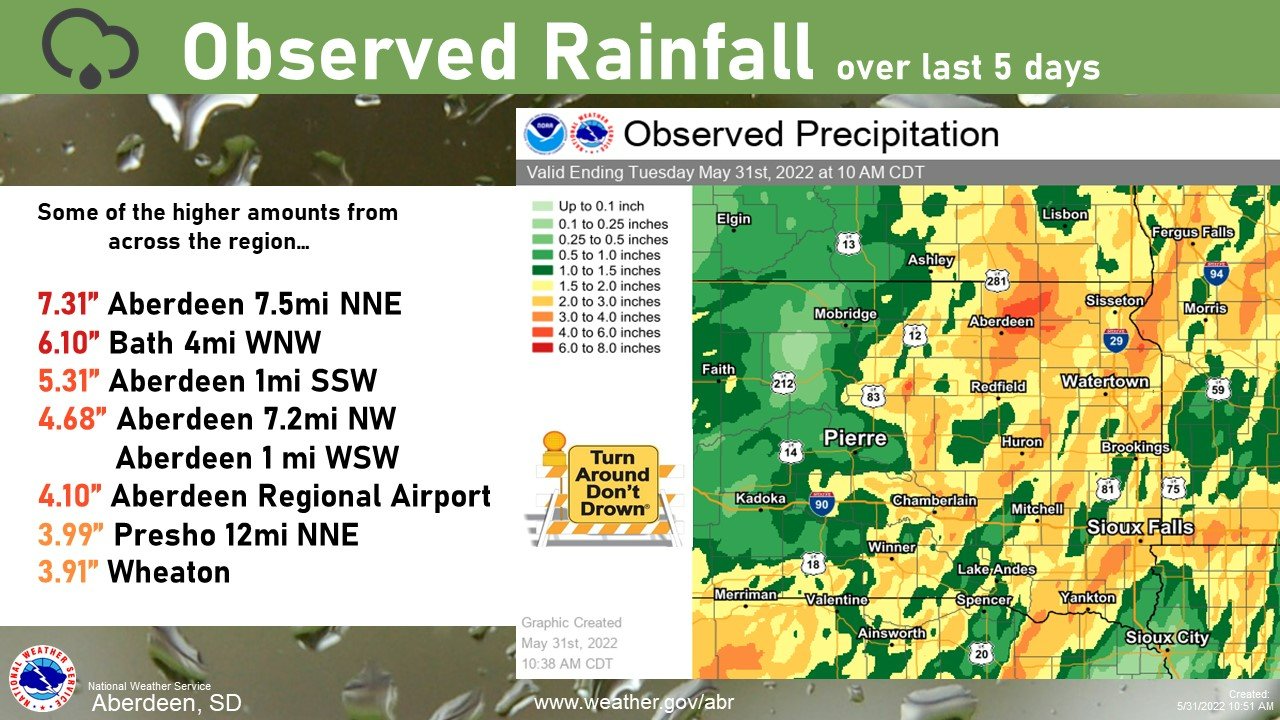
May 30th capped off a wet several days across the area.
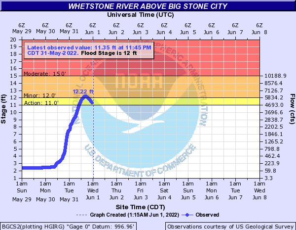
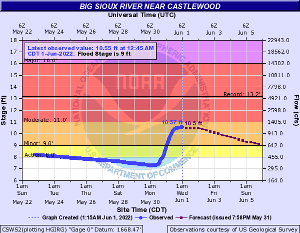
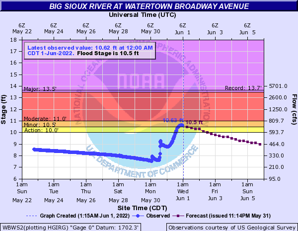
As a result of the heavy rain on May 30th, which fell on already saturated soils, flooding was observed across many roadways from Hamlin to Traverse Counties, and locally elsewhere. River flooding also became an issue, with several river gauge sites spiking to minor flood stage.
 |
 |
 |
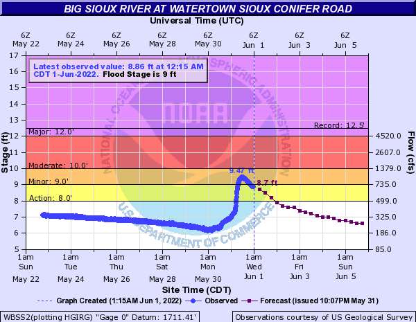 |
| Whetstone River above Big Stone City, MN | Big Sioux River near Castlewood, SD | Big Sioux River at Watertown - Broadway Avenue | Big Sioux River at Watertown - Sioux Conifer Road |
Environment, Historical Significance
Surface observations
 |
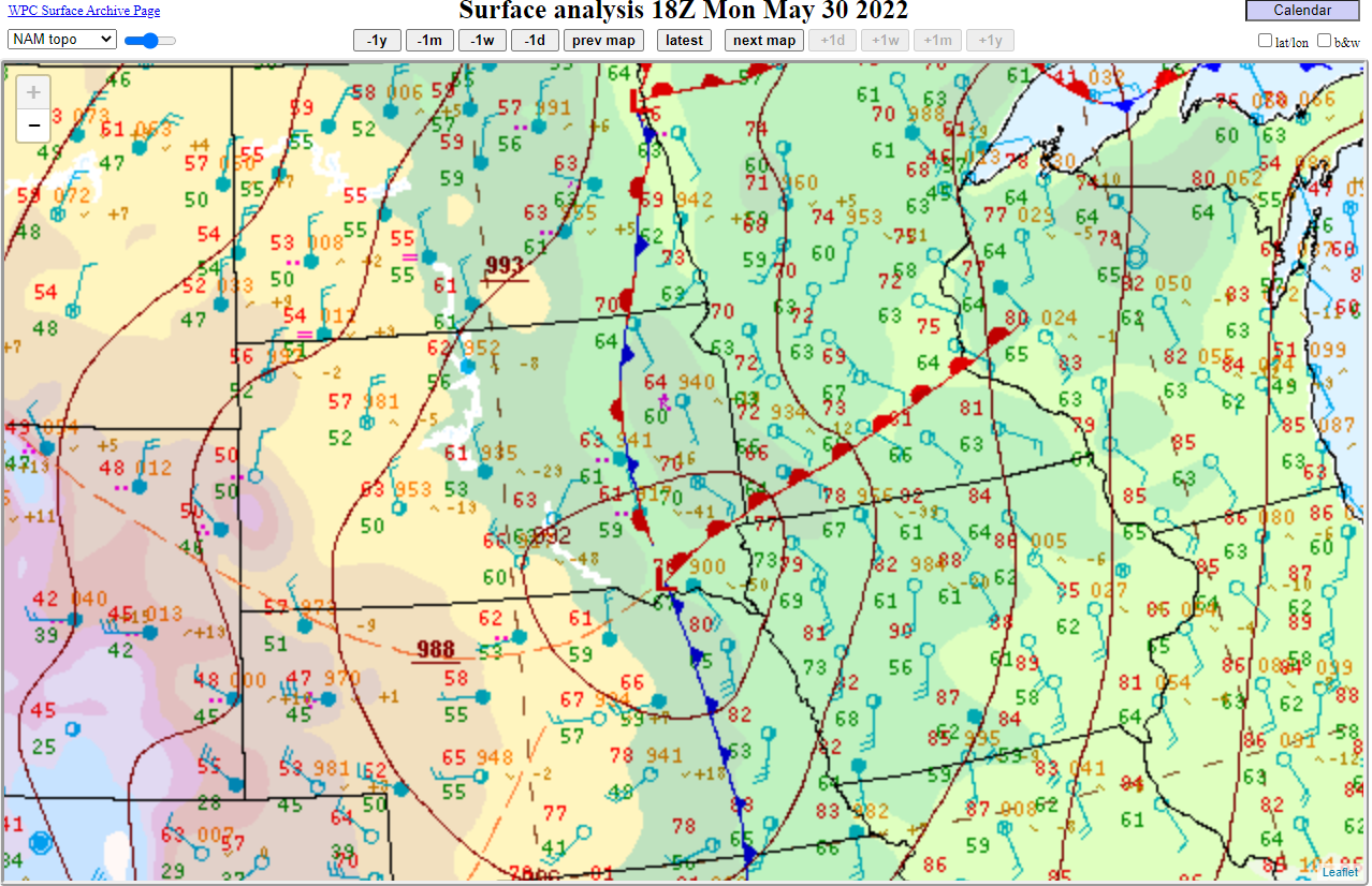 |
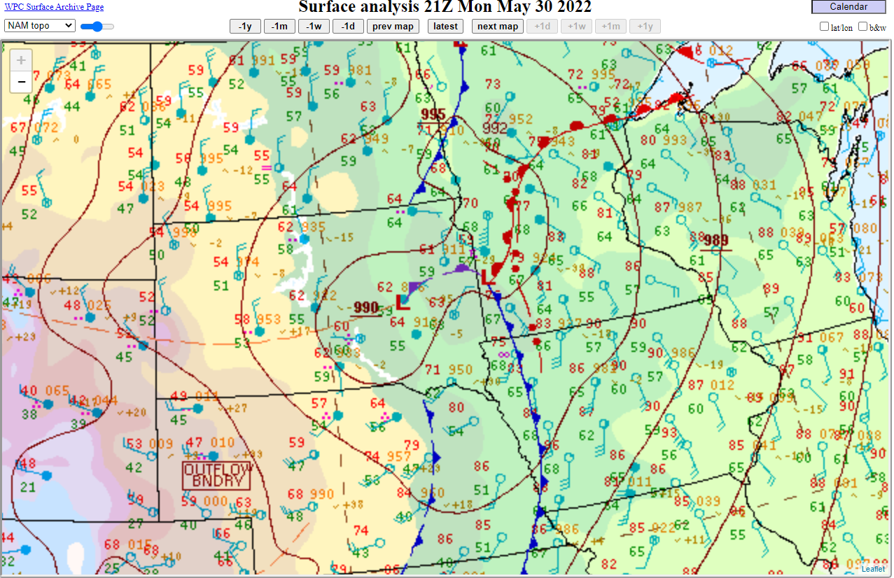 |
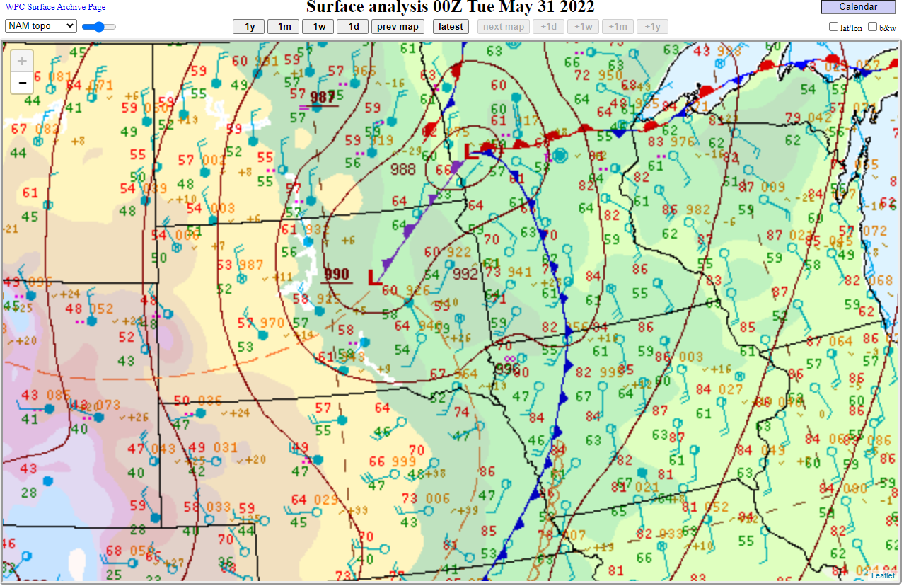 |
| 10am, May 30th, showing strong low pressure across Nebraska | 1pm, May 30th, showing low pressure and its associated warm front lifting north | 4pm, May 30th, showing the system continuing north and east | 7pm, May 30th, showing low pressure remaining in the area, leading to continued heavy rainfall |
Historical Significance
12 tornadoes were confirmed in South Dakota on May 30th, 2022. By the end of May 2022, 29 total tornadoes had been confirmed during the month across South Dakota, which ranks tied 3rd for the most of any May since records began in 1950 (29 in 2007, 31 in 1985 and 42 in 1965). South Dakota averages 6.6 tornadoes during a typical May, and a total of 30 tornadoes each season (from 1991-2021).
30 tornadoes were confirmed in Minnesota on May 30th, 2022. This was the largest single-day tornado outbreak in the state since September 20th, 2018 when 33 tornadoes were confirmed. By the end of May 2022, 58 total tornadoes had been confirmed during the month across Minnesota, which ranks as the most for any May since records began in 1950 (27 in 2001, 24 in 1965), and as the second most in any single month behind only June 2010's 83. Minnesota averages 6.4 tornadoes during a typical May, and a total of 49 tornadoes each season (from 1991-2021).
 |
 |
 |
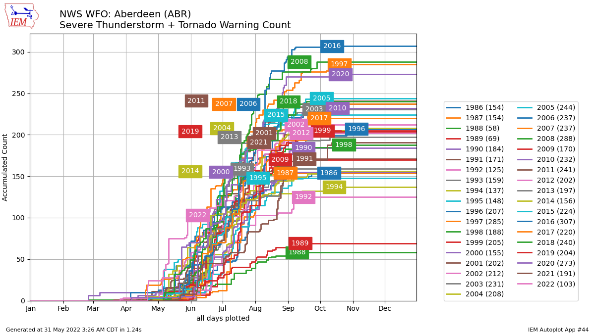 |
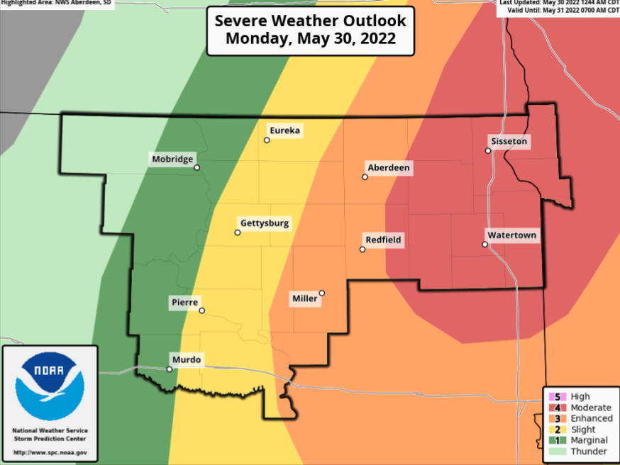
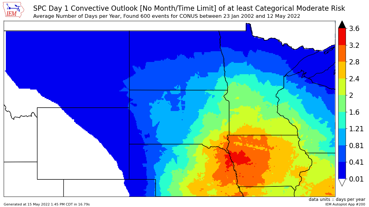
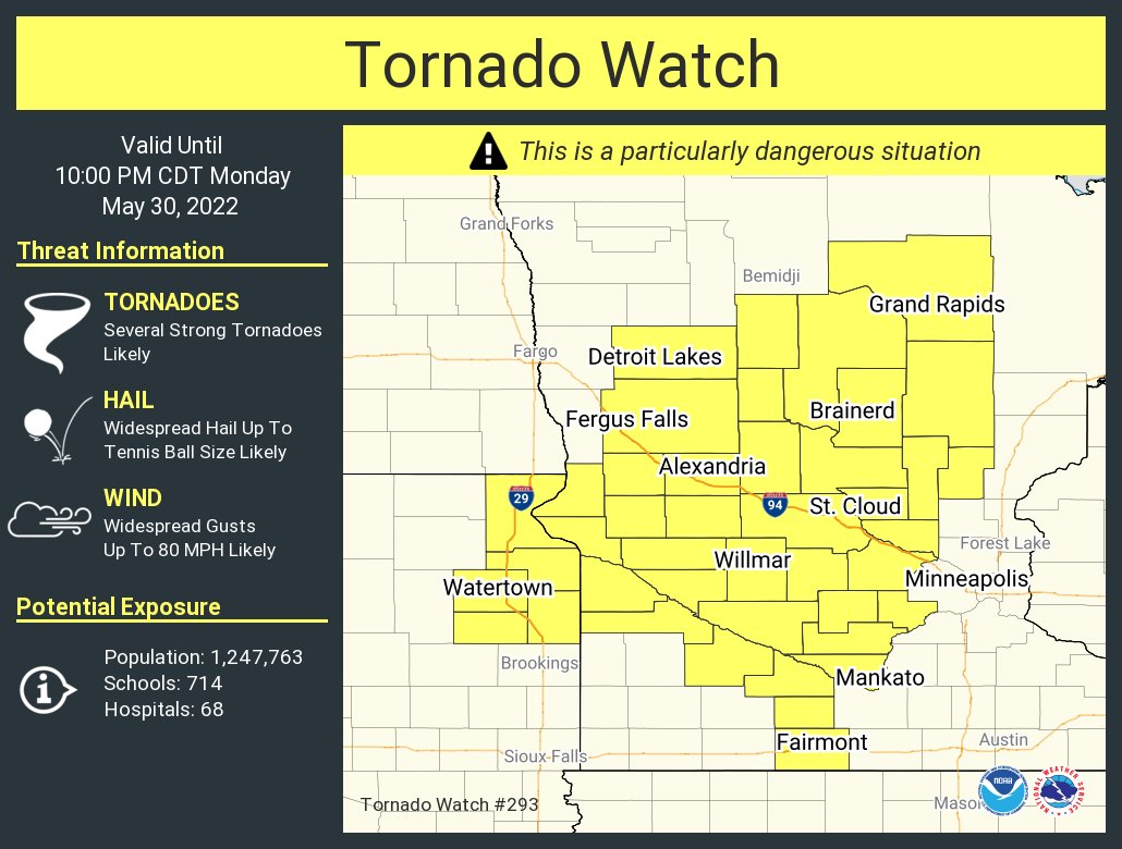
| A Moderate risk of severe weather from the Storm Prediction Center (SPC) was in place across the area. Shown is the initial morning forecast on the 30th. | Moderate risks from the SPC are only issued about 1 to 2 times on average each year across central & northeastern SD and west central MN. | A Particularly Dangerous Situation (PDS) Tornado Watch was in place across portions of northeastern SD and west central MN. These are issued in rare situations when particularly dangerous tornadoes are possible. | NWS Aberdeen has issued more Severe Thunderstorm and Tornado Warnings (combined) through May 31st than any other year on record since 1986 (when records began): 103 of them. 2nd place was 70 in 1996. |
 |
|||
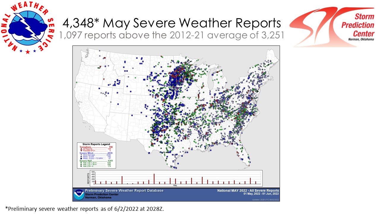
| Preliminary storm reports as of June 2nd across the country for May 2022 |
 |
Media use of NWS Web News Stories is encouraged! Please acknowledge the NWS as the source of any news information accessed from this site. |
|