
Heat expands across the Desert Southwest, Plains, Mississippi Valley and Midwest into Monday. Fire weather concerns continue for portions of the Intermountain West. Active monsoonal moisture fuels thunderstorms over the Southwest with possible flash flooding. Tropical cyclone Fausto in the Pacific, should weaken as it approaches Hawaii; Dangerous surf, swells and rip currents are expected. Read More >
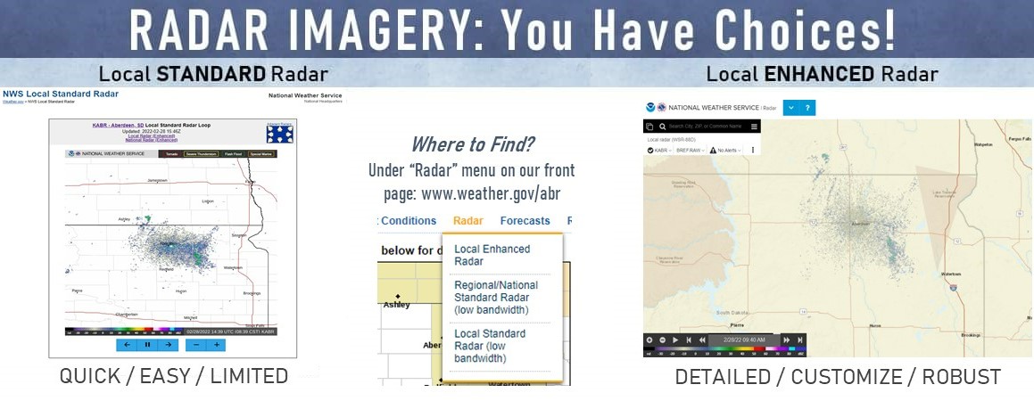
We've listened to your feedback and made some changes to how we serve you radar data. In addition to performance improvements to the enhanced page (local Aberdeen, SD area), we've added a simplified version that allows for faster loading (local Aberdeen, SD area). Read more about the new pages and data here. A quick run-down of pros and cons for each are listed below.
Standard/Lite Version
Pros: QUICKER load times (good for low bandwidth), can loop data (10 frames, about 45 minutes), automatically updated every 5 minutes, includes overlays for warnings (Tornado, Severe Thunderstorm, Flash Flood, Snow Squall), best for a "quick look" at what's going on.
Cons: Only reflectivity data, fixed view (cannot zoom in/out or scroll to other locations), no additive overlays (other hazards, map backgrounds, forecast information for a point, etc.).
Enhanced Version
Pros: Multiple radar products available (reflectivity, velocity, storm relative motion, etc.), more frequent updates, 4x higher resolution compared to the Standard/Lite versions, multiple overlays (all storm-based warnings, other hazards, forecasts for a point, etc.), move anywhere (scroll, zoom in/out), customization, loop data, auto updates, extensive help menu, best for storm interrogation.
Cons: Longer load times (higher bandwidth recommended), a lot of options - not necessarily "load and go."

