
Record setting heat is expected over the next several days from the Intermountain West through the northern Plains. Furthermore, fire weather concerns increase with dry and breezy conditions. Meanwhile, heavy rainfall and severe thunderstorm threats for the Ohio/Tennessee Valleys, central Appalachians and Southeast today. The threat shifts to central Gulf Coast and across central Texas this week. Read More >
Overview
July started out as a very active severe weather month! Back to back events brought flooding, hail and high winds to the region. Read about the events from July 2nd & 3rd and July 3rd & 4th below.
|
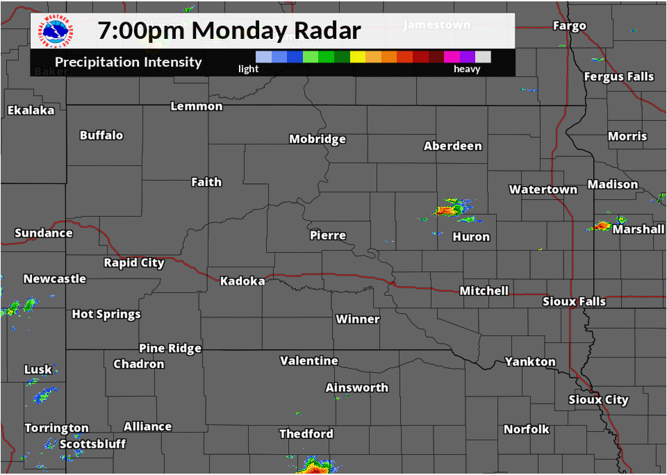
July 2-3 Thunderstorms developed during the evening of July 2nd, extending from Hyde and Hand counties northeast through parts of northeast South Dakota and west central MN. Due to lack of steering winds and back building, the storms over Hand and Spink counties became almost stationary, dumping rain over the same area for over four hours straight. The most significant flooding was reported over northern Hand County where rainfall estimates came in anywhere between 4 and 11 inches. Additional storms developed east into Clark and Hamlin counties and also produced hail and gusty winds. |
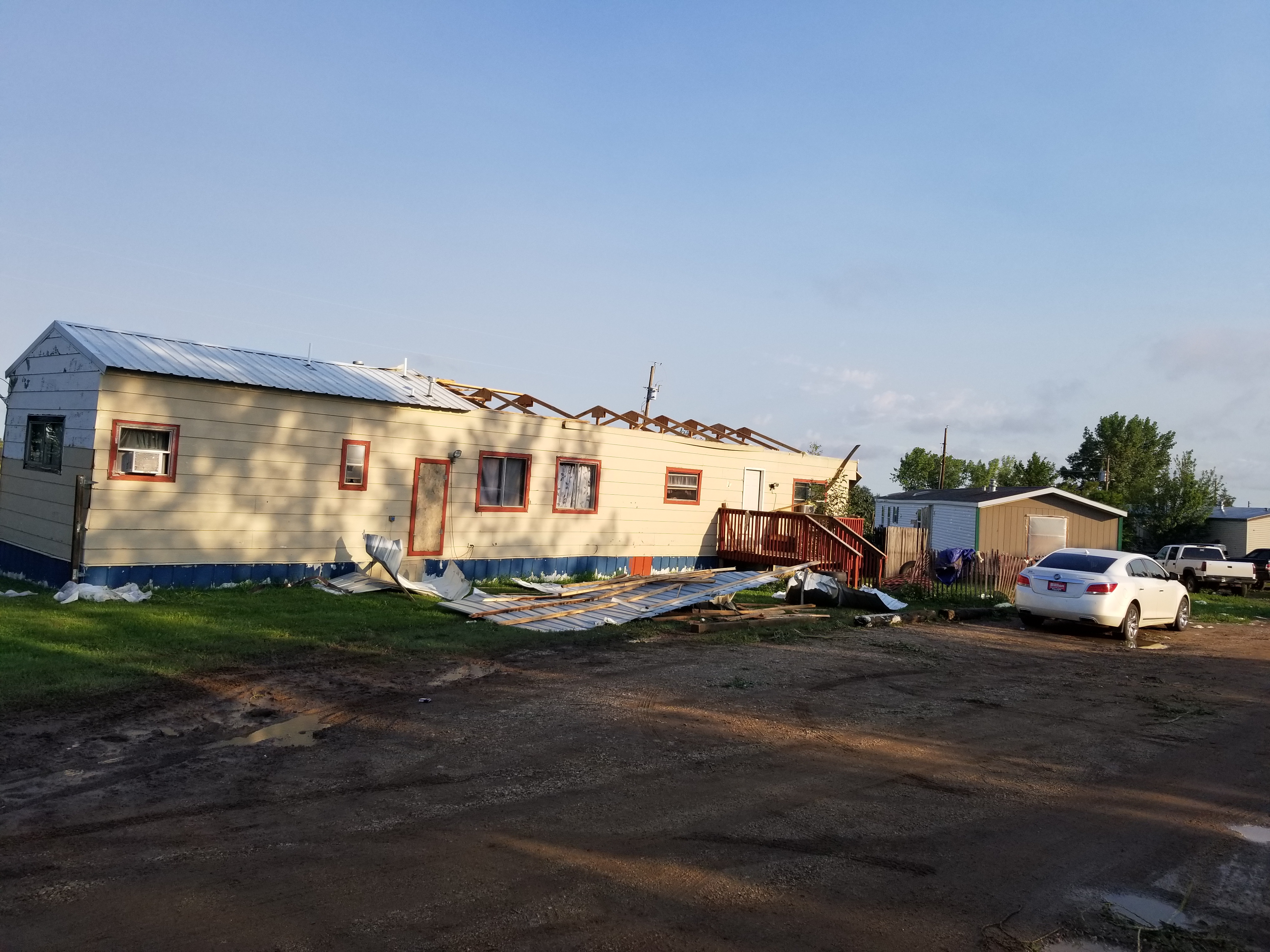
July 3-4 Initial isolated, slow moving storms developed the night of July 3rd, producing heavy rain and large hail, mainly over parts of Faulk county. A second straightline wind producing system developed over western South Dakota after midnight and tracked east northeast across parts of north central South Dakota. Significant damage was reported around the Eagle Butte, Mobridge and Long Lake areas. A weather reporting station at the Mobridge airport recorded 96 mph winds and a weather station 10 miles west of Long Lake also recorded 96 mph winds. |
 |
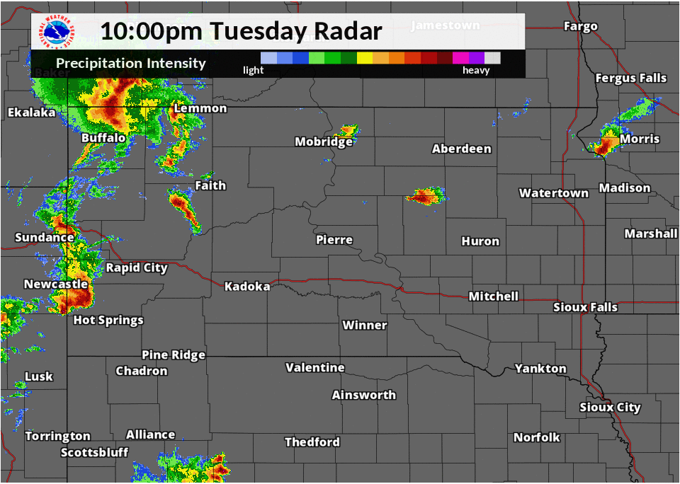 |
| July 2 & 3 Radar Loop | July 3 & 4 Radar Loop |
Wind & Hail:
July 3rd and 4th
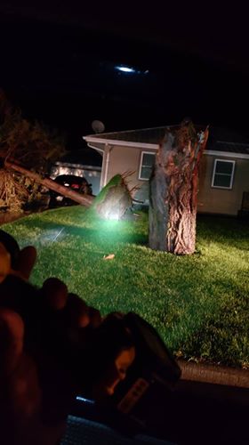
Eagle Butte Wind Damage on July 4th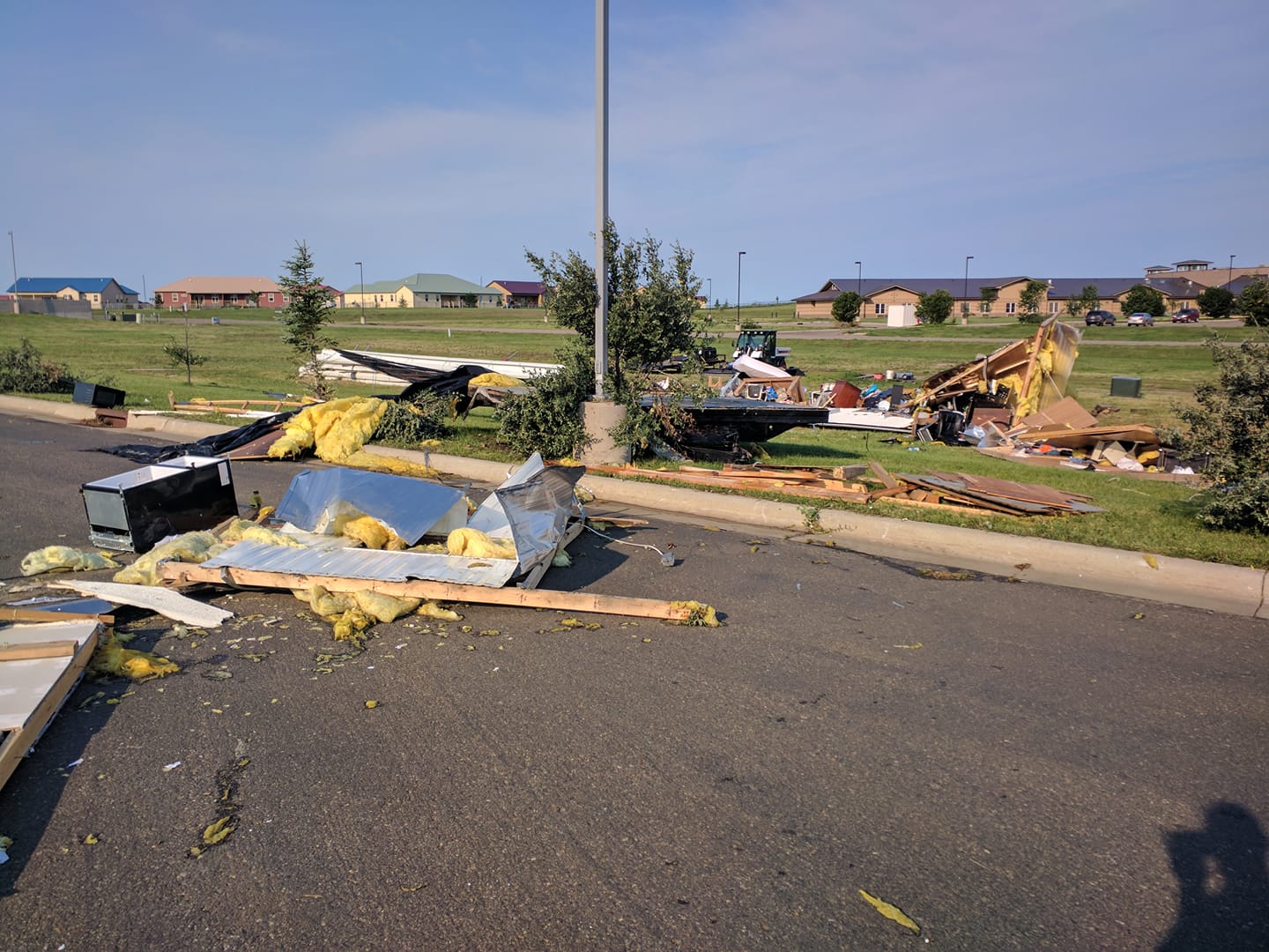 |
 |
 |
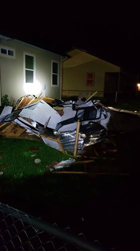 |
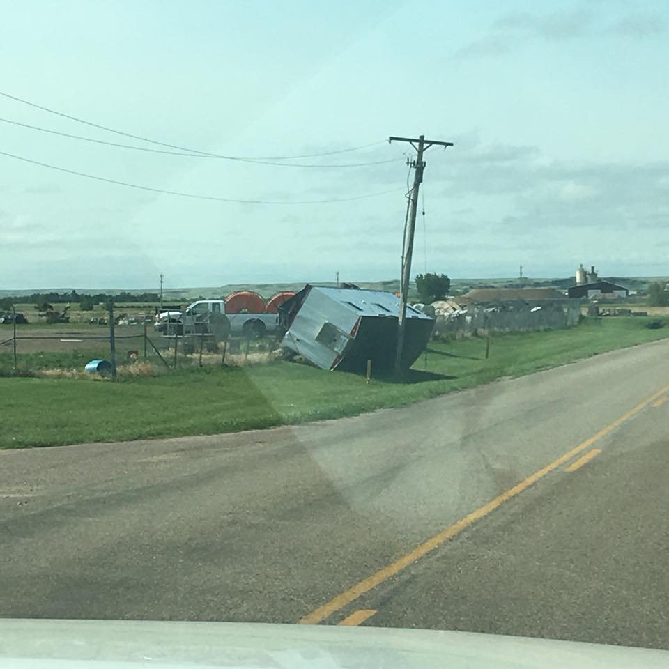
| Trailer destroyed, photo courtesy of Justin Nichols | Machine shed roof damage, photo courtesy of Randolph Runsafter | Truck tipped on side, photo courtesy of Randolph Runsafter | Trailer destroyed, photo courtesy of Tonya White Bull |
 |
 |
 |
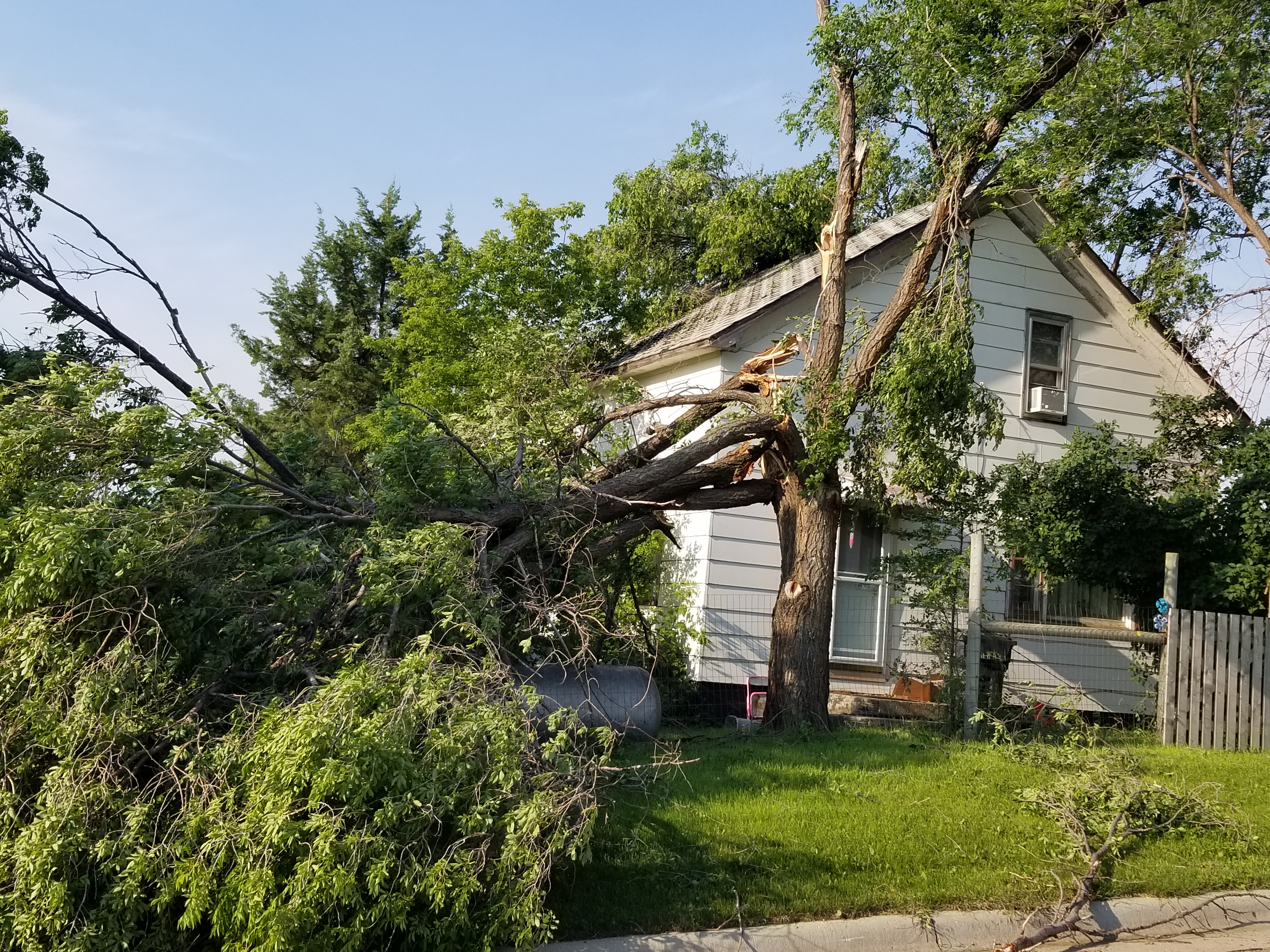 |
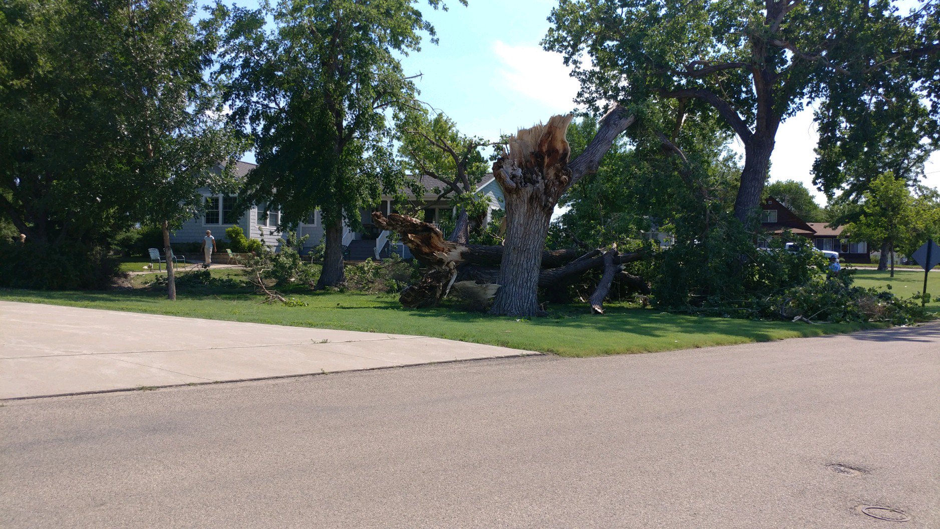
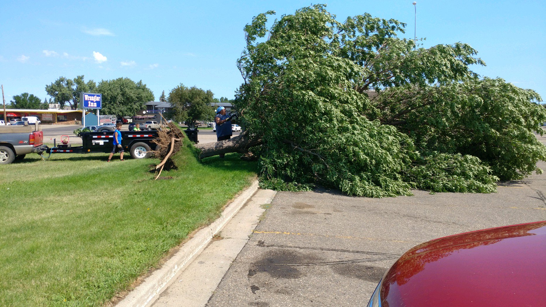
| Tree uprooted, photo courtesy of Tonya White Bull | Trailer damage, photo courtesy of Eagle Butte Police Department | Structure damage, photo courtesy of Eagle Butte Police Department | Tree damage, photo courtesy of Eagle Butte Police Department |
Mobridge Wind Damage on July 4th
 |
 |
 |
 |
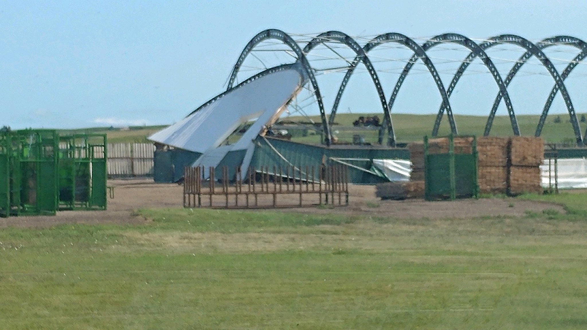
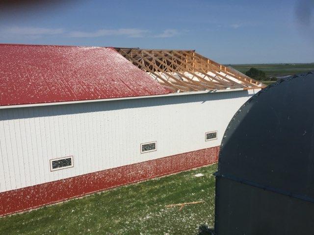
| Hoop barn damage, photo courtesy of Zach Chappell | Jog site trailer flipped, photo courtesy of Amber Zornes | Tree damage, photo courtesy of Zach Chappell | Tent damage, photo courtesy of Zach Chappell |
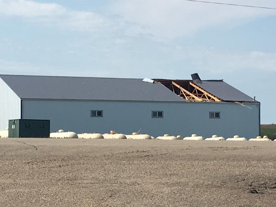
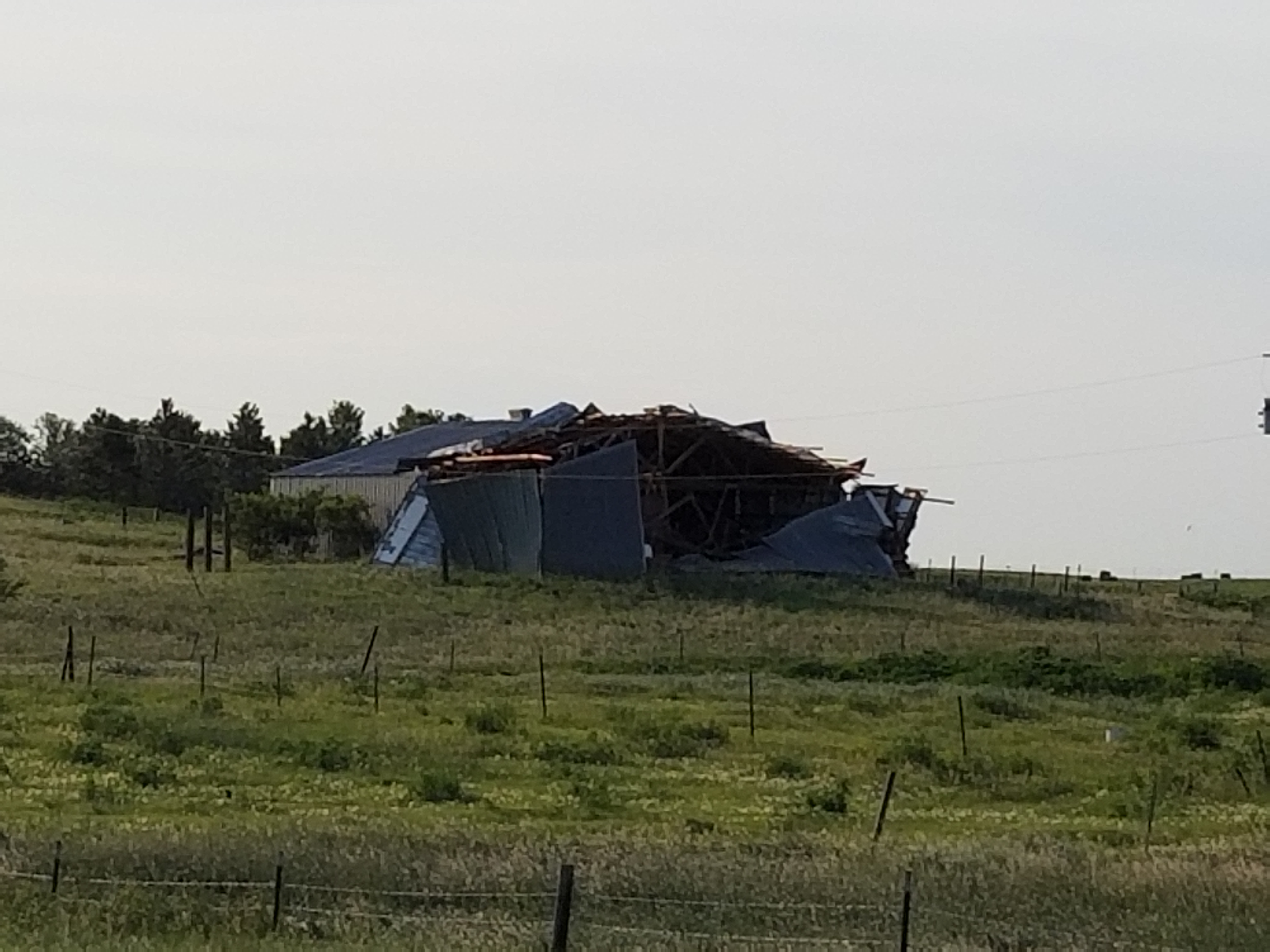
Long Lake Wind Damage on July 4th
 |
 |
| Machine shed damage, photo courtesy of Dennis Wolff | Piece of machine shed roof lodged into tin of grain bin, photo courtesy of Dennis Wolff |
July 2nd and 3rd
 |
 |
 |
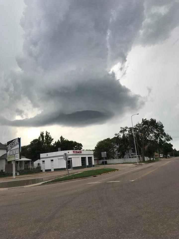 |
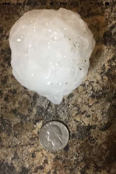
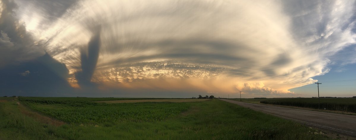
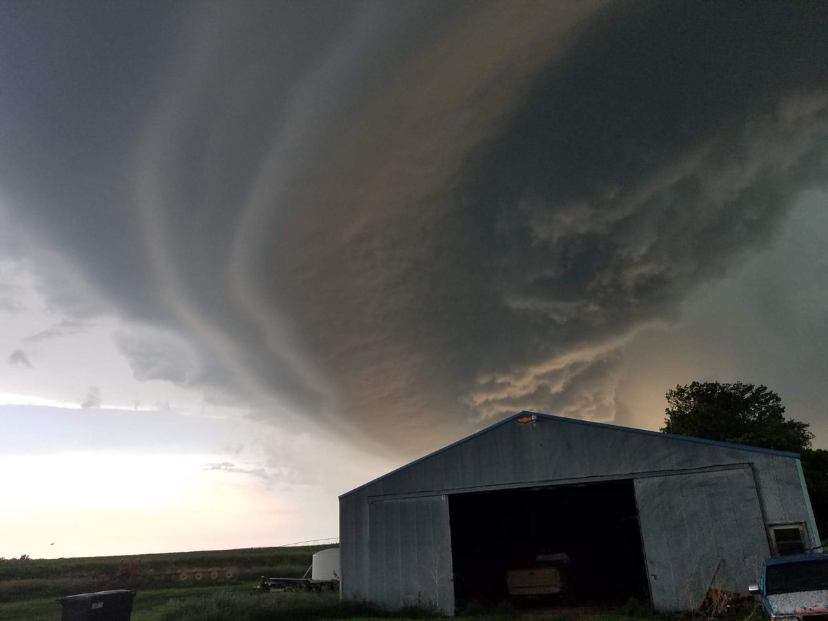
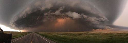
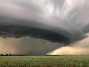
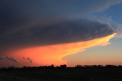
| Large hail 4 miles West of Burdette, SD on July 2nd, photo courtesy of Hand County Emergency Management | Cumulonimbus cloud as seen from Aberdeen at 9:56 pm, courtesy of Steven Fleegel | Supercell approaching Tulare at 8:34 pm, courtesy of Dave Brooker relayed via Brent Nathaniel | Storm clouds from Redfield, courtesy of Derrick J. Quitsch relayed via Brent Nathaniel |
 |
 |
 |
 |
| Funnel cloud SW of Tulare at 8:15 PM, courtesy of John Doren | Supercell east of Hitchcock, courtesy of Clay Martin | Supercell east of Hitchcock, courtesy of Clay Martin | Cumulonimbus at sunset, as seen from west of Aberdeen. Courtesy of Mike Scott |
Flooding
Hand County Flooding from the July 2-3 Event
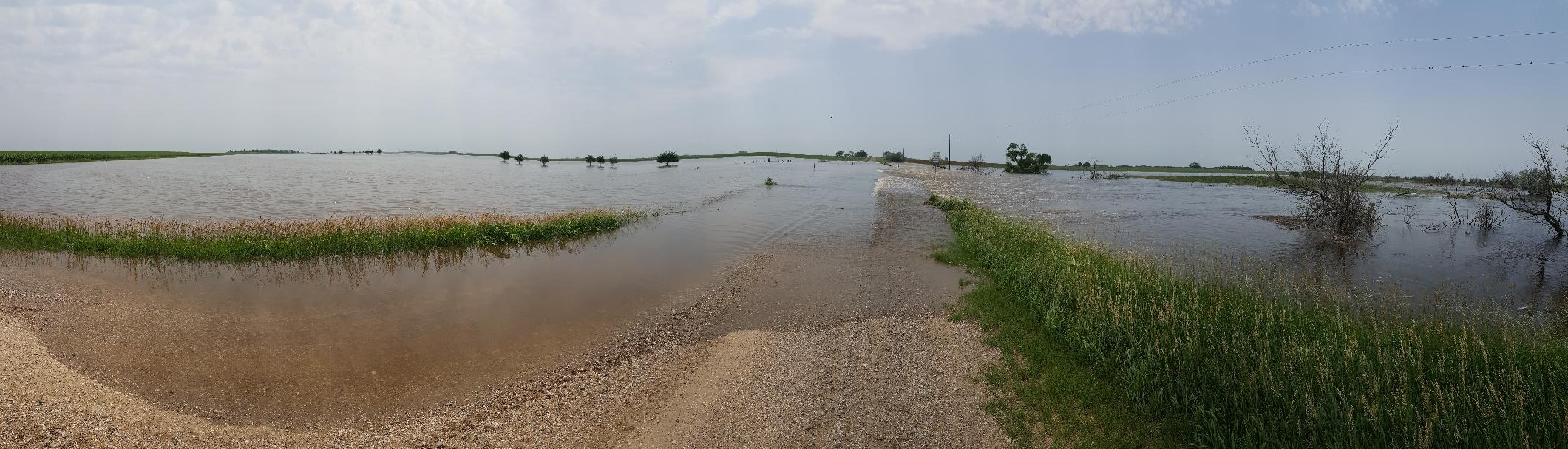 |
| Road flooded over in Hand County. Photo courtesy of Hand County Emergency Management. |
Oak Creek Hydrograph July 3-4
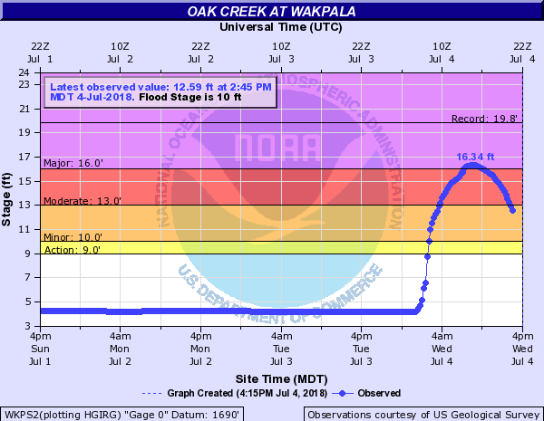 |
| The Oak Creek river gauge at Wakpala showed water level increased by 12 feet due to heavy rains in the area. |
24 Hour Radar Estimated Rainfall Totals as of 10 am July 3rd
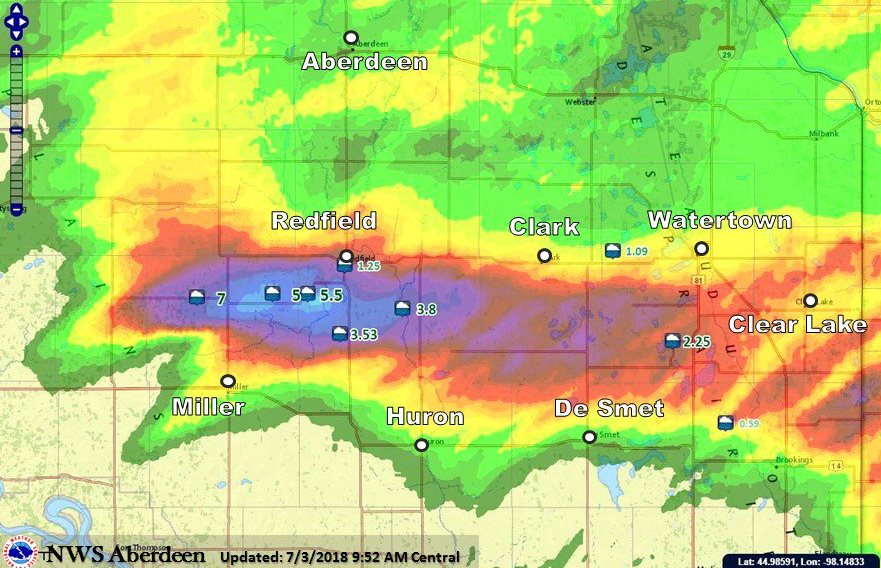 |
| From the NWS Enhanced Data Display. The highest recorded rainfall amount was 11" from a KELO-LAND rain gauge 3 miles SSW of Polo. Rain fell from about 9:30 pm CDT Monday night through about 2:30 am CDT Tuesday, July 3rd. |
Storm Reports
For a complete list of storm reports, visit this page: https://mesonet.agron.iastate.edu/lsr/#ABR/201807020500/201807041700/0101
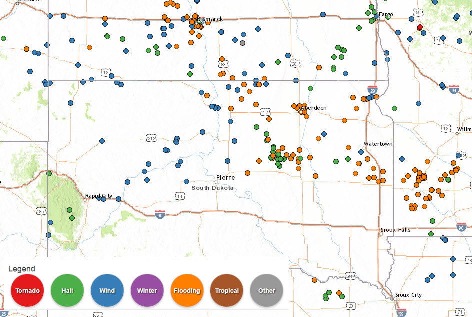 |
| Storm reports from July 2nd to July 4th, 2018 |
 |
Media use of NWS Web News Stories is encouraged! Please acknowledge the NWS as the source of any news information accessed from this site. |
|

