Record setting heat is expected over the next several days from the Intermountain West through the northern Plains. Furthermore, fire weather concerns increase with dry and breezy conditions. Meanwhile, heavy rainfall and severe thunderstorm threats for the Ohio/Tennessee Valleys, central Appalachians and Southeast today. The threat shifts to central Gulf Coast and across central Texas this week. Read More >
Overview
|
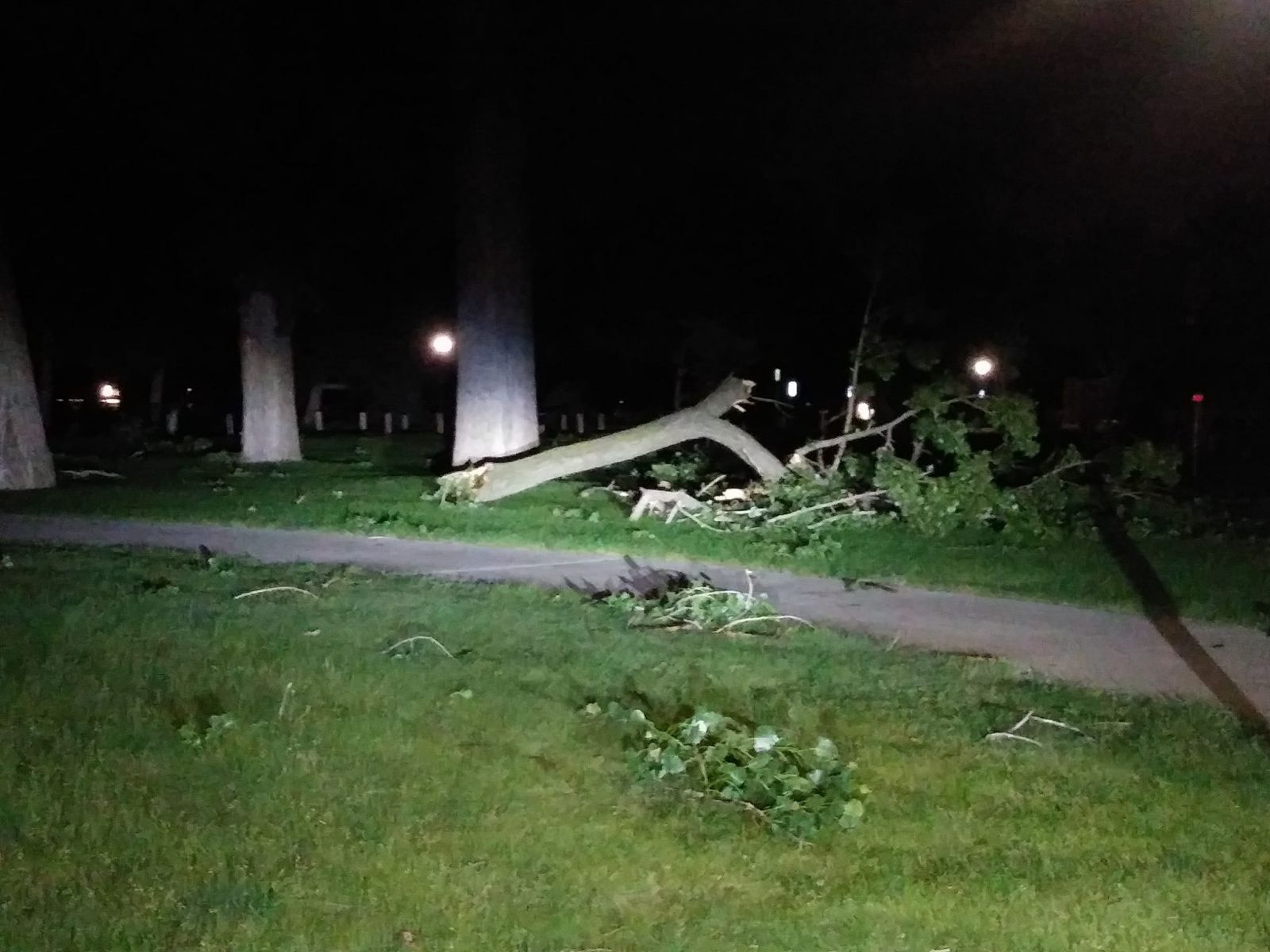
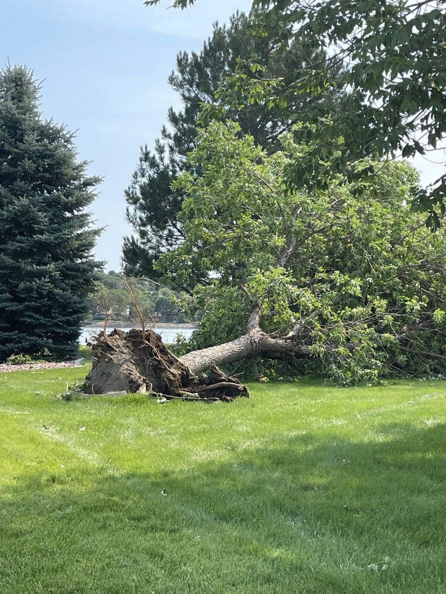
Thunderstorms originating in Montana moved into the western Dakotas while organizing into a squall line and producing winds up to 70 mph. Over time, this squall line began to bow out and generated a concentrated corridor of 80 to 100+ mph straight-line wind gusts over portions of west central to central South Dakota. |
Credit: KCCR Pierre |
Photos
 |
 |
 |
 |
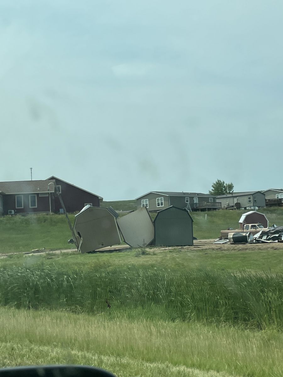
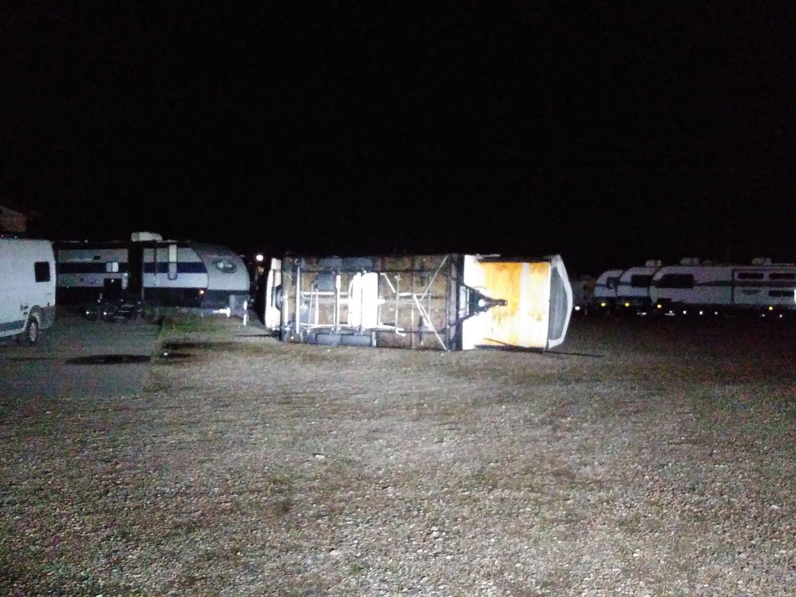
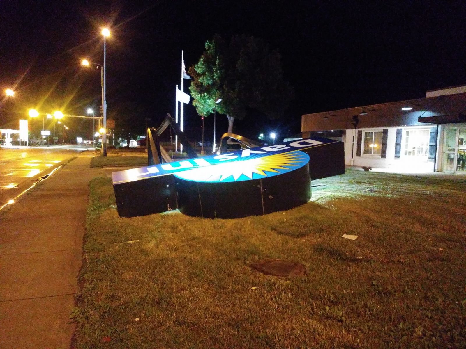
| Small sheds flipped over. Photo credit DRG Media Group. | Days Inn sign bent over. Photo credit KCCR Pierre. | RV trailer tipped over. Photo credit KCCR Pierre. | Portion of a tree snapped at the base. Photo credit DRG Media Group. |
 |
 |
 |
 |
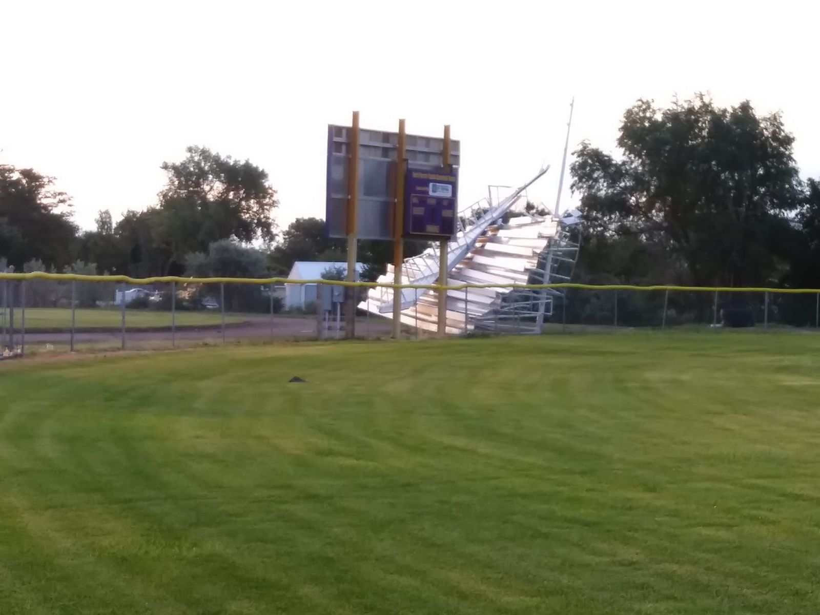
| Bleacher damage at a baseball field. Photo credit KCCR Pierre. | Another view of the Days Inn sign. Photo credit KCCR Pierre. | Siding pulled off a building. Photo credit DRG Media Group. | Tree snapped at the base of the trunk. Photo credit KCCR Pierre. |
 |
 |
 |
 |
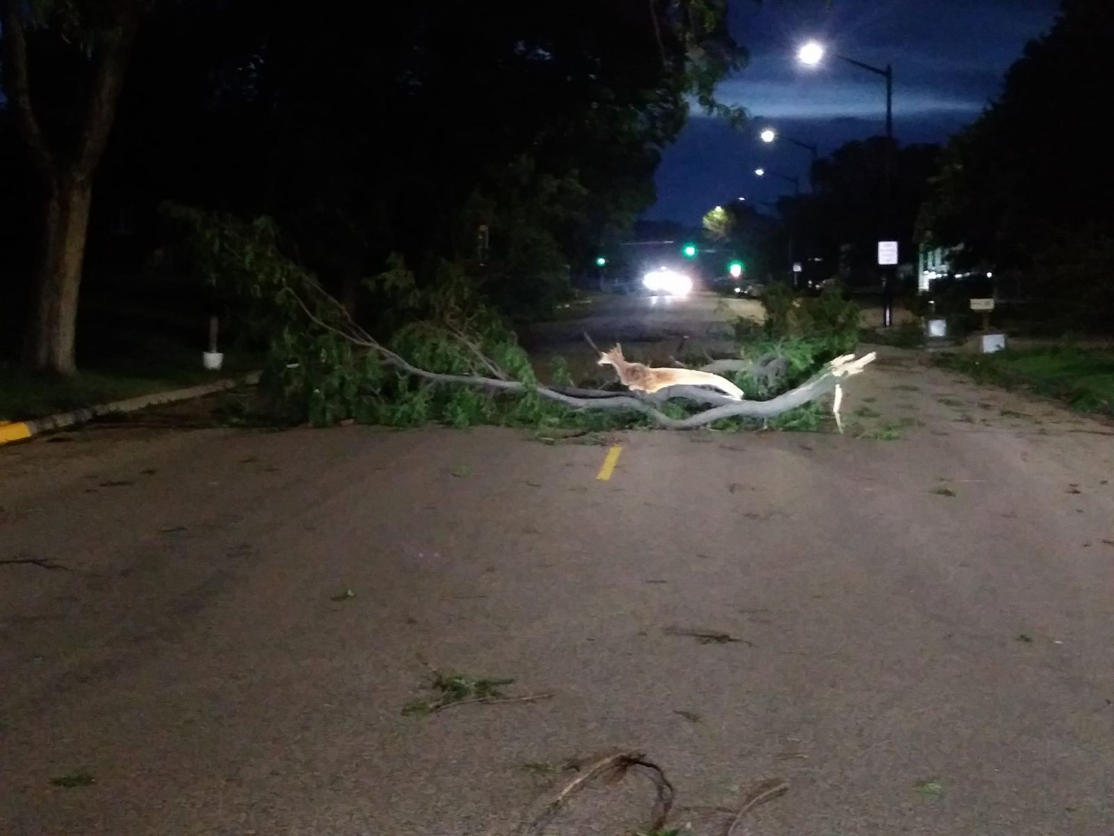
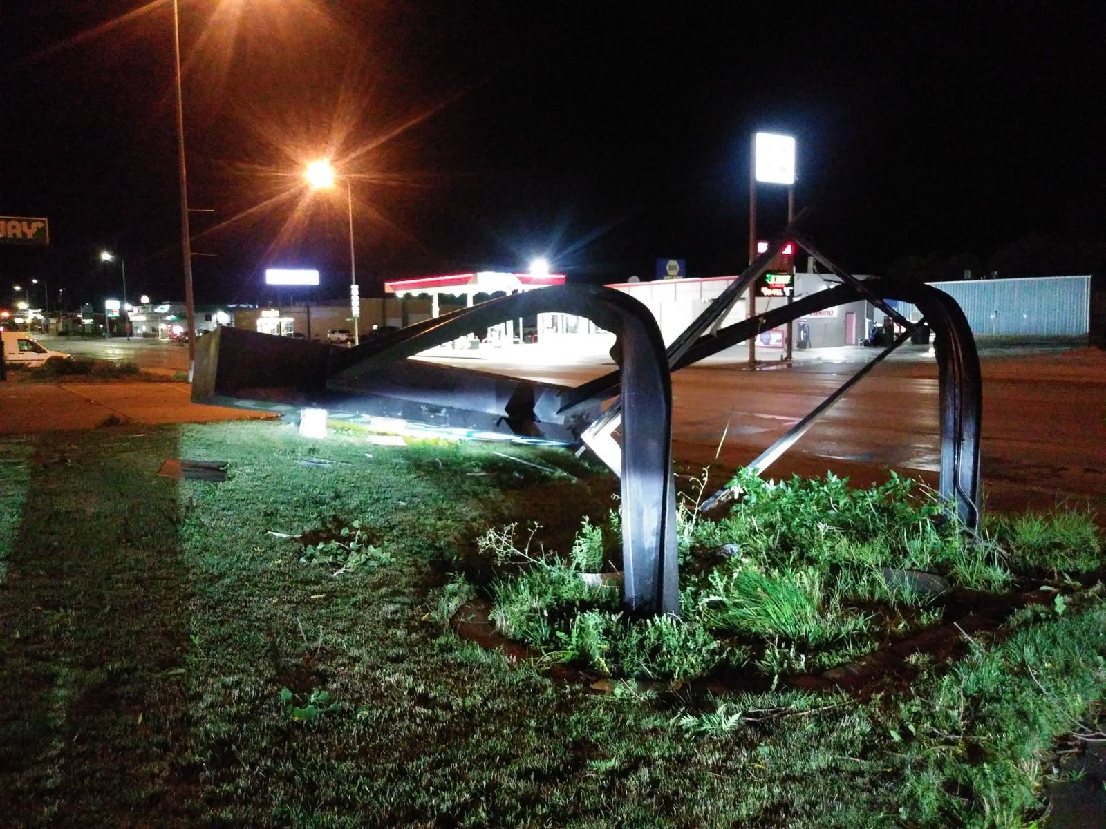
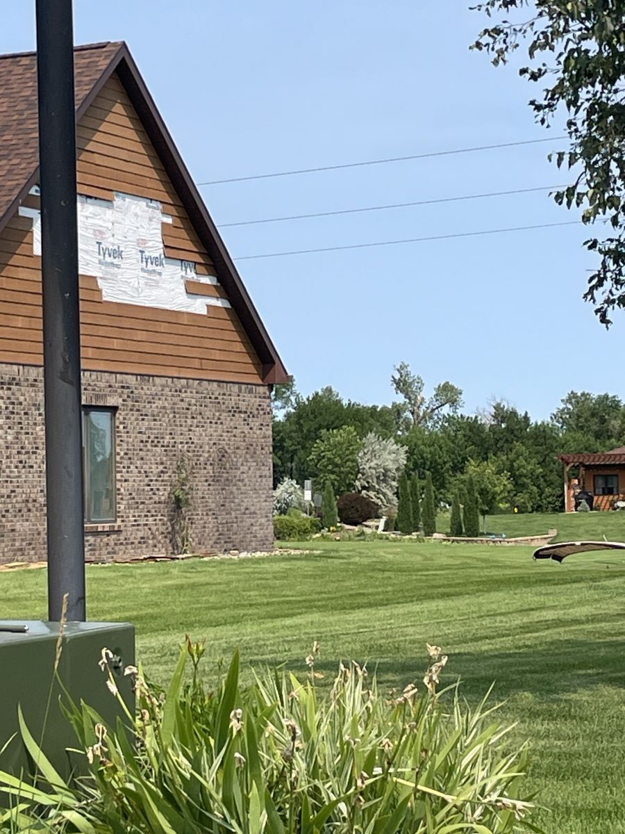
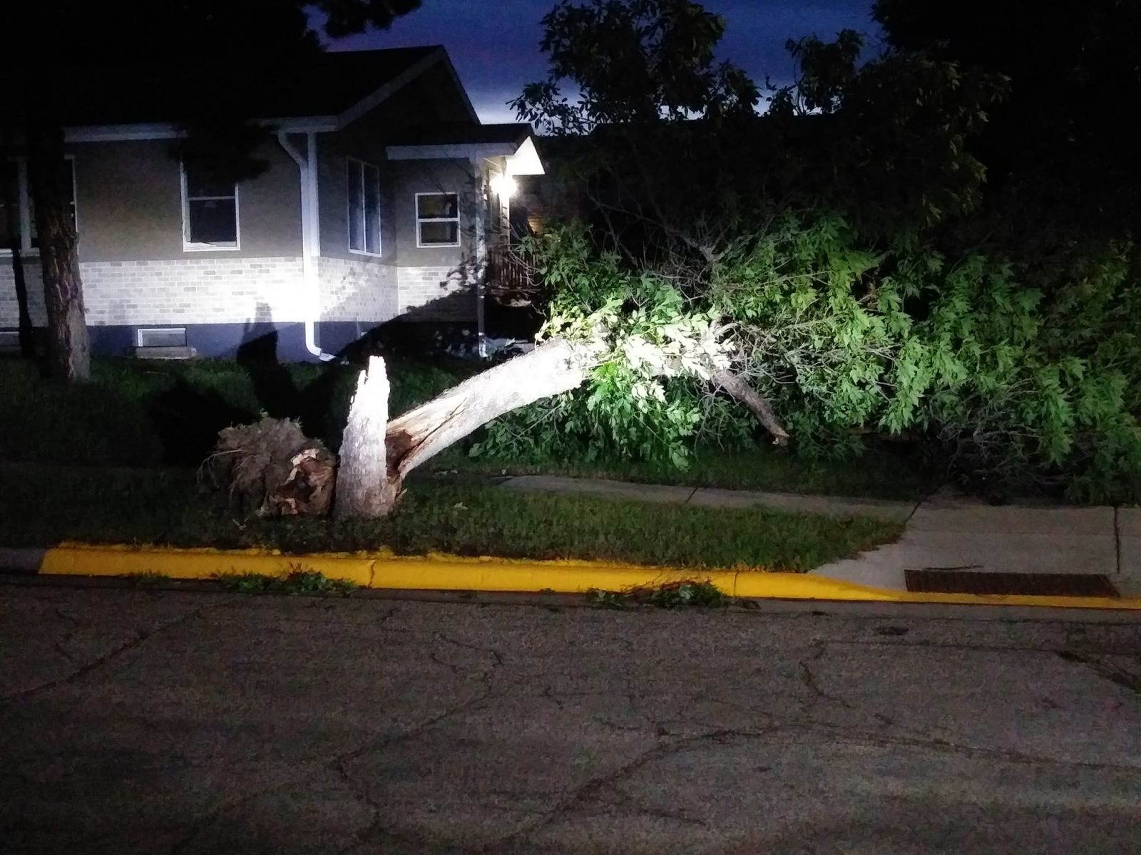
| Large tree branch knocked down next to a tree. Photo credit KCCR Pierre. | Large tree uprooted. Photo credit DRG Media Group. | At least two trees knocked down and on a park shelter. Photo credit DRG Media Group. | Damage to a gas station canopy. Photo credit DRG Media Group. |
Radar & Satellite
Radar
| A radar loop from 10 pm CDT on July 13th through 7 am CDT on July 14th, showing the storm move through central SD. |
| A broader view of the radar loop from 10 pm CDT on July 13th through 7 am CDT on July 14th, showing the storms moving in from southeast Montana and moving through western and central SD. |
Satellite
| This satellite imagery from GOES-East, shows the temperatures of the clouds as the storms moved through the region. In thunderstorms, traditionally the colder the clouds (orange, red, maroon), the taller and stronger the storm. The loop runs from 10 pm (3 UTC) 7/13/2024 to 5 am (10 UTC) 7/14/2024. |
Storm Reports
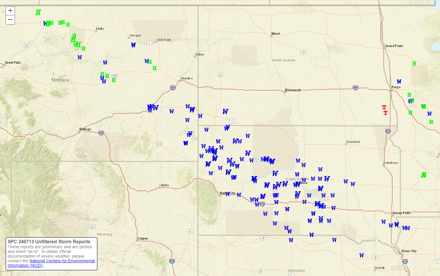
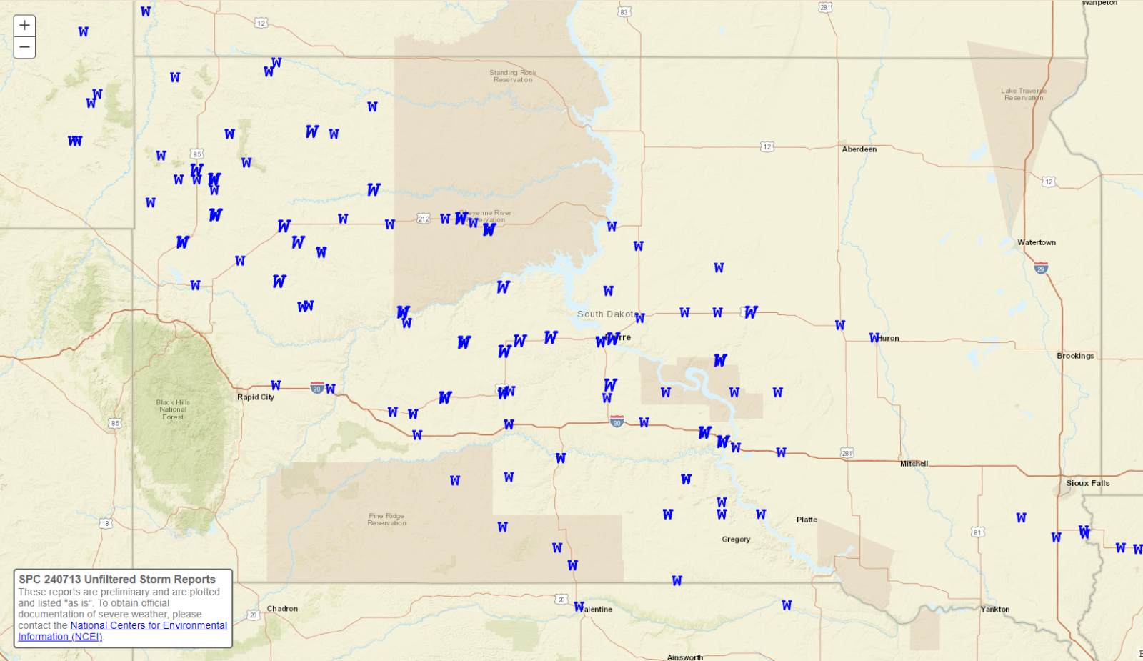
The graphics and text highlight the large number of wind reports that we received from this event, including 5 measured wind gusts of 80 mph or higher.
 |
 |
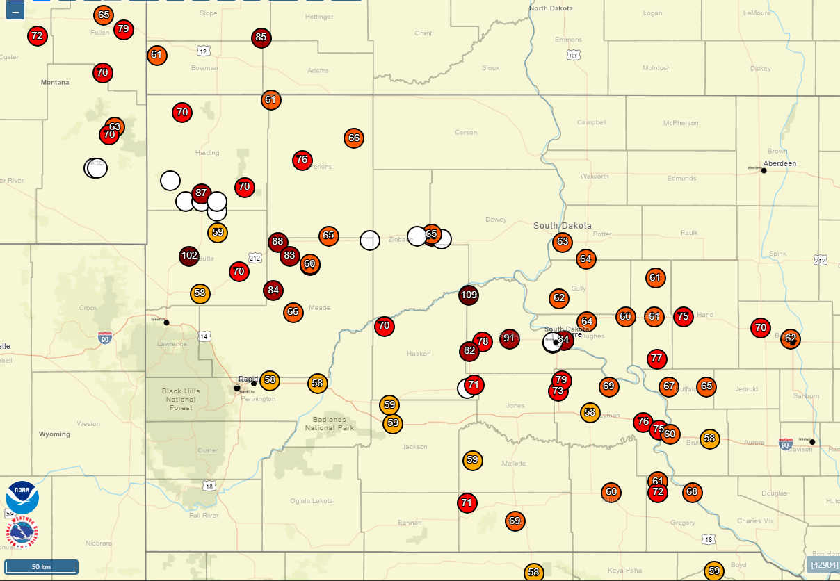 |
| Regional view of the Local Storm Reports for the 24 hours ending at 7am CDT on 7/14/2024. Wind reports are blue W's and hail reports are green H's. Source | South Dakota view of the Local Storm Reports for the 24 hours ending at 7am CDT on 7/14/2024. Wind reports are blue W's and hail reports are green H's. Source | Map of severe wind reports (58 mph or greater) and wind damage (white circles) from the event during the evening of July 13th into the early morning hours of July 14th. Full sized image |
Preliminary Local Storm Report...Summary
National Weather Service Aberdeen SD
202 PM CDT Sun Jul 14 2024

..TIME...   ...EVENT...      ...CITY LOCATION...     ...LAT.LON...
..DATE...   ....MAG....      ..COUNTY LOCATION..ST.. ...SOURCE....
            ..REMARKS..

1249 AM     Tstm Wnd Gst     13 NNW Sansarc          44.67N 101.14W
07/14/2024  M109 MPH         Stanley            SD   Mesonet

            Mesonet station 168 Foster Bay (SDDOT).

0108 AM     Tstm Wnd Gst     10 SW Chantier Creek Re 44.39N 100.77W
07/14/2024  M91 MPH          Stanley            SD   Mesonet

            Mesonet station 202 Hayes (SDDOT).

0150 AM     Tstm Wnd Gst     1 E Pierre Regional Air 44.38N 100.28W
07/14/2024  M84 MPH          Hughes             SD   ASOS

            ASOS station KPIR Pierre Muni AP.

1255 AM     Tstm Wnd Gst     5 NNW Bunker            44.31N 101.13W
07/14/2024  M82 MPH          Stanley            SD   Mesonet

            Mesonet station HAMS2 Hayes 7SW (SD
            Mesonet).

1220 AM     Tstm Wnd Gst     4 NW Lantry             45.05N 101.47W
07/14/2024  E80 MPH          Dewey              SD   Public

            Trees uprooted/damaged. Time estimated based
            on radar data.

0159 AM     Tstm Wnd Gst     13 N Vivian             44.12N 100.30W
07/14/2024  M79 MPH          Lyman              SD   Mesonet

            Mesonet station RFPS2 Vivian 13 N.

1245 AM     Tstm Wnd Gst     1 ENE Hayes             44.37N 101.01W
07/14/2024  M78 MPH          Stanley            SD   Mesonet

            Mesonet station DVI03752 Hayes.

0206 AM     Tstm Wnd Gst     1 NE Stephan            44.26N 99.44W
07/14/2024  M77 MPH          Hyde               SD   Mesonet

            Mesonet station 183 Macs Corner (SDDOT).

0216 AM     Tstm Wnd Gst     3 SE Reliance           43.85N 99.56W
07/14/2024  M76 MPH          Lyman              SD   Mesonet

            Mesonet station 54 Reliance (SDDOT).

0235 AM     Tstm Wnd Gst     2 W Oacoma              43.80N 99.42W
07/14/2024  M75 MPH          Lyman              SD   Mesonet

            Mesonet station OCMS2 Oacoma 2W (SD
            Mesonet).

0223 AM     Tstm Wnd Gst     1 N Ree Heights         44.53N 99.20W
07/14/2024  M75 MPH          Hand               SD   Mesonet

            Mesonet station 312 Ree Heights (SDDOT).

0138 AM     Tstm Wnd Gst     9 NNW Vivian            44.05N 100.33W
07/14/2024  M73 MPH          Lyman              SD   Mesonet

            Mesonet station 13 Vivian (SDDOT).

0152 AM     Tstm Wnd Gst     6 SW Joe Creek Rec Area 44.08N 99.87W
07/14/2024  M69 MPH          Lyman              SD   Mesonet

            Mesonet station 285 14W Lower Brule (SDDOT).

0158 AM     Tstm Wnd Gst     1 ENE Harrold           44.53N 99.72W
07/14/2024  M68 MPH          Hughes             SD   Mesonet

            Mesonet station 19 Harrold (SDDOT).

0222 AM     Tstm Wnd Gst     1 NNW Lees Corner       44.08N 99.33W
07/14/2024  M67 MPH          Buffalo            SD   Mesonet

            Mesonet station 289 Lees Corner (SDDOT).

1220 AM     Tstm Wnd Gst     4 NW Lantry             45.06N 101.47W
07/14/2024  M65 MPH          Dewey              SD   Mesonet

            Mesonet station LANS2 Bear Creek. Time
            estimated based on radar data.

0232 AM     Tstm Wnd Gst     3 N Gann Valley         44.08N 98.99W
07/14/2024  M65 MPH          Buffalo            SD   Mesonet

            Mesonet station 201 Gann Valley (SDDOT).

0212 AM     Tstm Wnd Gst     4 N Agar                44.90N 100.08W
07/14/2024  M64 MPH          Potter             SD   Mesonet

            Mesonet station 212 Agar (SDDOT).

0127 AM     Tstm Wnd Gst     4 WSW Blunt             44.50N 100.07W
07/14/2024  M64 MPH          Hughes             SD   Mesonet

            Mesonet station 185 Blunt (SDDOT).

0151 AM     Tstm Wnd Gst     3 SSW Whitlocks Bay Rec 45.01N 100.29W
07/14/2024  M63 MPH          Potter             SD   Mesonet

            Mesonet station 157 Forest City (SDDOT).

0155 AM     Tstm Wnd Gst     8 ENE Okobojo Creek Rec 44.65N 100.32W
07/14/2024  M62 MPH          Sully              SD   Mesonet

            Mesonet station ONMS2 Onida 13WSW (SD
            Mesonet).

0210 AM     Tstm Wnd Gst     1 WNW Highmore          44.53N 99.46W
07/14/2024  M61 MPH          Hyde               SD   Mesonet

            Mesonet station HIHS2 Highmore (SD Mesonet).

0217 AM     Tstm Wnd Gst     17 W Polo               44.78N 99.45W
07/14/2024  M61 MPH          Hyde               SD   Mesonet

            Mesonet station 215 Polo 17 W JCT SD47/SD26
            (SDDOT).

0155 AM     Tstm Wnd Gst     1 E Presho              43.91N 100.04W
07/14/2024  M58 MPH          Lyman              SD   Mesonet

            Mesonet station DVI01081 Presho.

0135 AM     Tstm Wnd Dmg     1 NNW Fort Pierre       44.37N 100.38W
07/14/2024                   Stanley            SD   Emergency Mngr

            Corrects the report source from the previous
            tstm wnd dmg report from 1 NNW Fort Pierre.
            Six 20X20 foot doors blown off local
            construction company shop. Time estimated
            based on radar data.

0135 AM     Tstm Wnd Dmg     1 NNW Fort Pierre       44.37N 100.38W
07/14/2024                   Stanley            SD   Emergency Mngr

            Corrects the time from the previous tstm wnd
            dmg report from 1 NNW Fort Pierre. Damage to
            grain bins at local agricultural service.
            Time estimated based on radar data.

0135 AM     Tstm Wnd Dmg     Fort Pierre             44.36N 100.38W
07/14/2024                   Stanley            SD   Emergency Mngr

            Several campers/travel trailers damaged or
            overturned at local business. Time estimated
            based on radar data.

1246 AM     Tstm Wnd Dmg     2 ENE Lantry            45.03N 101.38W
07/14/2024                   Dewey              SD   Public

            3 inch tree limbs broken and power poles
            broken.


&&
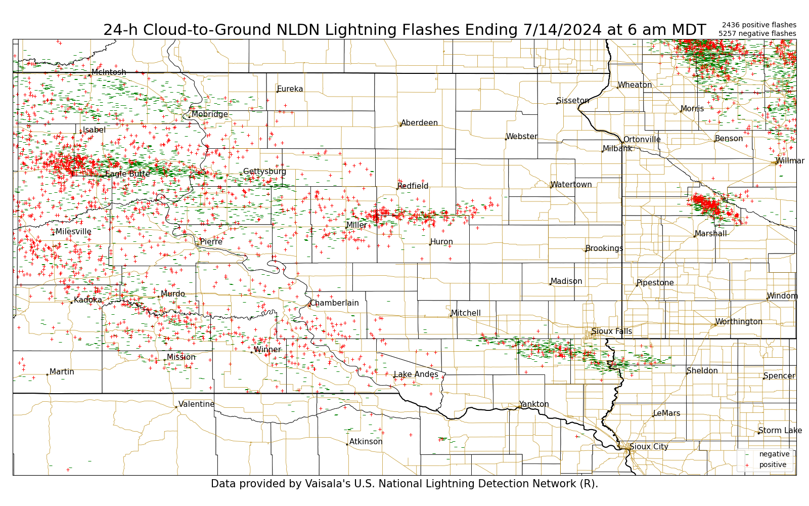
Lightning
The image below shows the 24 hour Cloud-to-Ground Lightning Strikes from the NLDN, ending at 7am CDT on July 14, 2024.
 |
Media use of NWS Web News Stories is encouraged! Please acknowledge the NWS as the source of any news information accessed from this site. |
|