
Record setting heat is expected over the next several days from the Intermountain West through the northern Plains. Furthermore, fire weather concerns increase with dry and breezy conditions. Meanwhile, heavy rainfall and severe thunderstorm threats for the Ohio/Tennessee Valleys, central Appalachians and Southeast today. The threat shifts to central Gulf Coast and across central Texas this week. Read More >
Overview
|
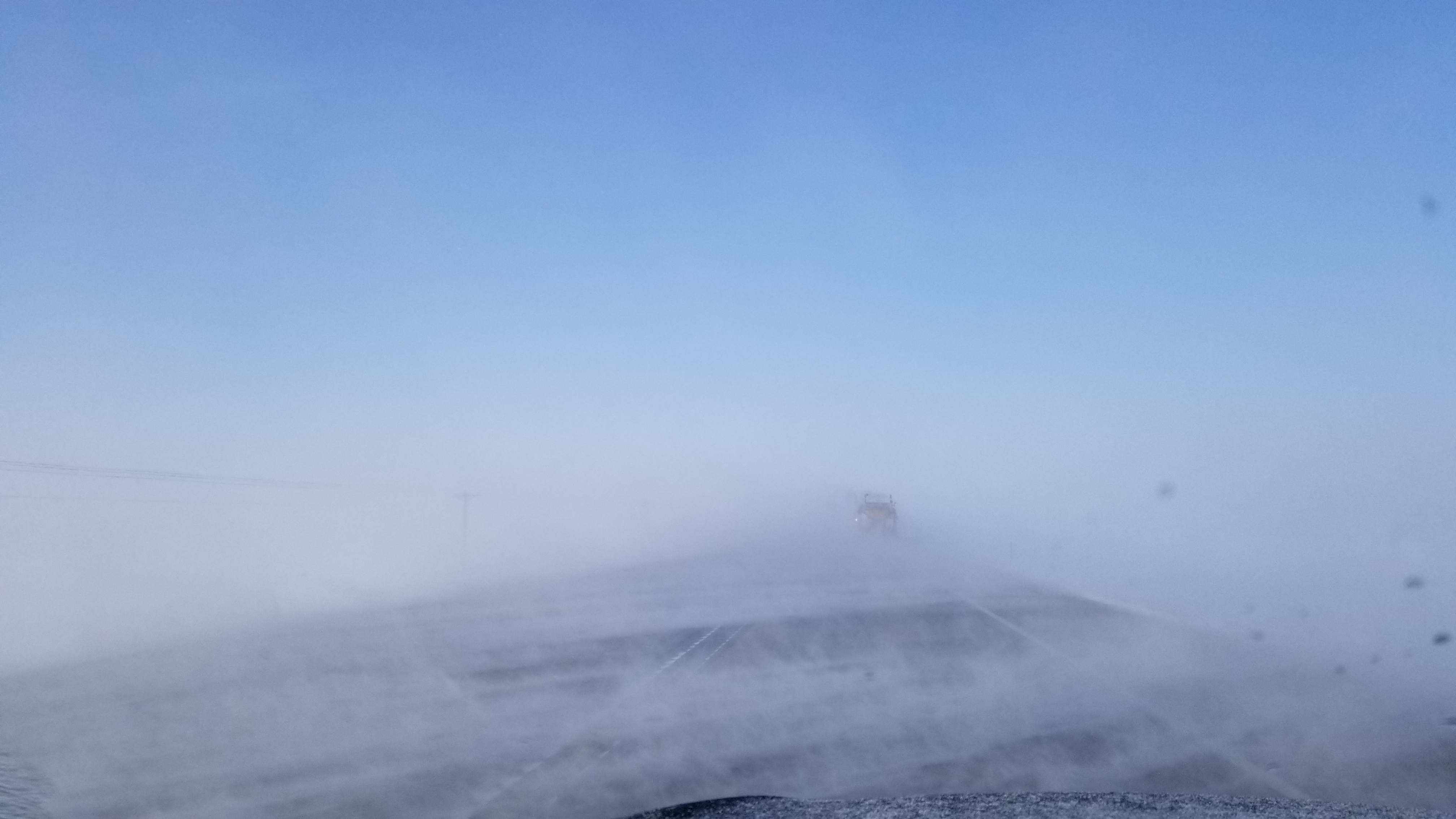
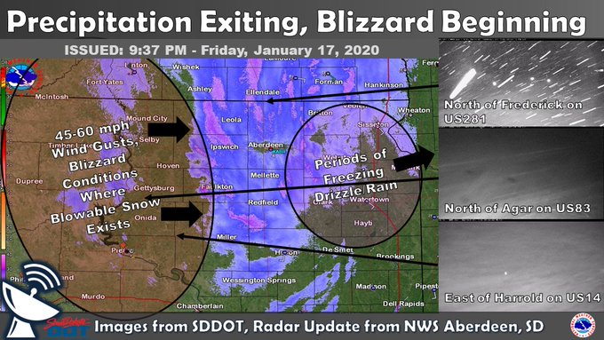
A strong low pressure system tracked from Wyoming across the state of South Dakota on Friday, January 17th and Saturday, January 18th. Ahead of the low, strong southerly winds combined with falling snow to produce widespread blowing snow and even blizzard conditions for some east of the Missouri River. Freezing drizzle and freezing rain were observed across the area at times as well on Friday. By Friday evening, a brief lull in the winds allowed for improvements to the visibility, but blizzard conditions swiftly returned on surging northwest winds from west to east across the state, beginning roughly at the Missouri River around 8 pm (no or too little blowable snow further west). Ground blizzard conditions then continued through much of the day Saturday across northeastern South Dakota and west central Minnesota. Very cold air moved in with the northwest winds as well. Impacts included road closures such as I-29 across all of eastern SD from 7pm on the 17th through 3pm 18th (portions of I-90 too) as well as other roads for even longer than that in some cases, power outages, and many vehicles in ditches. |
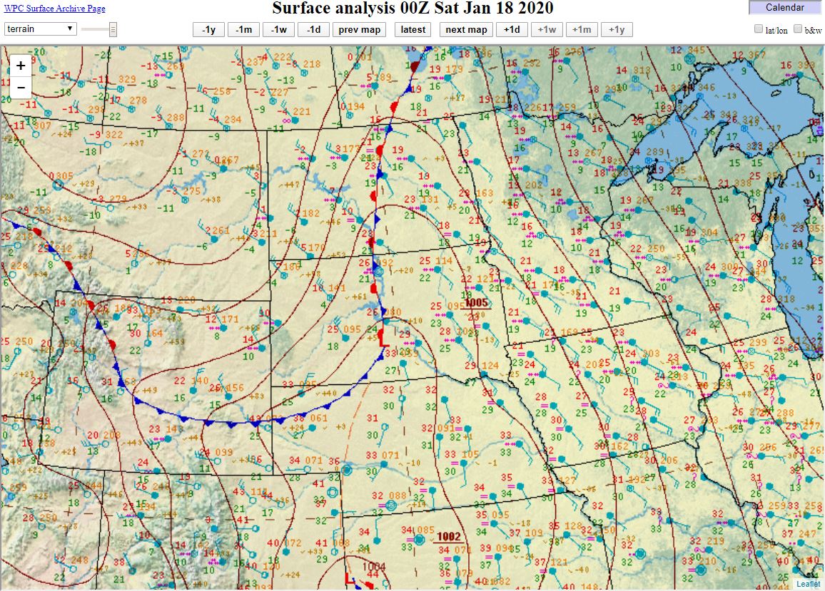 Surface weather map at 6pm on Friday, January 17th |
Snow
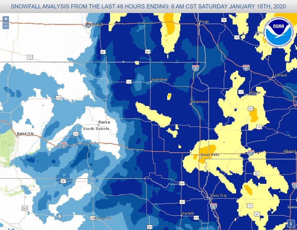
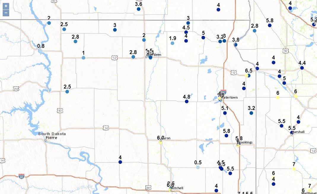
Below is a map of snowfall accumulations (yellow is 6-8", dark blue is 4-6", the next shade is 3-4", the next is 2-3", then 1-2" and then less than 1"), as well as individual reports from the 17th and 18th.
Photos & Video
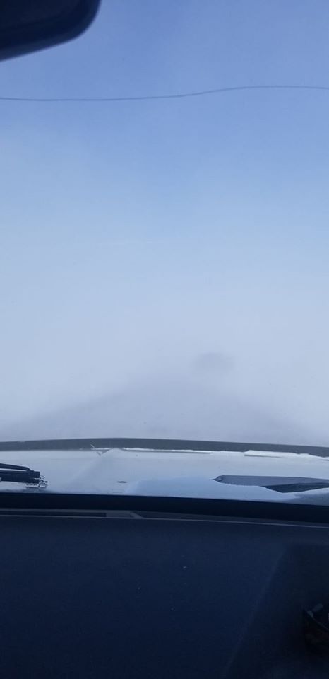
Friday (17th)
 |
 |
 |
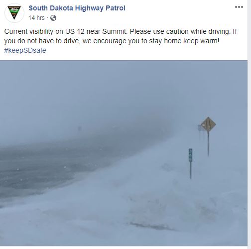 |
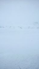
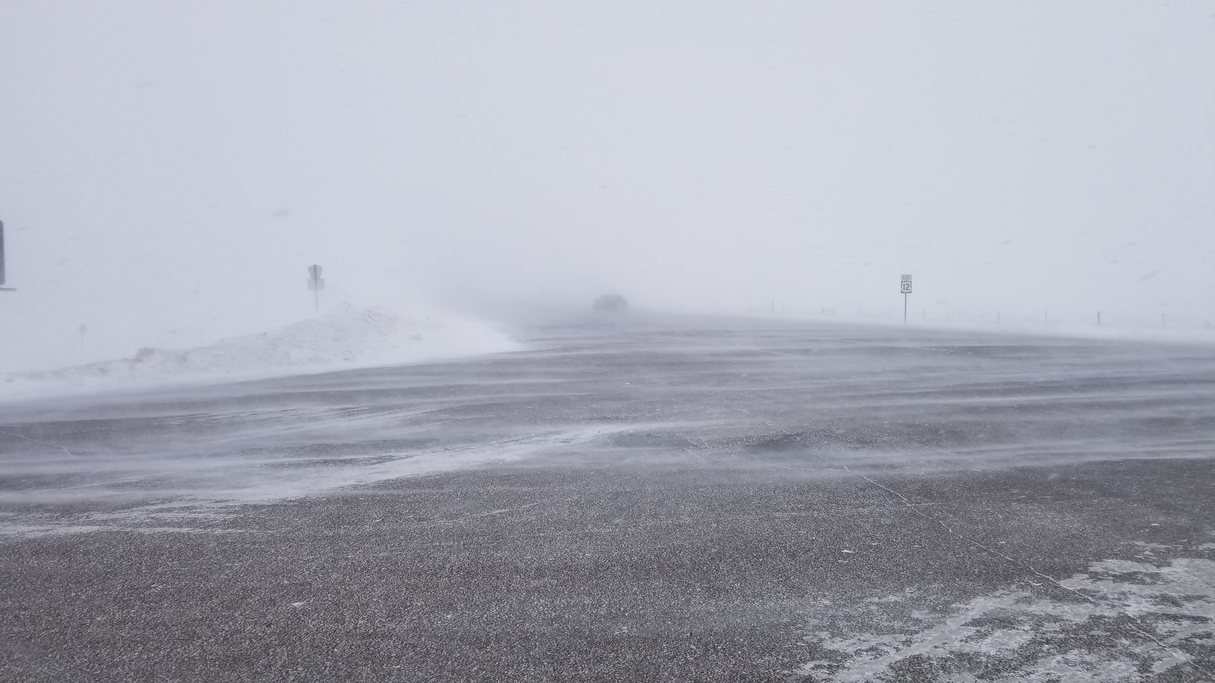
| 4 miles north of Craven around noon (sheltered somewhat), courtesy of Gerald Ray Noble | Near Clark, courtesy of Kristen Marie White | 11 miles south of Vayland, courtesy of Beverly Rae Letsche | Near Summit on US 12, courtesy of the South Dakota Highway Patrol |
 |
 |
 |
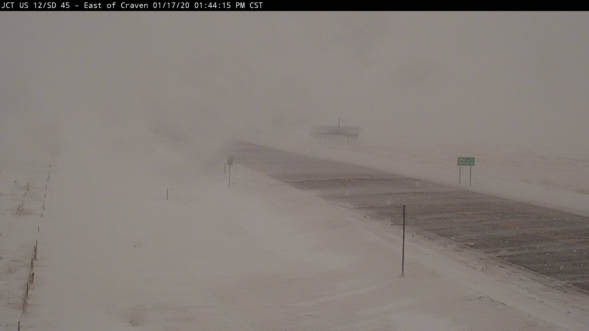 |
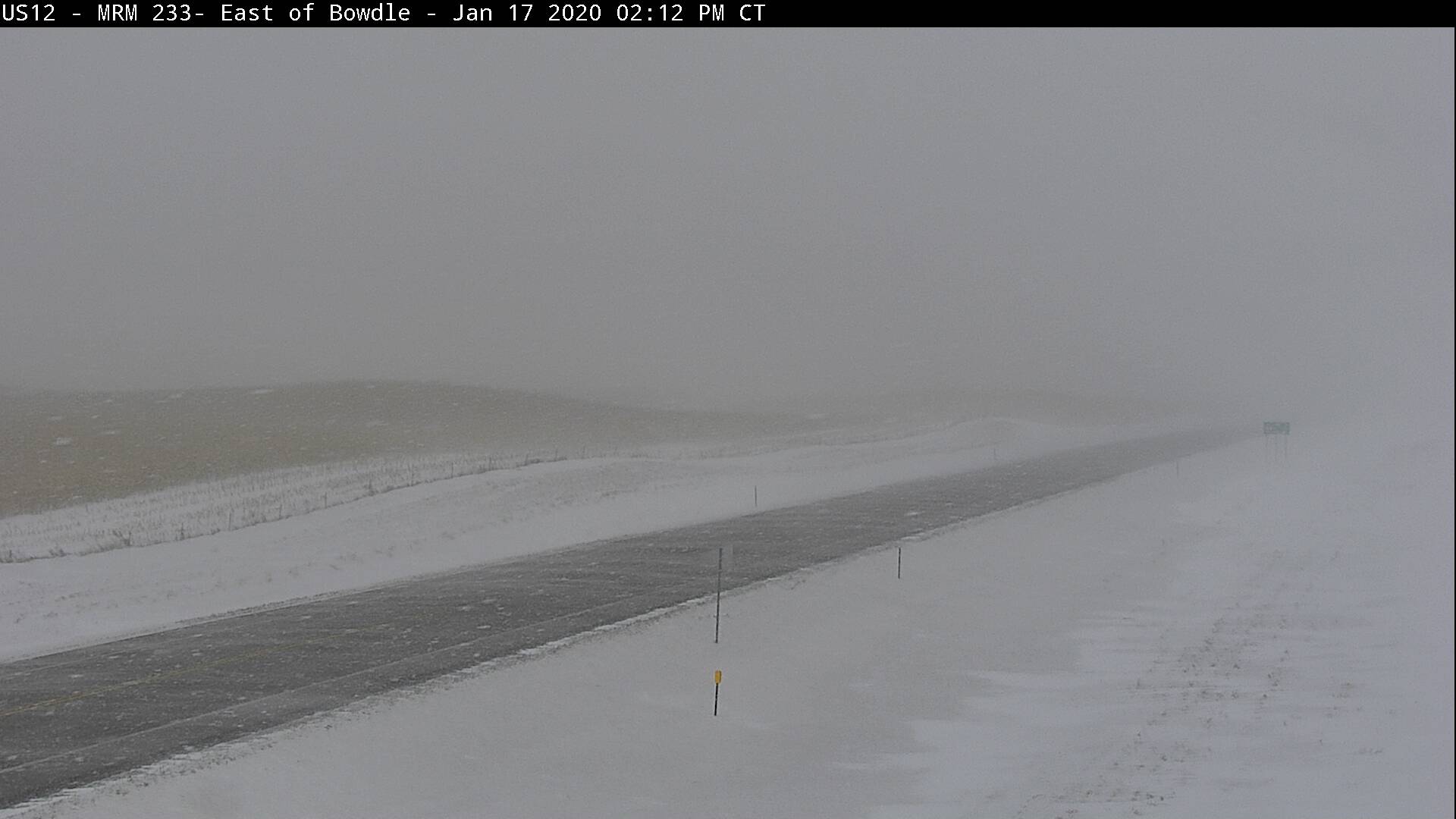
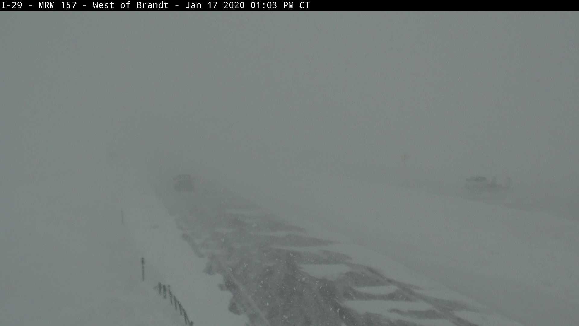
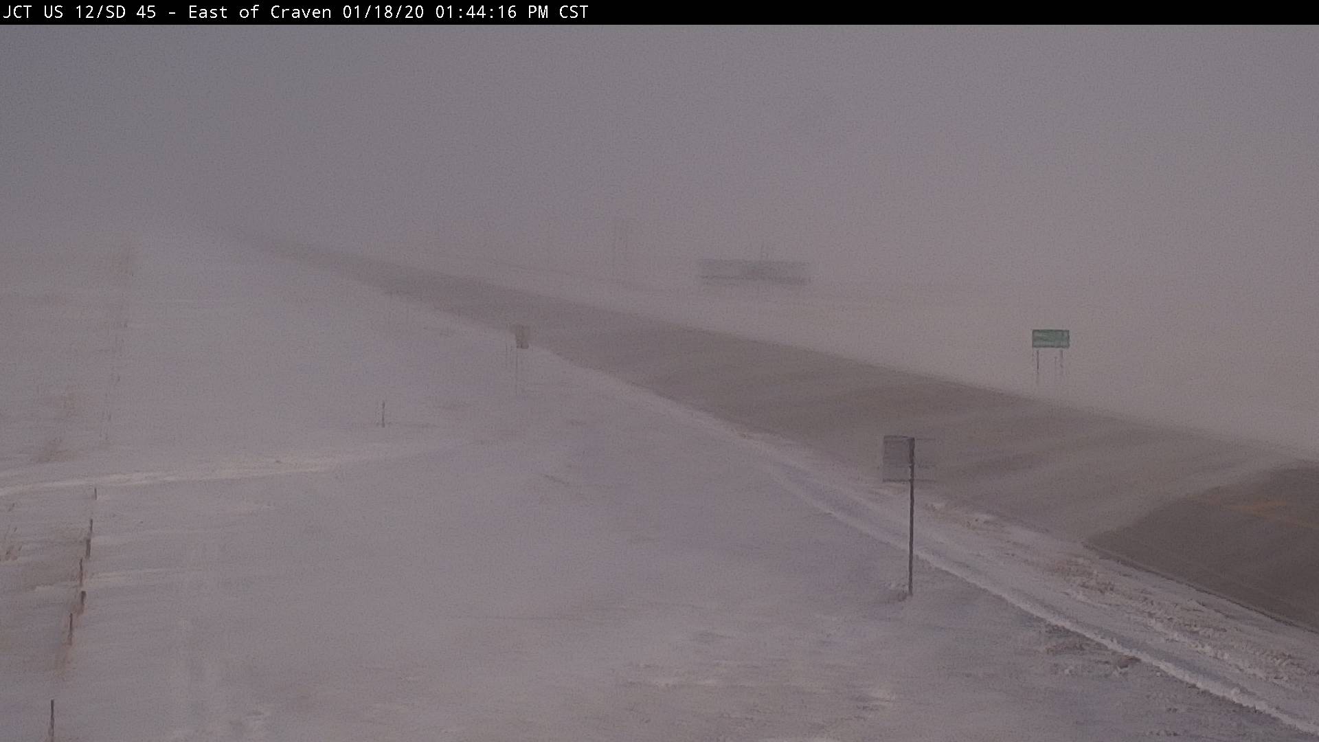
| Hwy 12 at Mina at 1:20 pm | SDDOT webcam image from Bowdle at 2:30 pm | SDDOT webcam image from Brandt at 1 pm | SDDOT webcam image from Craven at 2 pm |
 |
 |
 |
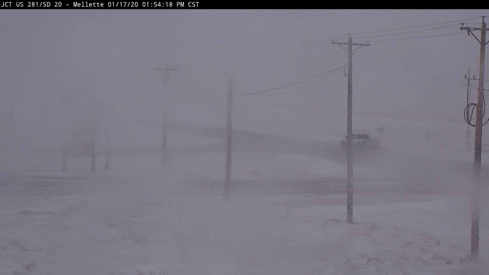 |
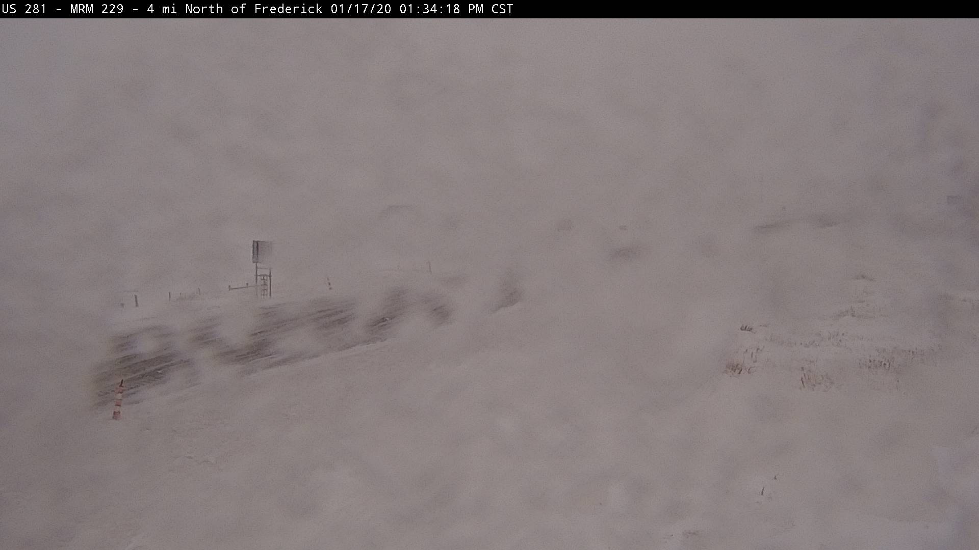
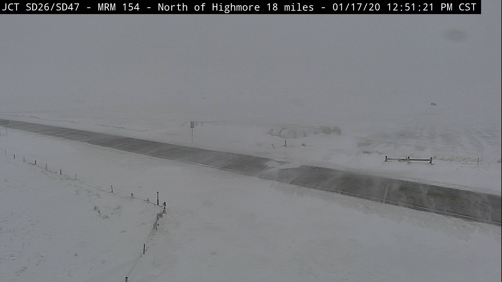
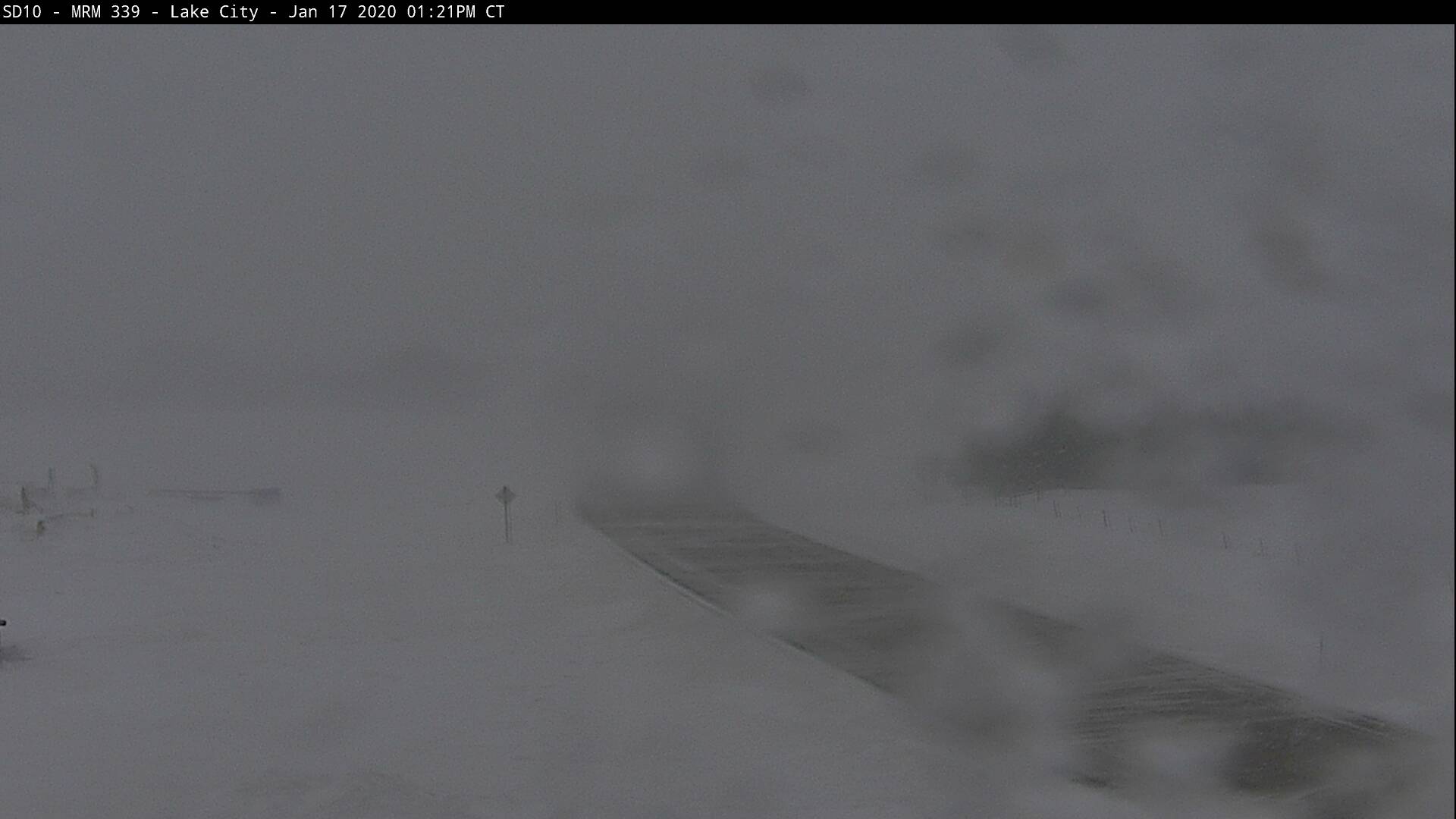
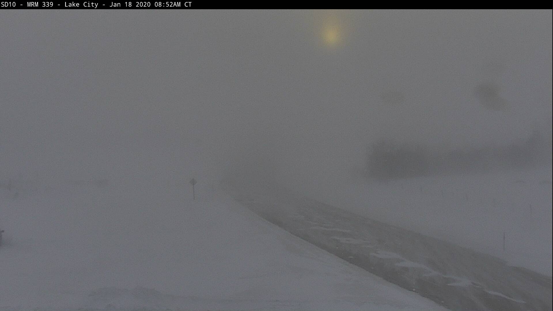
| SDDOT webcam image from Frederick at 1:30 pm | SDDOT webcam image from about 20 miles north of Highmore at 1 pm | SDDOT webcam image from Lake City at 1:30 pm | SDDOT webcam image from Mellette at 2:30 pm |
 |
 |
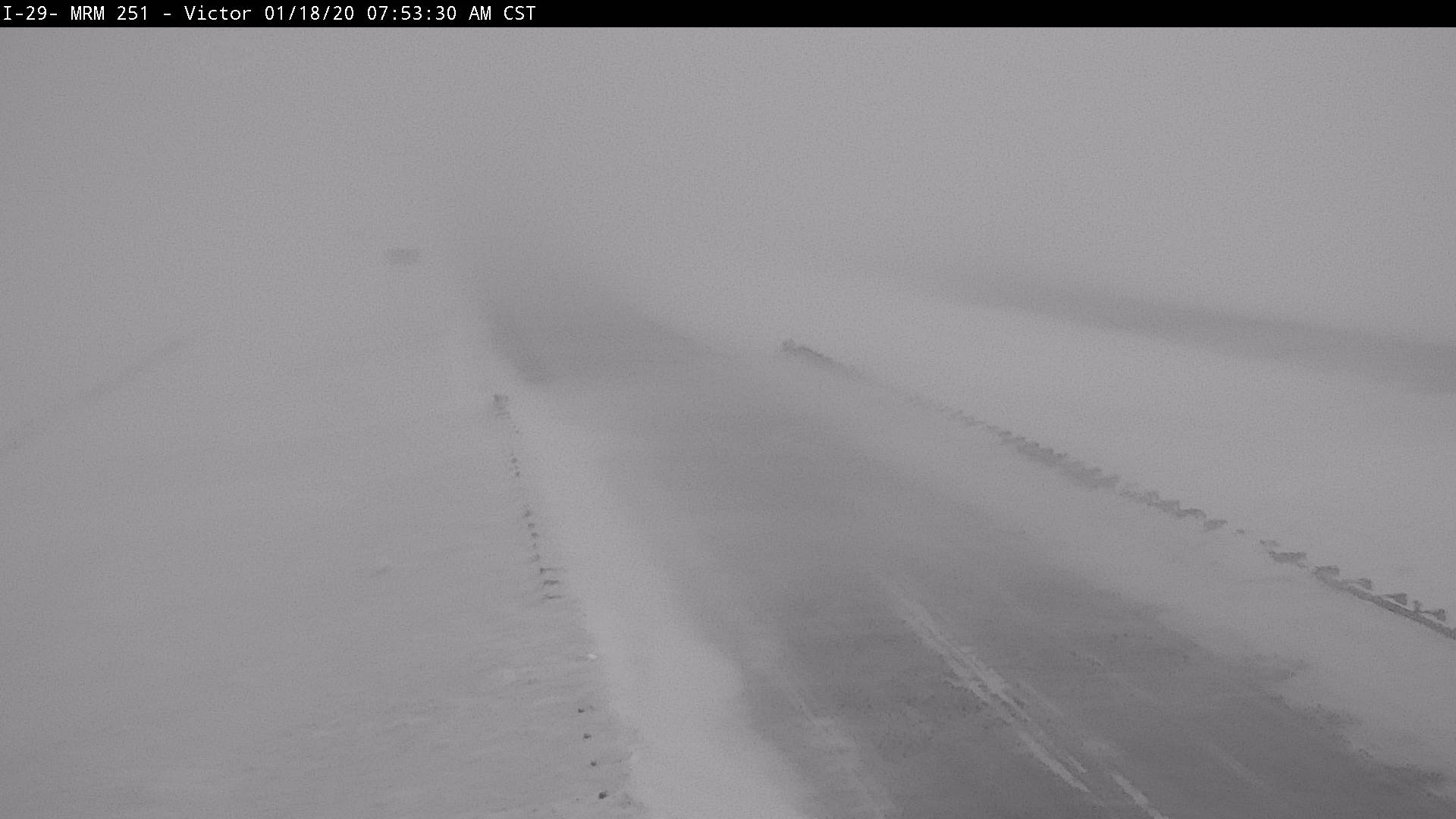
||
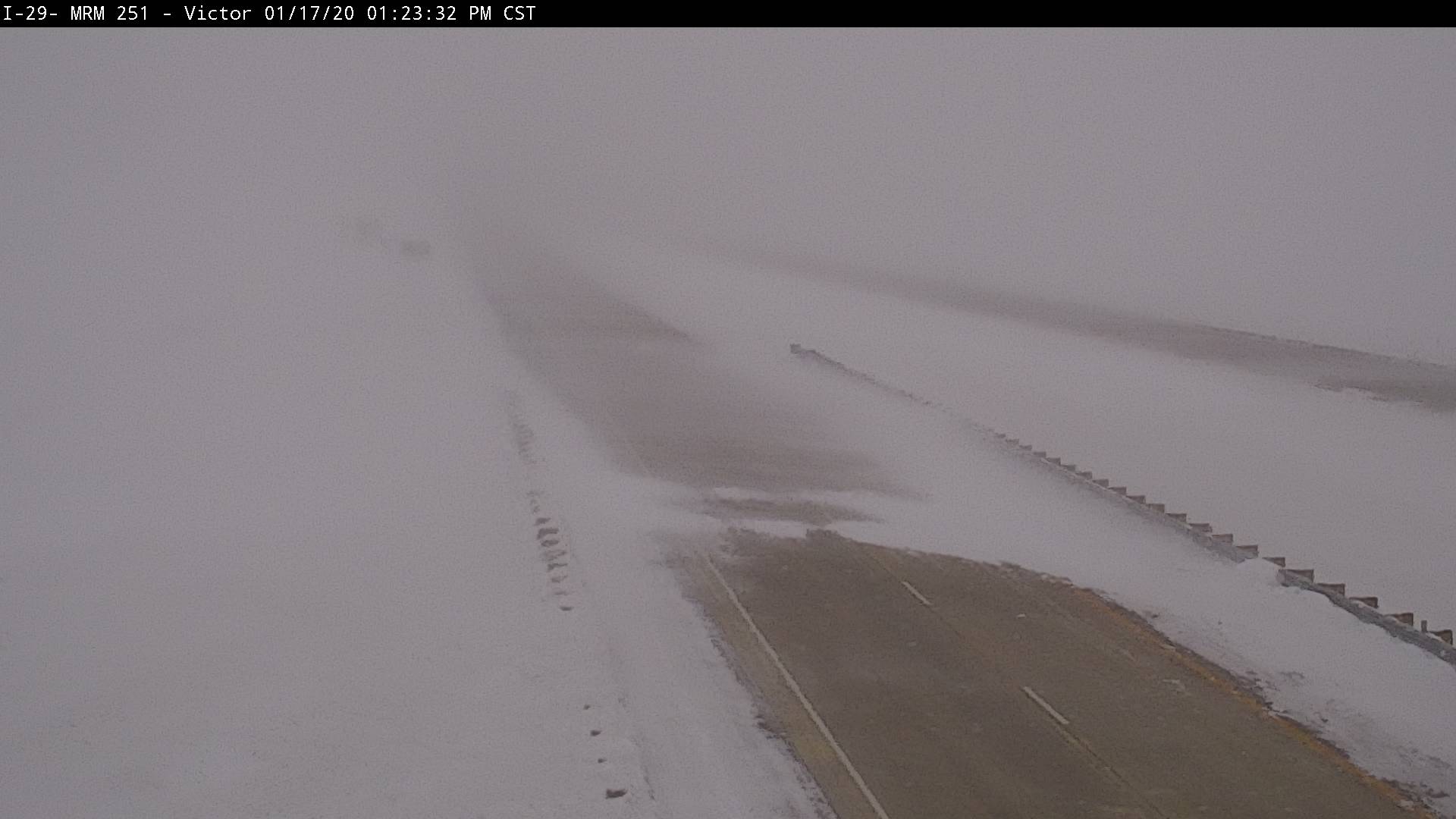
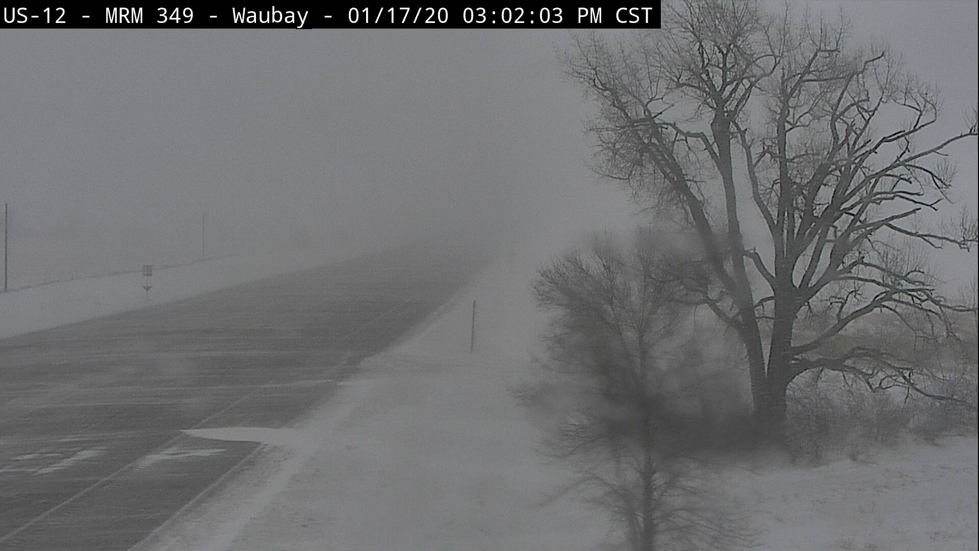
| SDDOT webcam image from Victor at 1:30 pm | SDDOT webcam image from Waubay at 3 pm |
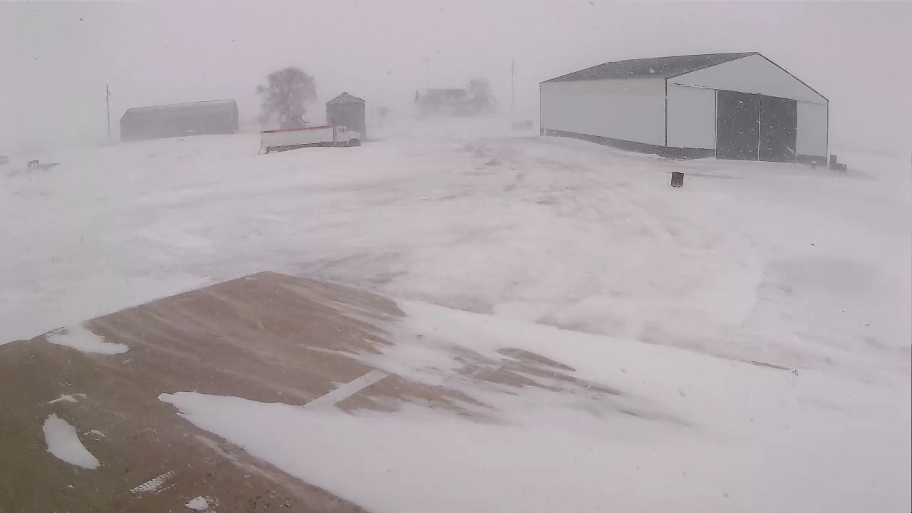
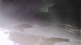
Friday Night and Saturday (18th)
 |
 |
 |
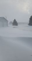 |
| 4 miles north of Craven around 11 pm on the 17th (sheltered somewhat), courtesy of Gerald Ray Noble | Near Bryant, courtesy of Kristen Marie White (ground blizzard as there is no new falling snow) | 5 foot drift in Deuel County, courtesy of Jenna and Dan Molengraaf | Southeast North Dakota on the ND/SD border at 11am, courtesy of Joan Medhaug Biewer |
 |
 |
 |
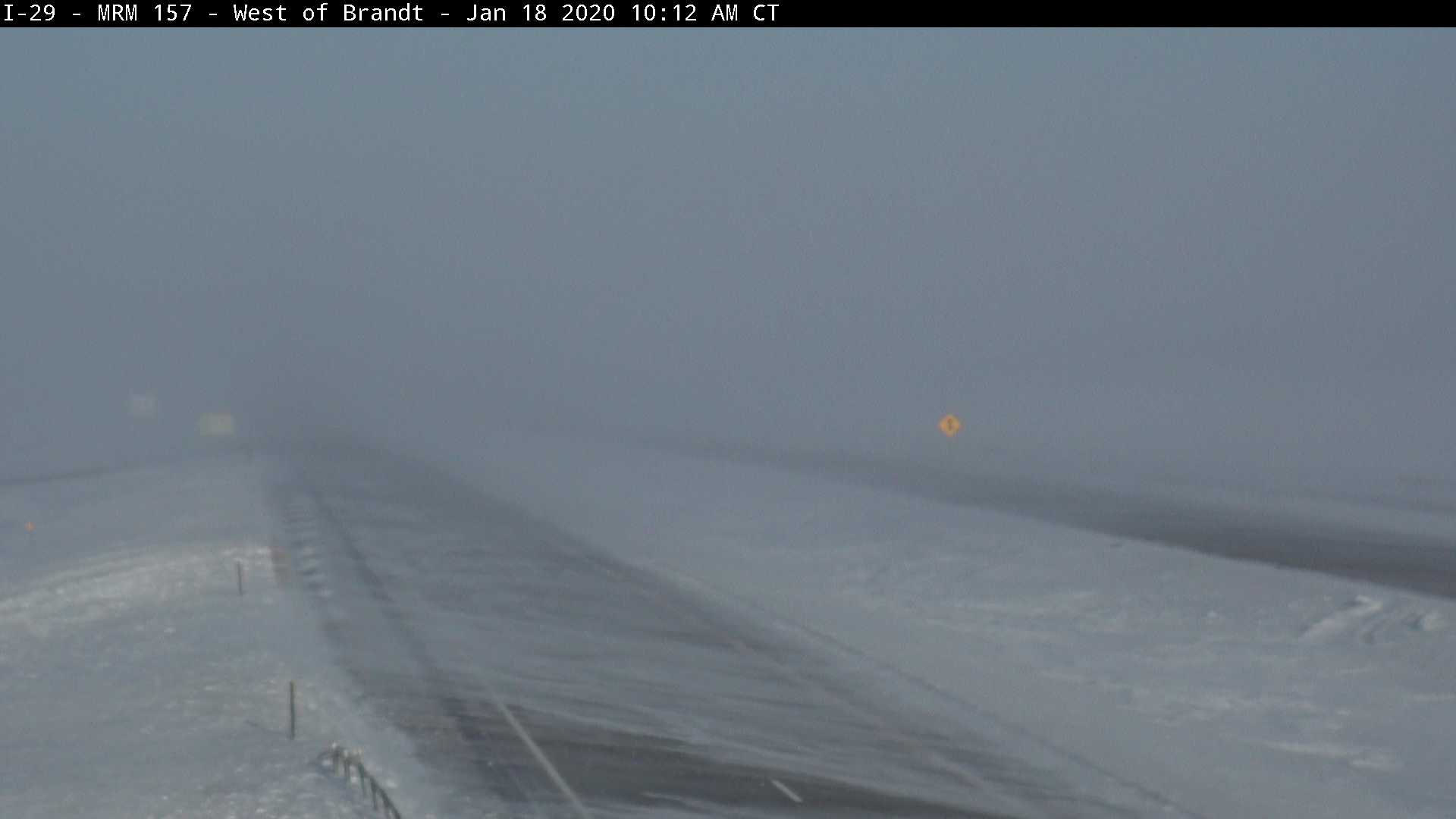 |
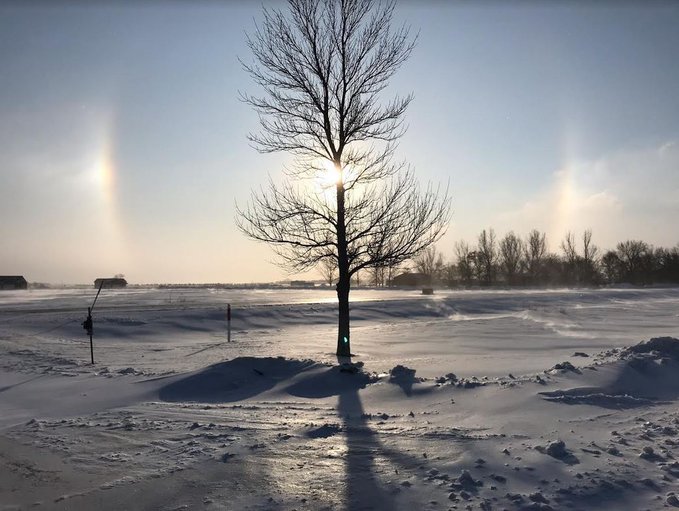
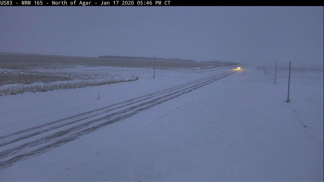
| Hwy 12 just west of Aberdeen at 10:10 am | Sun dogs were widely observed throughout the day. Here's an example at sunrise from the NWS office in Aberdeen | SDDOT webcam images from Agar at 5:46 pm on the 17th, 9:50 pm on the 17th and then 8:40 am on the 18th. A couple vehicles went into the ditch presumably during the blizzard | SDDOT webcam image from Brandt at 10 am |
 |
 |
 |
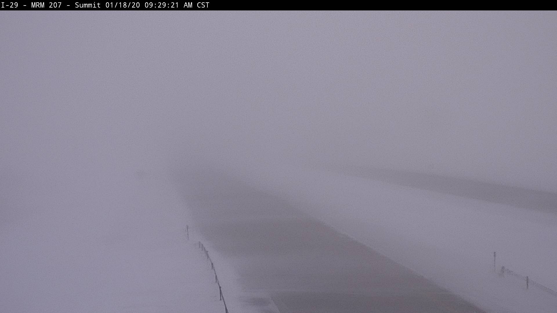 |
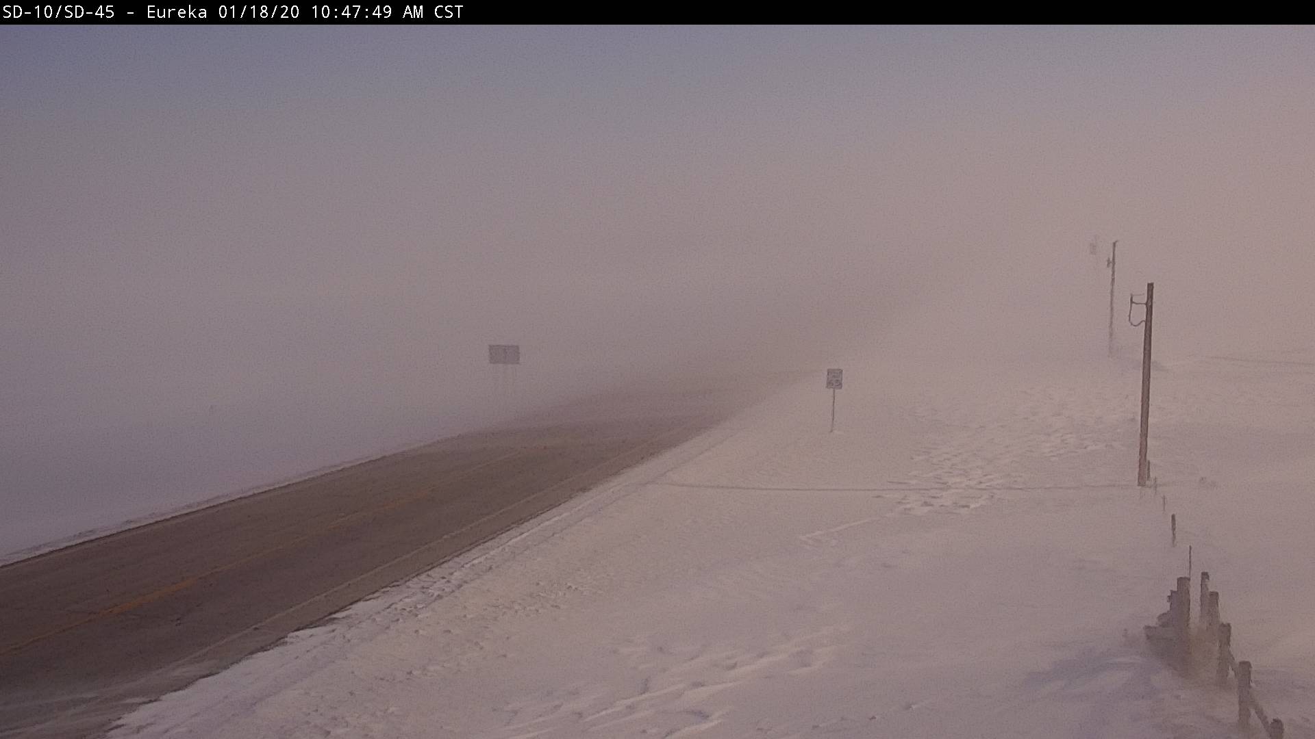
| SDDOT webcam image from Craven at 2 pm | SDDOT webcam image from about 13 miles east of Eureka at 11 am | SDDOT webcam image from Lake City at 9 am | SDDOT webcam image from Summit at 9:30 am |
 |
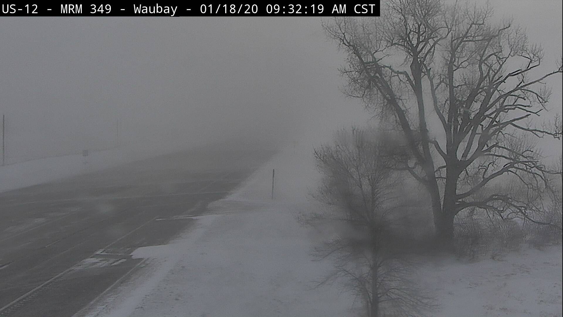 |
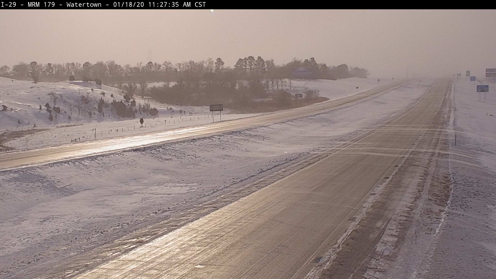 |
|
| SDDOT webcam image from Victor at 8 am | SDDOT webcam image from Waubay at 9:30 am | SDDOT webcam image from Watertown at 11:27 am, showing the slick road conditions |
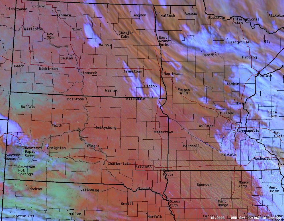
Radar & Satellite
 |
 |
 |
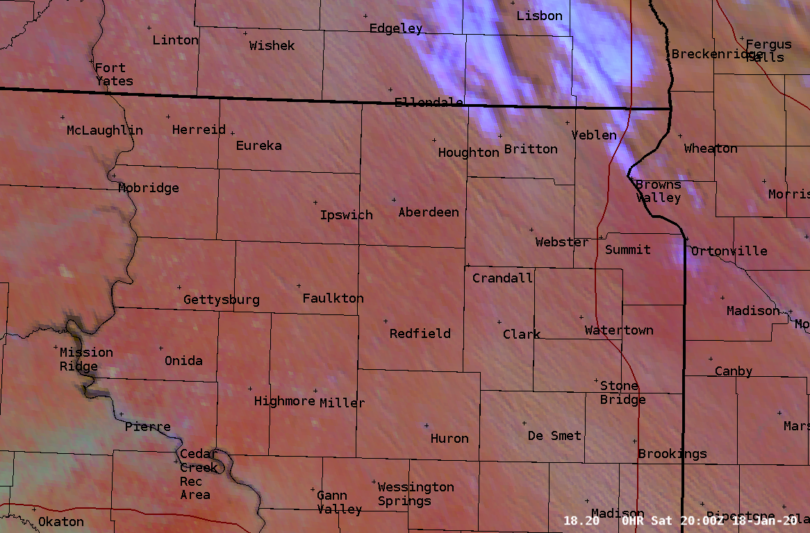 |
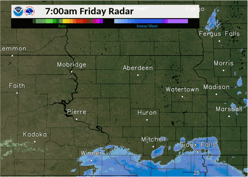
| Radar reflectivity from 7am Friday the 17th to 6am Saturday the 18th | Radar and conditions snapshot at 9:30 pm on the 17th | GOES16 Satellite Imagery (Day Snow-Fog) at 2pm on the 18th, showing the blowing snow/blizzard conditions across northeastern SD, etc (tan streamers) | Close-up of left image. Note, this was a ground blizzard as no new snow was falling. For an animated loop from 10:20 am to 3:16 pm on the 18th, visit https://youtu.be/rwCXJ4N-pk4 |
Storm Reports
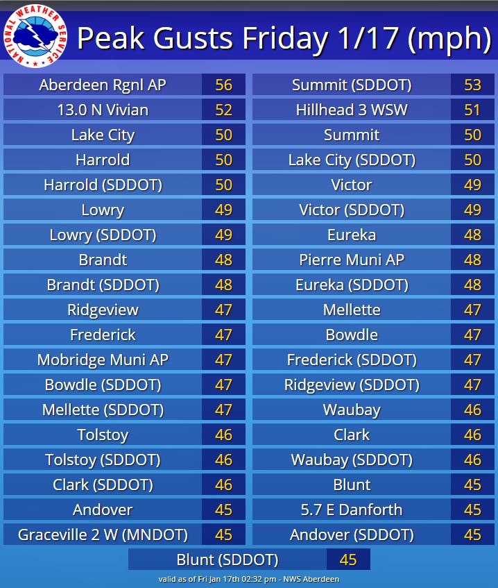 |
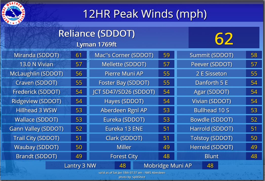 |
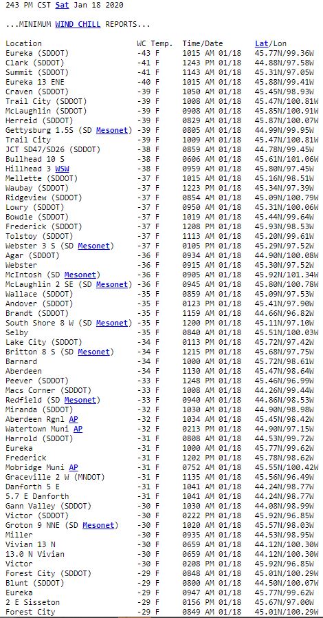 |
| Peak southeasterly wind gusts on the 17th up until 2:30 pm | Peak northwesterly wind gusts from late on the 17th until 8am on the 18th | 24 hour minimum wind chills as of 2:45 pm on the 18th |
 |
 |
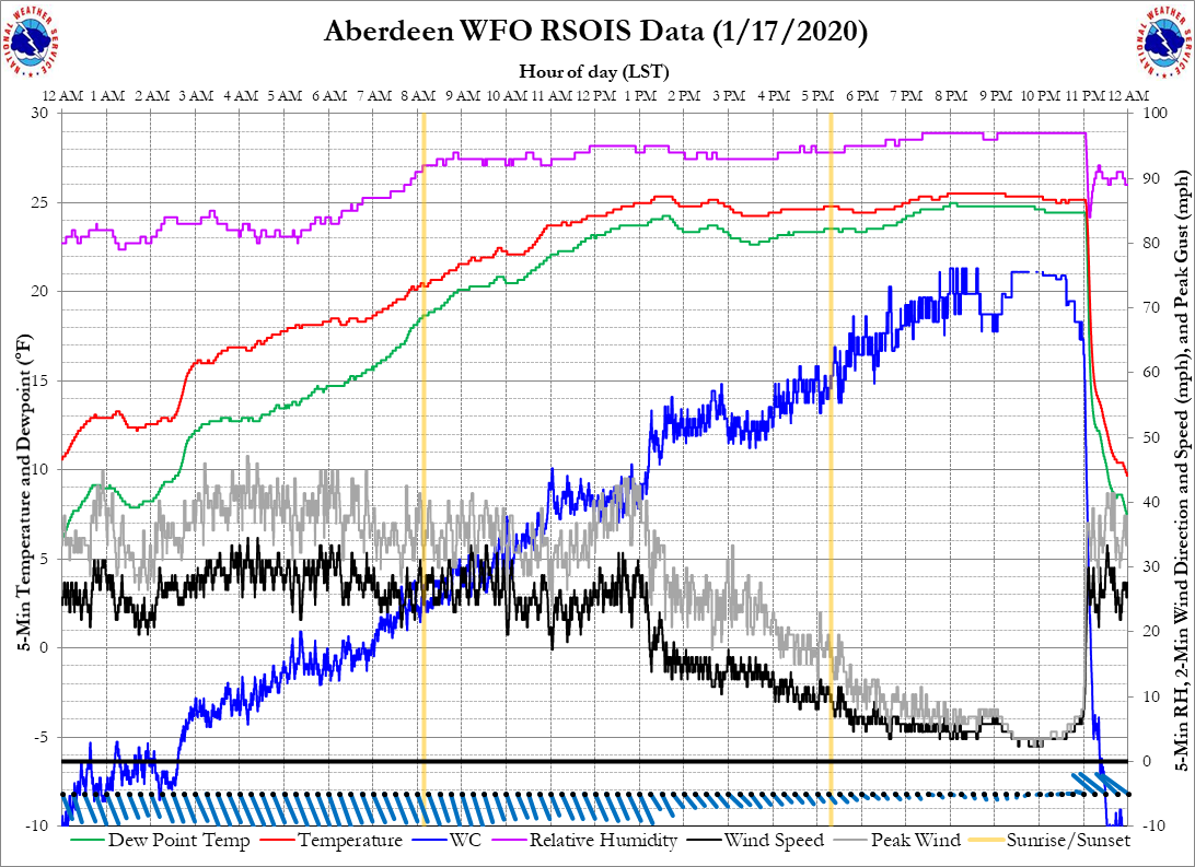
|
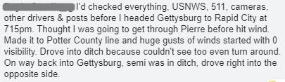
| Graph of temperature (red), wind (grey for gusts and black for sustained), wind chill (blue) and other weather elements on the 17th at the Aberdeen Regional Airport. | A personal account that serves as a testament to the rapid onset and severity of the blizzard on the evening of the 17th in the Gettysburg area (Facebook) |
Below is a listing of all storm reports through the course of the event including wind, blizzard conditions, snow, ice, etc.
PRELIMINARY LOCAL STORM REPORT...SUMMARY NATIONAL WEATHER SERVICE ABERDEEN SD 959 PM CST SAT JAN 18 2020 ..TIME... ...EVENT... ...CITY LOCATION... ...LAT.LON... ..DATE... ....MAG.... ..COUNTY LOCATION..ST.. ...SOURCE.... ..REMARKS.. 0852 PM NON-TSTM WND GST 3 SE RELIANCE 43.85N 99.56W 01/17/2020 M62 MPH LYMAN SD MESONET MESONET STATION 54 RELIANCE (SDDOT). 1053 AM NON-TSTM WND GST 1 WNW SUMMIT 45.31N 97.05W 01/17/2020 M57 MPH ROBERTS SD MESONET MESONET STATION 55 SUMMIT (SDDOT). 0859 PM NON-TSTM WND GST 13 N VIVIAN 44.12N 100.30W 01/17/2020 M57 MPH LYMAN SD MESONET MESONET STATION RFPS2 VIVIAN 13 N. 1236 PM NON-TSTM WND GST 3 ESE ABERDEEN 45.45N 98.42W 01/17/2020 M56 MPH BROWN SD ASOS ASOS STATION KABR ABERDEEN RGNL AP. 0717 PM NON-TSTM WND GST 10 SW CHANTLER CREEK RE 44.39N 100.77W 01/17/2020 M54 MPH STANLEY SD MESONET MESONET STATION 202 HAYES (SDDOT). 0757 PM NON-TSTM WND GST 2 S GORMAN 44.90N 100.08W 01/17/2020 M53 MPH POTTER SD MESONET MESONET STATION 212 AGAR (SDDOT). 0707 PM NON-TSTM WND GST 13 NNW SANSARC 44.67N 101.14W 01/17/2020 M52 MPH STANLEY SD MESONET MESONET STATION 168 FOSTER BAY (SDDOT). 0757 PM NON-TSTM WND GST 9 NNW VIVIAN 44.05N 100.33W 01/17/2020 M52 MPH LYMAN SD MESONET MESONET STATION 13 VIVIAN (SDDOT). 1159 AM NON-TSTM WND GST 13 N VIVIAN 44.12N 100.30W 01/17/2020 M52 MPH LYMAN SD MESONET MESONET STATION RFPS2 VIVIAN 13 N. 0753 PM NON-TSTM WND GST 2 ENE PIERRE 44.38N 100.28W 01/17/2020 M52 MPH HUGHES SD ASOS ASOS STATION KPIR PIERRE MUNI AP. 0842 PM NON-TSTM WND GST 1 NE RIDGEVIEW 45.09N 100.79W 01/17/2020 M52 MPH DEWEY SD MESONET MESONET STATION SD560 RIDGEVIEW. 0822 PM NON-TSTM WND GST 5 WNW MCLAUGHLIN 45.85N 100.91W 01/17/2020 M52 MPH CORSON SD MESONET MESONET STATION 205 MCLAUGHLIN (SDDOT). 0142 PM NON-TSTM WND GST LAKE CITY 45.72N 97.42W 01/17/2020 M50 MPH MARSHALL SD MESONET SIGNIFICAN VISIBILITY REDUCTIONS AS WELL. MESONET STATION 2 LAKE CITY (SDDOT). 0730 AM SNOW MILBANK 45.22N 96.63W 01/18/2020 M6.0 INCH GRANT SD CO-OP OBSERVER CO-OP OBSERVER STATION MLBS2 MILBANK. 0800 AM SNOW 2 E WATERTOWN 44.92N 97.12W 01/18/2020 M6.0 INCH CODINGTON SD COCORAHS COCORAHS STATION SD-CD-30 WATERTOWN 2.3 E. 0930 AM SNOW CASTLEWOOD 44.73N 97.03W 01/18/2020 M5.1 INCH HAMLIN SD CO-OP OBSERVER CO-OP OBSERVER STATION CLWS2 CASTLEWOOD. 0600 PM SNOW ROY LAKE STATE PARK 45.71N 97.43W 01/18/2020 M5.0 INCH MARSHALL SD CO-OP OBSERVER STORM TOTAL. 0600 AM SNOW CLARK 44.88N 97.74W 01/18/2020 M4.8 INCH CLARK SD CO-OP OBSERVER CO-OP OBSERVER STATION CAKS2 CLARK. 0700 AM SNOW BRITTON 45.78N 97.75W 01/18/2020 M4.5 INCH MARSHALL SD CO-OP OBSERVER CO-OP OBSERVER STATION BRIS2 BRITTON. 1000 AM SNOW 6 NE LANGFORD 45.67N 97.75W 01/18/2020 E4.0 INCH MARSHALL SD PUBLIC ESTIMATED 3 TO 5 INCHES. RELAYED VIA SOCIAL MEDIA. 0700 AM SNOW LA BOLT 45.05N 96.68W 01/18/2020 M4.0 INCH GRANT SD COCORAHS COCORAHS STATION SD-GT-9 LABOLT. 0700 AM SNOW 3 NNE GANN VALLEY 44.08N 98.97W 01/18/2020 M4.0 INCH BUFFALO SD CO-OP OBSERVER CO-OP OBSERVER STATION GNVS2 GANN VALLEY 3 NNE. 0700 PM SNOW 2 ESE ARTICHOKE 45.39N 96.13W 01/18/2020 M4.0 INCH BIG STONE MN CO-OP OBSERVER STORM TOTAL. 0730 AM SNOW 1 NE ORTONVILLE 45.31N 96.43W 01/18/2020 M4.0 INCH BIG STONE MN CO-OP OBSERVER 0630 AM SNOW 2 N BROWNS VALLEY 45.62N 96.83W 01/18/2020 M3.8 INCH TRAVERSE MN CO-OP OBSERVER CO-OP OBSERVER STATION BRVM5 BROWNS VALLEY. 0700 PM SNOW 2 E MILBANK 45.22N 96.59W 01/17/2020 E3.5 INCH GRANT SD PUBLIC RELAYED VIA SOCIAL MEDIA. STILL SNOWING. 0700 AM SNOW 4 W SISSETON 45.66N 97.12W 01/18/2020 M3.2 INCH ROBERTS SD COCORAHS COCORAHS STATION SD-RB-1 SISSETON 3 W. 0720 PM SNOW MILBANK 45.22N 96.63W 01/17/2020 E3.2 INCH GRANT SD PUBLIC RELAYED VIA SOCIAL MEDIA. STILL SNOWING. 0800 AM SNOW 4 WNW LAKE COCHRANE REC 44.73N 96.54W 01/18/2020 M3.2 INCH DEUEL SD COCORAHS COCORAHS STATION SD-DL-7 CLEAR LAKE 7 ESE. 0557 AM SNOW 3 ESE ABERDEEN 45.46N 98.41W 01/18/2020 M3.1 INCH BROWN SD OFFICIAL NWS OBS 0630 PM SNOW SISSETON 45.67N 97.04W 01/17/2020 E3.0 INCH ROBERTS SD CO-OP OBSERVER STILL SNOWING. 0730 PM SNOW 7 ESE LONG LAKE 45.81N 99.07W 01/17/2020 E3.0 INCH MCPHERSON SD PUBLIC RELAYED VIA SOCIAL MEDIA, ESTIMATED 2-4 INCHES. STILL SNOWING. 0625 PM SNOW 1 N KIDDER 45.90N 97.71W 01/17/2020 M3.0 INCH MARSHALL SD CO-OP OBSERVER STILL SNOWING. 1000 AM SNOW 2 E WATERTOWN 44.91N 97.12W 01/18/2020 M3.0 INCH CODINGTON SD TRAINED SPOTTER AVERAGE OF MEASUREMENTS ACROSS AREA. 0600 PM SNOW 2 ESE ARTICHOKE 45.39N 96.13W 01/17/2020 M3.0 INCH BIG STONE MN CO-OP OBSERVER STILL SNOWING. 0600 AM SNOW 2 NE MINA 45.46N 98.73W 01/18/2020 M2.8 INCH EDMUNDS SD COCORAHS STORM TOTAL. 0700 AM SNOW 11 SW EUREKA 45.66N 99.80W 01/18/2020 M2.8 INCH CAMPBELL SD COCORAHS COCORAHS STATION SD-CP-9 EUREKA 11 WSW. 0800 AM SNOW 1 ESE WHEATON 45.80N 96.48W 01/18/2020 M2.8 INCH TRAVERSE MN CO-OP OBSERVER CO-OP OBSERVER STATION WHTM5 WHEATON. 0815 PM SNOW GETTYSBURG 45.01N 99.95W 01/17/2020 E2.5 INCH POTTER SD PUBLIC RELAYED VIA SOCIAL MEDIA. SIGNIFICANT VISIBILITY REDUCTIONS AS WELL WITH INCREASING WIND. 0700 AM SNOW 4 ESE HERREID 45.82N 100.01W 01/18/2020 M2.5 INCH CAMPBELL SD COCORAHS COCORAHS STATION SD-CP-6 HERREID 3 ESE. 0600 PM SNOW 3 ESE ABERDEEN 45.45N 98.41W 01/17/2020 M2.3 INCH BROWN SD OFFICIAL NWS OBS TOTAL SO FAR, STILL SNOWING. 0700 PM SNOW POLLOCK 45.90N 100.29W 01/17/2020 M2.0 INCH CAMPBELL SD CO-OP OBSERVER . 0600 AM SNOW 3 NW WESTPORT 45.68N 98.53W 01/18/2020 M2.0 INCH BROWN SD CO-OP OBSERVER CO-OP OBSERVER STATION WPTS2 WESTPORT 2 NW. 0700 AM SNOW 2 SSE CLAREMONT 45.64N 98.00W 01/18/2020 M1.9 INCH BROWN SD COCORAHS COCORAHS STATION SD-BR-3 CLAREMONT 2 SSE. 0900 AM SNOW 3 ESE WATERTOWN 44.90N 97.11W 01/18/2020 M1.8 INCH CODINGTON SD CO-OP OBSERVER CO-OP OBSERVER STATION WRTS2 2.7 E WATERTOWN. 0254 PM SNOW 2 E ABERDEEN 45.48N 98.44W 01/17/2020 E1.5 INCH BROWN SD PUBLIC STILL SNOWING. 0600 PM SNOW BOWDLE 45.45N 99.65W 01/17/2020 M1.0 INCH EDMUNDS SD CO-OP OBSERVER STILL SNOWING. 0930 PM SNOW MOBRIDGE 45.54N 100.44W 01/17/2020 E0.8 INCH WALWORTH SD EMERGENCY MNGR ESTIMATED BETWEEN A HALF INCH AND AN INCH OF SNOW. 0900 AM FREEZING RAIN MURDO 43.89N 100.71W 01/18/2020 M0.03 INCH JONES SD CO-OP OBSERVER ALONG WITH 1 INCH OF SNOW. 0500 PM FREEZING RAIN 2 ENE PIERRE 44.38N 100.29W 01/17/2020 M0.01 INCH HUGHES SD ASOS LIGHT ICING FROM FREEZING DRIZZLE REPORTED ON AND OFF OVER THE PAST FEW HOURS. 0430 PM FREEZING RAIN HAYTI 44.66N 97.20W 01/17/2020 U0.01 INCH HAMLIN SD PUBLIC STEADY FREEZING DRIZZLE ACROSS THE AREA MAKING CONDITIONS SLICK. 0410 PM FREEZING RAIN 3 WNW MINA 45.45N 98.82W 01/17/2020 U0.01 INCH EDMUNDS SD NWS EMPLOYEE FREEZING DRIZZLE MAKING HWY 12 ICY. 0927 PM FREEZING RAIN BRISTOL 45.35N 97.75W 01/17/2020 U0.01 INCH DAY SD PUBLIC FREEZING RAIN REPORTED BETWEEN WEBSTER AND GROTON. 0425 PM FREEZING RAIN CLARK 44.88N 97.73W 01/17/2020 M0.01 INCH CLARK SD PUBLIC STEADY FREEZING DRIZZLE. 1201 AM BLIZZARD SELBY 45.51N 100.03W 01/18/2020 WALWORTH SD EMERGENCY MNGR 1 INCH OF SNOWFALL ON FRIDAY IN SELBY. VISIBILITY LESS THAN 1/4MI BETWEEN 830 PM FRIDAY AND 7 AM SATURDAY. FREQUENT GUSTS 40+MPH. 0100 AM BLIZZARD REDFIELD 44.87N 98.52W 01/18/2020 SPINK SD EMERGENCY MNGR ESTIMATED 2 TO 3 INCHES OF SNOWFALL ON FRIDAY. VISIBILITY LESS THAN 1/4MI BETWEEN 12 AM SATURDAY AND 4 PM SATURDAY. FREQUENT GUSTS 40+MPH. 0300 AM BLIZZARD 3 W SISSETON 45.66N 97.11W 01/18/2020 ROBERTS SD EMERGENCY MNGR 3.5 INCHES OF (STORM TOTAL) SNOWFALL. VISIBILITY LESS THAN 1/4MI BETWEEN 2 AM SATURDAY AND 12 PM SATURDAY. FREQUENT GUSTS 40+MPH. 0830 PM BLIZZARD 5 W GETTYSBURG 45.01N 100.06W 01/17/2020 POTTER SD LAW ENFORCEMENT SHERIFF HAS 20 FT VISIBILITY. VEHICLE IN DITCH AT HWY 212 AND 83 JUNCTION. 1201 AM BLIZZARD EUREKA 45.77N 99.62W 01/18/2020 MCPHERSON SD EMERGENCY MNGR ESTIMATED 2 TO 4 INCHES OF SNOWFALL ON FRIDAY. VISIBILITY LESS THAN 1/4MI BETWEEN 10 PM FRIDAY AND 4 PM SATURDAY. FREQUENT GUSTS 40+MPH. 0200 AM BLIZZARD ROY LAKE STATE PARK 45.71N 97.43W 01/18/2020 MARSHALL SD CO-OP OBSERVER 5 INCHES OF SNOWFALL ON FRIDAY. VISIBILITY LESS THAN 1/4MI BETWEEN 1 AM SATURDAY AND 5 PM SATURDAY. FREQUENT GUSTS 40+MPH. 0210 PM BLIZZARD ROY LAKE STATE PARK 45.71N 97.43W 01/17/2020 MARSHALL SD CO-OP OBSERVER FREQUENTLY LESS THAN A QUARTER MILE VISIBILITY. 1201 AM BLIZZARD HIGHMORE 44.52N 99.44W 01/18/2020 HYDE SD EMERGENCY MNGR ESTIMATED 2 INCHES OF SNOWFALL ON FRIDAY. VISIBILITY LESS THAN 1/4MI BETWEEN 1030 PM FRIDAY AND 7 AM SATURDAY. FREQUENT GUSTS 40+MPH. 65MPH GUST AT 1145PM CST FRIDAY. 1201 AM BLIZZARD SAINT LAWRENCE 44.52N 98.94W 01/18/2020 HAND SD EMERGENCY MNGR ESTIMATED 4 INCHES OF SNOWFALL IN MILLER/SAINT LAWRENCE ON FRIDAY. VISIBILITY LESS THAN 1/4MI BETWEEN 1030 PM FRIDAY AND 6 AM SATURDAY. NEAR ZERO VISIBILITY AT TIMES THROUGHOUT THE DAY ON SATURDAY, TOO. FREQUENT GUSTS 40+MPH. 0300 AM BLIZZARD HAYTI 44.66N 97.20W 01/18/2020 HAMLIN SD EMERGENCY MNGR 2.5 INCHES OF (STORM TOTAL) SNOWFALL IN HAYTI. 5.1 INCHES OF (STORM TOTAL) SNOWFALL IN CASTLEWOOD. VISIBILITY LESS THAN 1/4MI BETWEEN 230 AM SATURDAY AND 6 PM SATURDAY. FREQUENT GUSTS 40+MPH. 0400 AM BLIZZARD STOCKHOLM 45.10N 96.80W 01/18/2020 GRANT SD EMERGENCY MNGR ESTIMATED 4 TO 6 INCHES OF SNOWFALL FRIDAY. VISIBILITY LESS THAN 1/4MI BETWEEN 330 AM SATURDAY AND 6 PM SATURDAY. FREQUENT GUSTS 40+MPH. 1201 AM BLIZZARD FAULKTON 45.04N 99.13W 01/18/2020 FAULK SD EMERGENCY MNGR ESTIMATED 1 TO 3 INCHES OF SNOWFALL ON FRIDAY. VISIBILITY LESS THAN 1/4MI BETWEEN 10 PM FRIDAY AND 4 PM SATURDAY. FREQUENT GUSTS 40+MPH. 0948 PM BLIZZARD 1 E ROSCOE 45.45N 99.31W 01/17/2020 EDMUNDS SD PUBLIC WHITE OUT CONDITIONS REPORTED VIA SOCIAL MEDIA. 0400 AM BLIZZARD BRANDT 44.67N 96.63W 01/18/2020 DEUEL SD EMERGENCY MNGR ESTIMATED 4 TO 6 INCHES OF SNOWFALL FRIDAY. VISIBILITY LESS THAN 1/4MI BETWEEN 330 AM SATURDAY AND 6 PM SATURDAY. FREQUENT GUSTS 40+MPH. 0200 AM BLIZZARD ANDOVER 45.41N 97.90W 01/18/2020 DAY SD CO-OP OBSERVER 1.7 INCHES OF SNOWFALL ON FRIDAY. VISIBILITY LESS THAN 1/4MI BETWEEN 1 AM SATURDAY AND 5 PM SATURDAY. FREQUENT GUSTS 40+MPH. 0400 AM BLIZZARD WATERTOWN 44.91N 97.17W 01/18/2020 CODINGTON SD LAW ENFORCEMENT 1.8 INCHES OF (STORM TOTAL) SNOWFALL. VISIBILITY LESS THAN 1/4MI BETWEEN 3 AM SATURDAY AND 6 PM SATURDAY. FREQUENT GUSTS 40+MPH. 0200 AM BLIZZARD CLARK 44.88N 97.73W 01/18/2020 CLARK SD CO-OP OBSERVER 4.8 INCHES OF SNOWFALL ON FRIDAY. VISIBILITY LESS THAN 1/4MI BETWEEN 1 AM SATURDAY AND 6 PM SATURDAY. FREQUENT GUSTS 40+MPH. 1201 AM BLIZZARD HERREID 45.84N 100.08W 01/18/2020 CAMPBELL SD EMERGENCY MNGR ESTIMATED 1 TO 2 INCHES OF SNOWFALL ON FRIDAY. VISIBILITY LESS THAN 1/4MI BETWEEN 930PM FRIDAY AND 3AM SATURDAY. FREQUENT GUSTS 40+MPH. 1201 AM BLIZZARD GANN VALLEY 44.03N 98.99W 01/18/2020 BUFFALO SD LAW ENFORCEMENT 4 INCHES OF SNOWFALL ON FRIDAY (CO-OP OBSERVER). VISIBILITY LESS THAN 1/4MI BETWEEN 10 PM FRIDAY AND 5 AM SATURDAY. FREQUENT GUSTS 40+MPH. 0100 AM BLIZZARD 3 ESE ABERDEEN 45.46N 98.41W 01/18/2020 BROWN SD NWS EMPLOYEE 3.1 INCHES OF (STORM TOTAL) SNOWFALL MEASURED AT THE OFFICE. VISIBILITY LESS THAN 1/4MI OFF AND ON BETWEEN 1230 AM SATURDAY AND 2 PM SATURDAY. FREQUENT GUSTS 40+MPH. 0400 AM BLIZZARD WHEATON 45.81N 96.50W 01/18/2020 TRAVERSE MN LAW ENFORCEMENT 2.8 INCHES OF (STORM TOTAL) SNOWFALL. VISIBILITY LESS THAN 1/4MI BETWEEN 330 AM SATURDAY AND 6 PM SATURDAY. FREQUENT GUSTS 40+MPH. 0400 AM BLIZZARD ORTONVILLE 45.30N 96.44W 01/18/2020 BIG STONE MN EMERGENCY MNGR 4 INCHES OF (STORM TOTAL) SNOWFALL. VISIBILITY LESS THAN 1/4MI BETWEEN 330 AM SATURDAY AND 6 PM SATURDAY. FREQUENT GUSTS 35+MPH.
 |
Media use of NWS Web News Stories is encouraged! Please acknowledge the NWS as the source of any news information accessed from this site. |
|

