
Record setting heat is expected over the next several days from the Intermountain West through the northern Plains. Furthermore, fire weather concerns increase with dry and breezy conditions. Meanwhile, heavy rainfall and severe thunderstorm threats for the Ohio/Tennessee Valleys, central Appalachians and Southeast today. The threat shifts to central Gulf Coast and across central Texas this week. Read More >
Aberdeen, SD
Weather Forecast Office
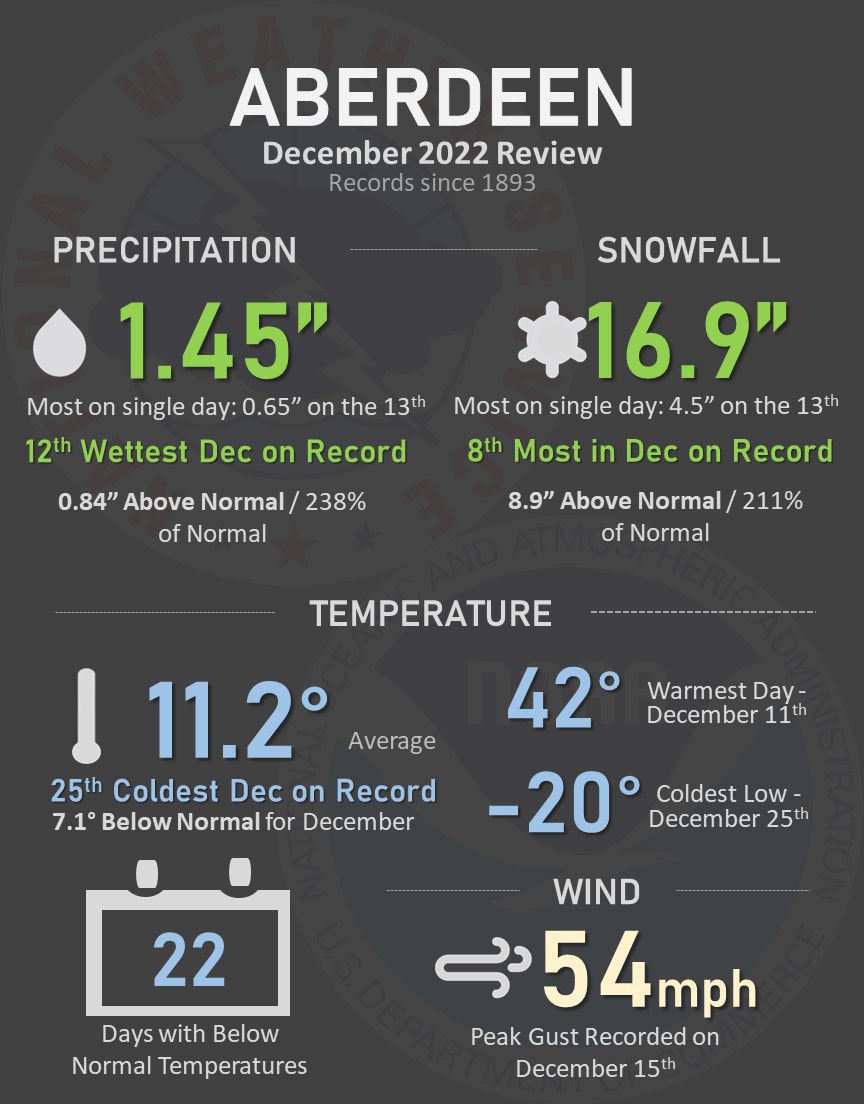
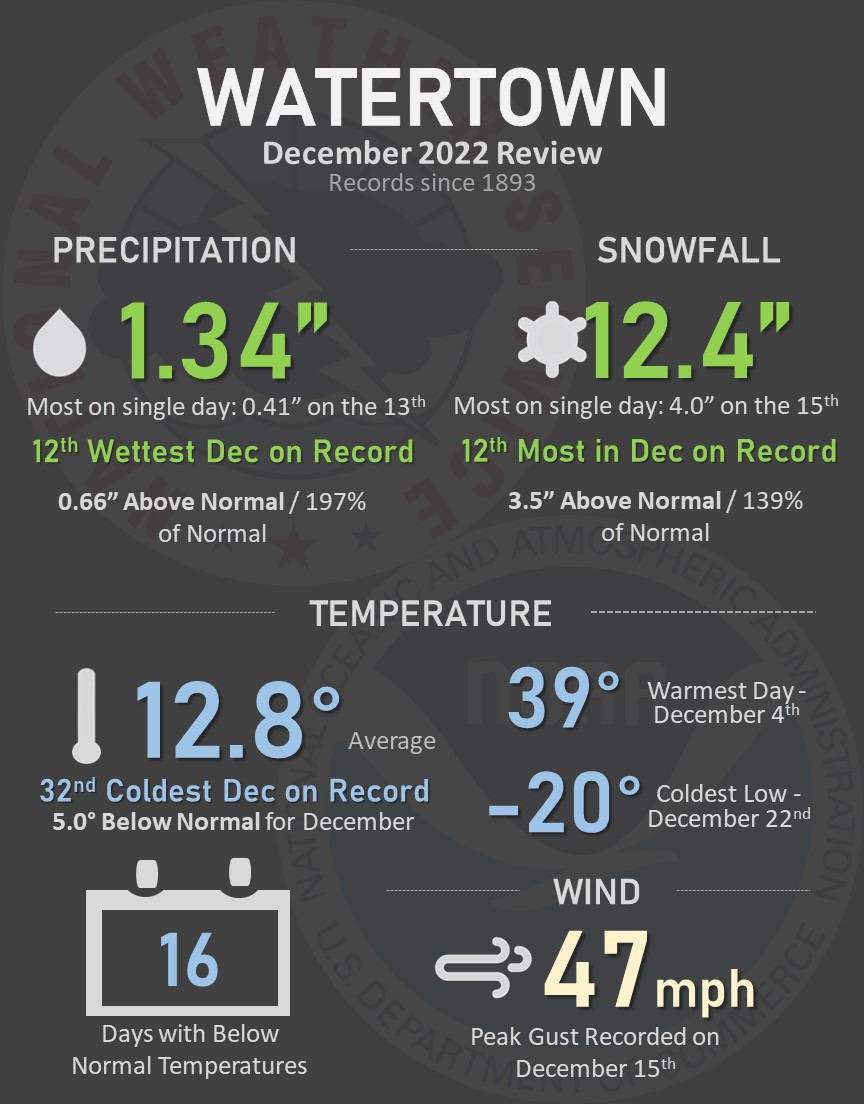
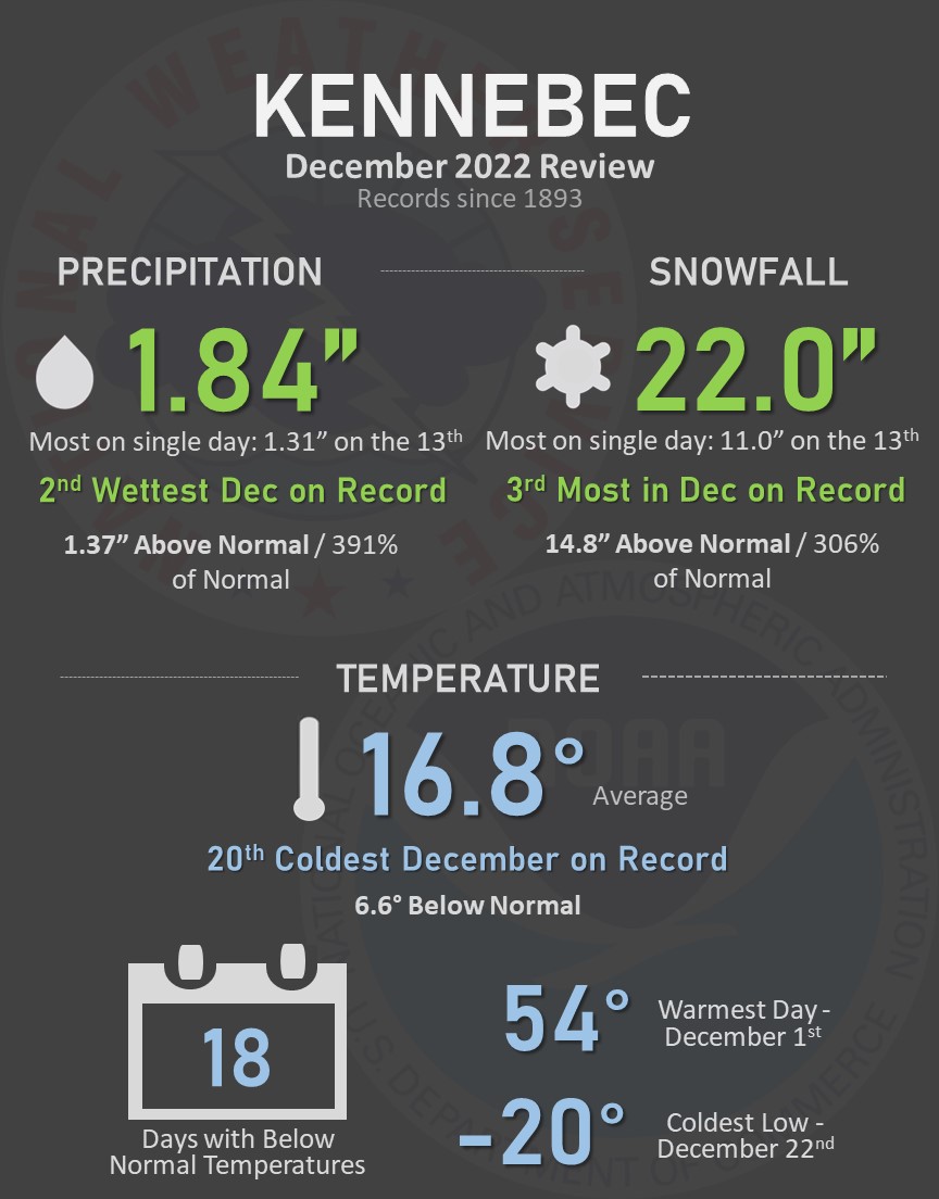
December 2022 will go down in the books as having been cold and snowy, thanks in large part to a couple of potent winter storm systems in the middle and later parts of the month. Find all the details for select locations in the graphics below. Some of the highlights include: Pierre recorded their 4th wettest and 3rd snowiest December on record, Mobridge recorded their 5th wettest December on record, Sisseton recorded their 5th wettest and 2nd snowiest December on record, Kennebec recorded their 2nd wettest and 3rd snowiest December on record, Timber Lake recorded their 4th wettest and 3rd snowiest December on record, and Wheaton recorded their 2nd wettest December on record.


US Dept of Commerce
National Oceanic and Atmospheric Administration
National Weather Service
Aberdeen, SD
824 391st Ave S.
Aberdeen, SD 57401-9311
605-225-0519
Comments? Questions? Please Contact Us.

