
Tropical Depression Two is expected to gradually strengthen and could bring tropical storm conditions to the Florida Panhandle beginning late Monday. Areas of flash flooding will be possible through Thursday along the eastern and central Gulf Coast. Severe thunderstorms will develop and move along a cold front crossing the Upper Midwest Monday, and through the Ohio Valley/Mid-Atlantic on Tuesday. Read More >
Atlanta
Center Weather Service Unit
| ZTL Airspace Summary For ATC Planning Purposes Only |
|---|
| Updated:
|
| Terminal Aerodrome Forecasts (TAFs) for ATL/AHN/CSG/MCN | |
|---|---|
ATL METAR:
|
AHN METAR:
|
CSG METAR:
|
MCN METAR:
|
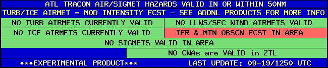
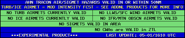
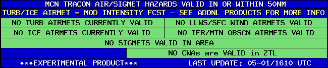
| TRACON Hazards for ATL/AHN/CSG/MCN | |
|---|---|
|
|
|
|
|
|
|
|
|
|
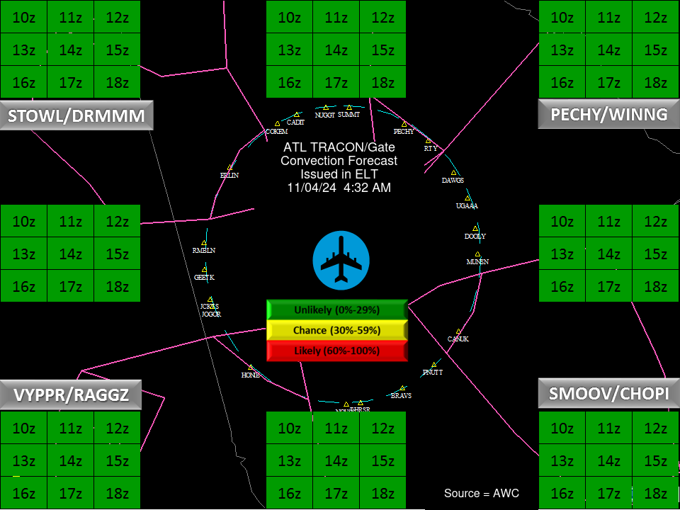
| ATL Convection Gates |
 |
| Forecast Surface Map Loop / Collaborative Convective Forecast Product / Vertical Wind Profile | ||
|---|---|---|
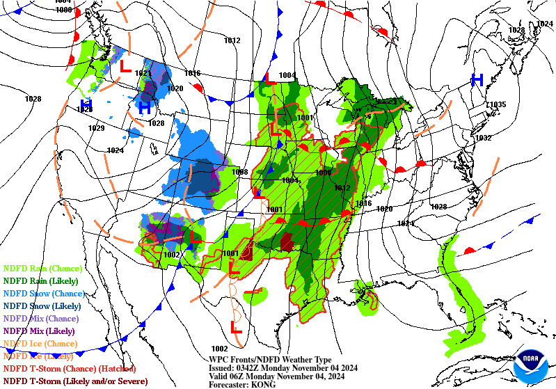 |
 |
|
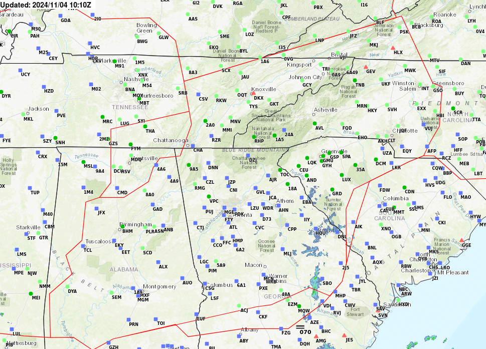
| AIRMETs & SIGMETS/ Southeast Radar loop / Satellite Image (click on image to enlarge) | ||
|---|---|---|
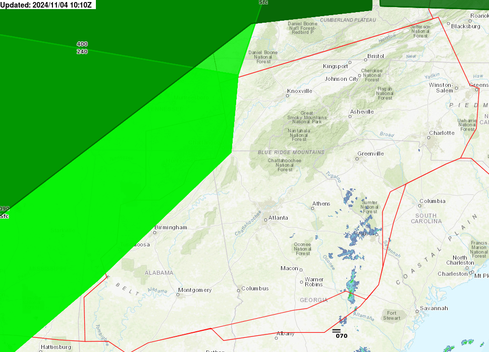 |
 |
|
US Dept of Commerce
National Oceanic and Atmospheric Administration
National Weather Service
Atlanta
299 Woolsey Road
Hampton, GA 30228
770.210.7693
Comments? Questions? Please Contact Us.


