
Heat expands across the Desert Southwest, Plains, Mississippi Valley and Midwest into Monday. Fire weather concerns continue for portions of the Intermountain West. Active monsoonal moisture fuels thunderstorms over the Southwest with possible flash flooding. Tropical cyclone Fausto in the Pacific, should weaken as it approaches Hawaii; Dangerous surf, swells and rip currents are expected. Read More >


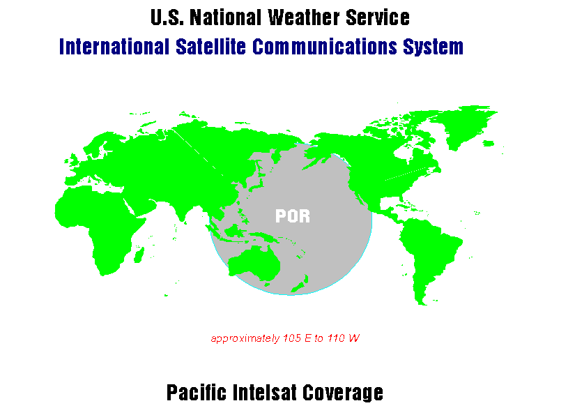
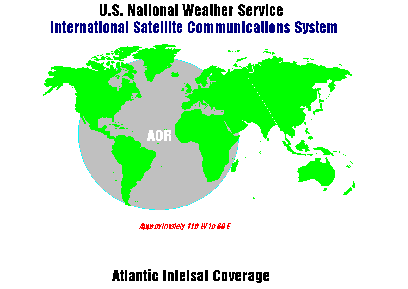
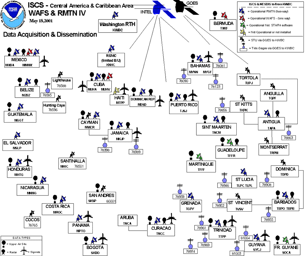
The ISCS has two parts. The two systems are for meteorological data delivery. They use the same satellites and communication protocols. The first service is the World Area Forecast System (WAFS) in support of the International Civil Aviation Organization (ICAO) program for aviation data distribution. The second service is a Global Telecommunication System (GTS) satellite data exchange system for WMO Region IV (North America) data exchange.
The ISCS Program Manager provides additional details and a modernization project that will use new telecommunication technology.

