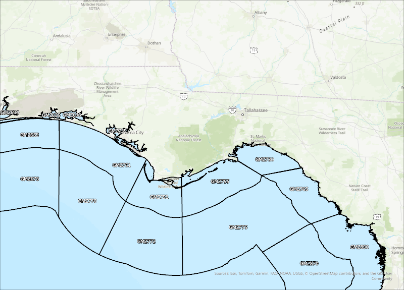
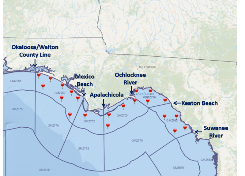
For a graphical forecast, visit weather.gov/beach/tae or see the county based surf zone forecast below:
Detailed Surf Zone Forecast
113
FZUS52 KTAE 010753
SRFTAE
Surf Zone Forecast
National Weather Service Tallahassee FL
353 AM EDT Sat Aug 1 2026
.THE SURF ZONE FORECAST GENERAL OUTLOOK...
Onshore winds of 15-20 mph will continue the high risk for rip
currents in west-facing Gulf County beaches and for Bay County
beaches. Surf heights are also expected to increase for the
remainder of the weekend, spreading the high risk for all beaches
with surf heights of 2-5 feet.
FLZ108-012015-
South Walton-
Including the beaches of Sandestin, Santa Rosa Beach,
and Turquoise Beach
253 AM CDT Sat Aug 1 2026
.TODAY...
Rip Current Risk............Moderate.
Surf Height.................Around 2 feet.
UV Index**..................Very High.
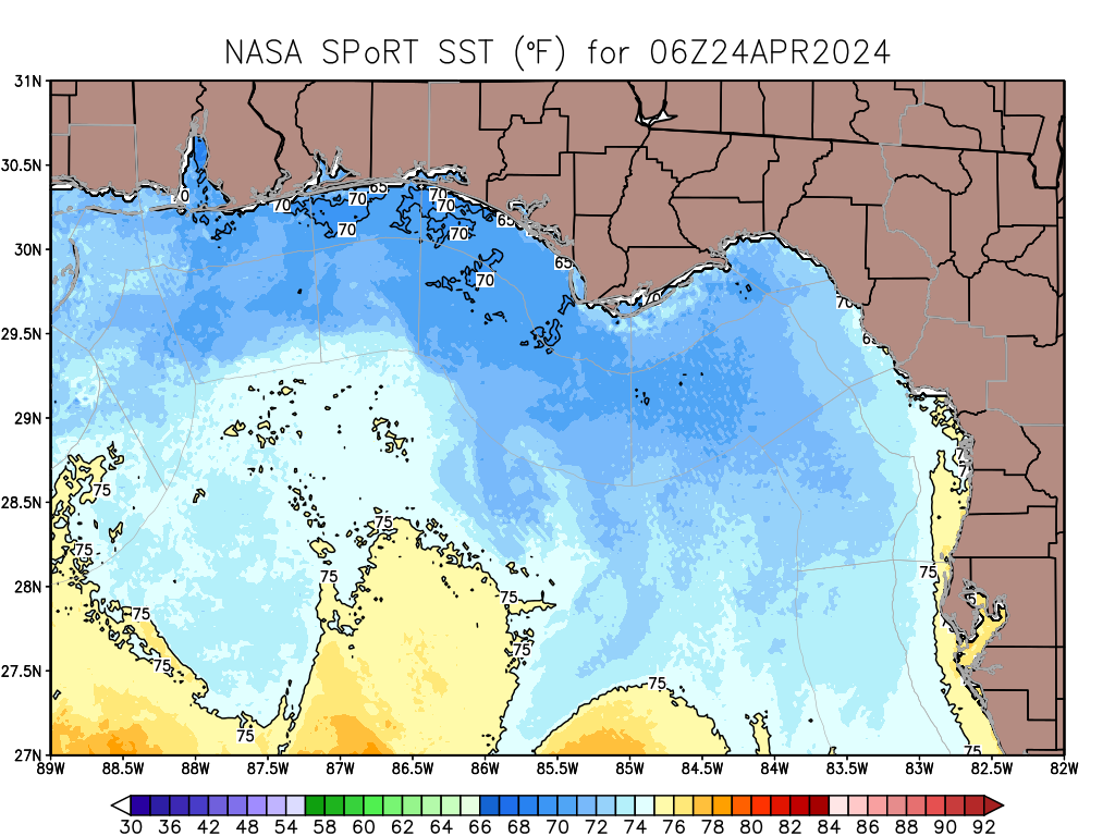
Water Temperature...........85 degrees.
Weather.....................Partly sunny. A chance of showers and a
slight chance of thunderstorms.
High Temperature............In the upper 80s.
Max Heat Index..............Up to 105.
Winds.......................West winds around 15 mph.
Tides...
Panama City..............High at 12:20 PM CDT.
Sunrise.....................7:03 AM.
Sunset......................8:39 PM.
.SUNDAY...
Rip Current Risk............High.
Surf Height.................Around 3 feet.
Weather.....................Partly sunny. Showers and a slight
chance of thunderstorms.
High Temperature............In the mid 80s.
Max Heat Index..............Up to 101.
Winds.......................Southwest winds 15 to 20 mph.
Tides...
Panama City..............High at 01:03 PM CDT.
Sunrise.....................7:04 AM.
Sunset......................8:38 PM.
.MONDAY...High rip current risk*. Surf height around 3 feet. Mostly
sunny. A chance of showers and a slight chance of thunderstorms.
Highs in the mid 80s. Southwest winds around 10 mph.
.TUESDAY...Moderate rip current risk*. Sunny. Isolated showers and
thunderstorms. Highs in the mid 80s. Southwest winds around 10 mph.
.WEDNESDAY...Moderate rip current risk*. Sunny. Highs in the upper
80s. Southwest winds around 5 mph.
&&
Rip Current Risk Category
* Low Risk - The risk for rip currents is low, however,
life-threatening rip currents often occur in the vicinity of groins,
jetties, reefs, and piers.
* Moderate Risk - Life-threatening rip currents are possible in the
surf zone.
* High Risk - Life-threatening rip currents are likely in the surf
zone.
** For lightning, waterspout, and UV definitions see:
https://www.weather.gov/beach/tae
$$
FLZ112-012015-
Coastal Bay-
Including the beaches of Panama City Beach and Magnolia Beach
253 AM CDT Sat Aug 1 2026
...HIGH RIP CURRENT RISK IN EFFECT THROUGH THIS EVENING...
.TODAY...
Rip Current Risk............High.
Surf Height.................Around 3 feet.
UV Index**..................Very High.
Water Temperature...........85 degrees.
Weather.....................Partly sunny. Showers likely and a
slight chance of thunderstorms.
High Temperature............In the upper 80s.
Max Heat Index..............Up to 106.
Winds.......................West winds 15 to 20 mph.
Tides...
Panama City..............High at 12:20 PM CDT.
Sunrise.....................7:01 AM.
Sunset......................8:37 PM.
.SUNDAY...
Rip Current Risk............High.
Surf Height.................Around 4 feet.
Weather.....................Partly sunny until 4 PM, then cloudy.
Showers and a slight chance of
thunderstorms.
High Temperature............In the mid 80s.
Max Heat Index..............Up to 103.
Winds.......................Southwest winds around 20 mph.
Tides...
Panama City..............High at 01:03 PM CDT.
Sunrise.....................7:02 AM.
Sunset......................8:36 PM.
.MONDAY...High rip current risk*. Surf height around 3 feet. Mostly
sunny. A chance of showers and a slight chance of thunderstorms.
Highs in the upper 80s. Southwest winds around 20 mph.
.TUESDAY...Moderate rip current risk*. Sunny. Isolated showers and
thunderstorms. Highs in the upper 80s. Southwest winds around 10 mph.
.WEDNESDAY...Moderate rip current risk*. Sunny. Highs in the upper
80s. Southwest winds around 5 mph.
&&
Rip Current Risk Category
* Low Risk - The risk for rip currents is low, however,
life-threatening rip currents often occur in the vicinity of groins,
jetties, reefs, and piers.
* Moderate Risk - Life-threatening rip currents are possible in the
surf zone.
* High Risk - Life-threatening rip currents are likely in the surf
zone.
** For lightning, waterspout, and UV definitions see:
https://www.weather.gov/beach/tae
$$
FLZ114-012015-
Coastal Gulf-
Including the beaches of Saint Joe Beach
353 AM EDT Sat Aug 1 2026 /253 AM CDT Sat Aug 1 2026/
...HIGH RIP CURRENT RISK IN EFFECT THROUGH THIS EVENING...
.TODAY...
Rip Current Risk...
W Facing Beaches.........High.
S Facing Beaches.........Moderate.
State Park Beaches.......High.
Surf Height...
W Facing Beaches.........Around 2 feet.
S Facing Beaches.........Around 2 feet.
State Park Beaches.......Around 3 feet.
UV Index**..................Extreme.
Water Temperature...........87 degrees.
Weather.....................Mostly cloudy. Showers and a slight
chance of thunderstorms.
High Temperature............In the upper 80s.
Max Heat Index..............Up to 104.
Winds.......................West winds around 20 mph.
Tides...
Apalachicola.............High at 07:03 AM EDT.
Low at 12:32 PM EDT.
High at 05:48 PM EDT.
Sunrise.....................7:01 AM.
Sunset......................8:34 PM.
.SUNDAY...
Rip Current Risk...
W Facing Beaches.........High.
S Facing Beaches.........High.
State Park Beaches.......High.
Surf Height...
W Facing Beaches.........Around 4 feet.
S Facing Beaches.........Around 3 feet.
State Park Beaches.......Around 5 feet.
Weather.....................Partly sunny. Showers and a slight
chance of thunderstorms.
High Temperature............In the mid 80s.
Max Heat Index..............Up to 103.
Winds.......................Southwest winds around 20 mph.
Tides...
Apalachicola.............High at 07:12 AM EDT.
Low at 01:14 PM EDT.
Sunrise.....................7:01 AM.
Sunset......................8:34 PM.
.MONDAY...High rip current risk*. Surf height around 4 feet. Partly
sunny. Showers likely and a slight chance of thunderstorms. Highs in
the mid 80s. Southwest winds around 20 mph.
.TUESDAY...High rip current risk*. Mostly sunny. Isolated showers and
thunderstorms. Highs in the mid 80s. Southwest winds around 10 mph.
.WEDNESDAY...Moderate rip current risk*. Sunny. Highs in the upper
80s. Southwest winds around 5 mph.
&&
Rip Current Risk Category
* Low Risk - The risk for rip currents is low, however,
life-threatening rip currents often occur in the vicinity of groins,
jetties, reefs, and piers.
* Moderate Risk - Life-threatening rip currents are possible in the
surf zone.
* High Risk - Life-threatening rip currents are likely in the surf
zone.
** For lightning, waterspout, and UV definitions see:
https://www.weather.gov/beach/tae
$$
FLZ115-012015-
Coastal Franklin-
Including the beaches of Apalachicola
353 AM EDT Sat Aug 1 2026
.TODAY...
Rip Current Risk............Moderate.
Surf Height.................Around 1 foot.
UV Index**..................Extreme.
Water Temperature...........89 degrees.
Weather.....................Mostly cloudy. Showers and a slight
chance of thunderstorms.
High Temperature............In the mid 80s.
Max Heat Index..............Up to 103.
Winds.......................West winds around 15 mph.
Tides...
Apalachicola.............High at 07:03 AM EDT.
Low at 12:32 PM EDT.
High at 05:48 PM EDT.
Sunrise.....................6:59 AM.
Sunset......................8:33 PM.
.SUNDAY...
Rip Current Risk............High.
Surf Height.................Around 2 feet.
Weather.....................Partly sunny. Showers and a slight
chance of thunderstorms.
High Temperature............In the mid 80s.
Max Heat Index..............Up to 101.
Winds.......................Southwest winds around 20 mph.
Tides...
Apalachicola.............High at 07:12 AM EDT.
Low at 01:14 PM EDT.
Sunrise.....................6:59 AM.
Sunset......................8:32 PM.
.MONDAY...High rip current risk*. Surf height around 2 feet. Partly
sunny. Showers and a slight chance of thunderstorms. Highs in the mid
80s. Southwest winds around 20 mph.
.TUESDAY...Moderate rip current risk*. Mostly sunny. Scattered
showers and thunderstorms. Highs in the mid 80s. Southwest winds
around 10 mph.
.WEDNESDAY...Moderate rip current risk*. Mostly sunny. Highs in the
upper 80s. South winds around 5 mph.
&&
Rip Current Risk Category
* Low Risk - The risk for rip currents is low, however,
life-threatening rip currents often occur in the vicinity of groins,
jetties, reefs, and piers.
* Moderate Risk - Life-threatening rip currents are possible in the
surf zone.
* High Risk - Life-threatening rip currents are likely in the surf
zone.
** For lightning, waterspout, and UV definitions see:
https://www.weather.gov/beach/tae
$$