Tallahassee, FL
Weather Forecast Office
| The Valdosta Tornado of December 29, 2014 |
At 11:26 am EST on December 29, 2014 a tornado touched down in Valdosta, Georgia. Several buildings were damaged at the Langdale Forest Product Company. A survey team determined that the tornado was rated EF2 on the Enhanced Fujita Scale and maximum winds were around 120 mph. Below are several social media posts about the tornado and pictures of the damage. Click images for larger versions.
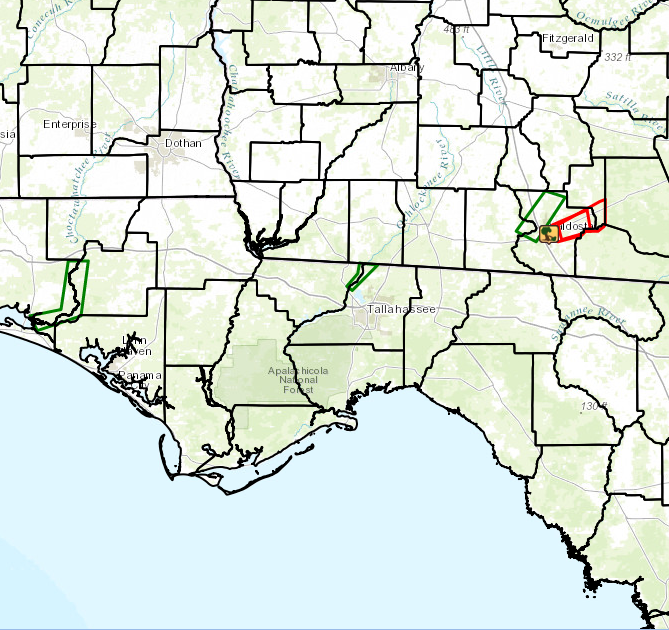
Figure 1. Map showing tornado warnings (red) and river flood warnings (green) issued on December 29, 2014.
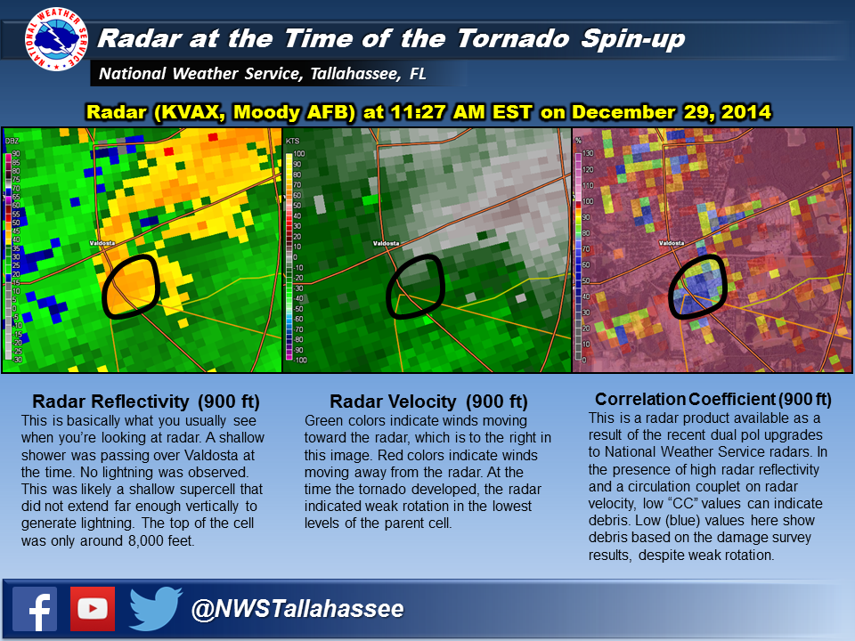
Figure 2. Radar imagery of tornado.
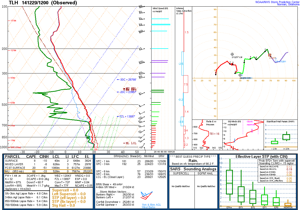
Figure 3. Sounding from KTLH at 12z on December 29, 2014.
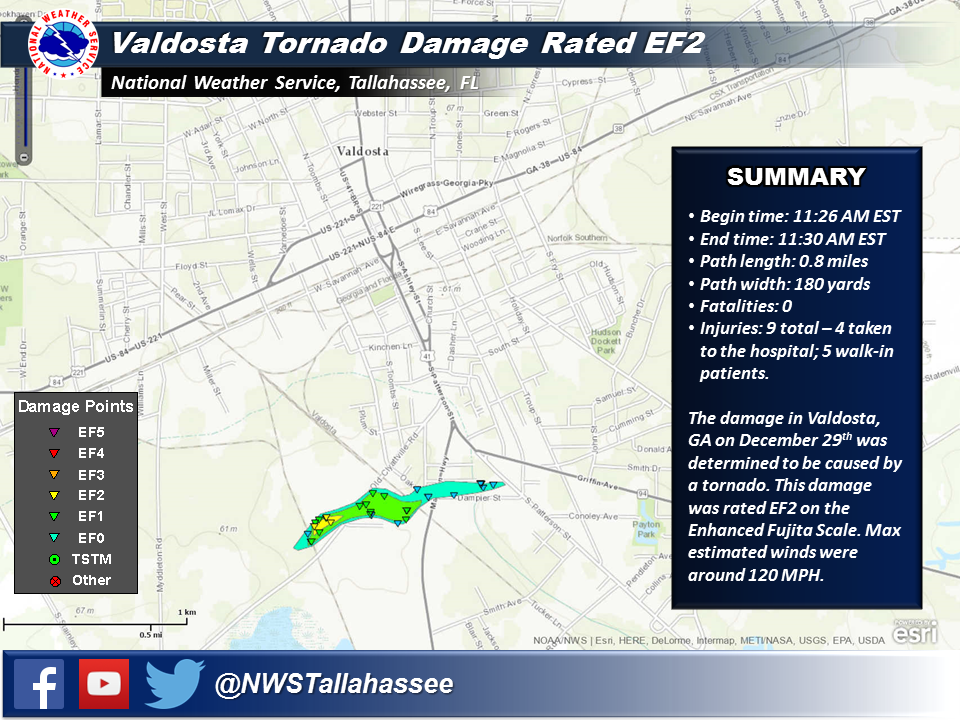
Figure 4. Tornado track with damage points indicated by triangles.
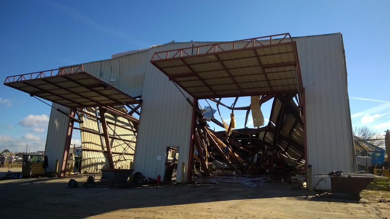
Figure 5. Damage at Langley Forest Products Company. Photo courtesy of Emma Weston.
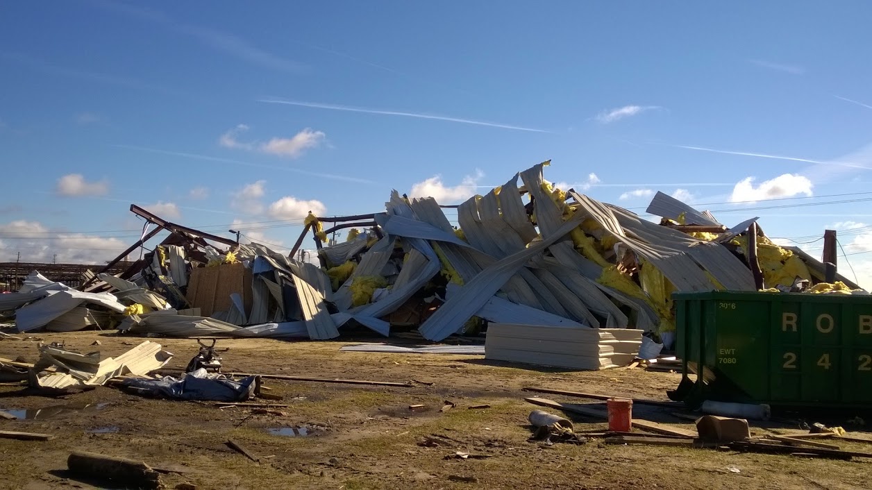
Figure 6. Damage at Langley Forest Products Company. Photo courtesy of Emma Weston.
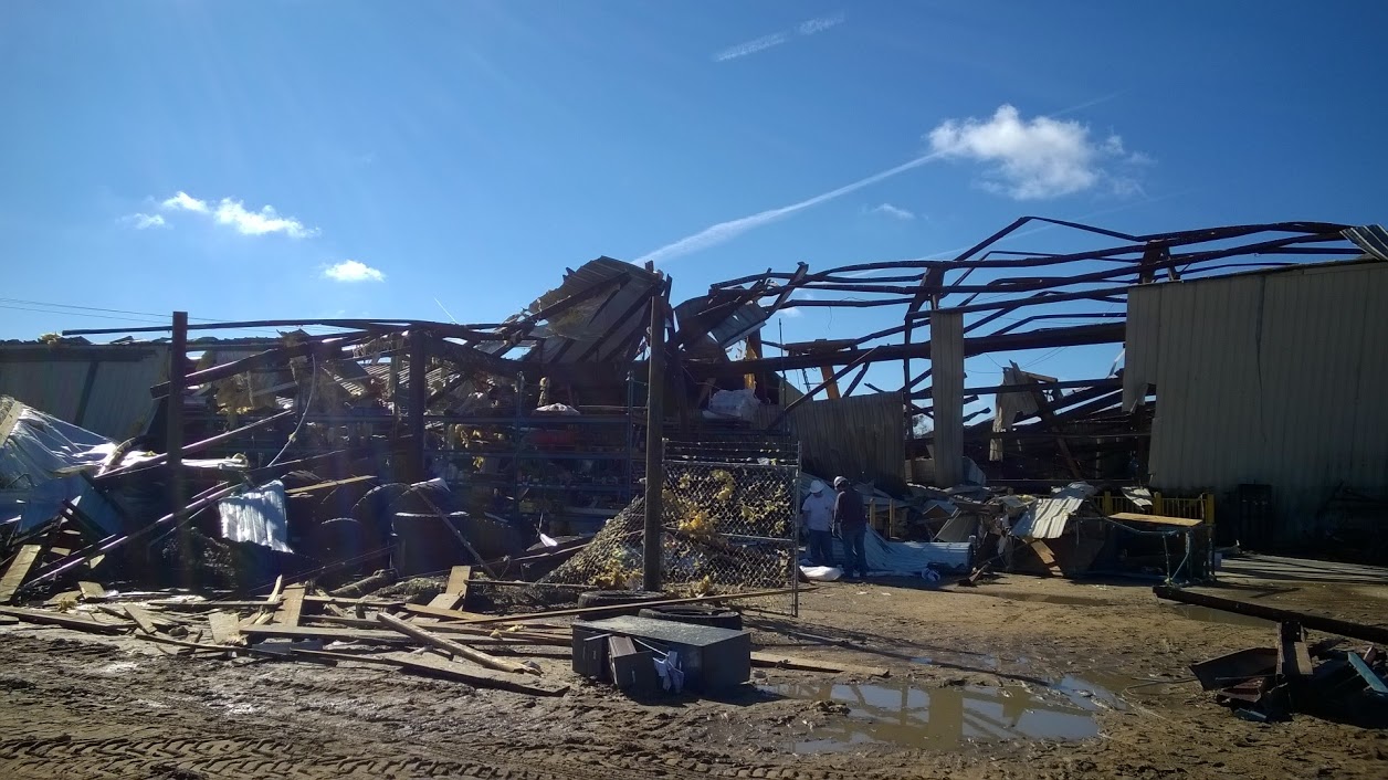
Figure 7. Damage at Langley Forest Products Company. Photo courtesy of Emma Weston.
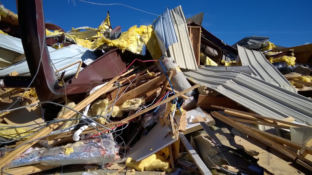
Figure 8. Damage at Langley Forest Products Company. Note the bent steel beams. Photo courtesy of Emma Weston.
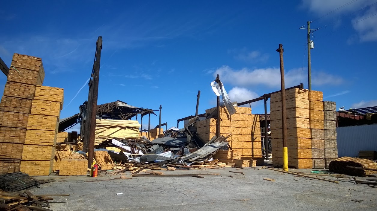
Figure 9. Damage at Langley Forest Products Company. Photo courtesy of Emma Weston.
This page was authored by Emma Weston. The tornado track map was assembled using the Damage Assessment Toolkit base on information gathered by Kelly Godsey and Emma Weston during a damage survey.
Current Hazards
Hazardous Weather Outlook
National Outlook
Rip Current Risk
Local Storm Reports (Text)
Local Storm Reports (Map)
Submit a Storm Report
Radar Imagery
National
Florida Panhandle (EVX)
Southwest Alabama (EOX)
Tallahassee (TLH)
Valdosta (VAX)
Current Weather
Observations (Map)
Observations (Text)
Observed Precipitation
Rivers and Lakes
Satellite Images
Upper Air Sounding
Forecasts
Aviation Weather
Fire Weather
Forecast Discussion
Forecast Text Products
Hydrology
Local Model Data
Marine Weather
Tropical Weather
Climate
Climate Text Products
Climate Graphs
CoCoRAHS
Drought
Local Data and Records
ENSO
Tropical Cyclone Reports
US Dept of Commerce
National Oceanic and Atmospheric Administration
National Weather Service
Tallahassee, FL
1017 Academic Way
FSU, Love Bldg, 4th Floor
Tallahassee, FL 32306-4509
850-942-8833 (person) or 850-942-8851 (recording)
Comments? Questions? Please Contact Us.

