Tallahassee, FL
Weather Forecast Office
| Apalachicola Tornado of October 27, 2006 |
Warm moist, unstable air in advance of approaching cold front produced several tornadoes across the eastern Florida Panhandle and Big Bend on Friday afternoon and evening, October 27th. One tornado flipped a Frito-Lay truck on its side in the Winn-Dixie parking lot in the Phillips Inlet area of western Bay County.
The most significant severe weather occurred when a waterspout came ashore and produced F1 tornado damage in Apalachicola. The tornado cut a path approximately 1 mile long (see Figure 1) and more than 100 yards wide, damaging a fast food restaurant, school, hospital, electric power substation, and dozens of homes. Hundreds of trees were either uprooted or had their tops sheared off. Luckily, no one was hurt. Figures 2 and 3 shows the reflectivity and storm-relative velocity, respectively, associated with the convective cell as it moved ashore near Apalachicola. Rotational velocities were surprisingly weak, unlike other tornadoes of this magnitude. Figure 4 shows damage to a home caused by the tornado.
The SPC report archive gives additional damage reports received during this event.

Figure 1. Damage path of the tornado that hit Apalachicola, FL, on Friday, October 27, 2006.
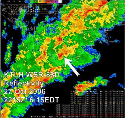
Figure 2. Base reflectivity image from the Tallahassee, FL, (KTLH) doppler radar showing a tornadic thunderstorm as it moved ashore into Apalachicola, FL, at 2215 UTC Friday, October 27, 2006.
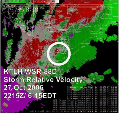
Figure 3. Storm relative velocity image from the Tallahassee, FL, (KTLH) doppler radar showing a tornadic thunderstorm as it moved ashore into Apalachicola, FL, at 2215 UTC Friday, October 27, 2006.
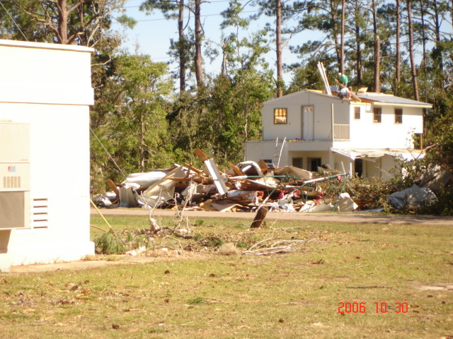
Figure 4. This image depicts a home damaged by the tornado.
Current Hazards
Hazardous Weather Outlook
National Outlook
Rip Current Risk
Local Storm Reports (Text)
Local Storm Reports (Map)
Submit a Storm Report
Radar Imagery
National
Florida Panhandle (EVX)
Southwest Alabama (EOX)
Tallahassee (TLH)
Valdosta (VAX)
Current Weather
Observations (Map)
Observations (Text)
Observed Precipitation
Rivers and Lakes
Satellite Images
Upper Air Sounding
Forecasts
Aviation Weather
Fire Weather
Forecast Discussion
Forecast Text Products
Hydrology
Local Model Data
Marine Weather
Tropical Weather
Climate
Climate Text Products
Climate Graphs
CoCoRAHS
Drought
Local Data and Records
ENSO
Tropical Cyclone Reports
US Dept of Commerce
National Oceanic and Atmospheric Administration
National Weather Service
Tallahassee, FL
1017 Academic Way
FSU, Love Bldg, 4th Floor
Tallahassee, FL 32306-4509
850-942-8833 (person) or 850-942-8851 (recording)
Comments? Questions? Please Contact Us.

