Tallahassee, FL
Weather Forecast Office
Tornado Strikes Fort Rucker
Widespread showers and thunderstorms ahead of a cold front lifted northward across the tri-state area on Sunday, April 22, 2018. While overall damage reports with the thunderstorms were limited, strong low level shear caused rotation in numerous storms. Despite the strong low level shear, instability was limited and the resultant storm mode was mini-supercells.
 |
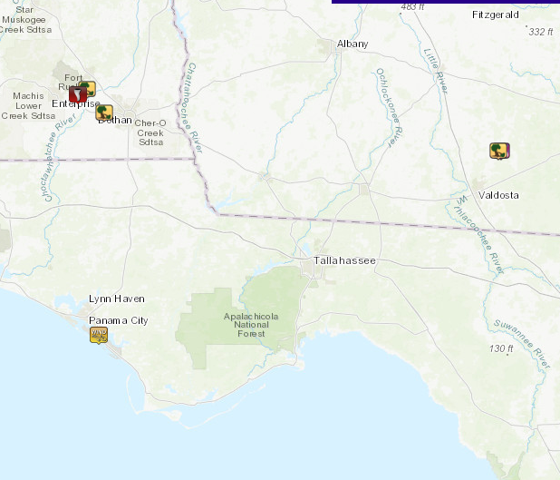
| Map of Local Storm Reports from April 22, 2018 |
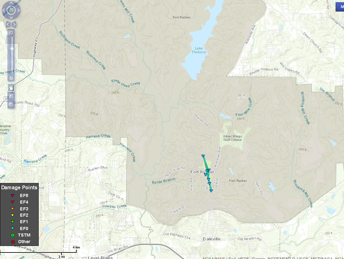
A few reports of trees and even a downed street sign were reported in Houston County, AL and a downed tree was reported in Lanier County, GA. Despite the low-topped convection, the core of one storm in Lanier County, GA was also strong enough to produce nickel sized hail. While rotation was noted in multiple storms and a few Tornado Warnings were issued, only one storm produced a tornado that moved through Dale County, AL. An NWS storm survey team found an EF-0 tornado with winds of 75mph tracked approximately 1 mile across Fort Rucker. The tornado snapped small trees and large tree limbs, uprooted small trees and damaged a wooden dugout at a baseball field. The tornado touched down near Kingsman Street and Andrews Avenue and moved north northwest, lifting near Baker Street.
Dale County Tornado
| Rating: | EF-0 |
| Estimated Peak Wind: | 75 mph |
| Path Length (statute): | 1.17 miles |
| Path Width (maximum): | 100 yards |
| Fatalities: | 0 |
| Injuries: | 0 |
| Start Date/Time: | April 22, 2018 1:11 PM CDT |
| Start Location: | 1 S Fort Rucker, Dale County, AL |
| Start Lat/Lon: | 31.3306, -85.7093 |
| End Date/Time | April 22, 2018 1:16PM CDT |
| End Location: | 1 WSW Fort Rucker, Dale County, AL |
| End Lat/Lon: | 31.3472, -85.7137 |
 |
| Dale County Tornado Track |
 |
 |
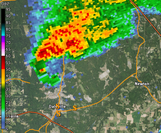
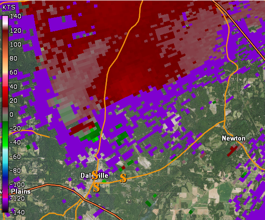
| Reflectivity | Velocity |
Current Hazards
Hazardous Weather Outlook
National Outlook
Rip Current Risk
Local Storm Reports (Text)
Local Storm Reports (Map)
Submit a Storm Report
Radar Imagery
National
Florida Panhandle (EVX)
Southwest Alabama (EOX)
Tallahassee (TLH)
Valdosta (VAX)
Current Weather
Observations (Map)
Observations (Text)
Observed Precipitation
Rivers and Lakes
Satellite Images
Upper Air Sounding
Forecasts
Aviation Weather
Fire Weather
Forecast Discussion
Forecast Text Products
Hydrology
Local Model Data
Marine Weather
Tropical Weather
Climate
Climate Text Products
Climate Graphs
CoCoRAHS
Drought
Local Data and Records
ENSO
Tropical Cyclone Reports
US Dept of Commerce
National Oceanic and Atmospheric Administration
National Weather Service
Tallahassee, FL
1017 Academic Way
FSU, Love Bldg, 4th Floor
Tallahassee, FL 32306-4509
850-942-8833 (person) or 850-942-8851 (recording)
Comments? Questions? Please Contact Us.

