Memphis, TN
Weather Forecast Office
January 25th-26th 2011 Snowfall
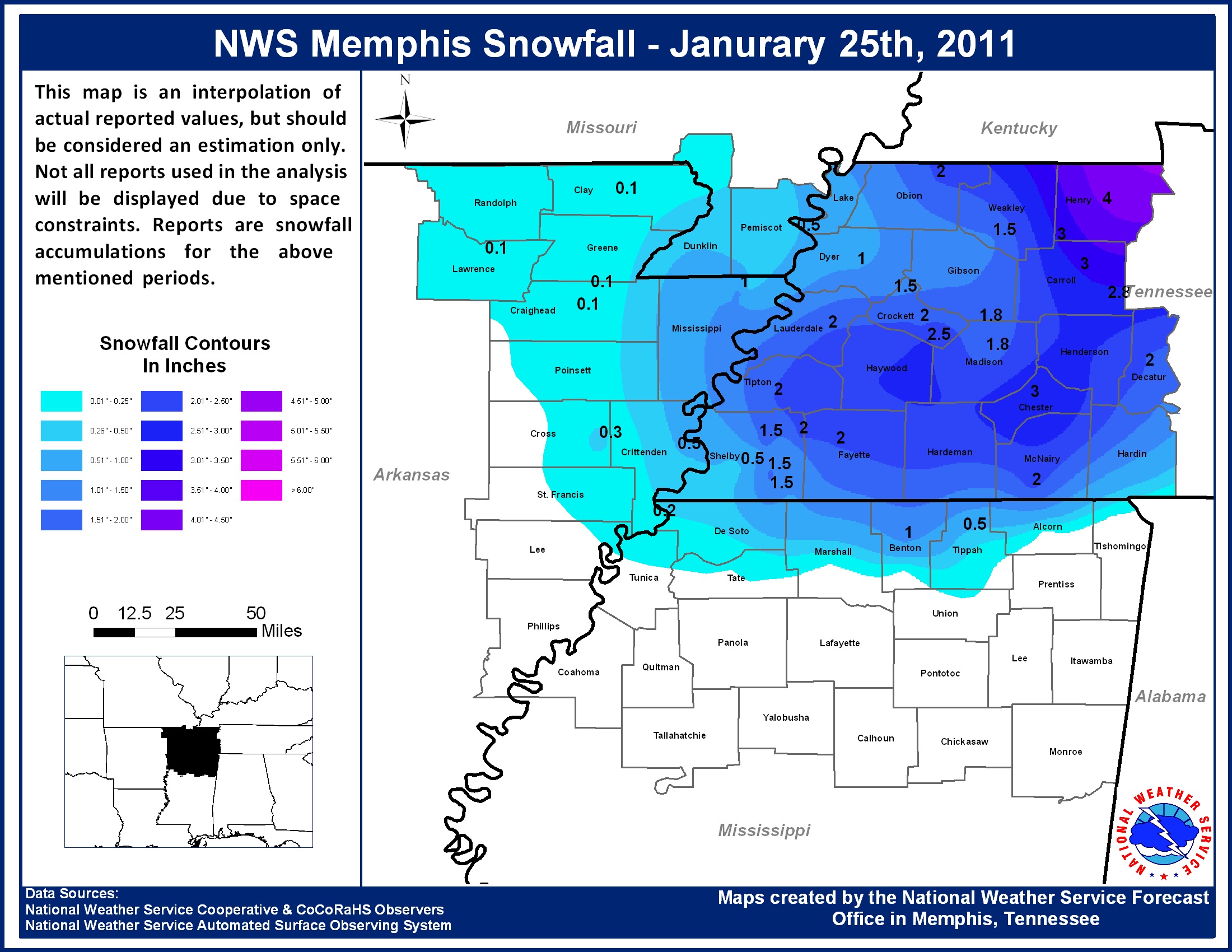
PUBLIC INFORMATION STATEMENT
NATIONAL WEATHER SERVICE MEMPHIS TN
406 PM CST WED JAN 26 2011

...SNOWFALL ACCUMULATIONS FROM JANUARY 25TH THROUGH 26TH...

COUNTY         SNOWFALL (INCHES)

IN MISSOURI...
PEMISCOT.......LESS THAN 1

IN ARKANSAS...
CRAIGHEAD......TRACE
CRITTENDEN.....LESS THAN 1
CROSS..........LESS THAN 0.5
MISSISSIPPI....1
PHILLIPS.......TRACE
POINSETT.......TRACE
ST. FRANCIS....TRACE

IN TENNESSEE...
CARROLL........2-3
CHESTER........3
CROCKETT.......2
DECATUR........1-2
DYER...........1
FAYETTE........2
HARDEMAN.......1-2
HENDERSON......2
HENRY..........2-5
LAUDERDALE.....2
MCNAIRY........2
MADISON........1-2
OBION..........1-2
SHELBY.........1-2
TIPTON.........2
WEAKLEY........1-2

IN MISSISSIPPI...
BENTON.........1
TIPPAH.........LESS THAN 1

$$

SWC
CURRENT HAZARDS
Briefing Page
Outlooks
Submit a Storm Report
Submit a Storm Photo
View Storm Report
Spot Forecast Request
Hazard Outlook
FORECASTS
Local
Graphical
Probabilistic
Precipitation
Aviation
Fire
Severe Weather
Winter Weather
Tropical Weather
Air Quality
US Dept of Commerce
National Oceanic and Atmospheric Administration
National Weather Service
Memphis, TN
7777 Walnut Grove Road, OM1
Memphis, TN 38120
(901) 544-0399
Comments? Questions? Please Contact Us.

