Memphis, TN
Weather Forecast Office
Weakley County, TN EF-1 Tornado
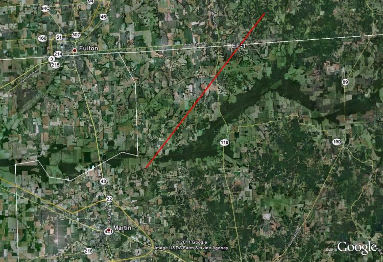
Tornado Track Map:
Survey Results:
...PRELIMINARY EF-1 TORNADO IN WEAKLEY COUNTY TENNESSEE...
* COUNTY: WEAKLEY
* TIME OF EVENT: NORTHERN WEAKLEY COUNTY 11:45 PM ON APRIL 25 2011
* BEGIN POINT: 36.396122, -88.804813
* END POINT: 36.499191, -88.693847
* STARTING POINT IN TN: 4.5 MILES NORTHEAST OF MARTIN, TN
* ENDING POINT IN TN: 14 MILES NORTHEAST OF MARTIN, TN
* STARTING POINT IN KY: 1.2 MILES EAST OF DUKEDOM, KY
* ENDING POINT IN KY - 2.6 MILES SOUTHWEST OF LYNNVILLE, KY
* RATING: EF-1
* ESTIMATED PEAK WIND: 100 mph
* PATH LENGTH: 15 MILES
* MAXIMUM WIDTH: 225 YARDS
* FATALITIES: 0
* INJURIES: 0
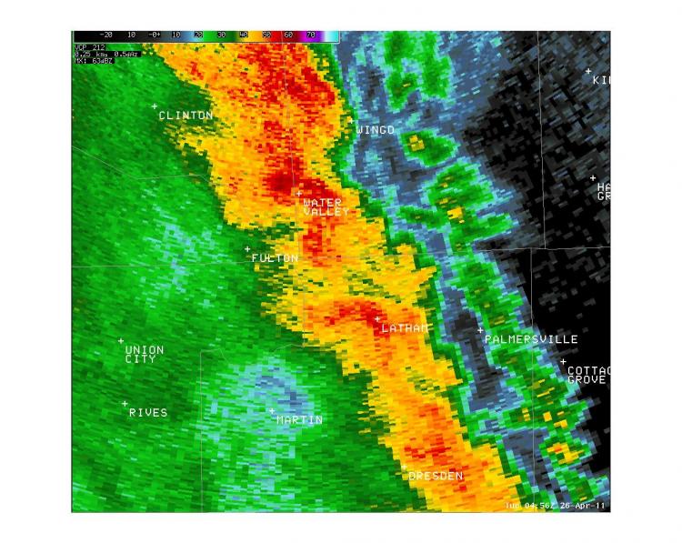
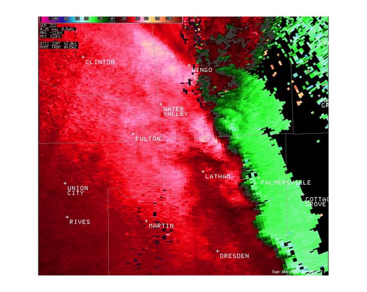
Radar Images:
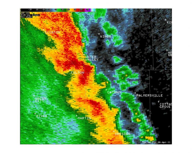 |
 |
 |
 |
CURRENT HAZARDS
Briefing Page
Outlooks
Submit a Storm Report
Submit a Storm Photo
View Storm Report
Spot Forecast Request
Hazard Outlook
FORECASTS
Local
Graphical
Probabilistic
Precipitation
Aviation
Fire
Severe Weather
Winter Weather
Tropical Weather
Air Quality
US Dept of Commerce
National Oceanic and Atmospheric Administration
National Weather Service
Memphis, TN
7777 Walnut Grove Road, OM1
Memphis, TN 38120
(901) 544-0399
Comments? Questions? Please Contact Us.

