Memphis, TN
Weather Forecast Office
Trebloc, MS EF-3 Tornado
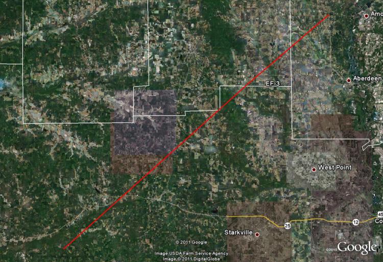
Tornado Track Map:
Survey Results:
...PRELIMINARY EF-3 TORNADO IN CHICKASAW AND MONROE COUNTIES MISSISSIPPI...
* COUNTY/COUNTIES: CHICKASAW AND MONROE
* LOCATION: FROM THE WEBSTER/CHICKASAW COUNTY LINE TO NEAR HWY 278
  NORTHEAST OF NEW WREN.
* TIME: 305 AM CDT WEDNESDAY APRIL 27 2011
* BEGINNING POINT: 33.44697, -88.37198
* ENDING POINT: 33.9889, -88.5987
* RATING: EF-3
* ESTIMATED PEAK WIND: 140 MPH
* PATH LENGTH: 59.9 MILES
* MAXIMUM WIDTH: 1 MILE
* FATALITIES: 0
* INJURIES: UNKNOWN NUMBER OF INJURIES
* SUMMARY OF DAMAGES: TORNADO MOVED IN FROM WEBSTER COUNTY, MS. DAMAGE
  CONSISTENT WITH AN EF-3 TORNADO OCCURED IN WEBSTER COUNTY. DAMAGE IN
  CHICKASAW AND MONROE COUNTIES WAS CONSISTENT WITH AN EF-1 TORNADO. MINOR
  HOME DAMAGE...BARN DAMAGED AND TREES UPROOTED NEAR HIGHWAYS 8 AND 47.
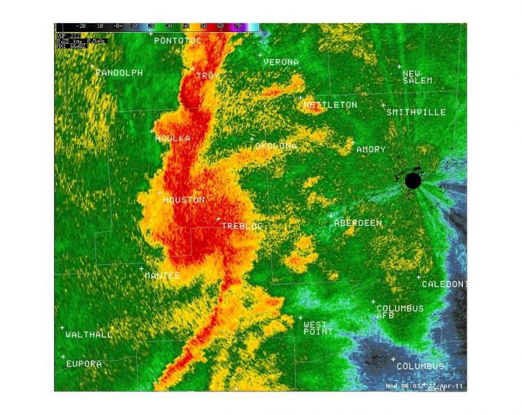
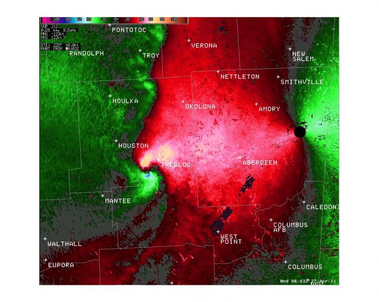
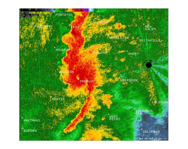
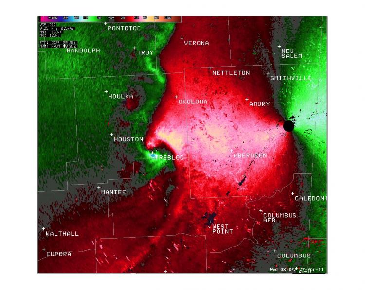
Radar Images:
 |
 |
 |
 |
CURRENT HAZARDS
Briefing Page
Outlooks
Submit a Storm Report
Submit a Storm Photo
View Storm Report
Spot Forecast Request
Hazard Outlook
FORECASTS
Local
Graphical
Probabilistic
Precipitation
Aviation
Fire
Severe Weather
Winter Weather
Tropical Weather
Air Quality
US Dept of Commerce
National Oceanic and Atmospheric Administration
National Weather Service
Memphis, TN
7777 Walnut Grove Road, OM1
Memphis, TN 38120
(901) 544-0399
Comments? Questions? Please Contact Us.

