Memphis, TN
Weather Forecast Office
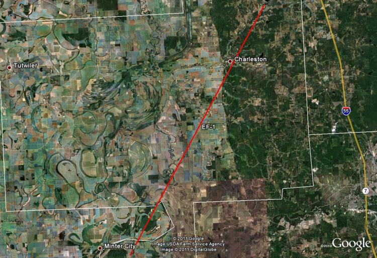
Tallahatchie County, MS EF-1 Tornado
Tornado Track Map:
Survey Results:
...PRELIMINARY EF-1 TORNADO IN TALLAHATCHIE COUNTY MISSISSIPPI...
* COUNTY: TALLAHATCHIE
* LOCATION/TIME OF EVENT: SOUTHERN AND EASTERN TALLAHATCHIE COUNTY 1:15 AM ON APRIL 27 2011
* BEGIN POINT: 33.740847, -90.243633
* END POINT: 34.083966, -89.993233
* RATING: EF-1
* ESTIMATED PEAK WIND: 90 MPH
* PATH LENGTH: 28 MILES
* MAXIMUM WIDTH: UP TO 50 YARDS
* FATALITIES: 0
* INJURIES: 0
* SUMMARY OF DAMAGES: DAMAGED SEVERAL HOMES WITH SHINGLE
DAMAGE AND RIPPED OFF A PORTION OF ROOF OF MOBILE HOME
AND BUILDING. MANY TREES SNAPPED AND UPROOTED. ESTIMATED
WINDS WITH TORNADO ABOUT 70 TO 75 MPH.
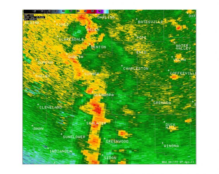
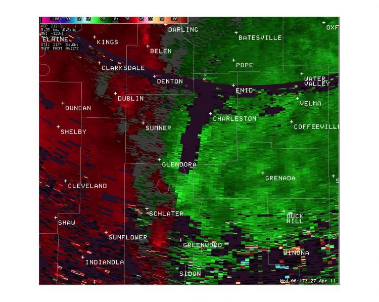
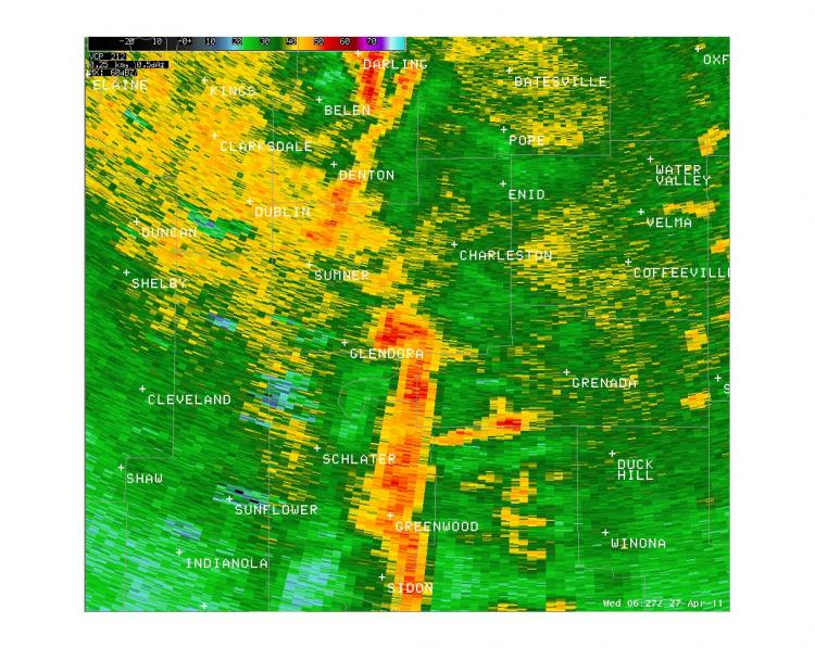
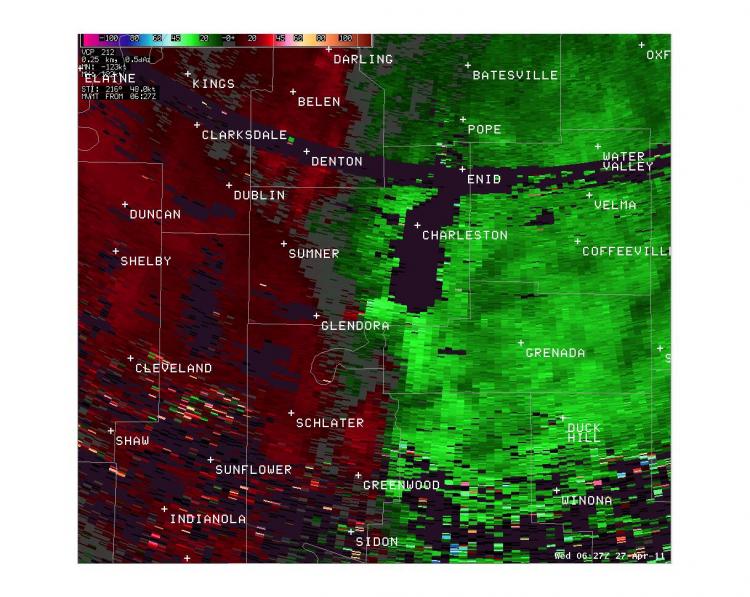
Radar Images:
 |
 |
 |
 |
CURRENT HAZARDS
Briefing Page
Outlooks
Submit a Storm Report
Submit a Storm Photo
View Storm Report
Spot Forecast Request
Hazard Outlook
FORECASTS
Local
Graphical
Probabilistic
Precipitation
Aviation
Fire
Severe Weather
Winter Weather
Tropical Weather
Air Quality
US Dept of Commerce
National Oceanic and Atmospheric Administration
National Weather Service
Memphis, TN
7777 Walnut Grove Road, OM1
Memphis, TN 38120
(901) 544-0399
Comments? Questions? Please Contact Us.

