Memphis, TN
Weather Forecast Office
Lafayette County, MS EF-3 Tornado
Tornado Track Map:
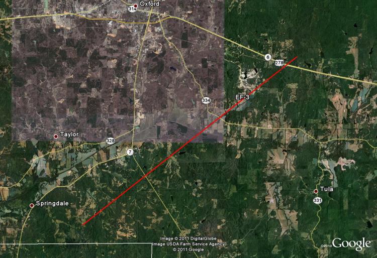
Survey Results:
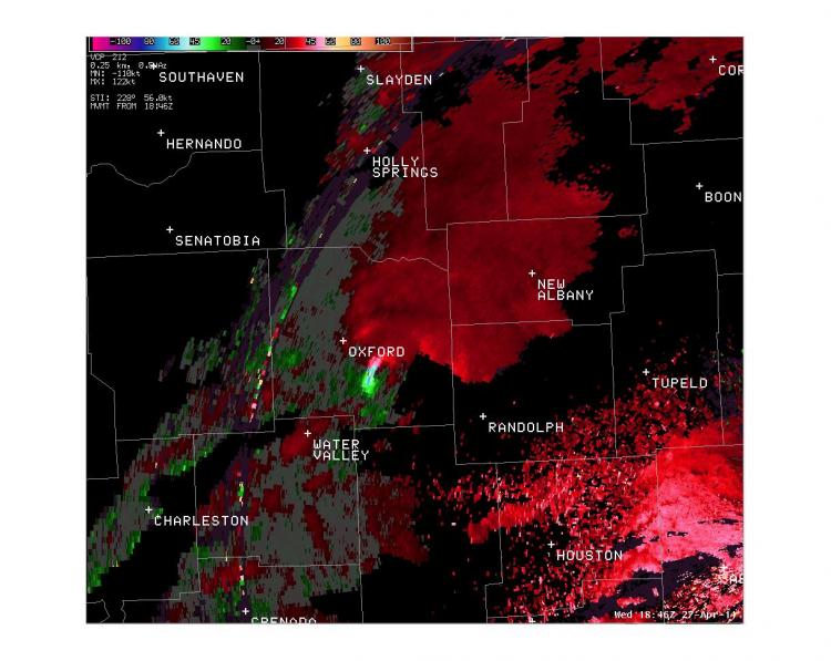
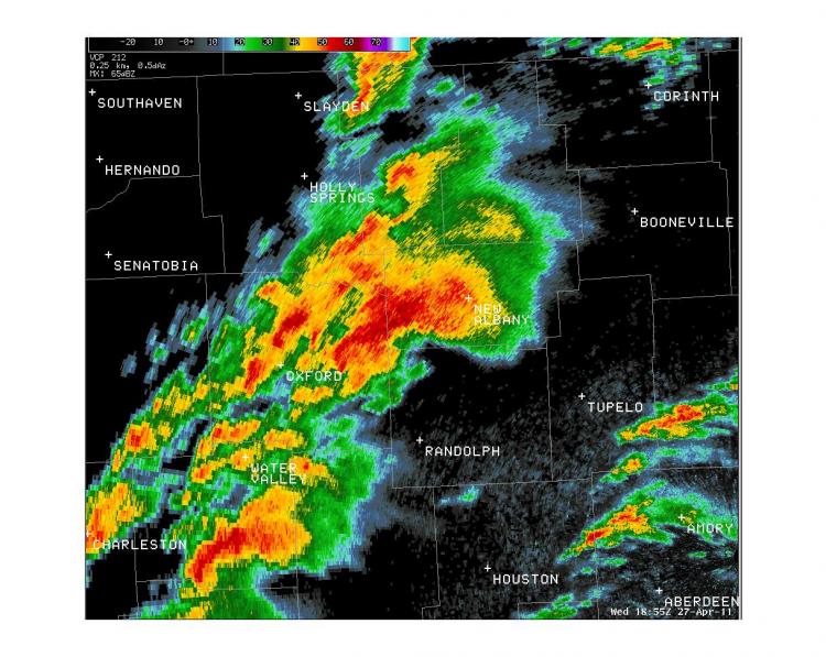
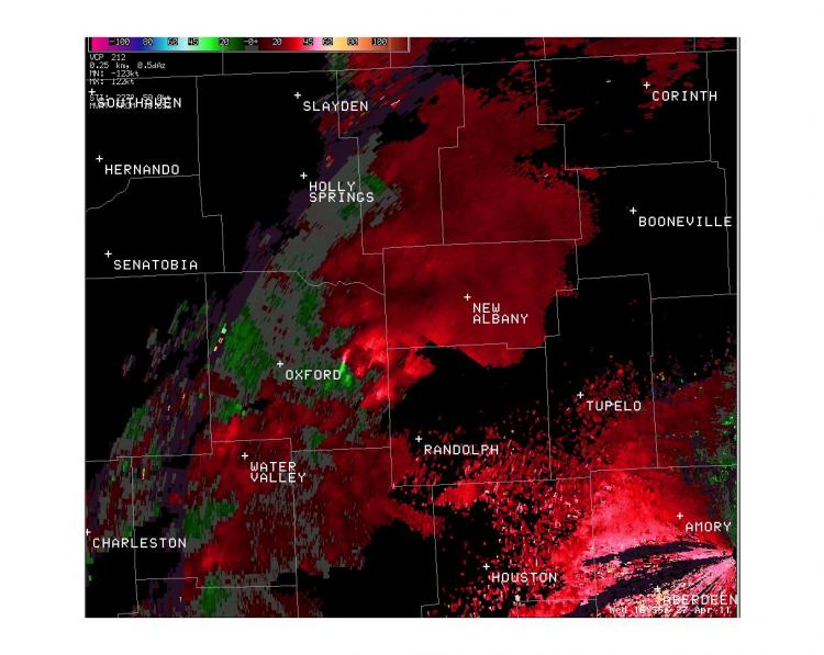
...PRELIMINARY EF-3 TORNADO IN LAFAYETTE COUNTY MISSISSIPPI...
* COUNTY: LAFAYETTE
* LOCATION/TIME OF EVENT: DAMAGE BEGAN SOUTH OF OXFORD AT 139 PM
  ON WEDNESDAY APRIL 27 2011
* BEGINNING POINT: 34.2084, -89.5653
* ENDING POINT: 34.3299, -89.3785
* RATING: EF-3
* ESTIMATED PEAK WIND: 140 MPH
* PATH LENGTH: 13.6 MILES
* MAXIMUM WIDTH: 1/4 MILE
* FATALITIES: 0
* INJURIES: 2
* SUMMARY OF DAMAGES: A NUMBER OF HOMES AND MOBILE HOMES WERE
  DAMAGED ALONG THE PATH OF THE TORNADO.
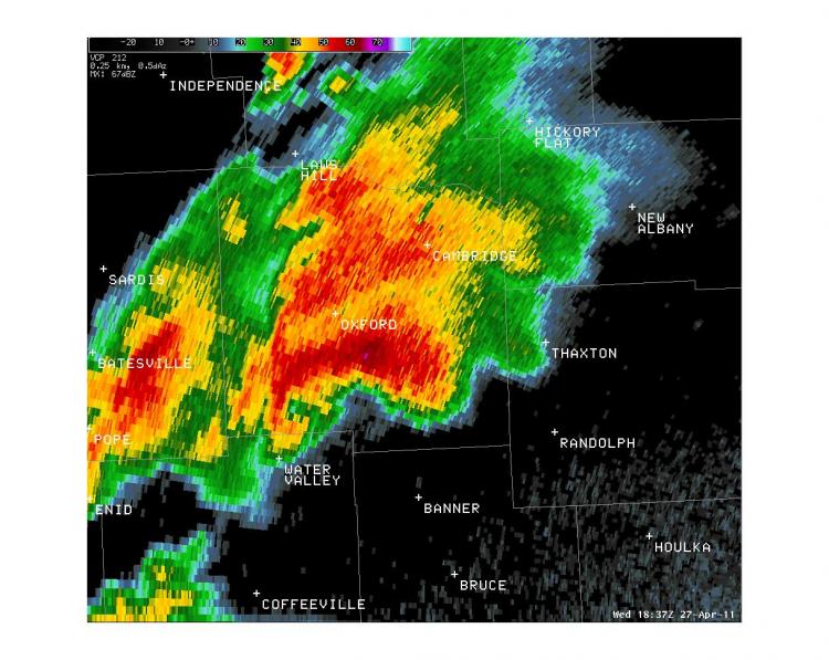
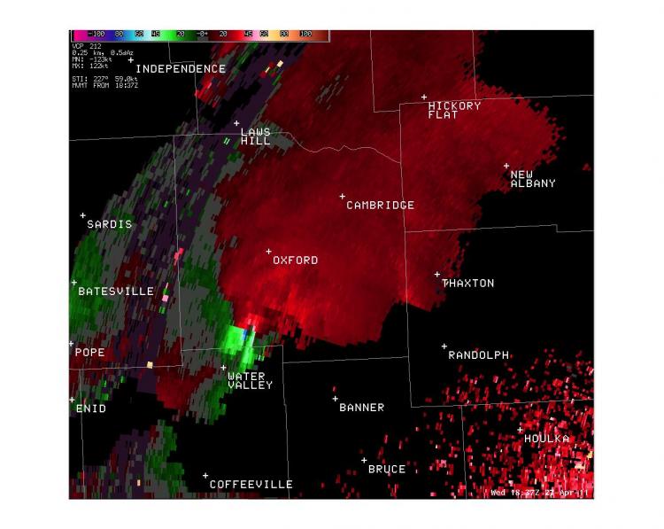
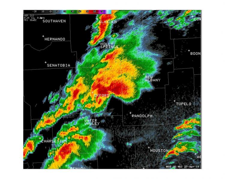
Radar Images:
 |
 |
 |
 |
 |
 |
CURRENT HAZARDS
Briefing Page
Outlooks
Submit a Storm Report
Submit a Storm Photo
View Storm Report
Spot Forecast Request
Hazard Outlook
FORECASTS
Local
Graphical
Probabilistic
Precipitation
Aviation
Fire
Severe Weather
Winter Weather
Tropical Weather
Air Quality
US Dept of Commerce
National Oceanic and Atmospheric Administration
National Weather Service
Memphis, TN
7777 Walnut Grove Road, OM1
Memphis, TN 38120
(901) 544-0399
Comments? Questions? Please Contact Us.

