Memphis, TN
Weather Forecast Office
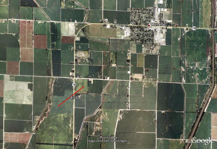
Monette, AR EF-0 Tornado
Tornado Track Map:
Survey Results:
...PRELIMINARY EF-0 TORNADO IN CRAIGHEAD CO. ARKANSAS...

* COUNTIES: CRAIGHEAD COUNTY ARKANSAS.

* LOCATION: 2 MILES NORTHEAST OF BLACK OAK ALONG COUNTY ROAD
  513...TO 1 SOUTHWEST OF MONETTE ALONG COUNTY ROAD 506.

* TIME: 317 PM ON WEDNESDAY APRIL 27 2011

* BEGINNING POINT: 35.86913, -90.37336

* ENDING POINT: 35.87442, -90.36501

* RATING: EF-0

* ESTIMATED PEAK WIND: 75 MPH

* PATH LENGTH: 0.6 MILES

* MAXIMUM WIDTH: 75 YARDS

* FATALITIES: 0

* INJURIES: 0

* SUMMARY OF DAMAGES: DAMAGED/FLIPPED FARM IRRIGATION PIVOT...TWO
  TELEPHONE POLES AND A FEW BROKEN TREE LIMBS.
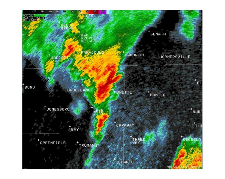
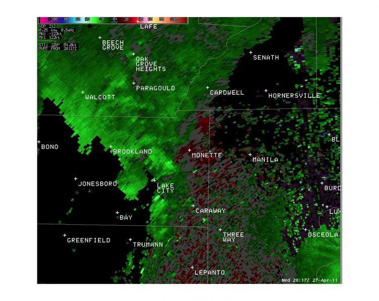
Radar Images:
 |
 |
CURRENT HAZARDS
Briefing Page
Outlooks
Submit a Storm Report
Submit a Storm Photo
View Storm Report
Spot Forecast Request
Hazard Outlook
FORECASTS
Local
Graphical
Probabilistic
Precipitation
Aviation
Fire
Severe Weather
Winter Weather
Tropical Weather
Air Quality
US Dept of Commerce
National Oceanic and Atmospheric Administration
National Weather Service
Memphis, TN
7777 Walnut Grove Road, OM1
Memphis, TN 38120
(901) 544-0399
Comments? Questions? Please Contact Us.

