Memphis, TN
Weather Forecast Office
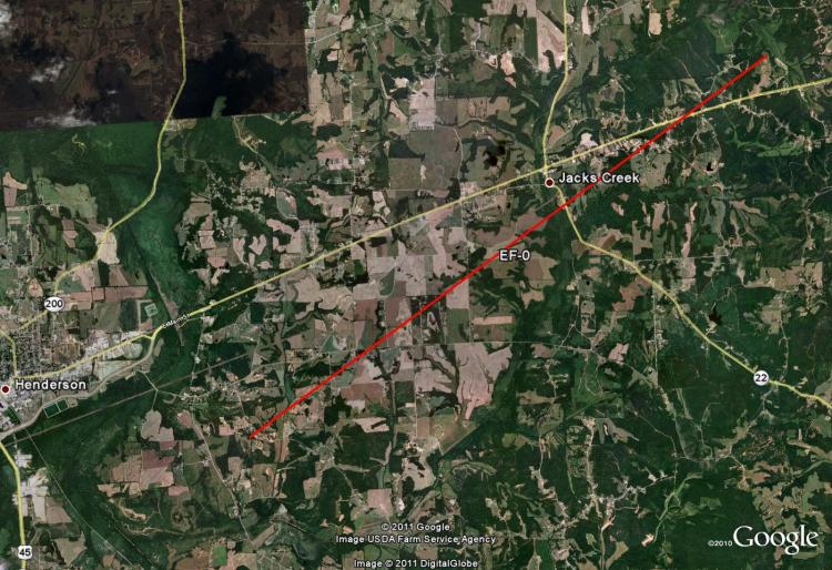
Chester County, TN EF-0 Tornado
Tornado Track Map:
Survey Results:
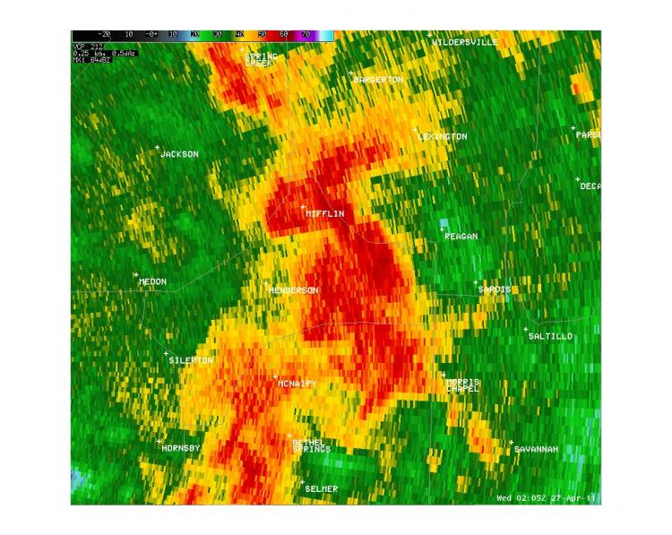
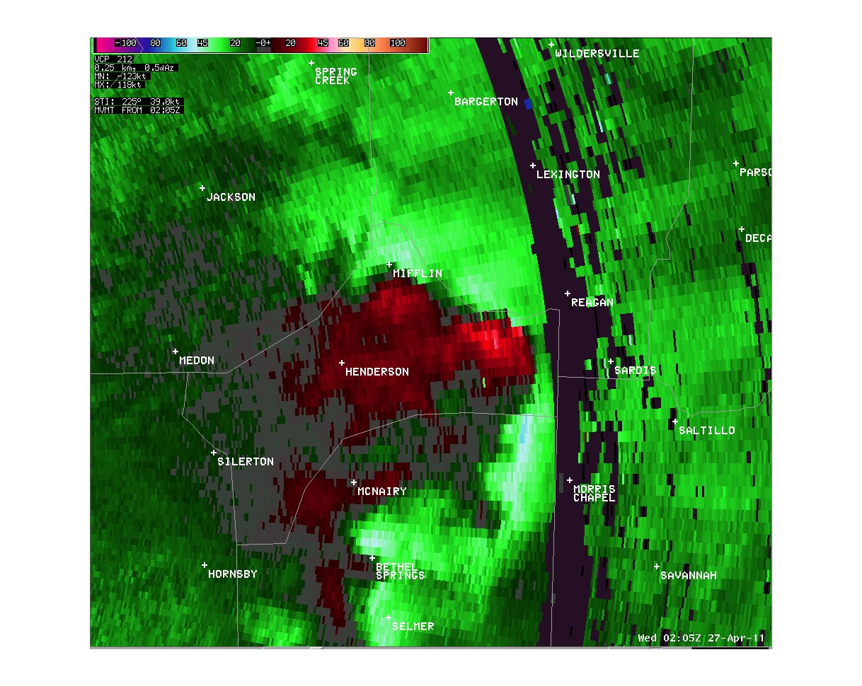
...PRELIMINARY EF-0 TORNADO IN CHESTER COUNTY TENNESSEE...
* COUNTY: CHESTER
* LOCATION/TIME OF EVENT: CHESTER COUNTY AT 900 PM ON APRIL 26 2011
* BEGIN POINT: 35.4529, -88.51625
* END POINT: 35.47845, -88.47143
* RATING: EF-0
* ESTIMATED PEAK WIND: 70 MPH
* PATH LENGTH: 7.9 MILES
* FATALITIES: 0
* INJURIES: 0
* SUMMARY OF DAMAGES: NUMEROUS TREETOPS BROKEN OFF AND MANY LARGE TREES
BROKEN...DOWNED OR BOTH. SEVERAL PEOPLE BELIEVE THEY SAW THE TORNADO.
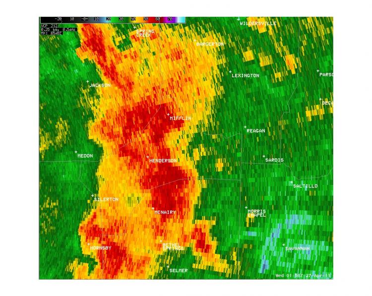
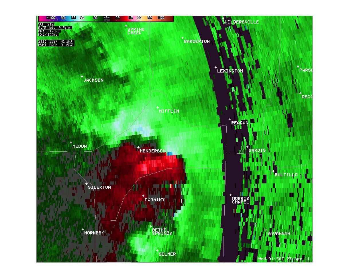
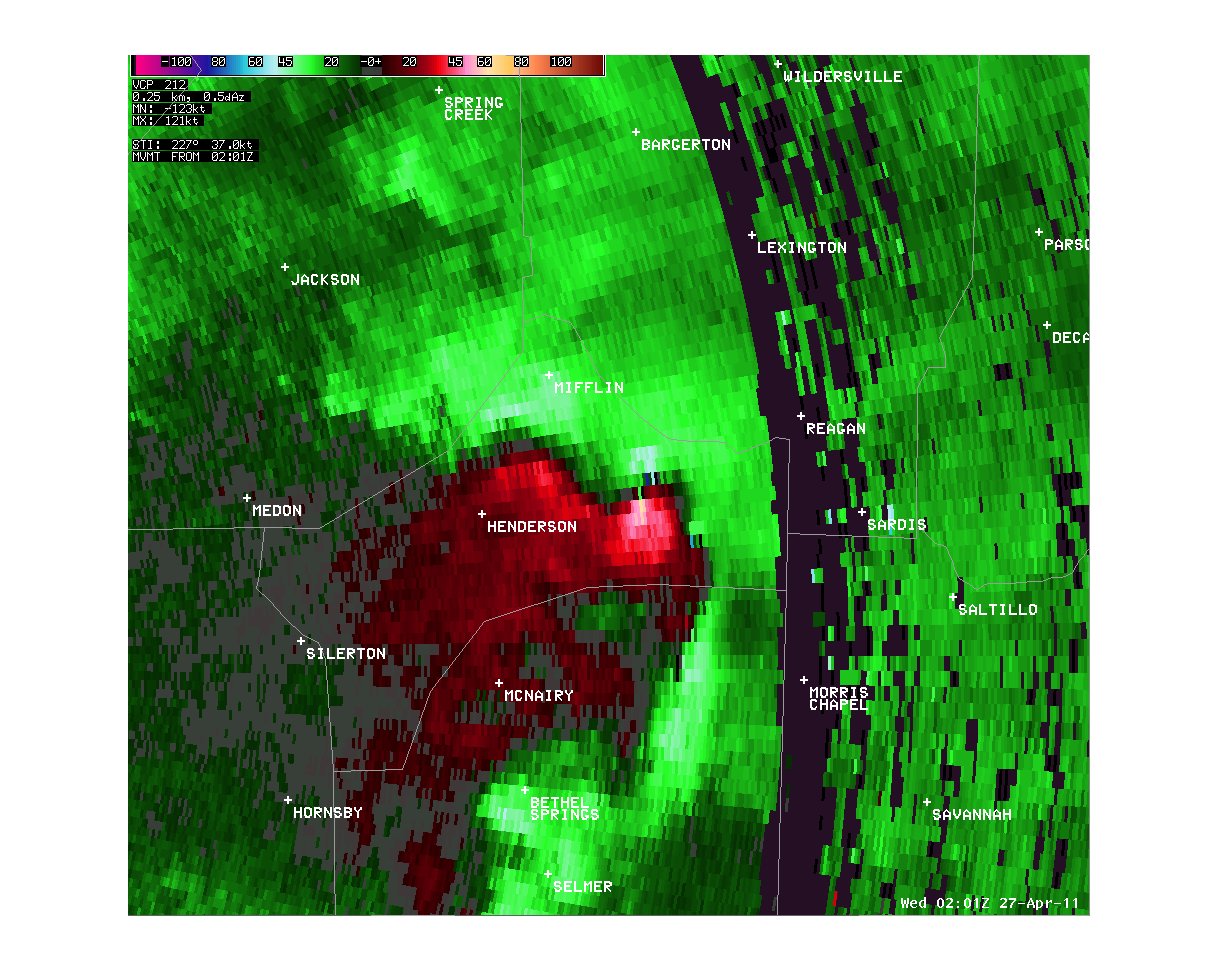
Radar Images:
 |
 |
 |
 |
 |
 |
CURRENT HAZARDS
Briefing Page
Outlooks
Submit a Storm Report
Submit a Storm Photo
View Storm Report
Spot Forecast Request
Hazard Outlook
FORECASTS
Local
Graphical
Probabilistic
Precipitation
Aviation
Fire
Severe Weather
Winter Weather
Tropical Weather
Air Quality
US Dept of Commerce
National Oceanic and Atmospheric Administration
National Weather Service
Memphis, TN
7777 Walnut Grove Road, OM1
Memphis, TN 38120
(901) 544-0399
Comments? Questions? Please Contact Us.

