Memphis, TN
Weather Forecast Office
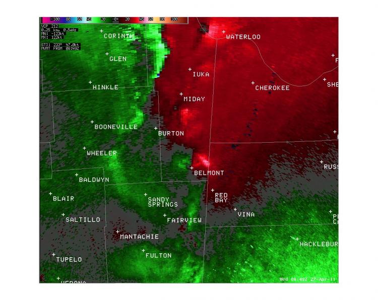
Belmont, MS EF-2 Tornado
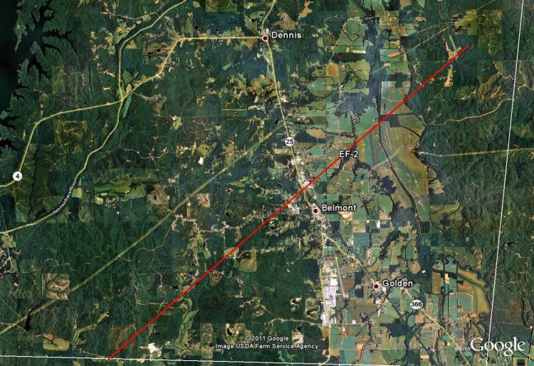
Tornado Track Map:
Survey Results:
...PRELIMINARY EF-2 TORNADO IN TISHOMINGO COUNTY MISSISSIPPI...
* COUNTY: TISHOMINGO
* LOCATION/TIME OF EVENT: BELMONT AT 348 AM ON APRIL 27 2011.
* BEGINNING POINT: 34.4683, -88.2808
* ENDING POINT: 34.5559, -88.1572
* RATING: EF-2
* ESTIMATED PEAK WIND: 125 MPH
* PATH LENGTH: 9.29 MILES
* MAXIMUM WIDTH: 150 YARDS
* FATALITIES: 0
* INJURIES: 0
* SUMMARY OF DAMAGES: NUMBER OF HOMES...BUSINESSES AND APARTMENTS
  DAMAGED. A LARGE METAL STORAGE BUILDING WAS SEVERELY DAMAGED.
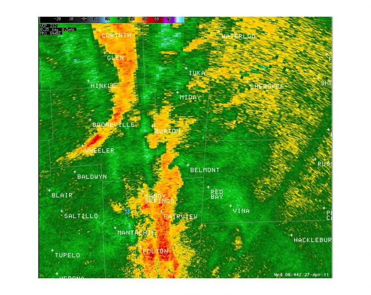
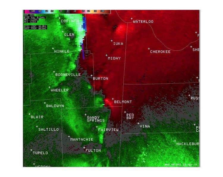
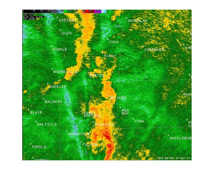
Radar Images:
 |
 |
 |
 |
CURRENT HAZARDS
Briefing Page
Outlooks
Submit a Storm Report
Submit a Storm Photo
View Storm Report
Spot Forecast Request
Hazard Outlook
FORECASTS
Local
Graphical
Probabilistic
Precipitation
Aviation
Fire
Severe Weather
Winter Weather
Tropical Weather
Air Quality
US Dept of Commerce
National Oceanic and Atmospheric Administration
National Weather Service
Memphis, TN
7777 Walnut Grove Road, OM1
Memphis, TN 38120
(901) 544-0399
Comments? Questions? Please Contact Us.

