Record setting heat is expected over the next several days from the Intermountain West through the northern Plains. Furthermore, fire weather concerns increase with dry and breezy conditions. Meanwhile, heavy rainfall and severe thunderstorm threats for the Ohio/Tennessee Valleys, central Appalachians and Southeast today. The threat shifts to central Gulf Coast and across central Texas this week. Read More >
Overview
|
|
|
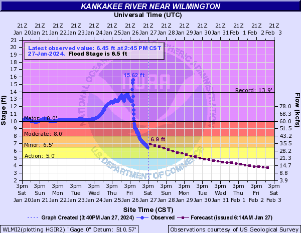
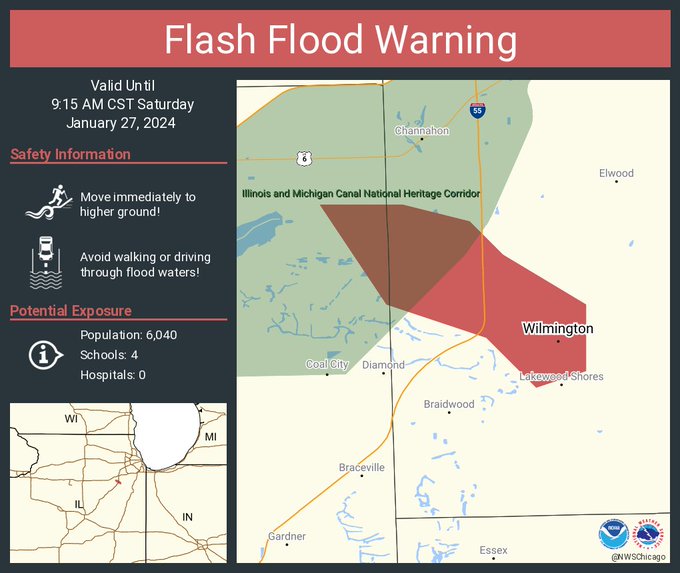
| Hydrograph of the Kankakee River near Wilmington, IL from the afternoon of Saturday, January 27. The river remained in major flood stage at this location for several days after the ice jam developed before the ice jam broke up the evening of January 26th and water levels subsided significantly. | The Flash Flood Warning that was issued along the Kankakee River near Wilmington on the morning of Thursday, January 25th to highlight the risk of a rapid and sudden rise in water levels and flash flooding as a result of the break up of an ice jam. |
For detailed information about this event, see The Wilmington Area Ice Jam on the Lower Kankakee River During January 2024, a NWS Technical Paper which details the development and break-up of this ice jam, and the related impacts.
Ice Jam and Flooding Reports
Below is a listing of ice jam and flooding reports processed by the
National Weather Service over the course of this event. Reports are
listed in reverse chronological order.
..TIME...   ...EVENT...      ...CITY LOCATION...     ...LAT.LON...
..DATE...   ....MAG....      ..COUNTY LOCATION..ST.. ...SOURCE....
            ..REMARKS..
0130 PM     Ice Jam          1 ENE Ottawa            41.36N 88.83W
01/27/2024                   La Salle           IL   Emergency Mngr

            Ice jam reported by the LaSalle County EMA
            at the Route 6 bridge on the Fox River in
            Ottawa. Some water and ice chunks spilled
            out of the rivers banks near the Saint
            Elizabeth Medical Center.
1150 AM     Flood            1 ESE Wilmington        41.30N 88.13W
01/26/2024                   Will               IL   Emergency Mngr

            Kahler Road closed east of Wilmington due to
            flooding, likely from Forked Creek.


1150 AM     Flood            Wilmington              41.31N 88.15W
01/26/2024                   Will               IL   Emergency Mngr

            Kankakee Street closed due to ice jam
            flooding in Wilmington.
1015 AM     Flood            1 NW Wilmington         41.32N 88.16W
01/26/2024                   Will               IL   Emergency Mngr

            Video from Will County EMA shows water
            surrounding at least two residences on
            Widows Road downstream of Wilmington.
            Possible interior flooding.
0700 AM     Flood            1 S Kankakee            41.11N 87.86W
01/26/2024                   Kankakee           IL   Trained Spotter

            Water flooding low-lying yards along the
            Kankakee River. Ice jam has begun to break
            up in the Kankakee and Aroma Park areas. Ice
            left on banks.
0300 AM     Flood            1 SSW Wilmington        41.30N 88.15W
01/26/2024                   Will               IL   Emergency Mngr

            Shifting of the ice jam located near and
            downstream of Wilmington occurred and was
            followed by a rapid rise in water levels.
            Water flooded yards and neared homes along
            Towpath Lane upstream of Wilmington.
1215 AM     Flood            Wilmington              41.31N 88.15W
01/26/2024                   Will               IL   Emergency Mngr

            Shifting of the ice jam located near and
            downstream of Wilmington occurred and was
            followed by a rapid rise in water levels by
            up to 3 feet. Water inundated portions of
            IL53 and Island Park near downtown
            Wilmington. Approximately 14 people
            evacuated from a motel and an apartment
            building. Shifting ice also caused damage to
            Park St on the upstream side of the island.
0300 PM     Flood            2 SW Sun River Terrace  41.11N 87.76W
01/24/2024                   Kankakee           IL   Emergency Mngr

            Kankakee County EM reports full ditches and
            minor flooding of roadway near Sand Bar Road
            and Dudley Grove Road.


0300 PM     Flood            3 SSE Aroma Park        41.03N 87.79W
01/24/2024                   Kankakee           IL   Emergency Mngr

            Kankakee County EM reports full ditches and
            minor flooding of roadway near 6000 South
            Road and 4000 East Road.
1100 AM     Ice Jam          1 WNW Sumava Resorts    41.17N 87.46W
01/20/2024                   Lake               IN   Other Federal

            Ice spotter reports and satellite imagery
            indicate that the ice jam located between
            Momence and Shelby may now extend from near
            the Illinois Indiana state line upstream to
            near Shelby. Shelby river gauge has been
            slowly rising over the last few days, and
            now is near bankfull stage.


1100 AM     Ice Jam          Wilmington              41.30N 88.15W
01/20/2024                   Will               IL   Other Federal

            Ice spotter reports and satellite imagery
            indicate that the ice jam located near
            Wilmington may now extend from just upstream
            of the Illinois River confluence upstream 13
            miles to near Lakewood Shores. Wilmington
            river gauge has been generally falling
            slowly over the last few days, but remains
            near major flood stage.


1100 AM     Ice Jam          Aroma Park              41.08N 87.81W
01/20/2024                   Kankakee           IL   Other Federal

            Ice spotter reports and satellite imagery
            indicate that the ice jam located near
            Kankakee and Aroma Park may now extend from
            near Schuyler Avenue in Kankakee upstream 8
            miles to just downstream of Sun River
            Terrace. The ice jam also may extend up the
            Iroquois River about 3 miles.
0430 PM     Ice Jam          4 WSW Schneider         41.17N 87.52W
01/19/2024                   Lake               IN   Local Official

            Kankakee Yellow River Basin Commission
            reports water nearing low-lying overbank
            areas near the Illinois Indiana state line
            bridge due to an ice jam on the Kankakee
            River. Upstream river gauge at Shelby now at
            bankfull.
0115 PM     Ice Jam          4 WSW Schneider         41.17N 87.52W
01/18/2024                   Newton             IN   Law Enforcement

            Kankakee County Sheriffs Office reports
            possible ice jam on the Kankakee River near
            the Illinois Indiana Stateline Bridge. Water
            levels on the upstream river gauge near
            Shelby continue to slowly rise.
1110 AM     Flood            1 W Aroma Park          41.08N 87.82W
01/18/2024                   Kankakee           IL   Public

            Flooding of overbank areas along the
            Kankakee River in Aroma Park. Likely due to
            developing ice jam downstream in Kankakee
            area.


1000 AM     Ice Jam          1 SSW Kankakee          41.11N 87.86W
01/18/2024                   Kankakee           IL   Trained Spotter

            River ice spotter reports ice jam on the
            Kankakee River beginning near the Schuyler
            Avenue bridge in Kankakee.
1000 AM     Ice Jam          1 SW Wilmington         41.29N 88.15W
01/17/2024                   Will               IL   NWS Storm Survey

            Ice jam previously located near Phelan Acres
            and I-55 has grown significantly upstream
            since yesterday. Ice jam now extends from
            near the confluence with the Illinois River
            upstream approximately 10 miles to near
            Towpath Lane in Wilmington.
0325 PM     Ice Jam          1 WNW Lyons             41.82N 87.83W
01/16/2024                   Cook               IL   Fire Dept/Rescue

            Riverside Fire Department reports ice jam on
            the Des Plaines river has continued to grow.
            The ice jam now extends from near McCook
            upstream through Lyons and Riverside, to
            near Salt Creek. Water levels on the
            Riverside gauge now exceeding bankfull.
1200 PM     Ice Jam          Warrenville             41.82N 88.17W
01/16/2024                   DuPage             IL   Other Federal

            USGS river gauge indicates likely ice jam on
            the West Branch DuPage River near
            Warrenville. Ice jam likely began during the
            day on Jan 14. Water levels currently about
            1 foot below bankfull.
1200 PM     Ice Jam          2 SE Rockton            42.43N 89.05W
01/16/2024                   Winnebago          IL   Other Federal

            USGS river gauge and satellite imagery
            indicates likely ice jam on the Rock River
            between Rockton and Roscoe. Ice jam began
            approximately the morning of Jan 15. No
            flooding currently reported.


1130 AM     Ice Jam          1 SSE Riverside         41.82N 87.81W
01/16/2024                   Cook               IL   Public

            USGS river gauges indicate likely ice jam on
            the Des Plaines River extending from near
            Lyons upstream to near Riverside. Ice jam
            likely began Jan 14 overnight into Jan 15
            with a steady accumulation of ice and
            increase in water levels. Water levels
            currently just below bankfull in the
            Riverside area.
1100 AM     Ice Jam          1 SSW Shelby            41.18N 87.36W
01/16/2024                   Lake               IN   Other Federal

            USGS river gauge indicates likely ice jam
            just downstream of Shelby. Ice jam began
            approximately midday on Jan 15. Water levels
            currently just under bankfull in the Shelby
            area.
0900 AM     Ice Jam          5 S Channahon           41.36N 88.23W
01/16/2024                   Will               IL   Emergency Mngr

            Will County EMA reports a significant ice
            jam extending from near Phalen Acres and
            Bardwell Island upstream to near the I-55
            bridge. The ice jam is causing flooding of
            Kelly Road and Blodgett Road due to river
            flow bypassing the ice jam. Flooding of
            yards and garages is occurring in the Phalen
            Acres neighborhood. The river gauge upstream
            of the jam near the Interstate 55 bridge has
            climbed above major flood stage.
0800 AM     Ice Jam          4 WSW Naplate           41.32N 88.94W
01/16/2024                   La Salle           IL   Other Federal

            USACE river gauges and satellite imagery
            indicate ice jam on the Illinois River
            upstream of Starved Rock Lock and Dam
            extending upstream to near Naplate. The ice
            jam is currently causing minor flooding near
            Ottawa.
1200 AM     Ice Jam          5 S Channahon           41.36N 88.23W
01/15/2024                   Will               IL   Public

            Local EMA and ice spotters reported that an
            ice jam developed in the vicinity of Phalen
            Acres and Bardwell island at some point
            overnight from January 14 to 15, and caused
            flooding of low-lying bank areas and yards
            of nearby homes.

$$
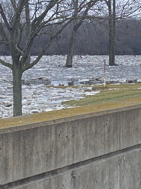
Photos
|
|
|
|
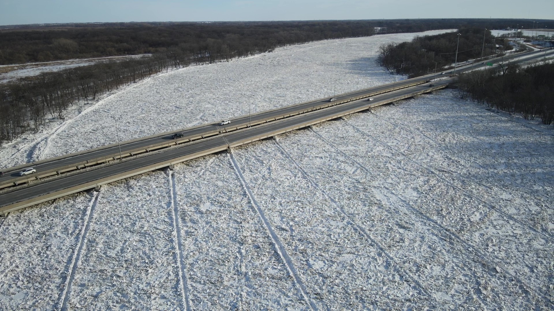
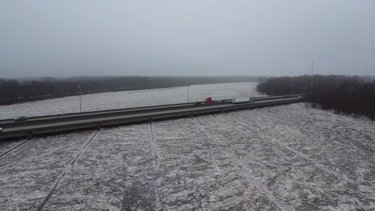
| Ice jam on the Kankakee River at I-55 near Wilmington, IL on January 21st. Drone footage courtesy of the Will County Emergency Management Agency. | Ice jam on the Kankakee River at I-55 near Wilmington, IL on January 21st. Drone footage courtesy of the Will County Emergency Management Agency. | Ice jam on the Kankakee River at I-55 near Wilmington, IL on January 26th. Drone footage courtesy of Luke Henderson. |
|
|
|
|
| Ice jam on the Kankakee River in Aroma Park, IL on January 24th. Drone footage courtesy of the Kankakee County Emergency Management Agency. | Ice jam on the Kankakee River in Kankakee, IL on January 24th. Drone footage courtesy of the Kankakee County Emergency Management Agency. | Flooding along the Sugar Creek in Watseka, IL Photo courtesy of the Iroquois County Emergency Management Agency. |
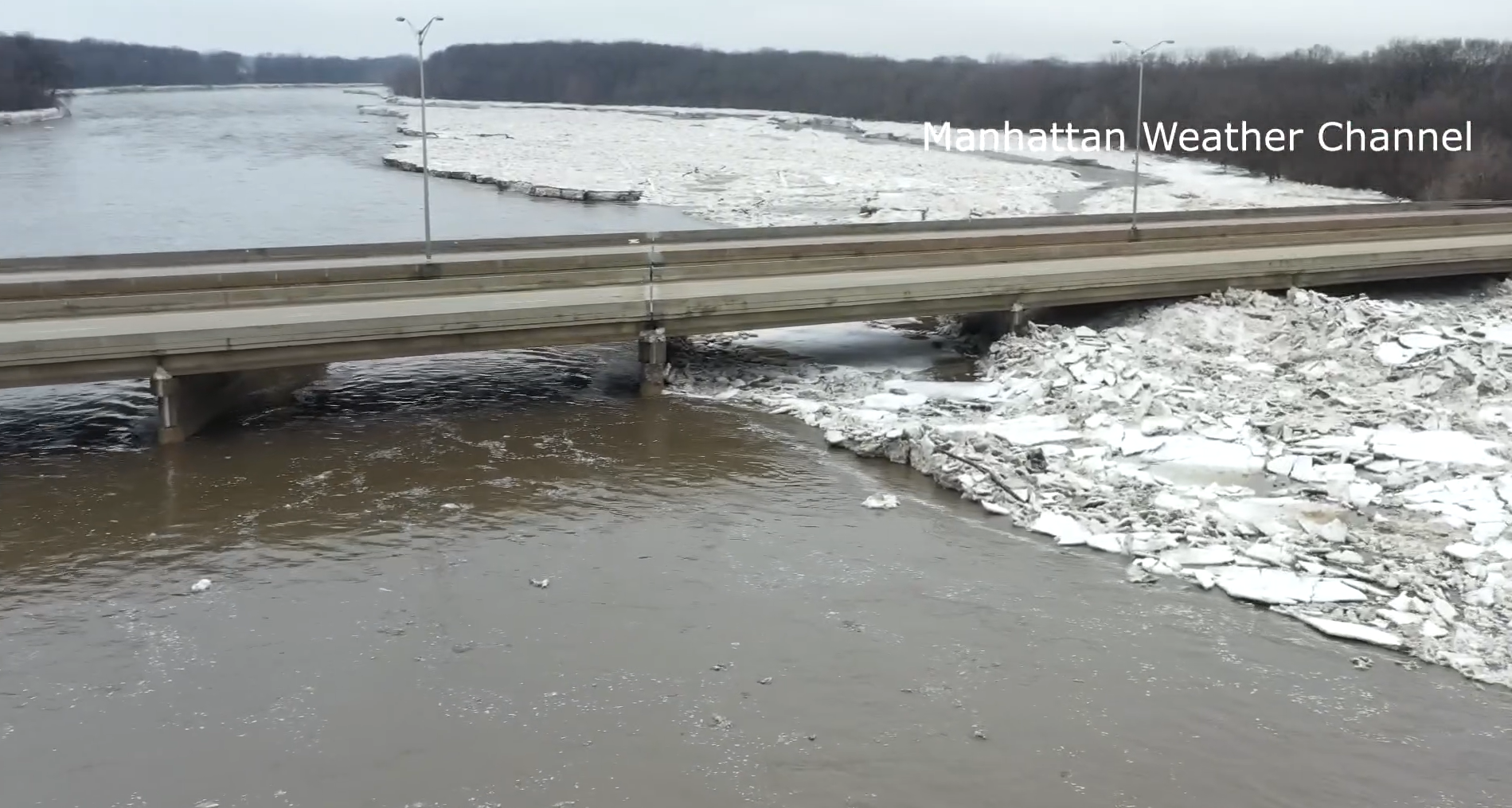
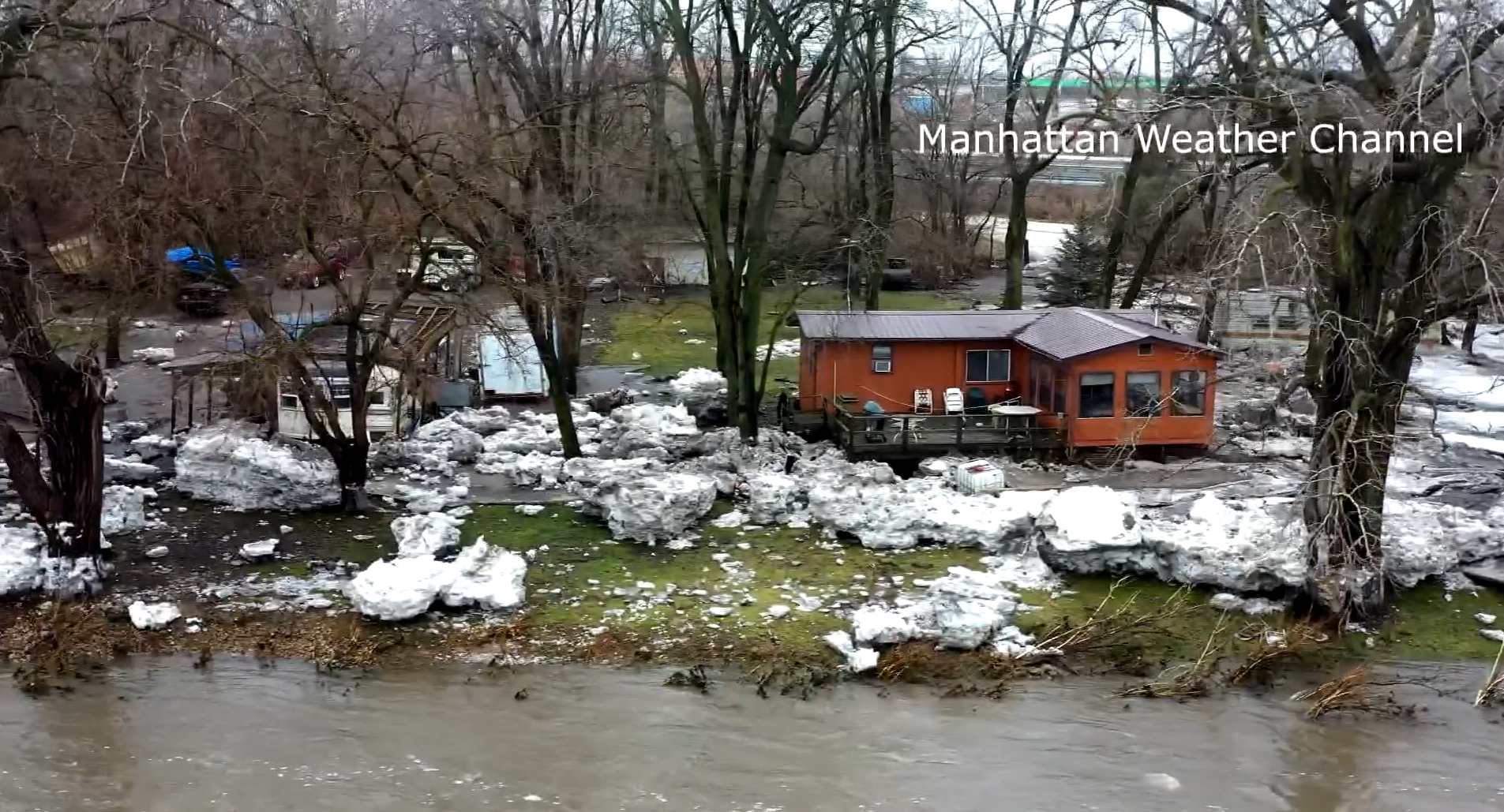
|
|
|
|
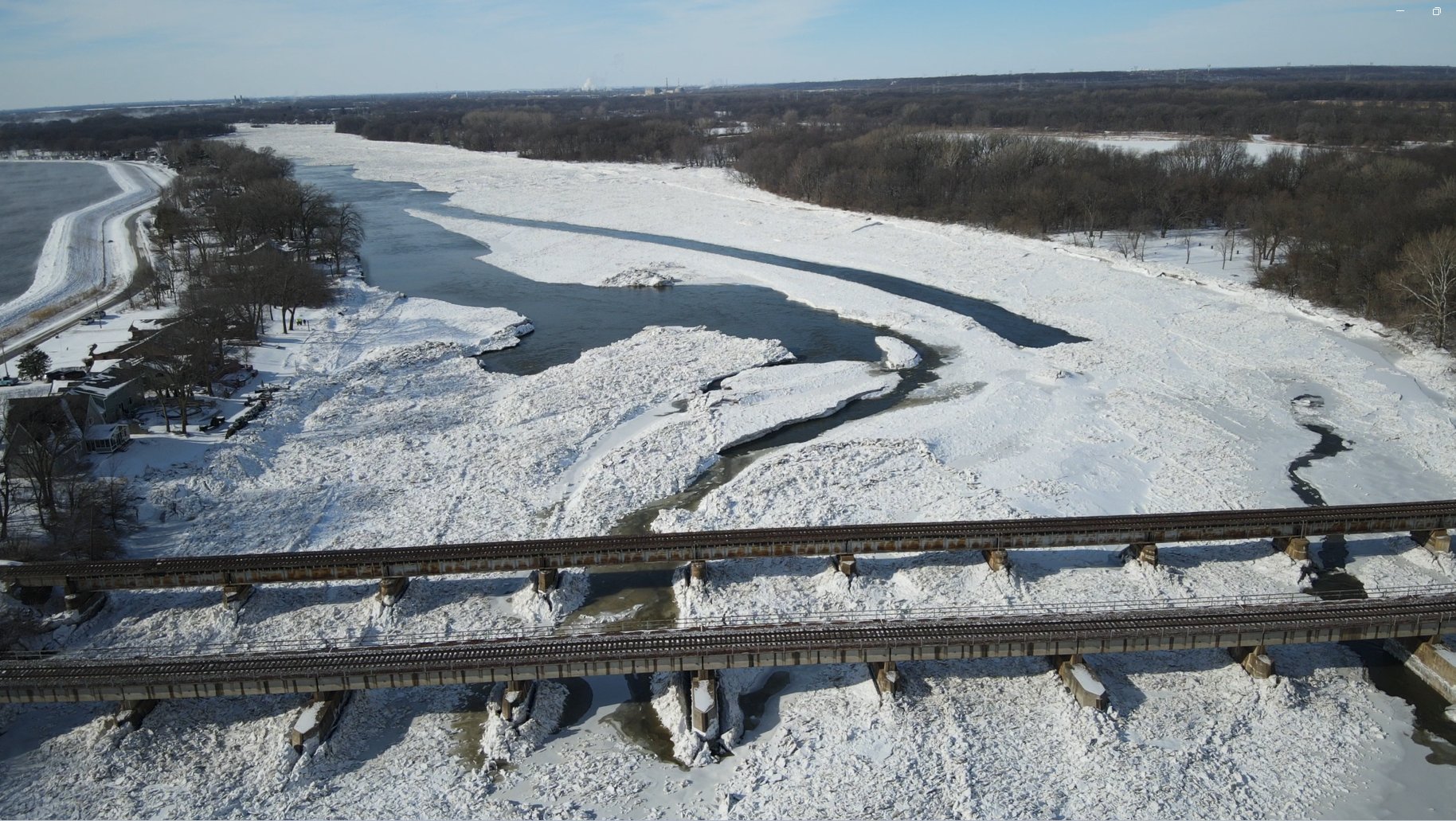
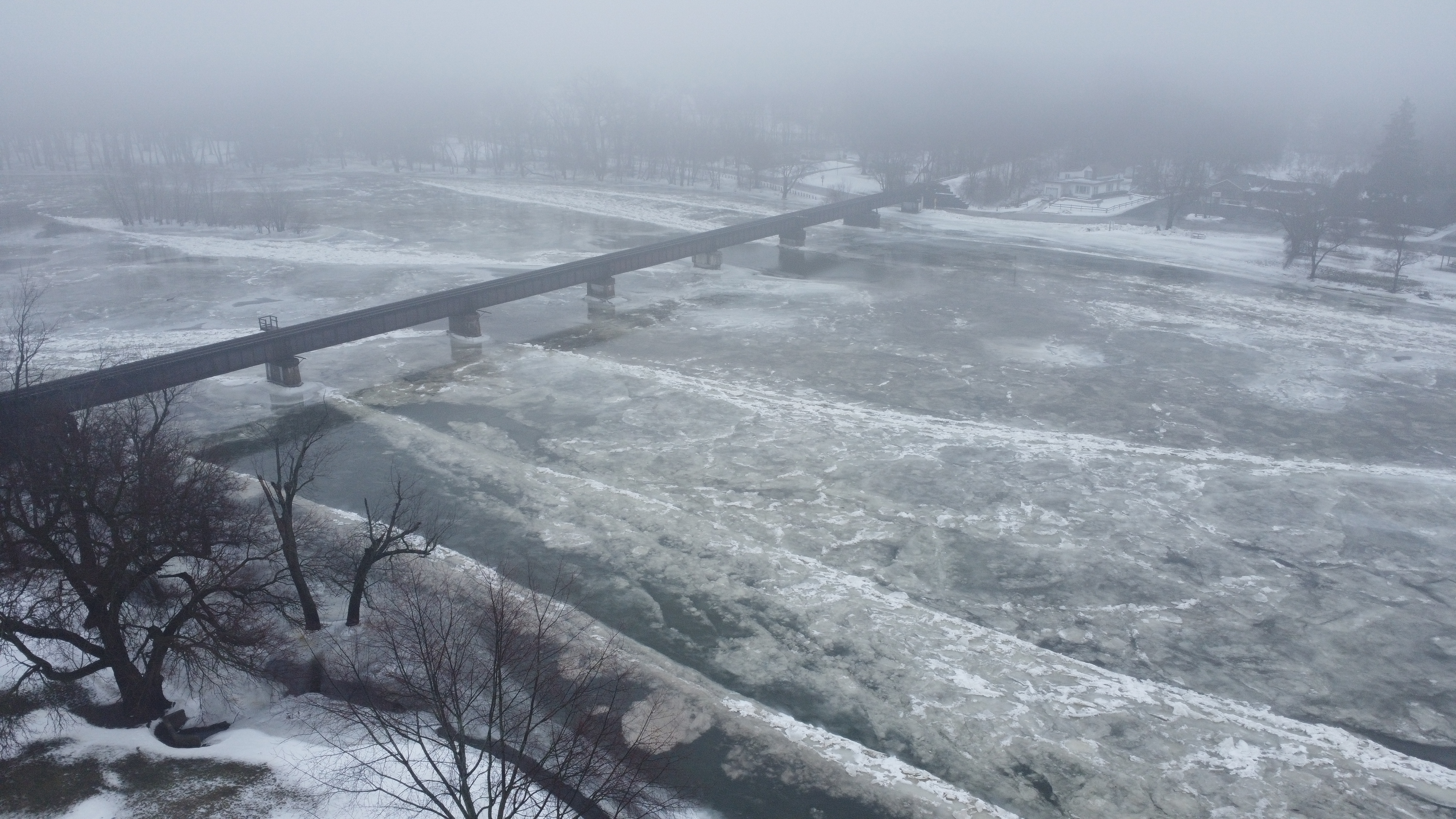
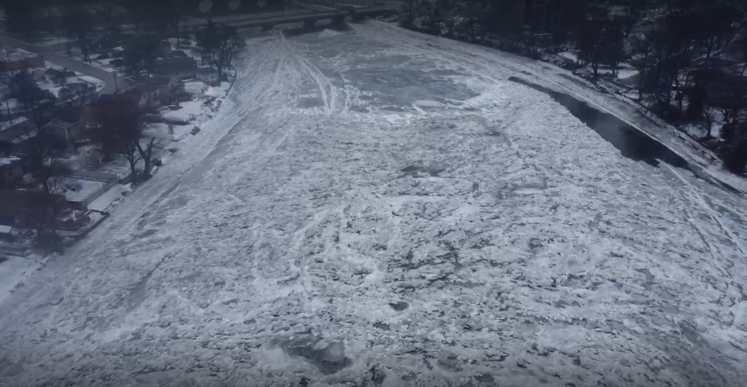
| Ice jam on the Fox River in Ottawa, IL on January 28th. Photo courtesy of the LaSalle County Emergency Management Agency. | The Kankakee River at I-55 near Wilmington, IL on January 27th after the ice jam broke up. Drone footage courtesy of the Manhattan Weather Channel. | The aftermath of the ice jam near Wilmington, IL on January 27th. Drone footage courtesy of the Manhattan Weather Channel. |
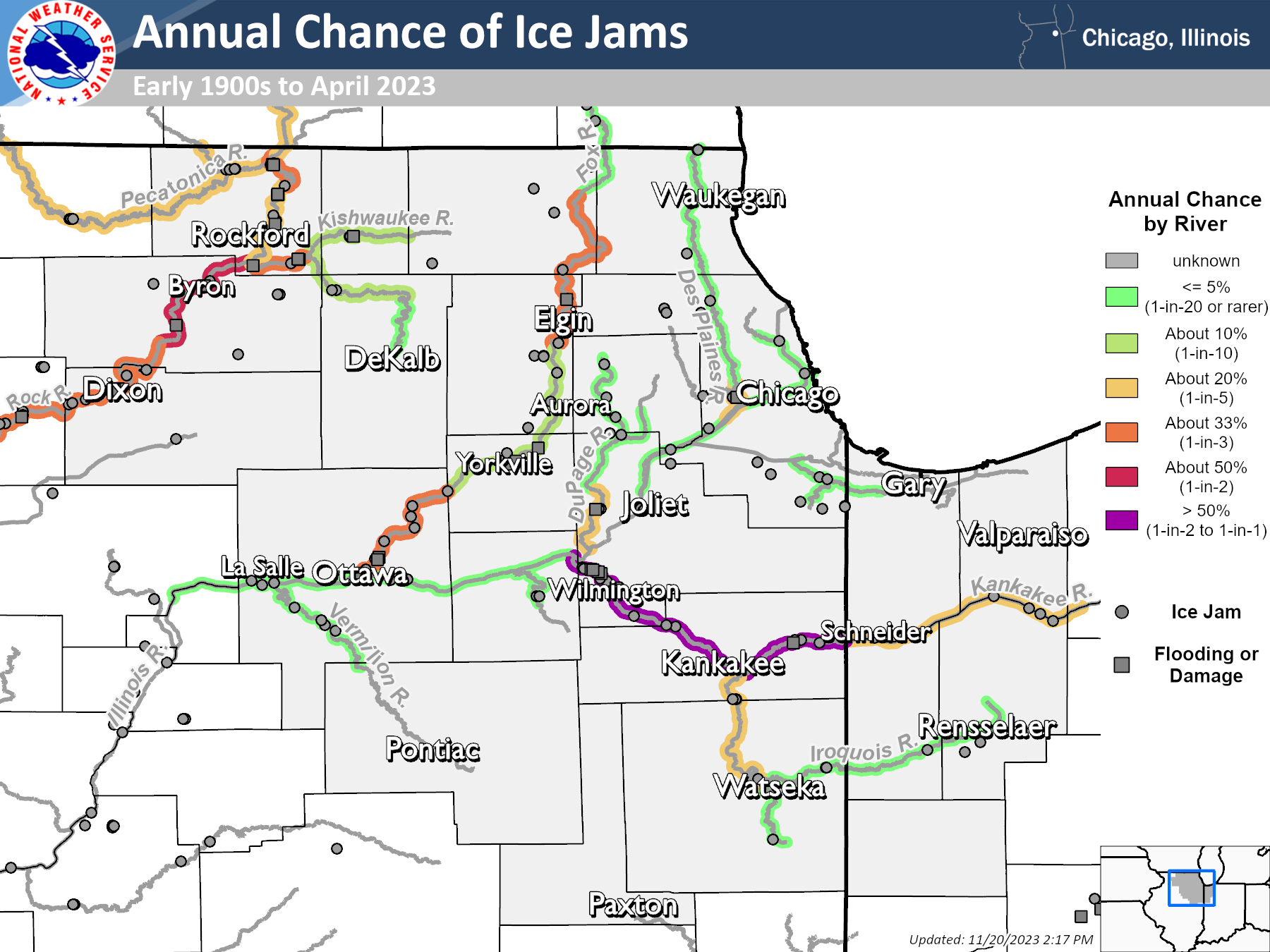
About Ice Jams
Ice jams occur when significant ice coverage on a river blocks the river's flow, potentially leading to rising water levels and/or localized flooding in the vicinity of the ice jam.
In order for significant ice coverage to develop on a river, air temperatures need to remain well below freezing for an extended period of time. Once this occurs, ice can then start to either pile up and/or freeze into a larger sheet of ice, leading to what is known as a “freeze-up” ice jam, where the recently frozen ice restricts the flow of water in the river and can lead to flooding upstream of the ice jam.
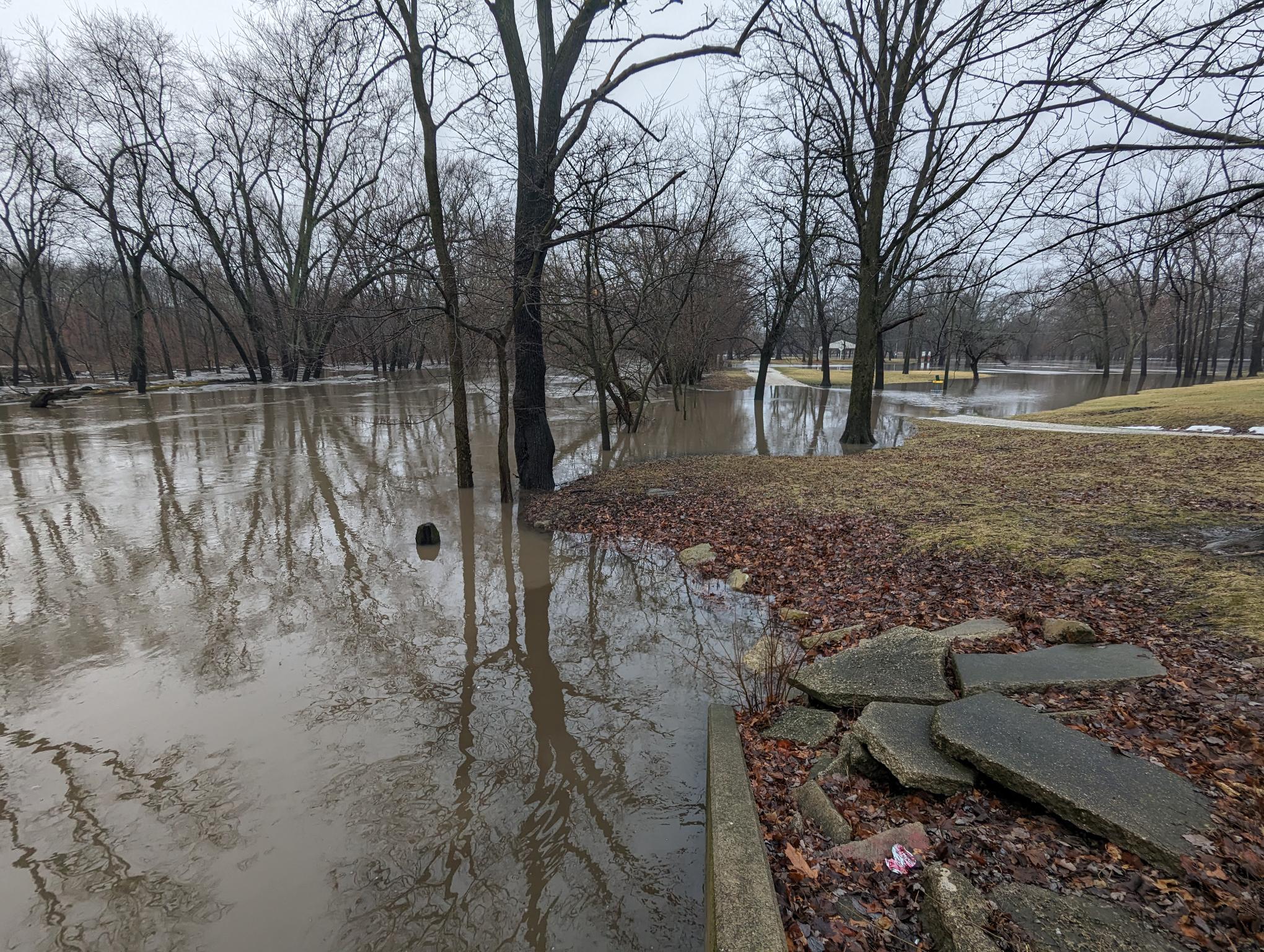
Then, when temperatures warm above freezing again, ice on rivers starts to melt and the streamflow on rivers starts to increase, which can cause existing ice jams to break up into smaller ice chunks. The sudden break-up of ice jams can release a surge of water than can cause flash flooding downstream of the original ice jam location. The smaller, broken up chunks of ice can also start to pile up again and get stuck, leading to "break-up" ice jams that also restrict the flow of the river and cause flooding upstream of their location.
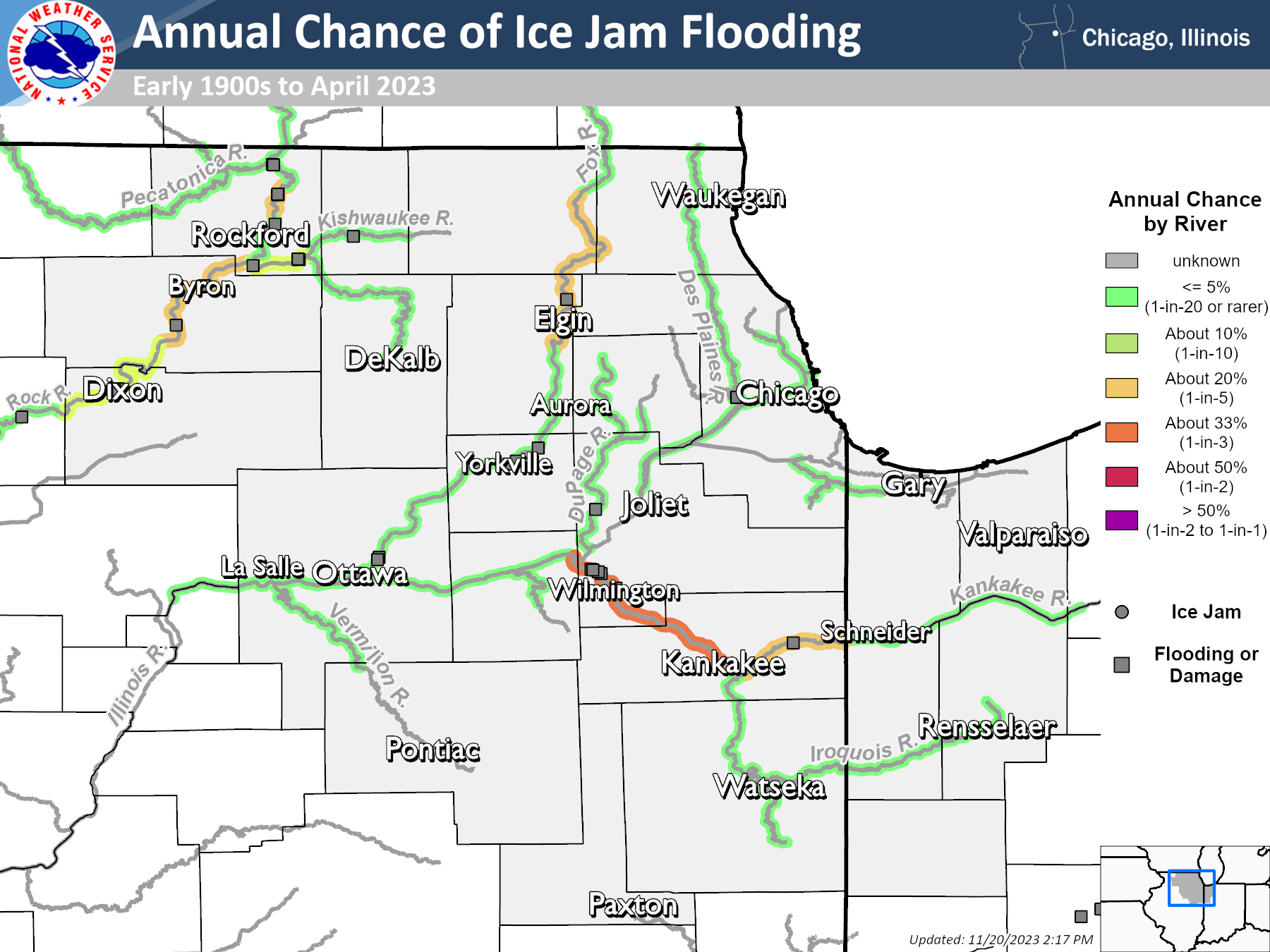
Ice jams are not uncommon in our area during the winter and early spring. In fact, there are some chronic ice jam locations along the Rock, Fox, and Kankakee rivers that have about a 1-in-2 (or 50%) chance of seeing an ice jam occur in any given year and up to about a 1-in-3 (or 33%) chance of seeing flooding caused by an ice jam in any given year. Ice jams are less common on other rivers in the area, but can still happen from time to time when significant ice cover develops.
|
|
|
| Map showing the annual risk of ice jams occurring at different locations along area rivers. | Map showing the annual risk of flooding caused by ice jams at different locations along area rivers. |
The National Weather Service relies on a volunteer network of river ice spotters to relay information about river ice coverage on area rivers in order to assess the risk for ice jams and associated potential for flooding. For more information about river ice spotting in northern Illinois and northwest Indiana, see this page.
 |
Media use of NWS Web News Stories is encouraged! Additional recaps can be found on the NWS Chicago Past Events Page. |
|