
Heat expands across the Desert Southwest, Plains, Mississippi Valley and Midwest into Monday. Fire weather concerns continue for portions of the Intermountain West. Active monsoonal moisture fuels thunderstorms over the Southwest with possible flash flooding. Tropical cyclone Fausto in the Pacific, should weaken as it approaches Hawaii; Dangerous surf, swells and rip currents are expected. Read More >
Important Disclaimer
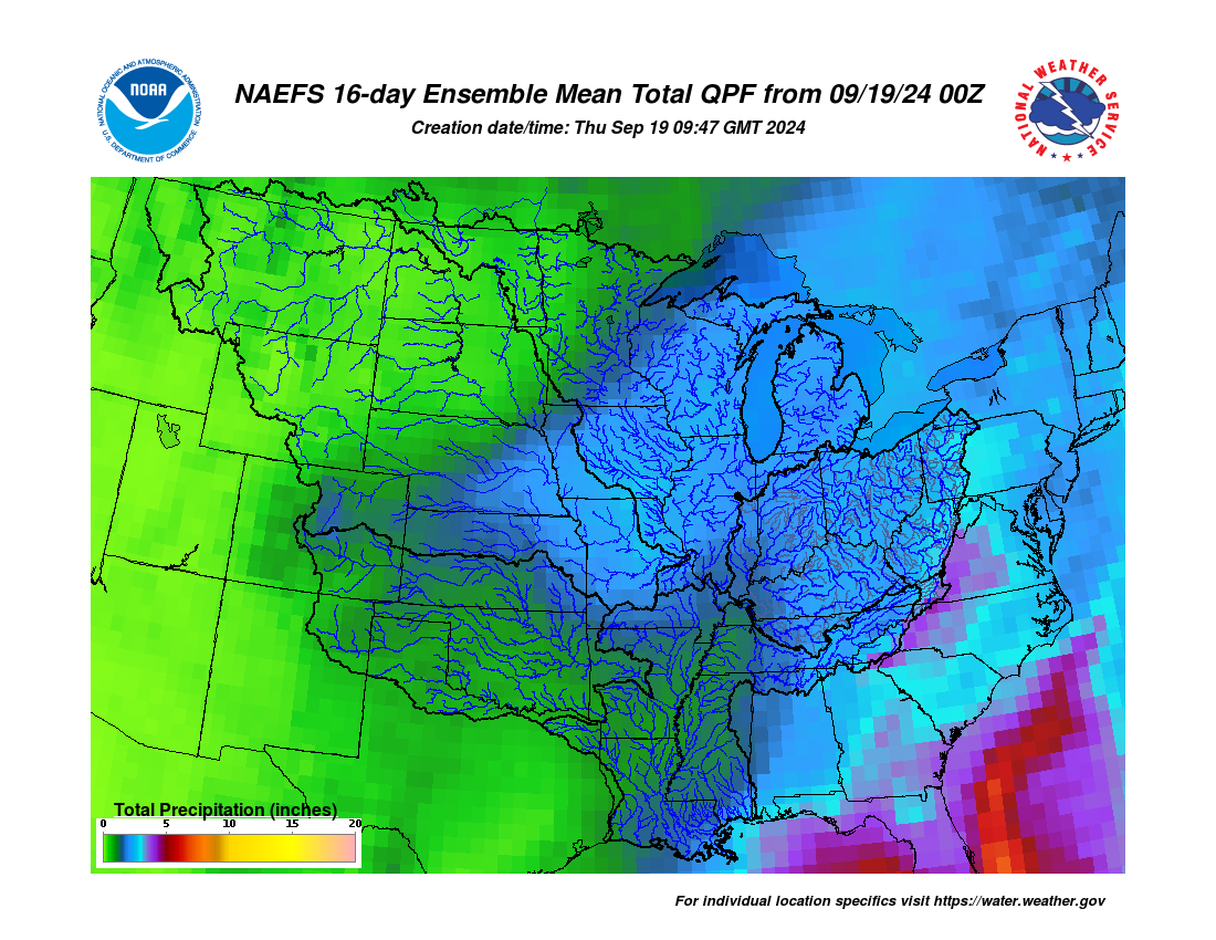
The following plots are experimental and not an official forecast product. They were created as a test based upon user feedback as a way to display 28-day forecasts for locations along the Lower Mississippi and Lower Ohio Rivers. Although 28-day forecasts using 2 days of forecast rainfall (QPF) are considered operational, 28-day forecasts using 16 days of forecast rainfall remain experimental.
Experimental products may not always update in a timely manner and may be discontinued at a future date. Experimental products may not always reflect accurate, quality controlled information and should be used with caution.
Official forecasts remain available from the main LMRFC web page or AHPS (water.weather.gov).
Click here for important information about uncertainty in long range Mississippi River forecasts


 Water Story