National Weather Service United States Department of Commerce

Warm and dry today with morning lows in the mid to upper 50s and afternoon highs reaching the mid to upper 70s. Humidity remains low for this time of year. Skies will be hazy at times from Canadian Wildfire smoke. Rain chances return Monday.
July ended up as the 12th warmest on record for Indianapolis with an average temperature of 79.5 degrees. There were 13 days of at least 90 degree high temperatures which is 6 above normal. Precipitation ended up just below normal with 4.3 inches of rain.
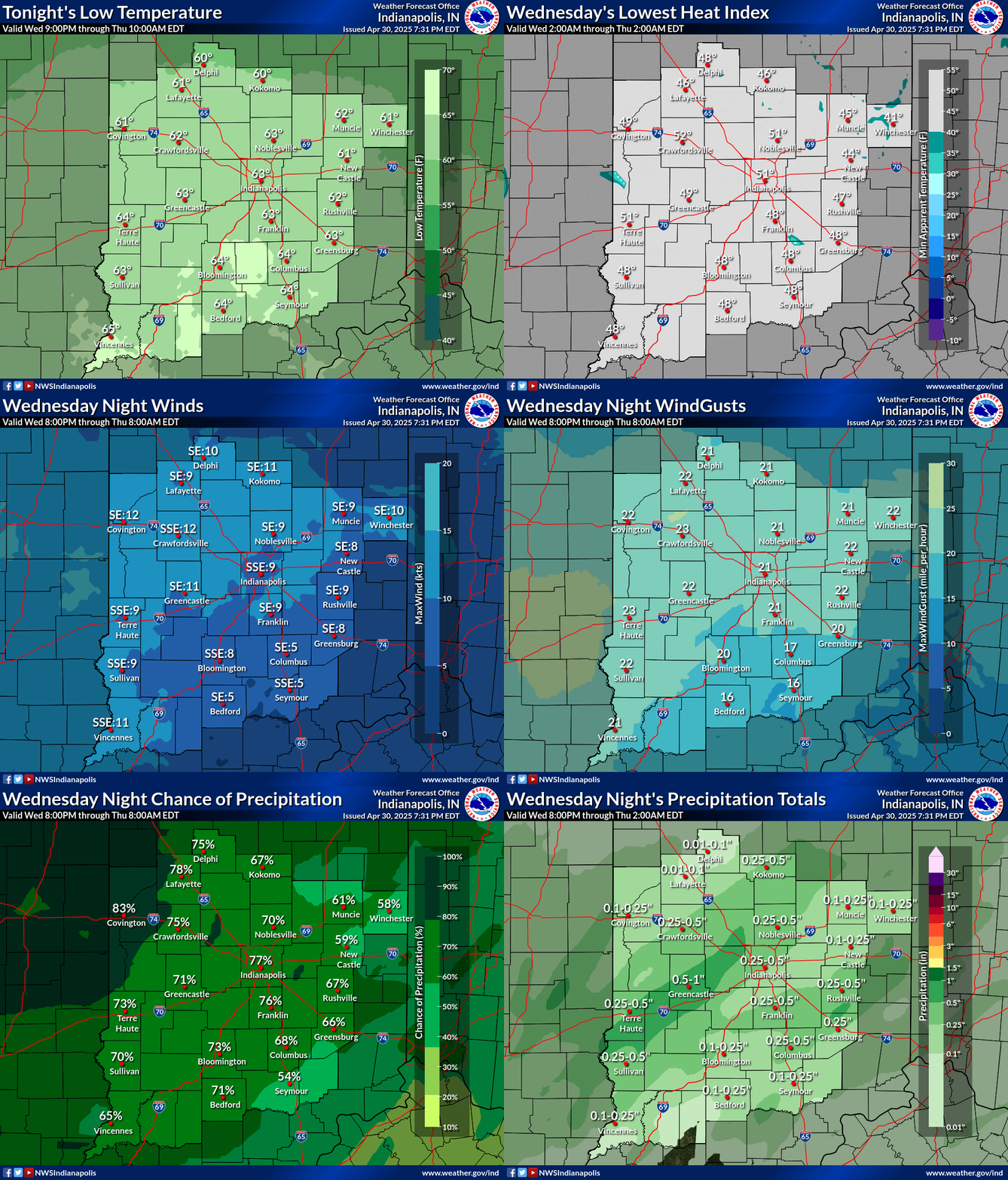
Forecast information for the first 12 hours of the forecast period, including temperatures, precipitation chances, and wind information.
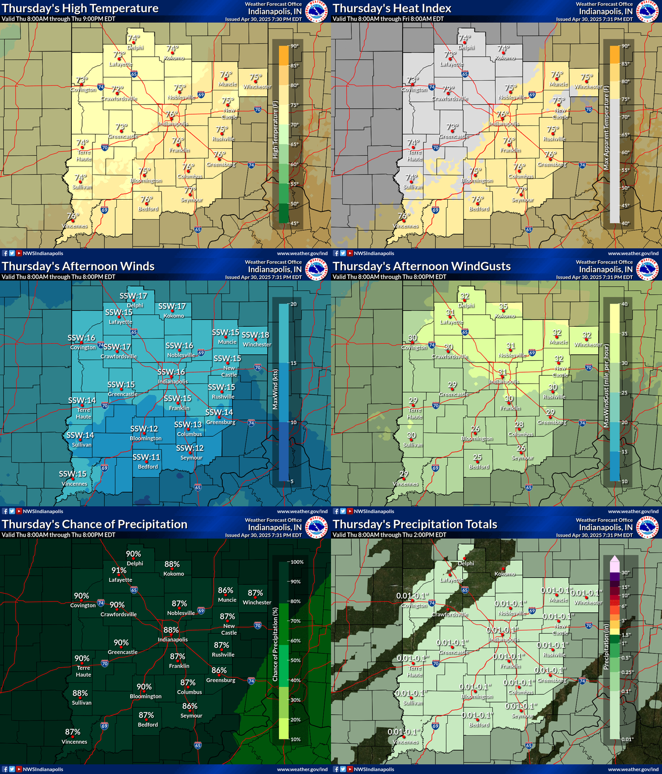
Forecast information for the 12-24 hour forecast. Graphic displays temperatures, precipitation chances, wind direction, and wind speeds for the 12-24 hour period of the forecast.
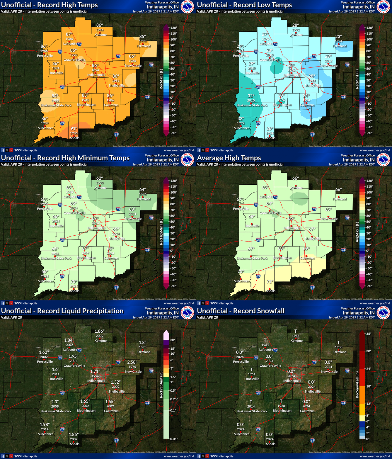
These images contain the daily records and averages across central Indiana. The data is an estimation and interpolation between the various points that have a long enough record across Central Indiana. Additional daily climate information available here including a full listing of all the points used to generate the maps: https://www.weather.gov/ind/Climate_Maps