Overview
|
Numerous thunderstorms developed in a warm and unstable environment during the afternoon and evening of May 7. Storms produced 5 tornadoes in addition to large hail and damaging winds. Locally heavy rain produced some flooding in a few areas. |
 Overview of Tornado Locations |
Tornadoes
|
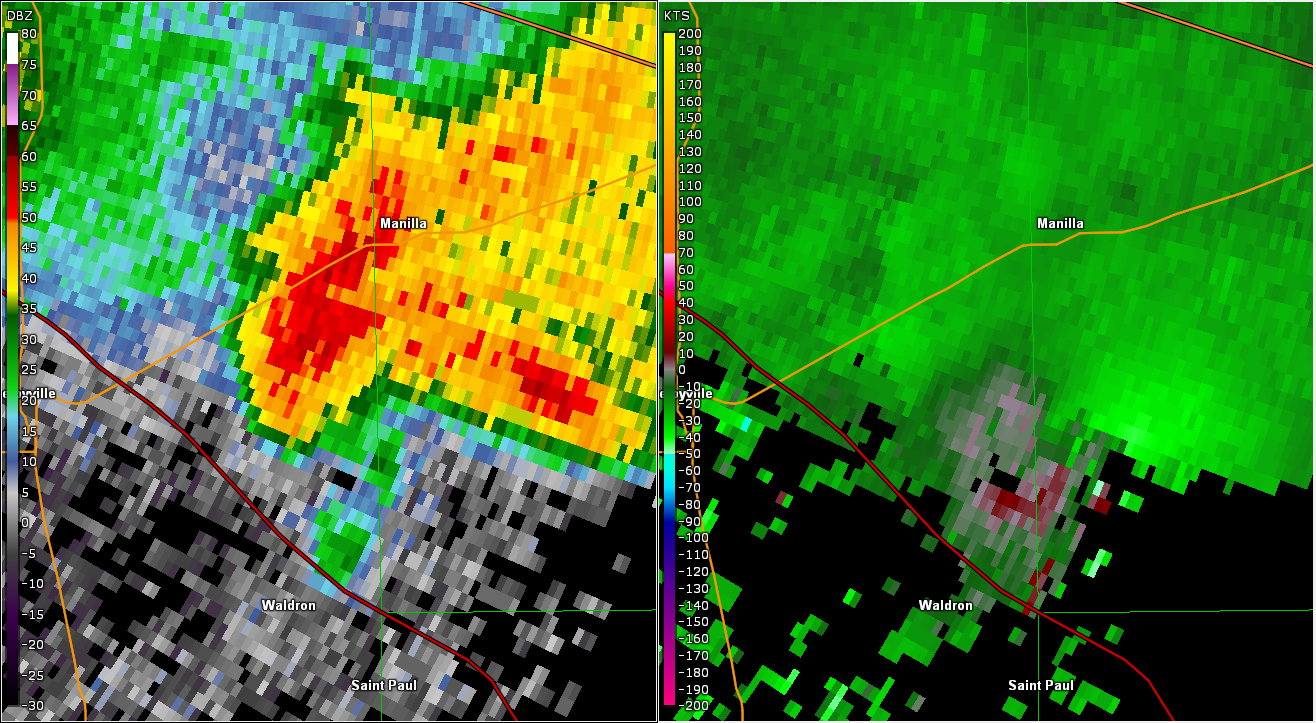
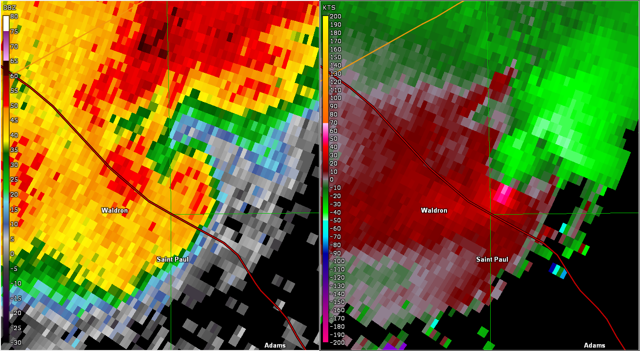
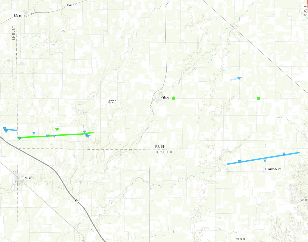
Tornado - 3 NW St Paul
Track Map 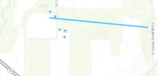 
|
||||||||||||||||
|
||||||||||||||||
|
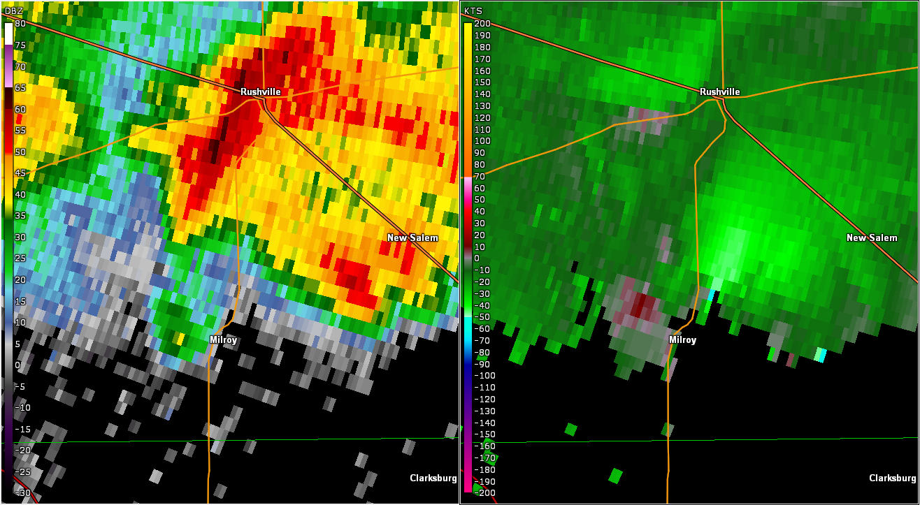
Tornado - 4 NNE of St Paul
Track Map 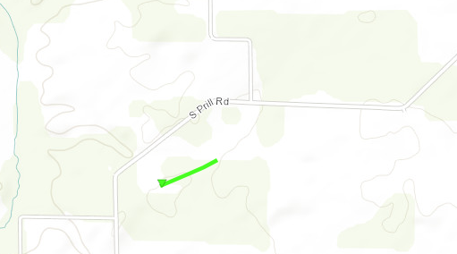
|
||||||||||||||||
|
||||||||||||||||
|
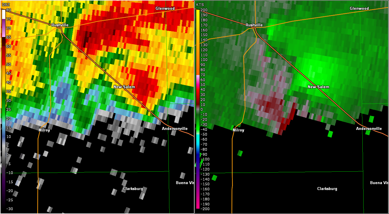
Tornado - 7 SE of Rushville
Track Map 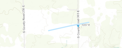
|
||||||||||||||||
|
||||||||||||||||
|
Tornado - 2 N of St Paul
Track Map 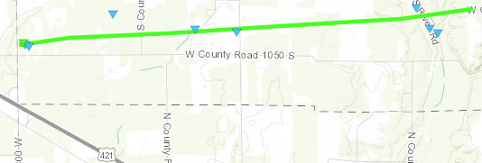
|
||||||||||||||||
|
||||||||||||||||
|
Tornado - 8 NE of Greensburg
Track Map 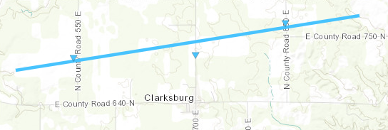
|
||||||||||||||||
|
||||||||||||||||
The Enhanced Fujita (EF) Scale classifies tornadoes into the following categories:
| EF0 Weak 65-85 mph |
EF1 Moderate 86-110 mph |
EF2 Significant 111-135 mph |
EF3 Severe 136-165 mph |
EF4 Extreme 166-200 mph |
EF5 Catastrophic 200+ mph |
 |
|||||
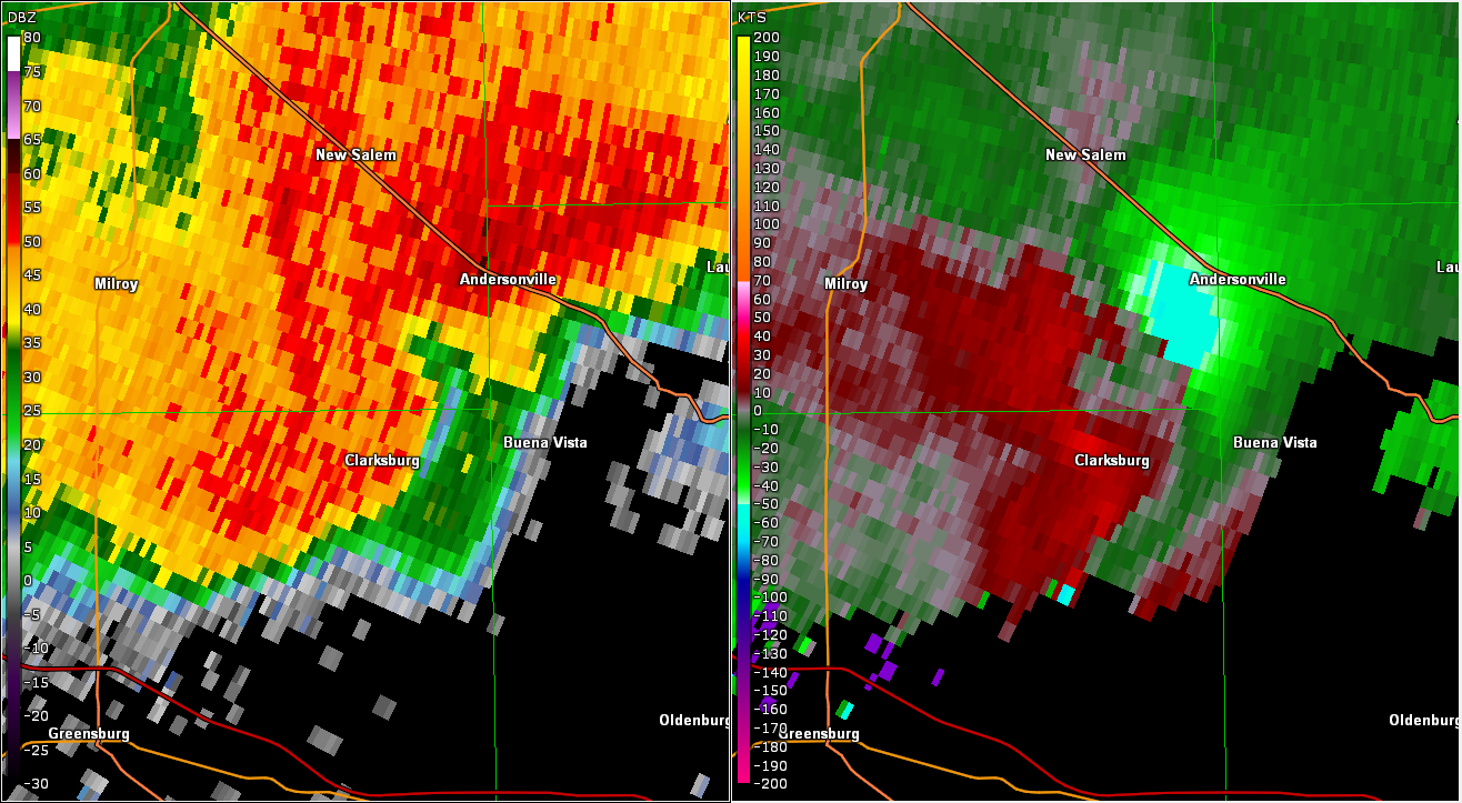
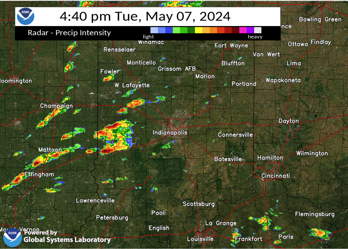
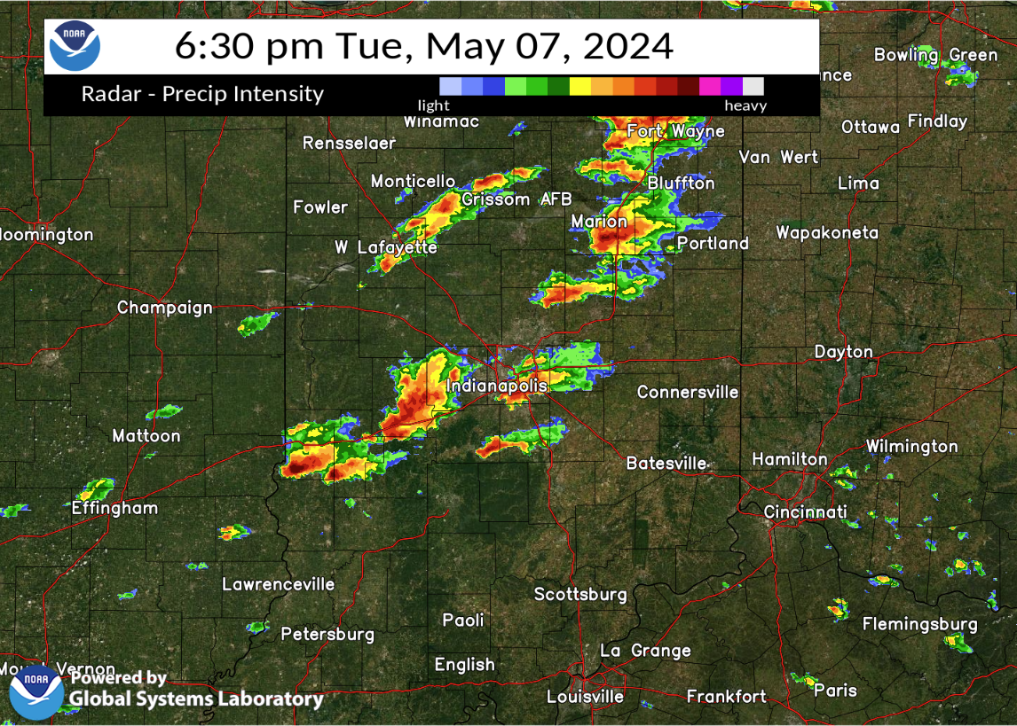
Radar
Below are some selected images from the event. A loop of radar from much of the event follows below.
 |
 |
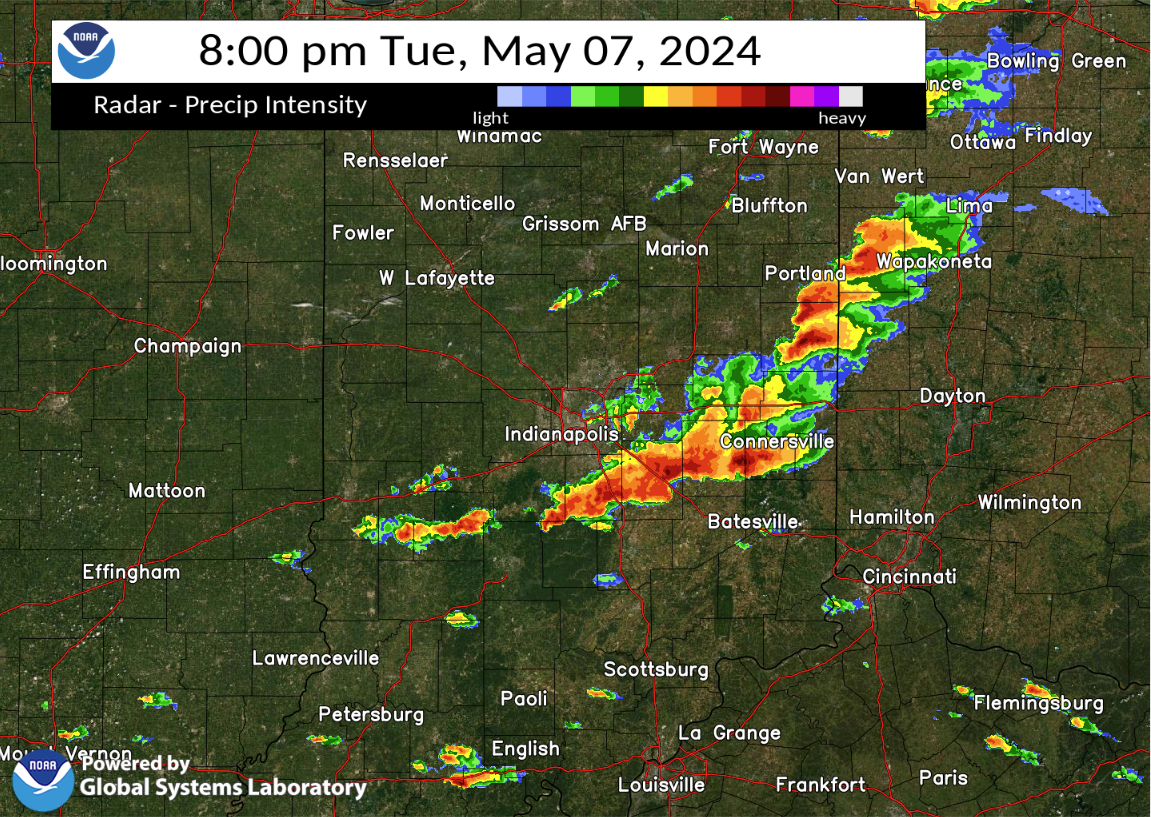 |
| Radar at 4:40 PM EDT | Radar at 6:30 PM EDT | Radar at 8:00 PM EDT |
Storm Reports
Preliminary Local Storm Report
National Weather Service Indianapolis IN


..TIME...   ...EVENT...      ...CITY LOCATION...     ...LAT.LON...
..DATE...   ....MAG....      ..COUNTY LOCATION..ST.. ...SOURCE....
            ..REMARKS..

0435 PM     Hail             2 SE West Terre Haute   39.44N 87.43W
05/07/2024  E1.00 Inch       Vigo               IN   Public

            Report from mPING: Quarter (1.00 in.).

0440 PM     Hail             Terre Haute             39.47N 87.38W
05/07/2024  E1.00 Inch       Vigo               IN   Amateur Radio

0456 PM     Hail             2 N Staunton            39.51N 87.19W
05/07/2024  E1.00 Inch       Clay               IN   Public

0500 PM     Tstm Wnd Gst     Brazil                  39.53N 87.12W
05/07/2024  E60 MPH          Clay               IN   Emergency Mngr

            Wind briefly reaching 50-60 mph amid
            torrential rain with no hail.

0508 PM     Hail             3 W Reelsville          39.54N 87.01W
05/07/2024  E1.00 Inch       Putnam             IN   Public

            Report from mPING.

0510 PM     Hail             Reelsville              39.55N 86.97W
05/07/2024  E1.50 Inch       Putnam             IN   Emergency Mngr

0540 PM     Hail             2 NNE Belle Union       39.60N 86.68W
05/07/2024  E1.25 Inch       Putnam             IN   Public

0626 PM     Tstm Wnd Dmg     4 W Greenwood           39.62N 86.18W
05/07/2024                   Johnson            IN   Broadcast Media

            Thunderstorm winds downed a few 12 inch
            diameter trees along Fairview Road at
            Leaning Tree Road and Peterman Road. Some
            fences down and some roofs damaged. Time
            estimated from radar.

0630 PM     Hail             2 W Pimento             39.30N 87.43W
05/07/2024  E1.00 Inch       Vigo               IN   Trained Spotter

0639 PM     Hail             3 N Trafalgar           39.46N 86.16W
05/07/2024  E1.00 Inch       Johnson            IN   Public

            Along SR 135.

            Winds gusting to estimated 45 mph.
0655 PM     Hail             2 NW Brooklyn           39.56N 86.40W
05/07/2024  E1.75 Inch       Morgan             IN   Public

0722 PM     Hail             New Whiteland           39.56N 86.09W
05/07/2024  E1.00 Inch       Johnson            IN   Public

0722 PM     Hail             4 E Southport           39.65N 86.04W
05/07/2024  E1.00 Inch       Marion             IN   Public

            Report from mPING: Quarter (1.00 in.).

0756 PM     Hail             3 S Marietta            39.39N 85.90W
05/07/2024  E1.00 Inch       Shelby             IN   Public

            Report from mPING: Quarter (1.00 in.).

0758 PM     Hail             Manilla                 39.57N 85.62W
05/07/2024  E1.00 Inch       Rush               IN   Amateur Radio

0801 PM     Tstm Wnd Dmg     4 WSW Union City        40.19N 84.88W
05/07/2024                   Randolph           IN   Amateur Radio

            Thunderstorm winds downed 2 foot diameter
            tree onto road.

0805 PM     Tstm Wnd Dmg     3 SE Winchester         40.15N 84.93W
05/07/2024                   Randolph           IN   Emergency Mngr

            Late report of trees downed by thunderstorm
            winds with power outages.

0815 PM     Hail             3 SSW Paragon           39.35N 86.59W
05/07/2024  E1.00 Inch       Morgan             IN   Cocorahs

            Third hail producing storm following pea
            hail in first two rounds.

0831 PM     Hail             1 E Saint Paul          39.43N 85.61W
05/07/2024  E1.00 Inch       Decatur            IN   Public

0833 PM     Tstm Wnd Dmg     1 ENE Saint Paul        39.43N 85.61W
05/07/2024                   Decatur            IN   Public

            Thunderstorm winds snapped off tops of trees
            50 to 60 feet high.

0927 PM     Hail             3 SE Greensburg         39.31N 85.44W
05/07/2024  E1.00 Inch       Decatur            IN   Public

1050 PM     Hail             1 W Ellettsville        39.23N 86.63W
05/07/2024  E1.75 Inch       Monroe             IN   Amateur Radio

1126 PM     Tstm Wnd Dmg     Stone Head              39.13N 86.16W
05/07/2024                   Brown              IN   Public

            Large tree limb over SR 135.
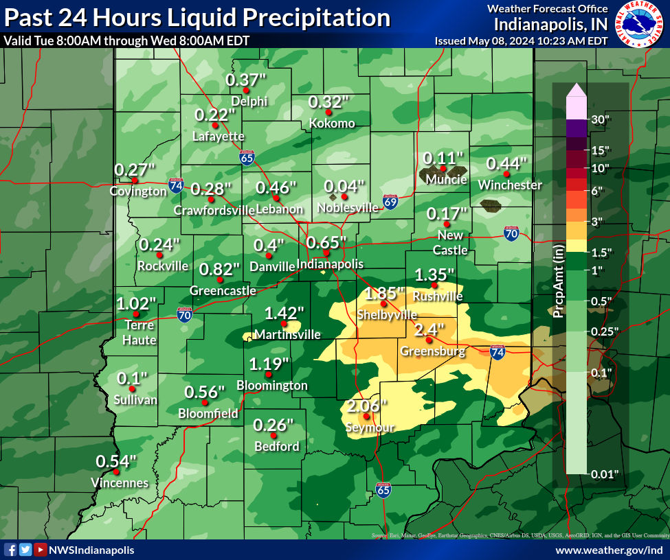
Rain Reports
Rain reports from across central Indiana (note that amounts may not match your location exactly).
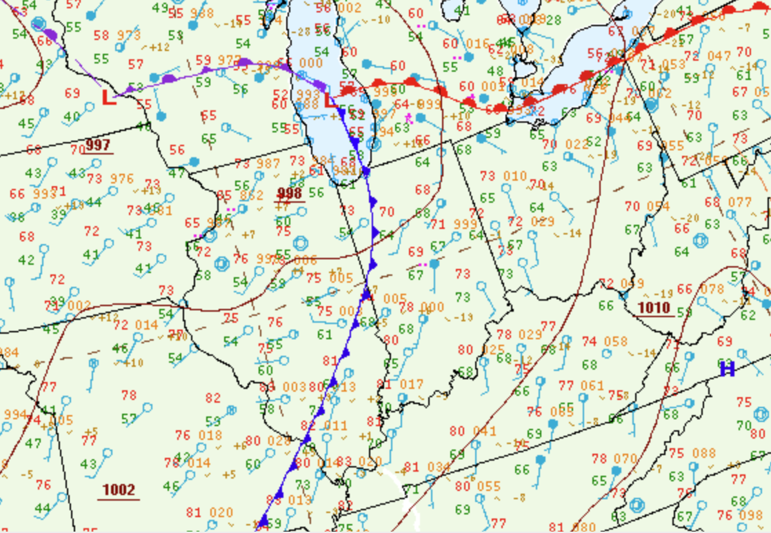
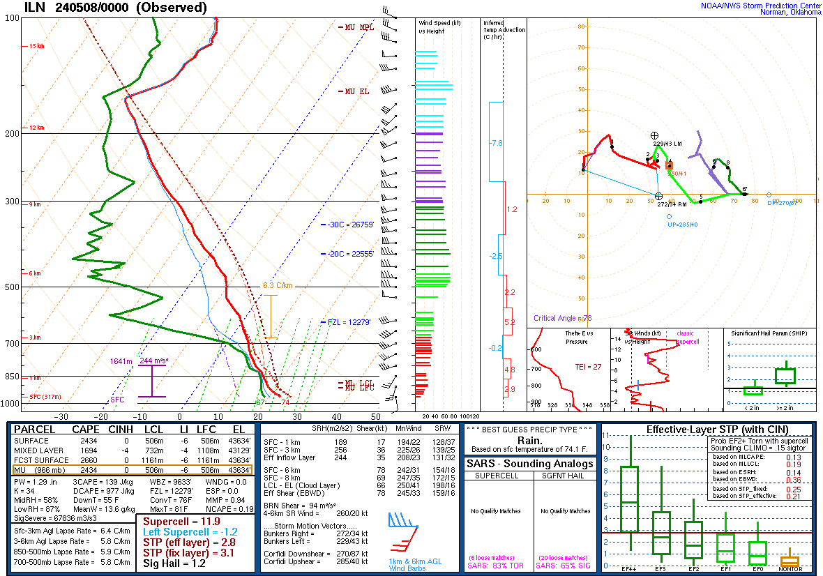
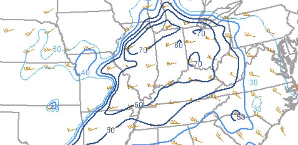
Environment
Warm and unstable air allowed thunderstorms to develop well ahead of an approaching cold front.
 |
 |
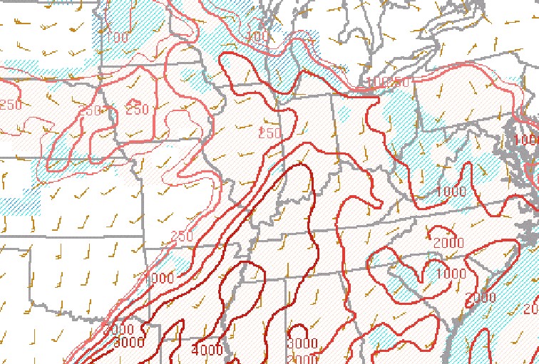 |
| Figure 1: Surface Map at 8:00 PM EDT | Figure 2: Sounding from Wilmington, OH at 8 PM EDT | Figure 3: Mixed Layer CAPE at 7 PM EDT |
 |
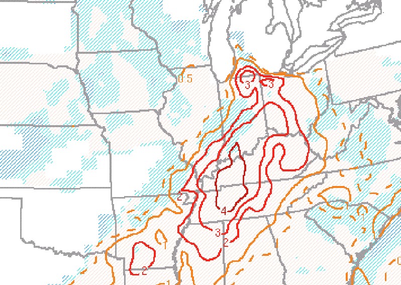 |
| Figure 4: Effective Bulk Shear at 7 PM EDT | Figure 5: Significant Tornado Parameter at 7 PM EDT |
WoFS Highlights
Images coming soon.
| Figure 1: Caption | Figure 2: Caption | Figure 3: Caption |
 |
Media use of NWS Web News Stories is encouraged! Please acknowledge the NWS as the source of any news information accessed from this site. |
|