Indianapolis, IN
Weather Forecast Office
Overview
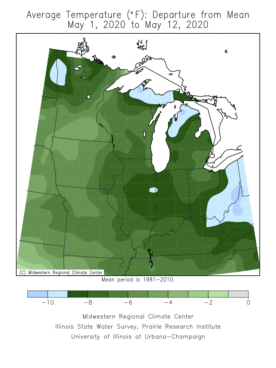
Roughly the first half of May 2020 saw well below normal temperatures across central Indiana. Many days saw average temperatures more than 10 degrees below normal. May 9, 2020 saw record cold temperatures across much of Indiana as very cold air flowed into the area from Canada.
Temperature
Much of the first half of may saw well below normal temperatures. Below is a plot of departure from normal for average temperature for May 1-12 (courtesy of the Midwest Regional Climate Center, click for a larger version):
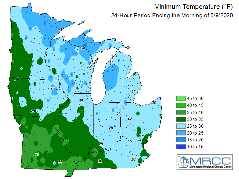
Temperatures dipped into the 20s across central Indiana early on May 9, 2020. At Indianapolis, the low temperature of 27 degrees not only set a record low temperature for the date but also set the record for coldest temperature on record for the month of May. The previous record for the month of May was 28 degrees, set in 1966. A list of some central Indiana low temperatures is below. Below this is an image which shows low temperatures across the Midwest the morning of the 9th.
List of central Indiana climate sites' low temperatures for May 9 (from north to south):
Image of low temperatures for the Midwest (courtesy of the Midwest Regional Climate Center):
Environment
Persistent northwest flow in the upper atmosphere allowed cold air from Canada to flow into central Indiana.
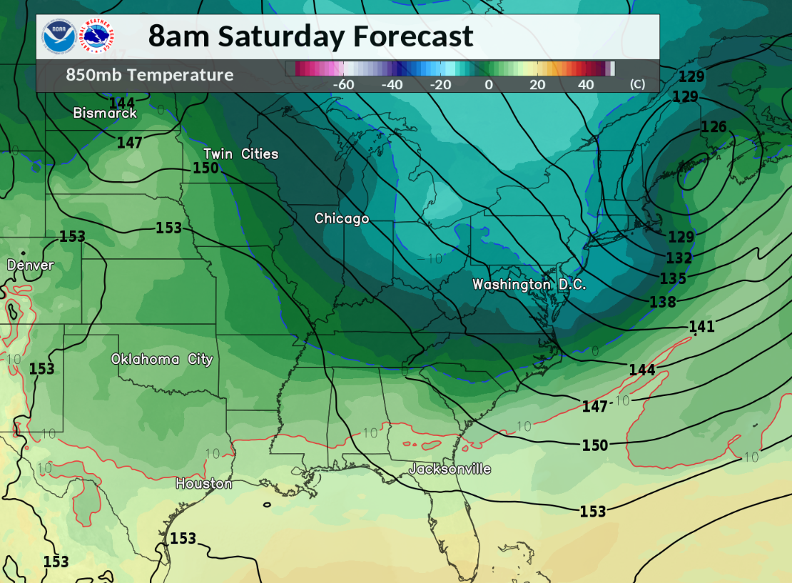 |
| Figure 1: 850mb Heights & Temperatures for 8:00 AM EDT May 9 |
 |
Media use of NWS Web News Stories is encouraged! Please acknowledge the NWS as the source of any news information accessed from this site. |
|
Hazards
Hazardous Weather Outlook
Drought Information
NOAA All Hazards Radio
Graphical Hazards Outlook
Spotter Information
Outdoor Event Watcher
Local forecasts
Local Area
Aviation
Computer Model Forecasts
Fire Weather
Graphical
Precipitation
Air Quality
Text River Forecasts
Area Forecast Discussion
Central Indiana Weather Brief
US Dept of Commerce
National Oceanic and Atmospheric Administration
National Weather Service
Indianapolis, IN
6900 West Hanna Avenue
Indianapolis, IN 46241-9526
317-856-0664
Comments? Questions? Please Contact Us.

