Overview
|
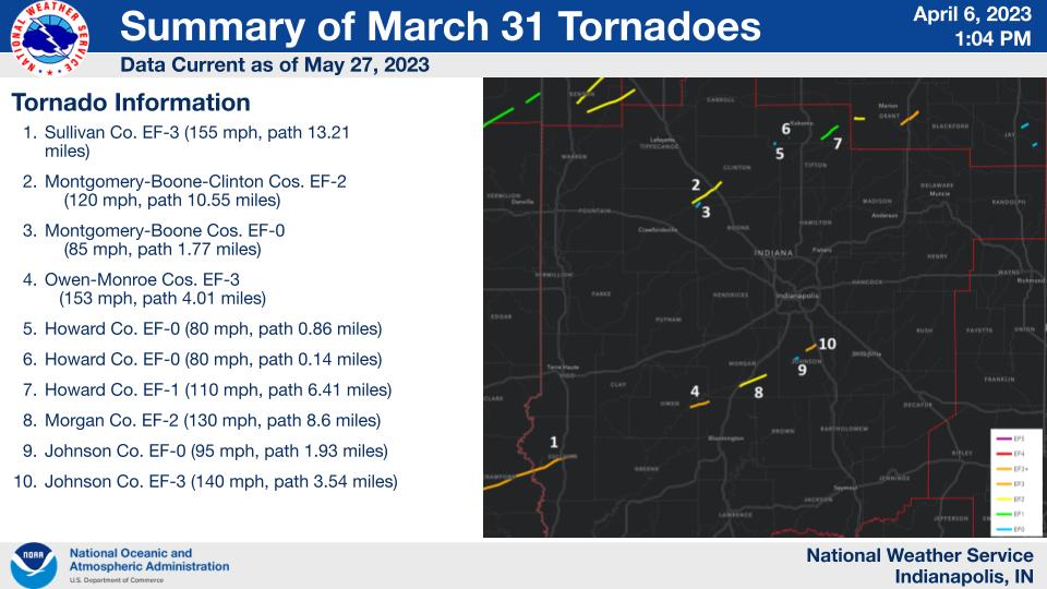
Thunderstorms developed along and ahead of a strong cold front on the evening of March 31. These storms produced 10 tornadoes along with widespread wind damage. Some fatalities were reported along with multiple injuries. This was part of a larger outbreak that produced a total of 23 tornadoes in Indiana alone. This makes the event the fifth largest tornado outbreak in Indiana history. This was the largest outbreak in central Indiana since November 17, 2013. For central Indiana, this is the first day with multiple fatalities from different tornadoes since June 2, 1990. For the entire state, this is the first day with multiple fatalities from different tornadoes since March 2, 2012.
...SUMMARY OF ALL INDIANA TORNADOES DURING 3/31 – 4/1/2023 OUTBREAK...

    #  TIME EF COUNTIES                  WIND LENGTH WIDTH  FTL INJ
        EDT                               MPH  MILES YARDS
   -----------------------------------------------------------------
    1  933P  2 BENTON                     120  11.70  400    -   -
    2  933P  2 BENTON-WHITE               115  15.30  500    -   -
    3  941P  1 BENTON-JASPER              105  10.30  500    -   -
    4  953P  1 LAKE                       100   3.30  250    -   -
    5  955P  0 WHITE                       85   1.29  125    -   -
    6 1001P  0 PORTER                      70    .63  125    -   -
    7 1013P  1 CASS...................... 100   1.73  300    -   -
    8 1021P  3 [JASPER-CRAWFORD]-SULLIVAN 155  13.21  660    3   1+
    9 1043P  2 MONTGOMERY-BOONE-CLINTON   120  10.55  100    -   -
   10 1043P  0 MONTGOMERY-BOONE            85   1.77   50    -   -
   11 1101P  3 OWEN-MONROE............... 153   4.01  400    2   2
   12 1111P  0 HOWARD                      80    .86   10    -   -
   13 1112P  2 MORGAN                     130   8.60  200    -   -
   14 1115P  0 HOWARD                      80    .14   10    -   -
   15 1120P  1 HOWARD.................... 110   6.41   25    -   1
   16 1127P  0 JOHNSON                     85   1.93   25    -   -
   17 1133P  3 JOHNSON                    140   3.54  316    -   -
   18 1133P  2 GRANT                      120   3.10  150    -   -
   19 1136P  2 ALLEN..................... 120   7.86  400    -   -
   20 1142P  3 GRANT                      140   6.35  200    -   -
   21 1144P  0 ALLEN                       75   1.14   75    -   -
   22 1219A  0 JAY                         85   1.55  175    -   -
   23 1220A  0 JAY........................ 80   2.45  100    -   -
|
 Summary of Tornadoes |
Tornadoes:
|
Tornado - Sullivan
Track Map 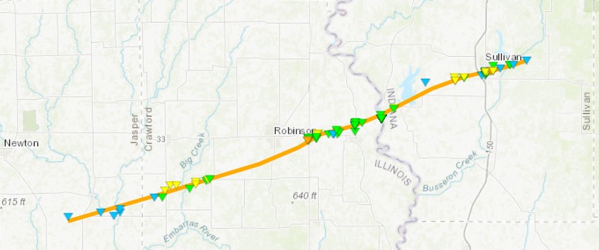 
|
||||||||||||||||
|
||||||||||||||||
|
Tornado - Near Bargersville
Track Map 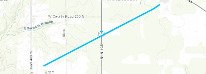 
|
||||||||||||||||
|
||||||||||||||||
|
Tornado - Near Whiteland
Track Map 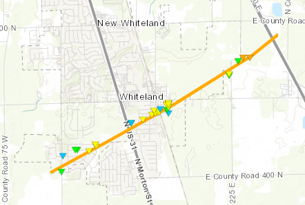 
|
||||||||||||||||
|
||||||||||||||||
|
Tornado - Near Colfax
Track Map 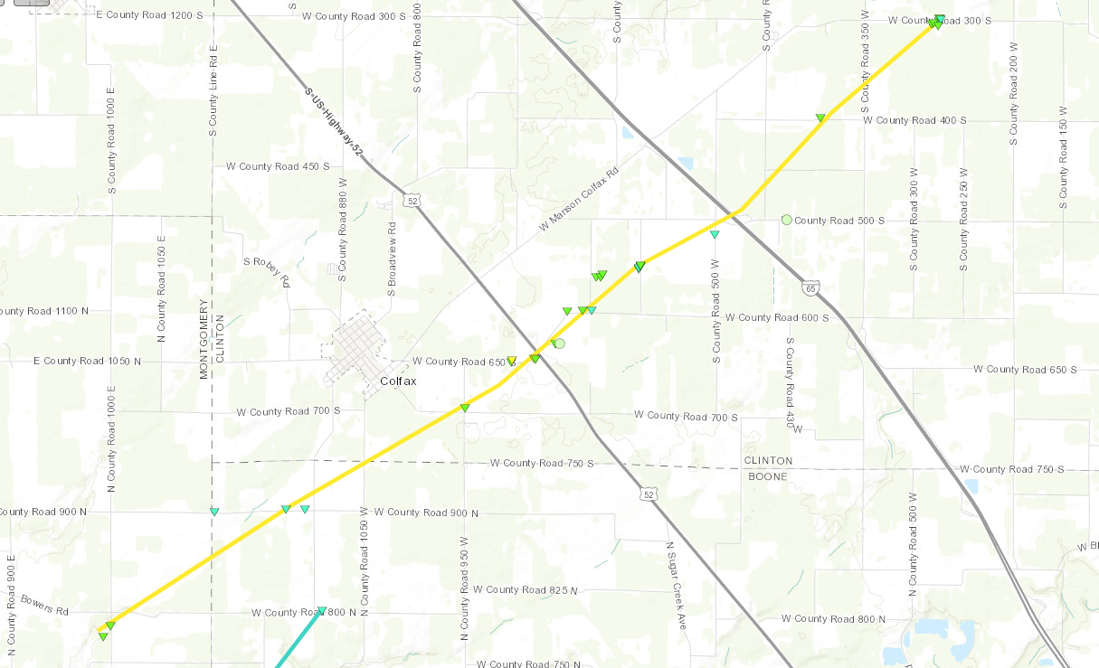 
|
||||||||||||||||
|
||||||||||||||||
|
Tornado - Northwest Boone Co.
Track Map 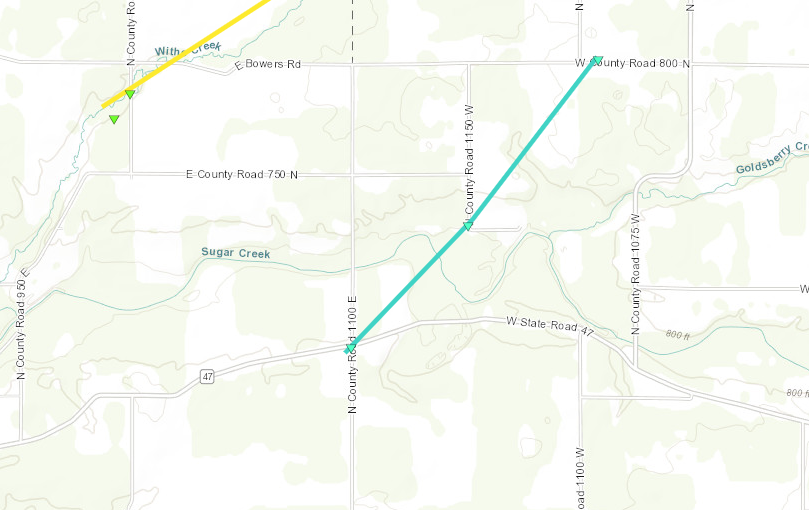 
|
||||||||||||||||
|
||||||||||||||||
|
Tornado - Near Russiaville
Track Map 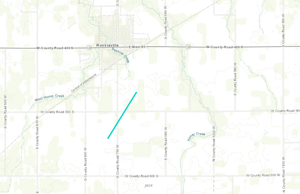 
|
||||||||||||||||
|
||||||||||||||||
|
Tornado - Near Russiaville
Track Map 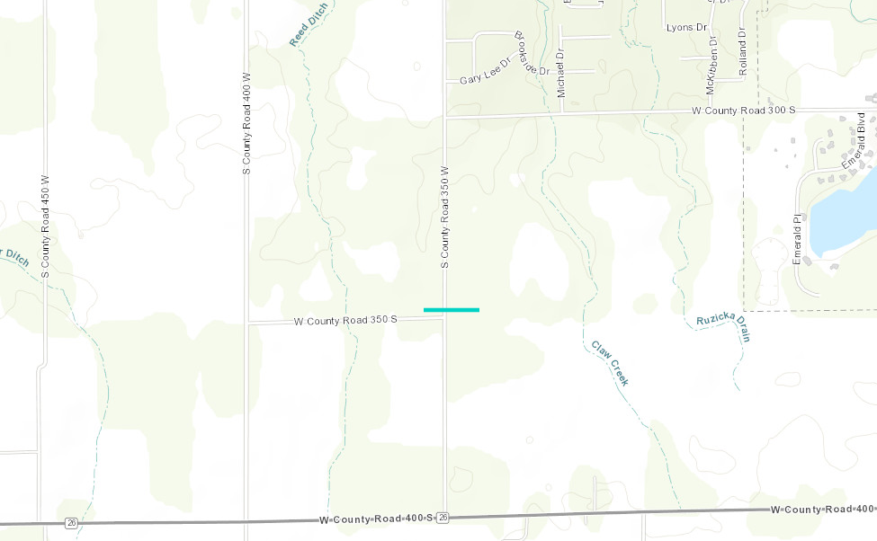 
|
||||||||||||||||
|
||||||||||||||||
|
Tornado - Near Greentown
Track Map 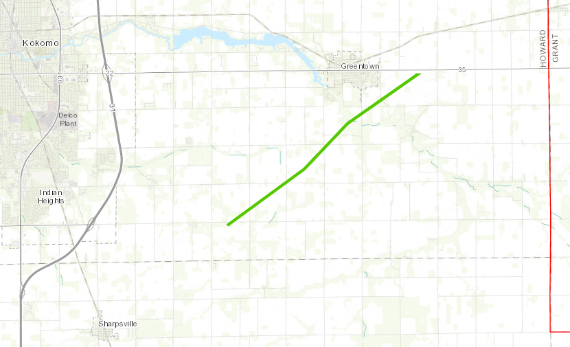 
|
||||||||||||||||
|
||||||||||||||||
|
Tornado - Near Martinsville
Track Map 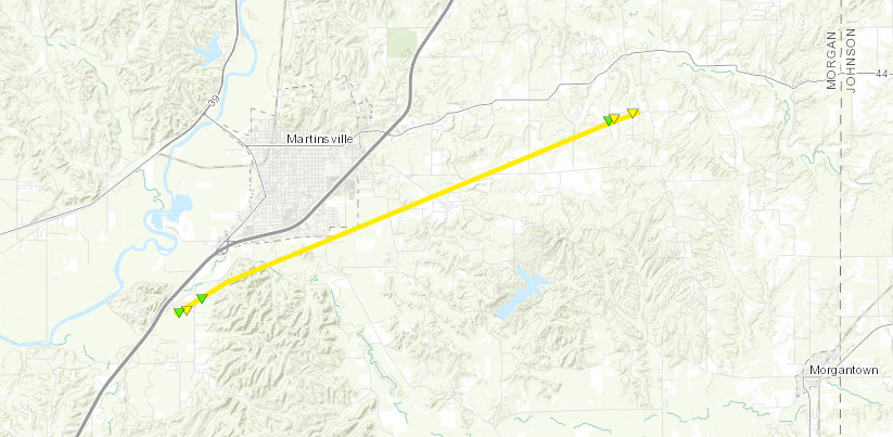 
|
||||||||||||||||
|
||||||||||||||||
|
Tornado - Near McCormick's Creek
Track Map
|
||||||||||||||||
|
||||||||||||||||
The Enhanced Fujita (EF) Scale classifies tornadoes into the following categories:
| EF0 Weak 65-85 mph |
EF1 Moderate 86-110 mph |
EF2 Significant 111-135 mph |
EF3 Severe 136-165 mph |
EF4 Extreme 166-200 mph |
EF5 Catastrophic 200+ mph |
 |
|||||
Radar
Radar loop of the event:
Storm Reports
PRELIMINARY LOCAL STORM REPORT
NATIONAL WEATHER SERVICE INDIANAPOLIS IN
636 AM EDT SAT APR 1 2023

..TIME...   ...EVENT...      ...CITY LOCATION...     ...LAT.LON...
..DATE...   ....MAG....      ..COUNTY LOCATION..ST.. ...SOURCE....
            ..REMARKS..

0936 PM     HAIL             4 W RAINSVILLE          40.41N 87.39W
03/31/2023  E1.00 INCH       WARREN             IN   AMATEUR RADIO

1021 PM     TORNADO          2 ENE TURTLE CREEK RESE 39.07N 87.50W
03/31/2023                   SULLIVAN           IN   NWS STORM SURVEY

            *** 3 FATAL ***
            A LARGE, SIGNIFICANT TORNADO BEGAN WEST OF
            SULLIVAN, AND CONTINUED EAST FOR NEARLY 9
            MILES, HITTING THE SOUTHERN PORTIONS OF
            SULLIVAN. MAXIMUM WIDTH OF TORNADO WAS 660
            YARDS.


1030 PM     TSTM WND DMG     8 WNW BATTLE GROUND     40.54N 86.98W
03/31/2023                   TIPPECANOE         IN   EMERGENCY MNGR

            THUNDERSTORM WINDS FLATTENED 2 STRUCTURES TO
            BASEMENT. SEVERAL OTHER STRUCTURES WITH
            ROOFS BLOWN OFF NEAR JUNCTION OF BENTON
            TIPPECANOE AND WHITE COUNTIES. 1 INCH HAIL
            ALSO REPORTED NEAR US HIGHWAY 231. TIME
            ESTIMATED BY RADAR.

1024 PM     TSTM WND DMG     3 WSW SULLIVAN          39.08N 87.46W
03/31/2023                   SULLIVAN           IN   EMERGENCY MNGR

            *** 2 FATAL, 1 INJ ***
            THUNDERSTORM WINDS CONSISTENT WITH PROBABLE
            TORNADO. 2 FATALITIES AND 1 INJURY AND 1
            PERSON MISSING. TIME ESTIMATED.

1041 PM     TSTM WND DMG     1 SW COLFAX             40.18N 86.68W
03/31/2023                   CLINTON            IN   PUBLIC

            THUNDERSTORM WINDS SNAPPED TOPS OFF OF 20
            TREES AND BLEW ROOF OF OF BARN.

1045 PM     TSTM WND DMG     1 W THORNTOWN           40.13N 86.63W
03/31/2023                   BOONE              IN   TRAINED SPOTTER

            BARN DESTROYED. TIME ESTIMATED VIA RADAR.


1053 PM     TSTM WND GST     PATRICKSBURG            39.31N 86.96W
03/31/2023  E75 MPH          OWEN               IN   911 CALL CENTER

            PEA SIZED HAIL ALSO REPORTED.

1101 PM     TORNADO          1 ENE MCCORMICKS CREEK  39.29N 86.73W
03/31/2023                   OWEN               IN   NWS STORM SURVEY

            *** 2 FATAL, 2 INJ ***
            EF3 TORNADO BEGAN WITHIN MCCORMICKS CREEK
            STATE PARK AND CONTINUED ENE, ENDING NORTH
            OF STINESVILLE. TOTAL PATH LENGTH WAS 4
            MILES WITH A MAXIMUM WIDTH OF 400 YARDS.

1110 PM     TSTM WND GST     GOSPORT                 39.35N 86.67W
03/31/2023  M83 MPH          OWEN               IN   TRAINED SPOTTER

            SEVERE WINDS LASTED 8 MINUTES 1110PM TO
            1118PM. 3 TREES DOWN. DIME HAIL.

1112 PM     TORNADO          3 SW MARTINSVILLE       39.39N 86.46W
03/31/2023                   MORGAN             IN   NWS STORM SURVEY

            EF2 TORNADO BEGAN SW OF MARTINSVILLE AND
            CONTINUED ENE FOR 8.6 MILES. MAXIMUM WIDTH
            WAS 200 YARDS.

1123 PM     TSTM WND DMG     3 ENE PARAGON           39.41N 86.50W
03/31/2023                   MORGAN             IN   AMATEUR RADIO

            WINDS DOWNED MULTIPLE TREES WITH
            CONSIDERABLE HOME DAMAGE BETWEEN
            MARTINSVILLE AND PARAGON. ALSO ESTIMATED 60
            MPH WINDS IN PARAGON.

1123 PM     TSTM WND DMG     3 S PARAGON             39.35N 86.56W
03/31/2023                   MORGAN             IN   TRAINED SPOTTER

            THUNDERSTORM WINDS DOWNED NUMEROUS LARGE
            TREES AND SNAPPED POWER POLES. TIME
            ESTIMATED.

1129 PM     TSTM WND DMG     MONROVIA                39.58N 86.48W
03/31/2023                   MORGAN             IN   NWS EMPLOYEE

            PRIVACY FENCE DESTROYED AND WINDOW BROKEN.

1035 PM     TSTM WND GST     2 N NEW MARKET          39.98N 86.92W
03/31/2023  M59 MPH          MONTGOMERY         IN   AWOS

            OBSERVED AT KCFJ AWOS.

1040 PM     HAIL             2 S DARLINGTON          40.08N 86.77W
03/31/2023  E1.00 INCH       MONTGOMERY         IN   PUBLIC


1134 PM     TSTM WND GST     1 SSE EAGLE CREEK RESER 39.83N 86.30W
03/31/2023  M59 MPH          MARION             IN   ASOS

            ASOS STATION KEYE INDIANAPOLIS (EAGLE
            CREEK).

1136 PM     TSTM WND GST     INDIANAPOLIS INT`L AIRP 39.72N 86.29W
03/31/2023  E67 MPH          MARION             IN   ASOS


1150 PM     TSTM WND GST     2 S ANDERSON            40.06N 85.69W
03/31/2023  E65 MPH          MADISON            IN   TRAINED SPOTTER

            WINDS AT ONSET OF THUNDERSTORM. REPORTS OF
            NUMEROUS POWER POLES AND LINES DOWN ACROSS
            MADISON COUNTY. TIME ESTIMATED.

1155 PM     TSTM WND DMG     MORRISTOWN              39.67N 85.70W
03/31/2023                   SHELBY             IN   BROADCAST MEDIA

            THUNDERSTORM WINDS DOWNED GAS STATION
            OVERHANGING ROOF. TIME ESTIMATED.

1133 PM     TSTM WND DMG     1 SSE WHITELAND         39.54N 86.08W
03/31/2023                   JOHNSON            IN   911 CALL CENTER

            THUNDERSTORM WINDS CONSISTENT WITH PROBABLE
            TORNADO DESTROYED MULTIPLE HOMES ON BOTH
            SIDES OF US HIGHWAY 31 WITH WAREHOUSE
            DAMAGE. TIME ESTIMATED.

1125 PM     TSTM WND DMG     4 ENE RUSSIAVILLE       40.43N 86.20W
03/31/2023                   HOWARD             IN   AMATEUR RADIO

            THUNDERSTORM WINDS PARTIALLY COLLAPSED 2
            HOMES AND DOWNED TREES AT COUNTY ROADS 400
            WEST AND 300 SOUTH. BUILDING COLLAPSED AT
            750 WEST AND 5145 SOUTH. POSSIBLE FUNNEL
            CLOUD AT ROUTE 26 AND PARK ROAD.
            MISCELLANEOUS DEBRIS AT ALTO ROAD AND PARK
            ROAD.

1140 PM     TSTM WND GST     3 E AVON                39.76N 86.34W
03/31/2023  E65 MPH          HENDRICKS          IN   TRAINED SPOTTER


1205 AM     HAIL             ALBANY                  40.30N 85.23W
04/01/2023  E1.00 INCH       DELAWARE           IN   AMATEUR RADIO
Environment
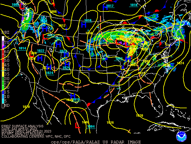
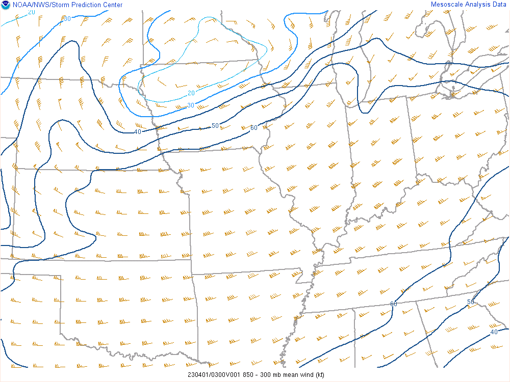
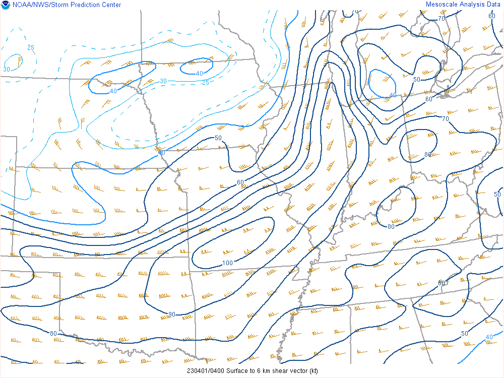
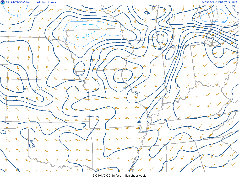
A strong low pressure system and an upper trough brought showers and thunderstorms to central Indiana on the afternoon and evening of March 31, into the early morning hours of April 1. Strong winds not far off the surface were able to mix down and cause damaging winds within thunderstorms. The wind fields aloft also created enough shear that some storms were able to rotate and produce tornadoes. The strong wind fields also led to fast storm motions.
 |
 |
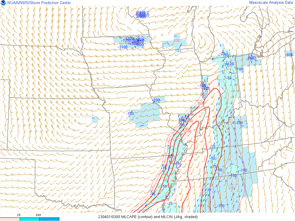 |
| Figure 1: Surface Map/Radar for 11pm EDT March 31 | Figure 2: 850mb-300mb mean wind at 11pm EDT March 31 | Figure 3: Mixed Layer CAPE at 11pm EDT March 31st |
 |
 |
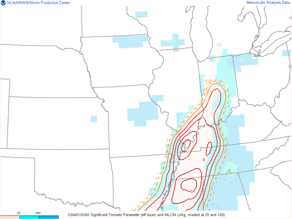 |
| Figure 4: 0-6km shear at 11pm EDT March 31st | Figure 5: 0-1km shear at 11pm EDT March 31st | Figure 6: Significant Tornado Parameter at 11pm EDT |
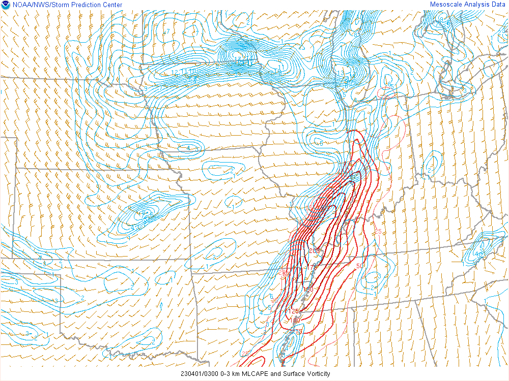 |
| Figure 7: Surface Vorticity and 0-1km CAPE at 11pm EDT |
Service
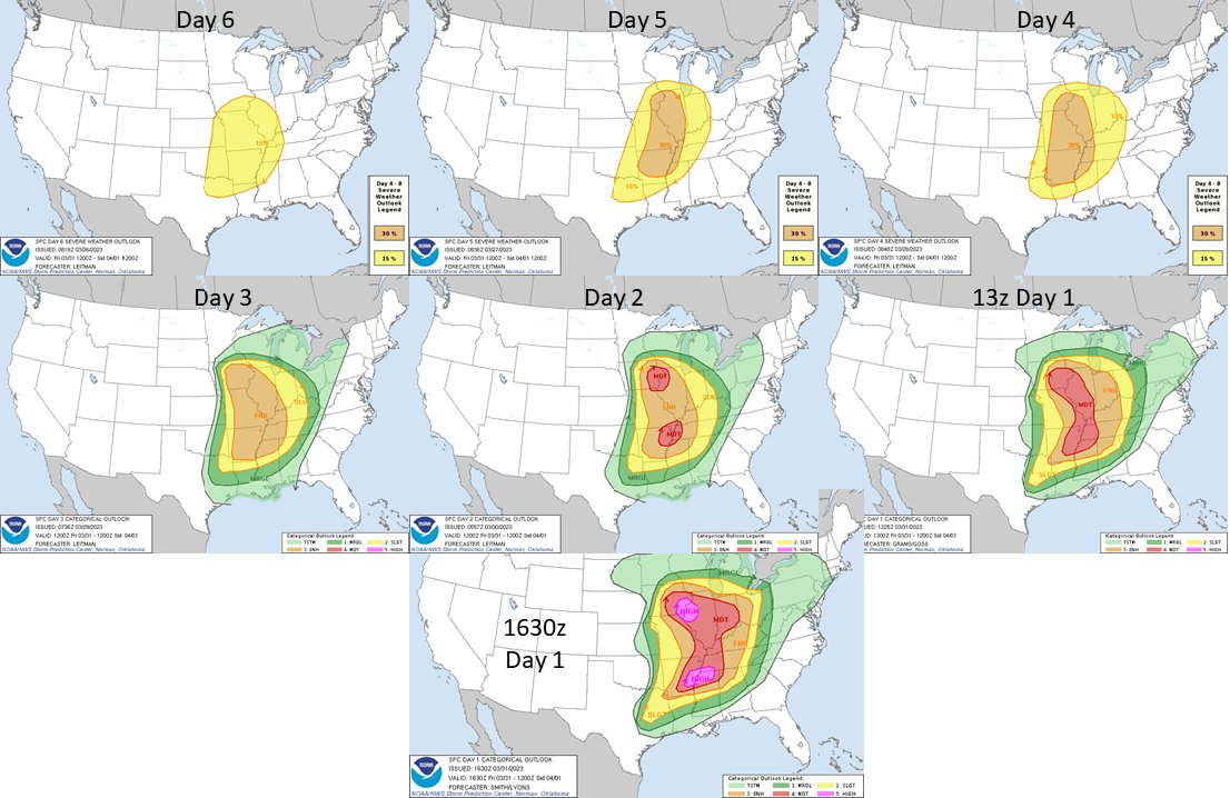
The Storm Prediction Center indicated a severe threat for portions of central Indiana 6 days before the event, with subsequent outlooks increasing the threat leve.
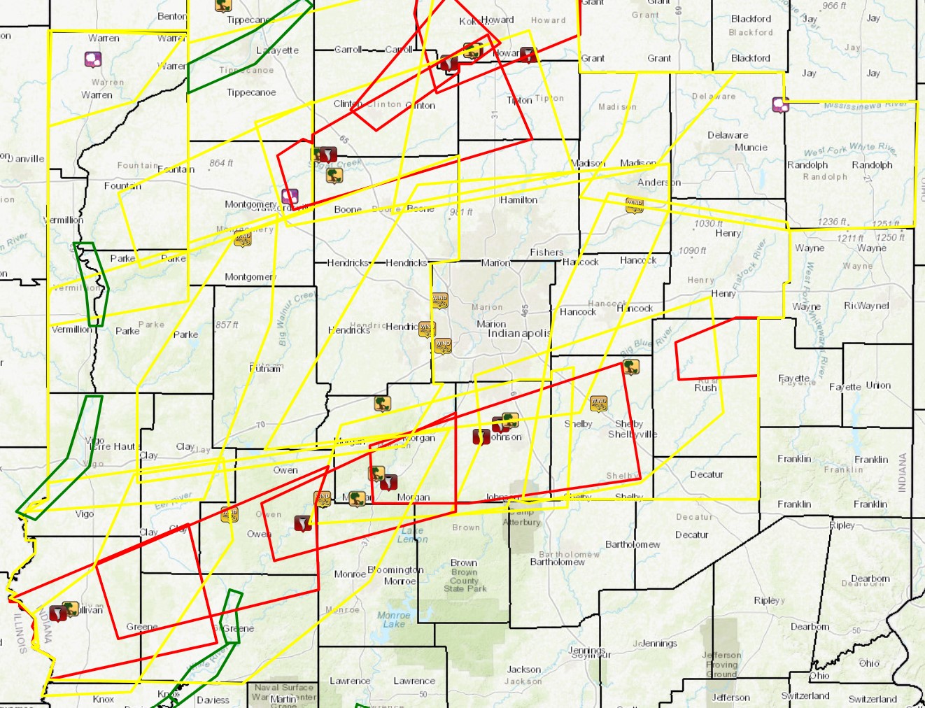
Map of Warnings Issued by NWS Indianapolis
Summaries from other NWS Offices
 |
Media use of NWS Web News Stories is encouraged! Please acknowledge the NWS as the source of any news information accessed from this site. |
 |