Overview
A thunderstorm spawned a couple of tornadoes across far northwest portions of central Indiana on the evening of June 25.
Tornadoes
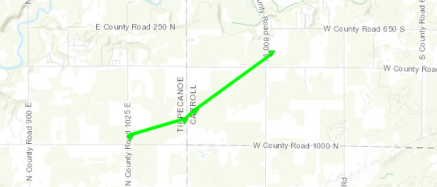
Tornado #1
TIPPECANOE into CARROLL Counties
| Date |
06/25/21 |
| Time (Local) |
8:18-8:23 PM EDT |
| EF Rating |
EF-1 |
| Est. Peak Winds |
95 mph |
| Path Length |
2.17 miles |
| Max Width |
50 yards |
| Injuries/Deaths |
0/0 |
|
Summary:
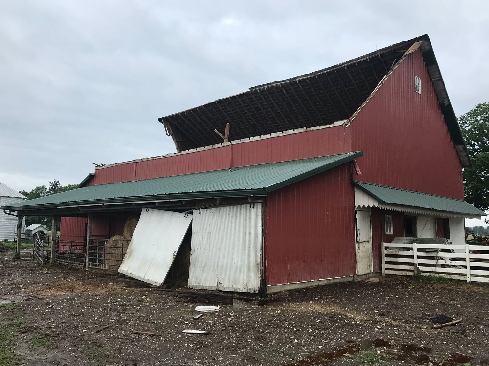
The first tornado was rated an EF1 with
maximum winds of 95 mph and a path length of 2.17 miles. It began near the intersection of 1025
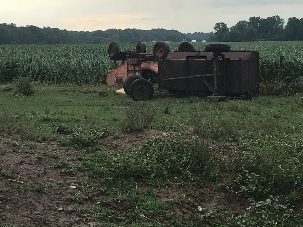
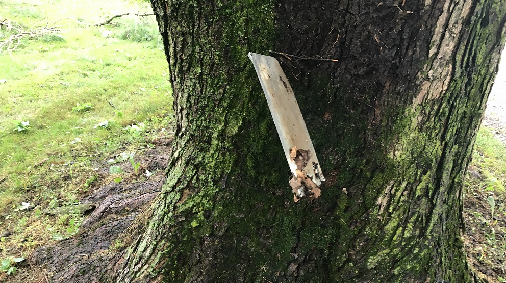
E and 100 N in far Eastern Tippecanoe county. The roof on the east side of a barn was lifted and thrown about 20 yards to the southeast. Several large branches were broken off trees and thrown
to the west and northwest, several being drug along the ground. A small wind mill was knocked down and pointed into the path of the tornado. Several small farm vehicles were moved or overturned. The tornado then appeared to lift briefly but may have occurred again in a field of corn before hitting a barn and house along county
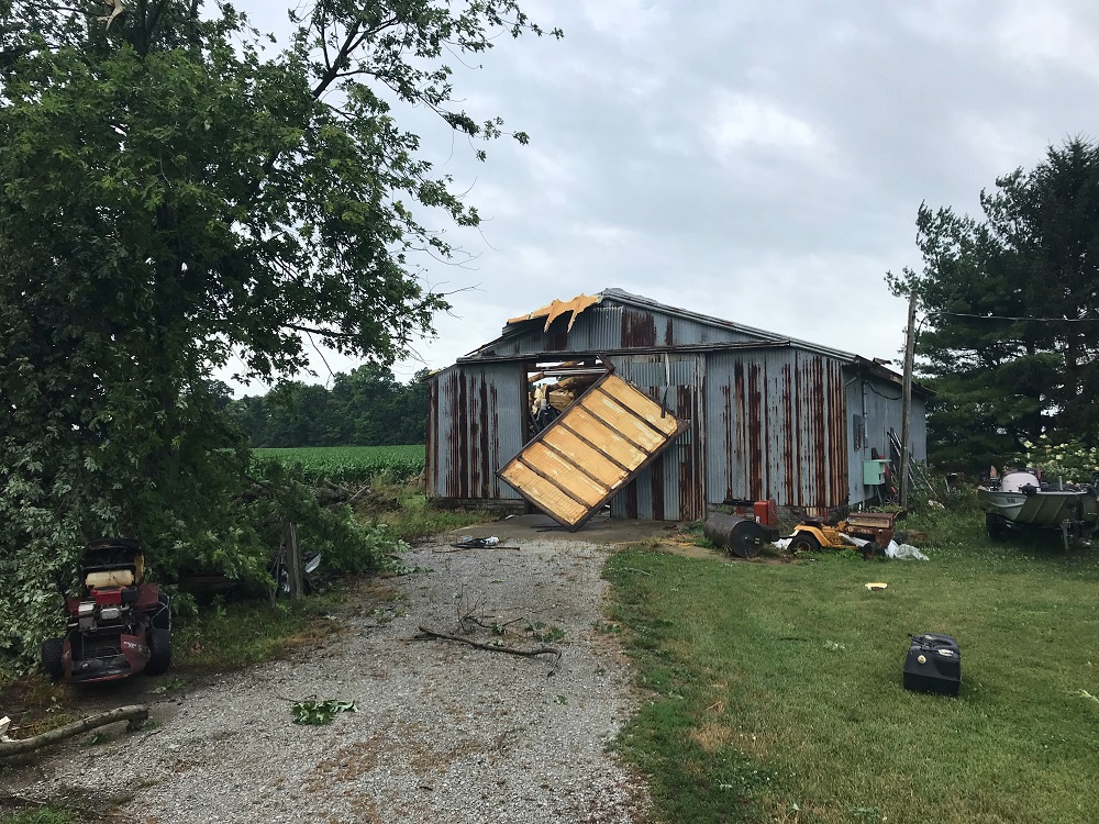
line road, northeast of where it originally began. Here another roof segment was torn off a small barn and tree branches were thrown into the side of a house and a few went through windows. A
car was also pulled about 5 feet. Another farm across the road in Carroll county had a barn roof lifted and the west wall collapsed. The tornado continued on a northeast path to just north of the
intersection of county road 700 S and 800 W where another farm was hit with the roof and sides of two barns thrown to the north and west. This appears to be where this tornado ended. Damage at all of these locations were consistent with an EF1 and winds up to 95 mph.
|
Track Map
|
|
|
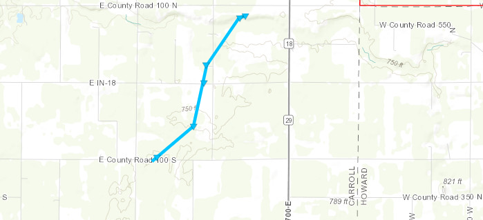
Tornado #2, Near Burlington
CARROLL County
| Date |
06/25/21 |
| Time (Local) |
9:09 - 9:12 PM EDT |
| EF Rating |
EF-0 |
| Est. Peak Winds |
74 mph |
| Path Length |
2.35 miles |
| Max Width |
200 yards |
| Injuries/Deaths |
0/0 |
|
Summary:
The storm continued moving northeast across large expanses of corn and bean fields as well as wooded areas. No additional damage could be found from the ground until just east of county road 500 E along 100 S where the second tornado began and brushed the corner of a wooded lot and home. This tornado was an EF0 with winds of 70 to 74 mph and a path length of 2.35 miles. The damage was primarily snapping of the tops of trees along its path. The first damage found included several trees that were snapped towards the top with large limbs broken and brought down to the northeast, but a few large limbs were convergent into the path of this tornado and pointing southeast. Marks on the ground indicated
some of the larger limbs had been pulled southeast. This tornado again appeared to dissipate but quickly start again multiple times along its path. This is consistent with spotter and
eyewitness reports. Several points surveyed showed mainly tree damage and some minor shingle or siding damage to homes. This tornado ended just south of county road 100 N about halfway between 600 E and SR 18 in Carroll County.
|
Track Map
|
 |
 |
 |
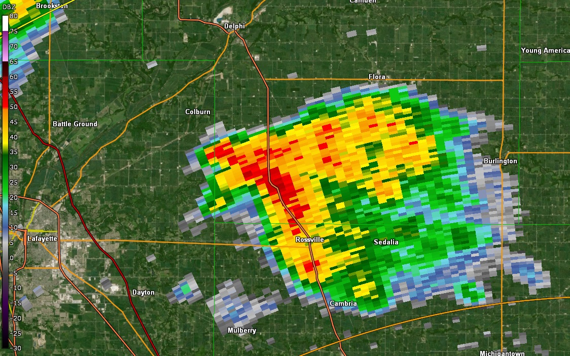
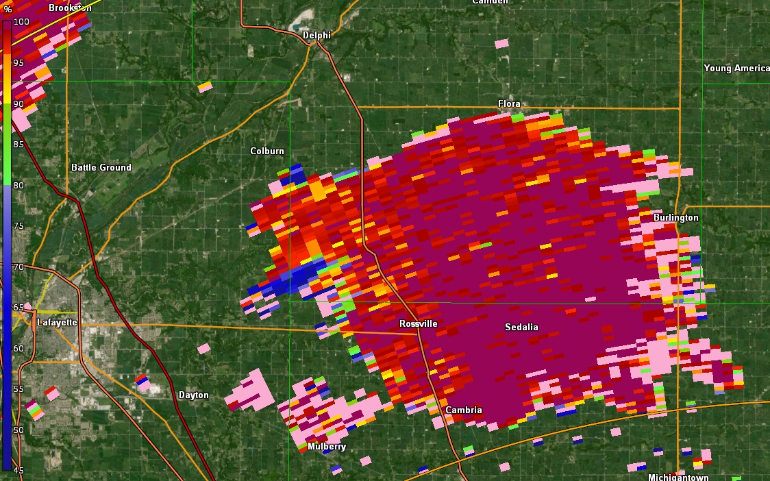
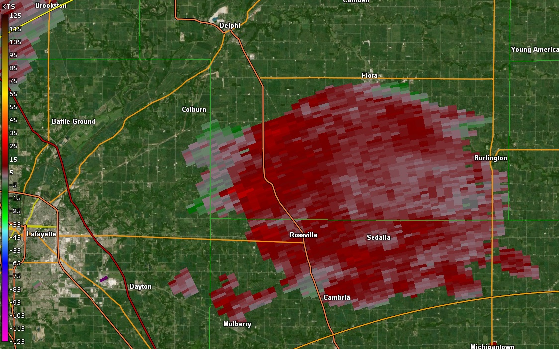
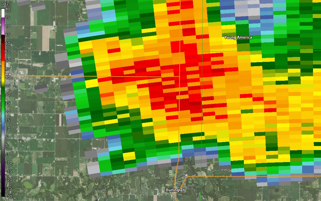
| Radar at 9:07 PM |
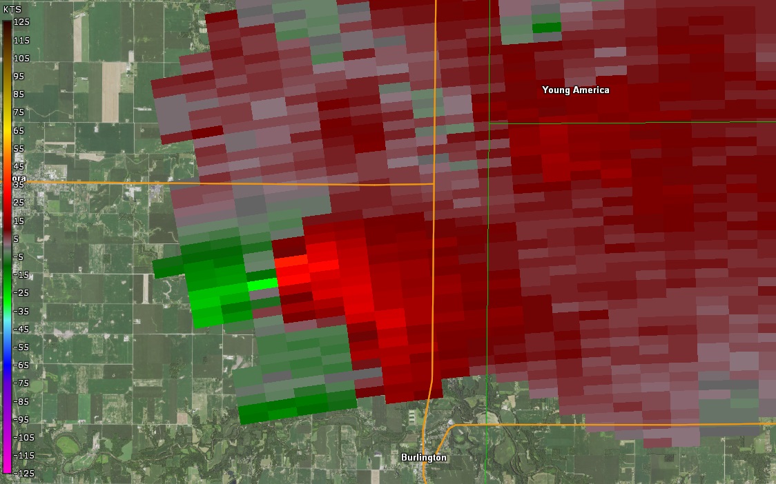
Storm Relative Velocity at 9:07 PM EDT |
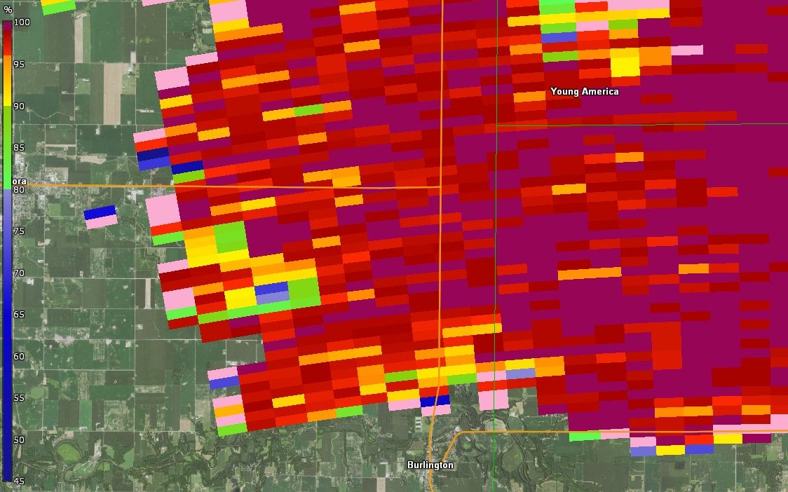
Correlation Coefficient (CC) at 9:07 PM EDT |
|
The Enhanced Fujita (EF) Scale classifies tornadoes into the following categories:
EF0
Weak
65-85 mph |
EF1
Moderate
86-110 mph |
EF2
Significant
111-135 mph |
EF3
Severe
136-165 mph |
EF4
Extreme
166-200 mph |
EF5
Catastrophic
200+ mph |
 |
Radar
Radar Loop from the Event
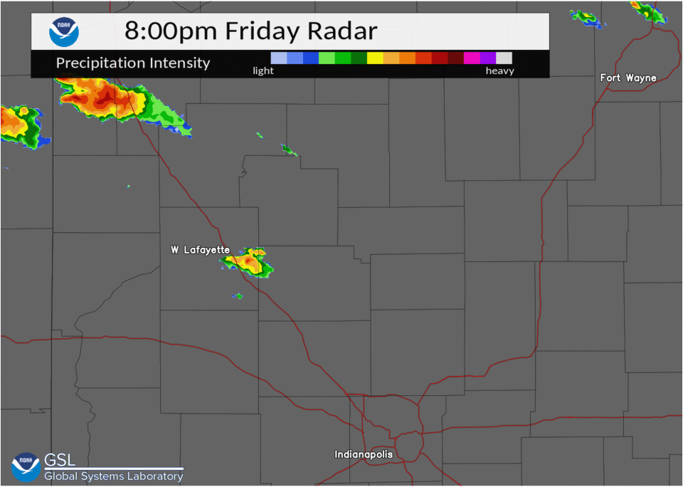
Click to Enlarge