Overview
Thunderstorms developed along a boundary across central Indiana during the evening of July 29. The storms brought 2 tornadoes, gusty winds, and heavy rain. Heavy rain brought flash flooding to parts of southern Shelby County and northern Bartholomew County.Tornadoes
|
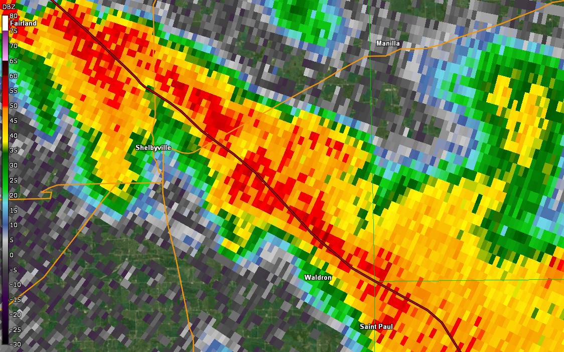
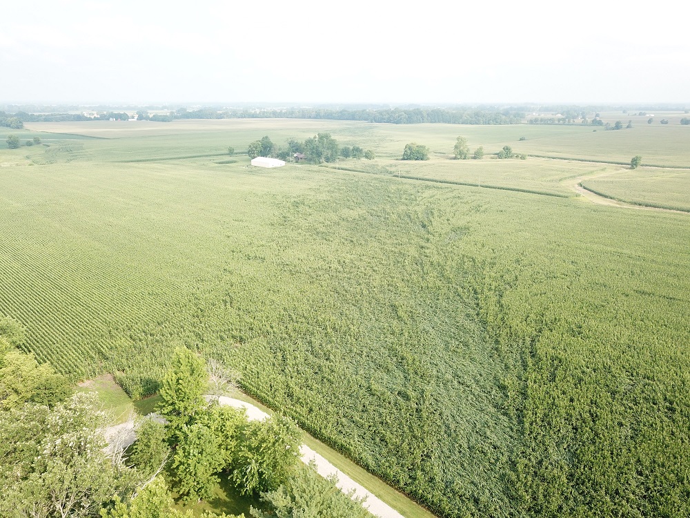
Tornado - SE of Shelbyville
Track Map 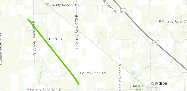 
|
||||||||||||||||
|
||||||||||||||||
|
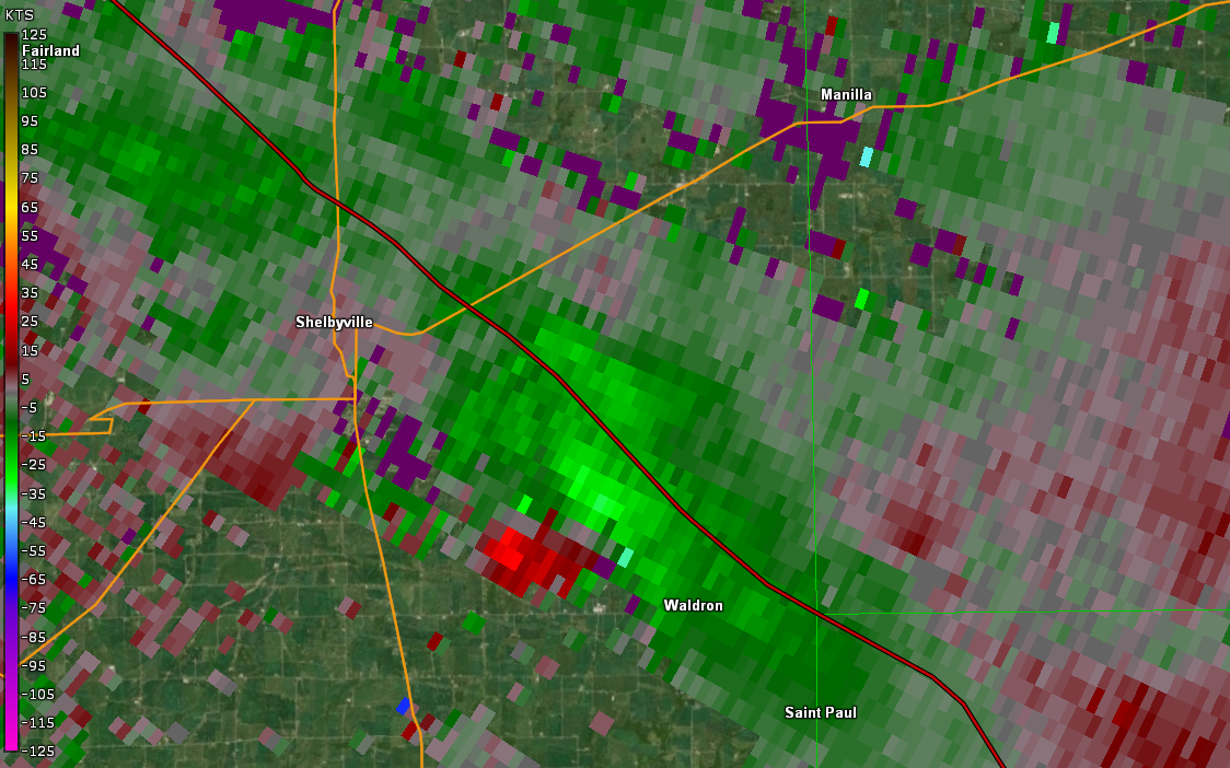
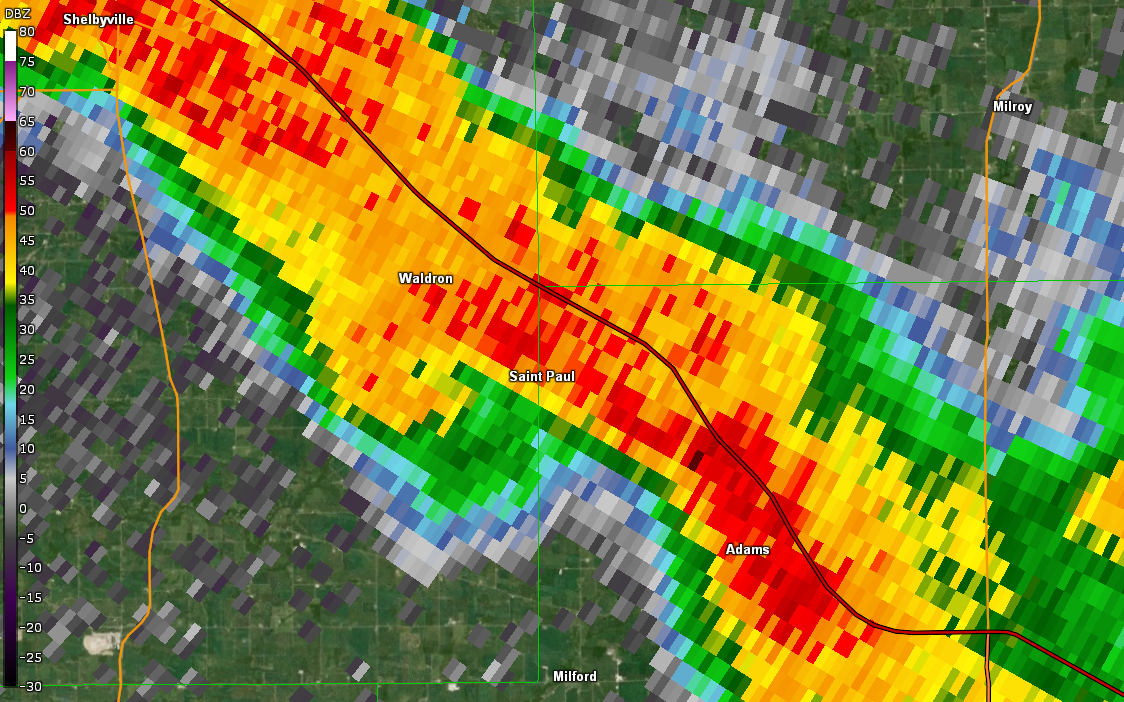
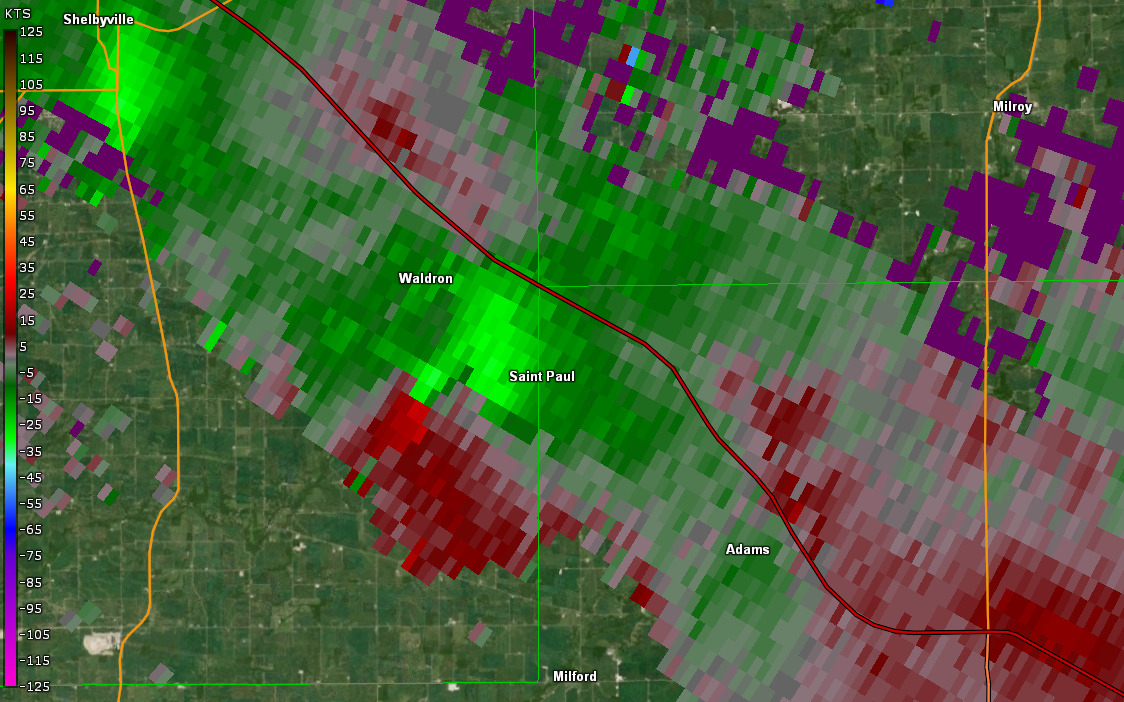
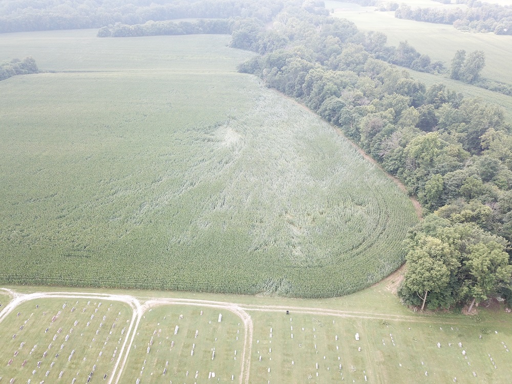
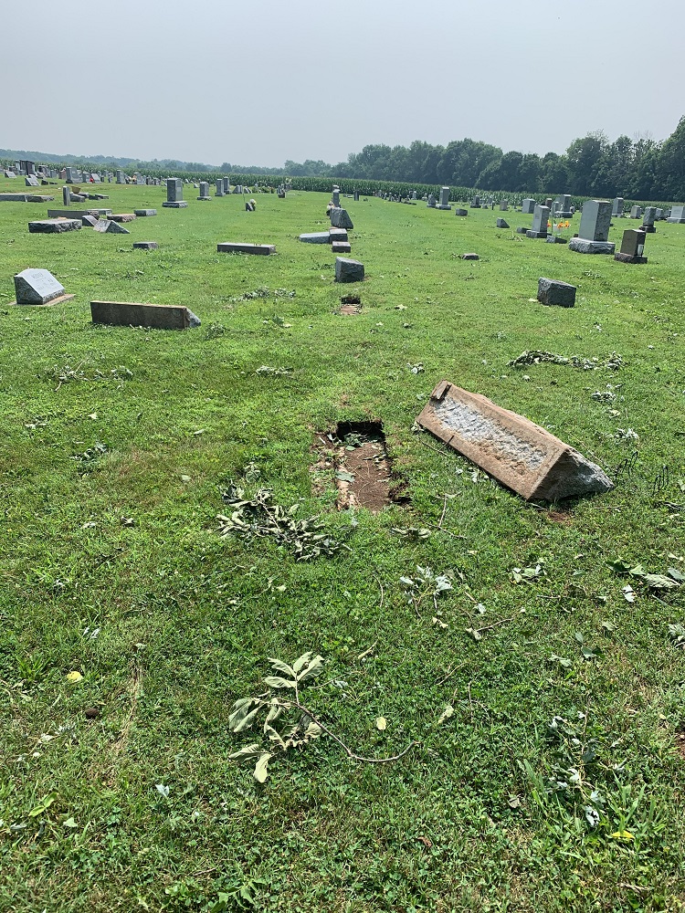
Tornado - 2 South Waldron
Track Map 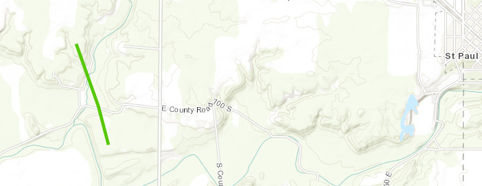
|
||||||||||||||||
|
||||||||||||||||
The Enhanced Fujita (EF) Scale classifies tornadoes into the following categories:
| EF0 Weak 65-85 mph |
EF1 Moderate 86-110 mph |
EF2 Significant 111-135 mph |
EF3 Severe 136-165 mph |
EF4 Extreme 166-200 mph |
EF5 Catastrophic 200+ mph |
 |
|||||
Storm Reports
PRELIMINARY LOCAL STORM REPORT
NATIONAL WEATHER SERVICE INDIANAPOLIS IN

..TIME...   ...EVENT...      ...CITY LOCATION...     ...LAT.LON...
..DATE...   ....MAG....      ..COUNTY LOCATION..ST.. ...SOURCE....
            ..REMARKS..

0758 PM     TORNADO          4 SE SHELBYVILLE        39.48N 85.73W
07/29/2021                   SHELBY             IN   NWS STORM SURVEY

            NWS STORM SURVEY CONFIRMED AN EF-1 TORNADO
            WITH MAX WIND SPEED OF 90 MPH AND A PATH
            LENGTH OF 2.50 MILES. MAX WIDTH WAS 50
            YARDS.


0814 PM     TORNADO          2 S WALDRON             39.42N 85.67W
07/29/2021                   SHELBY             IN   NWS STORM SURVEY

            NWS STORM SURVEY CONFIRMED AN EF1 TORNADO
            WITH MAX WIND SPEED OF 90 MPH AND A PATH
            LENGTH OF 0.71 MILES. THE MAX WIDTH WAS 50
            YARDS.

1000 PM     FLOOD            GENEVA                  39.39N 85.72W
07/29/2021                   SHELBY             IN   LAW ENFORCEMENT

            FLOODED ROADS ARE BEING REPORTED IN NUMEROUS
            LOCATIONS, REQUIRING ROAD SIGNS AND PEOPLE
            TURNING AROUND TO FIND ANOTHER ROUTE. THE
            FOLLOWING LOCATIONS SPECIFICALLY HAVE THESE
            PROBLEMS...1100 S AND 300 E...1000 S AND 275
            E...SR 9 AND SOUTH OF 252. WATER IS ON THE
            ROADWAY BUT NOT PRESENTLY DEEP AT 350 EAST
            SOUTH OF VANDALIA ROAD, AND 252 AND 25 W.

1100 PM     FLASH FLOOD      HOPE                    39.30N 85.77W
07/29/2021                   BARTHOLOMEW        IN   BROADCAST MEDIA

            ROAD FROM HOPE TOWN SQUARE TO THE SHELBY
            COUNTY LINE IS IMPASSABLE/WASHED OUT. AT
            LEASE ONE WATER RESCUE WAS PERFORMED.
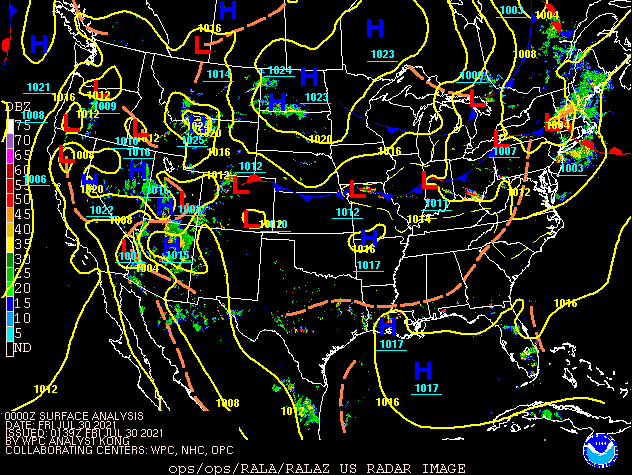
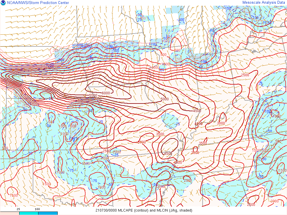
Environment
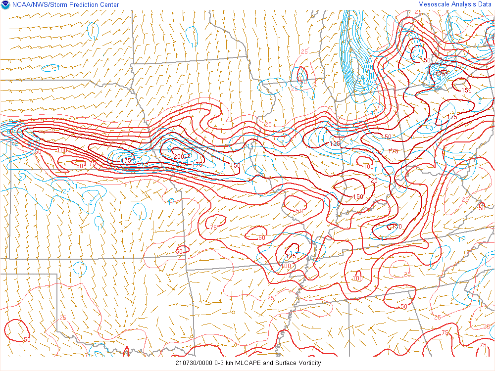
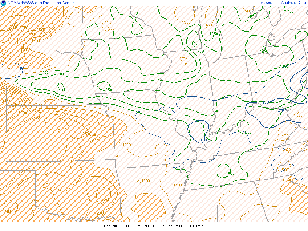
Thunderstorms developed along a surface boundary in an unstable environment with high moisture content. The boundary aided in the tornado development.
 |
 |
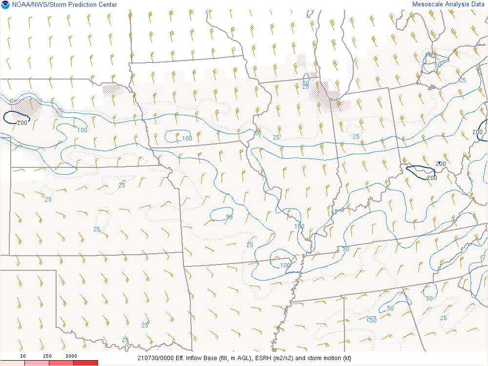 |
| Figure 1: Surface Map at 8:00 PM EDT | Figure 2: Mixed Layer CAPE at 8:00 PM EDT | Figure 3: Effective Storm Relative Helicity at 8:00 PM EDT |
 |
 |
 |
| Figure 4: 0-3km CAPE and Surface Vorticity at 8:00 PM EDT | Figure 5: Lifted Condensation Levels (LCL) at 8:00 PM EDT | Figure 6: Precipitable Water at 8:00 PM EDT |
 |
Media use of NWS Web News Stories is encouraged! Please acknowledge the NWS as the source of any news information accessed from this site. |
|