Overview
A line of thunderstorms moved across parts of central Indiana early on August 13. One of the thunderstorms produced a brief tornado in Sullivan County.Tornadoes
|
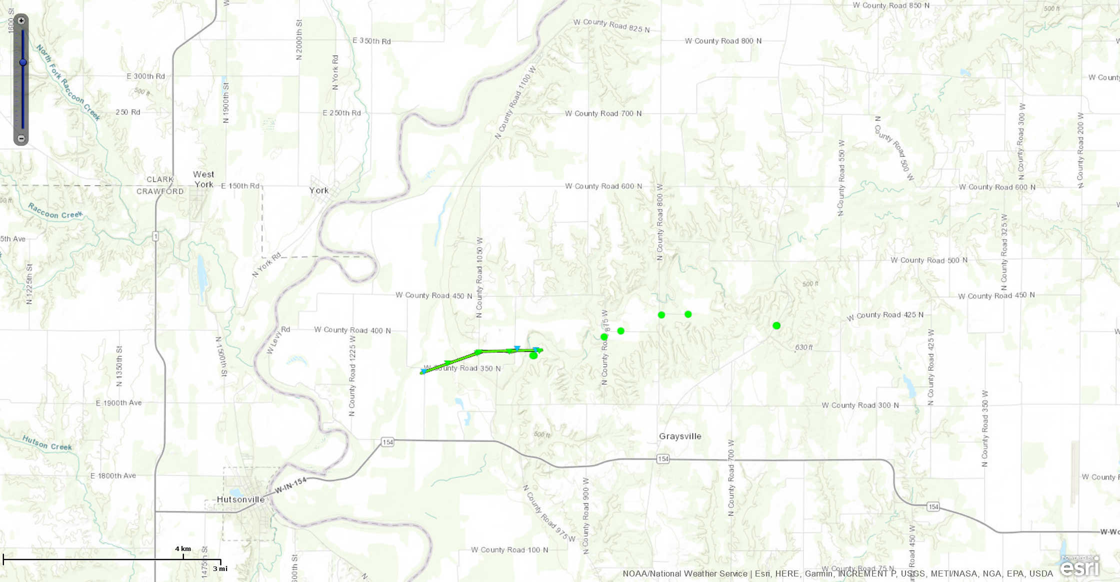
Tornado - 3 WNW Graysville
Track Map  
|
||||||||||||||||
|
||||||||||||||||
The Enhanced Fujita (EF) Scale classifies tornadoes into the following categories:
| EF0 Weak 65-85 mph |
EF1 Moderate 86-110 mph |
EF2 Significant 111-135 mph |
EF3 Severe 136-165 mph |
EF4 Extreme 166-200 mph |
EF5 Catastrophic 200+ mph |
 |
|||||
Storm Reports
PRELIMINARY LOCAL STORM REPORT
NATIONAL WEATHER SERVICE INDIANAPOLIS IN
TUE AUG 13 2019

..TIME...   ...EVENT...      ...CITY LOCATION...     ...LAT.LON...
..DATE...   ....MAG....      ..COUNTY LOCATION..ST.. ...SOURCE....
            ..REMARKS..

0108 AM     TSTM WND DMG     1 S SULLIVAN            39.08N 87.41W
08/13/2019                   SULLIVAN           IN   TRAINED SPOTTER

            SPOTTER REPORTED 3 UTILITY POLES SNAPPED AT
            THE GROUND AND HELD UP BY THE WIRES. RELAYED
            VIA AMATEUR RADIO AND TIME ESTIMATED FROM
            RADAR.

0123 AM     TSTM WND DMG     3 N BICKNELL            38.81N 87.32W
08/13/2019                   KNOX               IN   LAW ENFORCEMENT

            LARGE TREE LIMB DOWN ON FREELANDVILLE ROAD.
            TIME ESTIMATED FROM RADAR.


0129 AM     TSTM WND DMG     4 NW MONROE CITY        38.66N 87.40W
08/13/2019                   KNOX               IN   LAW ENFORCEMENT

            LARGE TREE DOWN ON ROBINSON ROAD BETWEEN
            ANSON ROAD AND MOUNT ZION ROAD. TIME
            ESTIMATED FROM RADAR.
 |
Media use of NWS Web News Stories is encouraged! Please acknowledge the NWS as the source of any news information accessed from this site. |
 |