Overview
A deep trough over the Midwest and a moist, buoyant warm sector lead to a line of strong storms over southern central Indiana. As a squall line organized and enveloped cells downstream, bowing segments lead to damaging winds and broad rotation in a bookend vortex radar signature. This region of broad rotation eventually lead to a brief tornado in Southeastern Decatur county. Straight line wind damage also occurred along the path of the bowing segment with significant damage noted along Lake Monroe where boat docks were damaged.Tornadoes:
|
Tornado - 3 W Millhousen
Track Map 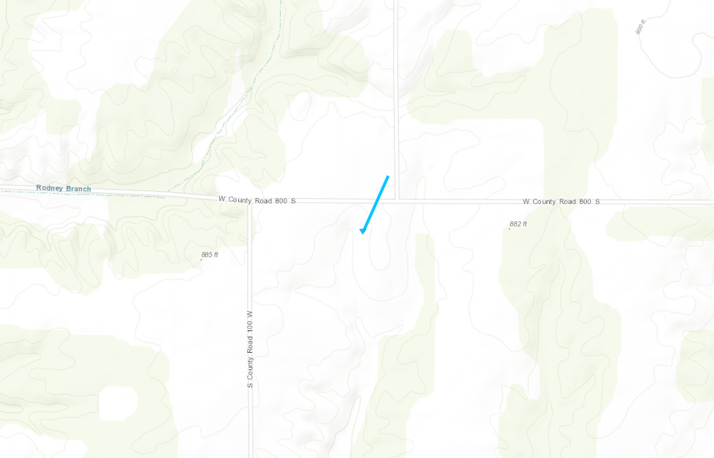 
|
||||||||||||||||
The Enhanced Fujita (EF) Scale classifies tornadoes into the following categories:
| EF0 Weak 65-85 mph |
EF1 Moderate 86-110 mph |
EF2 Significant 111-135 mph |
EF3 Severe 136-165 mph |
EF4 Extreme 166-200 mph |
EF5 Catastrophic 200+ mph |
 |
|||||
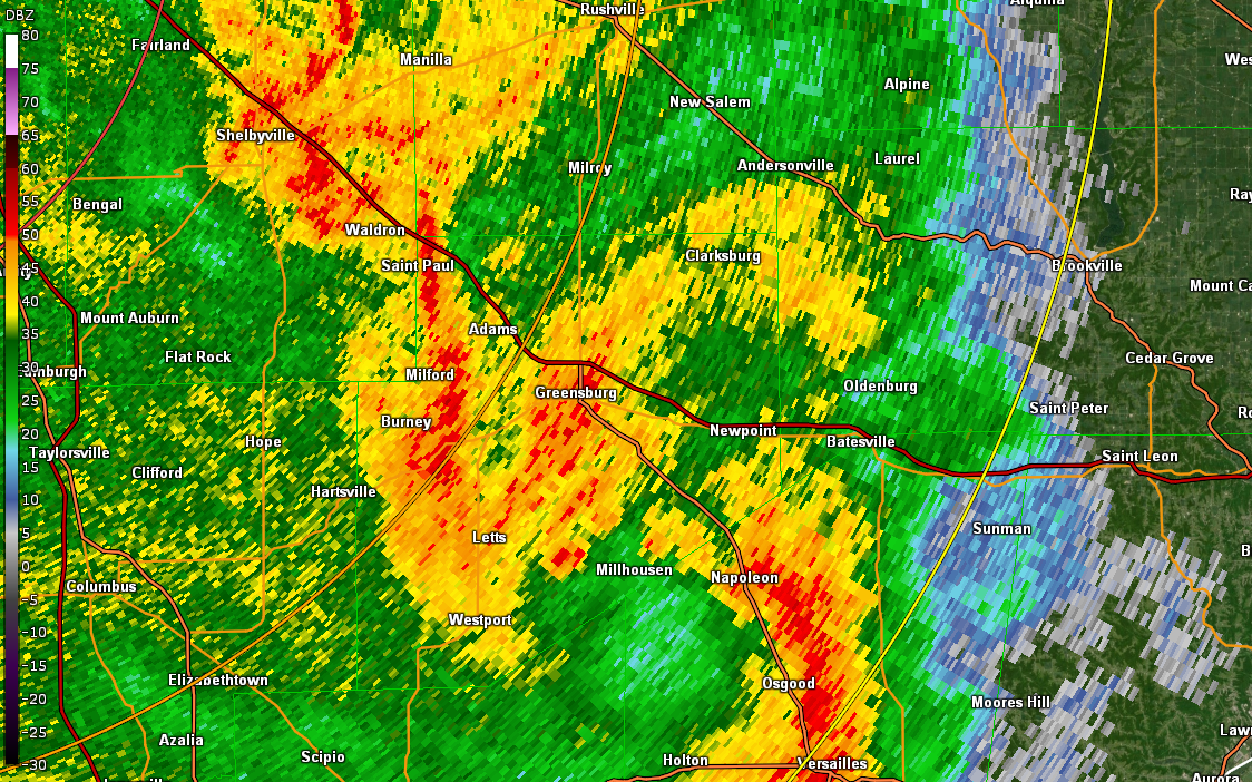
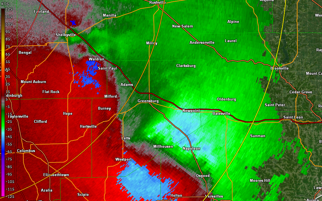
Radar
Radar Images from Tornado
 |
 |
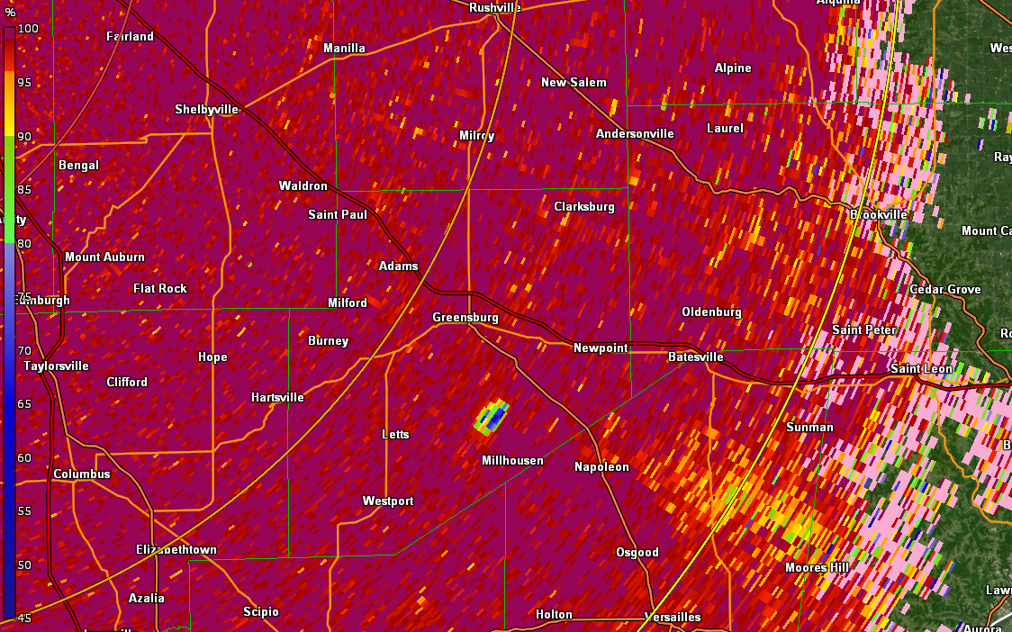 |
| Radar from near 8:26 PM EDT | Storm Relative Velocity near 8:26 PM EDT | CC near 8:30 PM EDT |
Wind:
..TIME...   ...EVENT...      ...CITY LOCATION...     ...LAT.LON...
..DATE...   ....MAG....      ..COUNTY LOCATION..ST.. ...SOURCE....
            ..REMARKS..

0635 PM     TSTM WND DMG     2 SE TERRE HAUTE        39.45N 87.36W
04/13/2022                   VIGO               IN   BROADCAST MEDIA

            LATE REPORT OF LARGE TREE FALLING ONTO TERRE
            HAUTE HUMANE SOCIETY CAUSING SIGNIFICANT
            DAMAGE. NO INJURIES AND 20 DISPLACED DOGS
            WERE ALL UNINJURED. TIME ESTIMATED FROM
            RADAR.
0640 PM     TSTM WND DMG     SHOALS                  38.67N 86.80W
04/13/2022                   MARTIN             IN   911 CALL CENTER

            LATE REPORT OF A FEW TREES DOWNED AROUND
            SHOALS. TIME ESTIMATED BY RADAR.
0712 PM     TSTM WND DMG     2 NE MONROE RESERVOIR   39.08N 86.42W
04/13/2022                   MONROE             IN   PARK/FOREST SRVC

            ESTIMATED 80 MPH STRAIGHT LINE WINDS CAUSED
            MAJOR STRUCTURAL DAMAGE TO THE LARGE WESTERN
            PORTION OF THE BOAT DOCKS AND AWNING NEAR
            THE NORTHEAST PORTION OF THE INDIANA ROUTE
            446 CAUSEWAY. TIME ESTIMATED FROM RADAR.
0712 PM     TSTM WND DMG     1 W BEDFORD             38.86N 86.52W
04/13/2022                   LAWRENCE           IN   911 CALL CENTER

            LATE REPORT OF RURAL KING FACADE DAMAGED.
            ESTIMATED 65 MPH WIND. TIME ESTIMATED BY
            RADAR.
0725 PM     TSTM WND DMG     1 ENE FREETOWN          38.98N 86.13W
04/13/2022                   JACKSON            IN   911 CALL CENTER

            LATE REPORT OF MULTIPLE TREES DOWN ALONG
            INDIANA STATE ROUTE 258 FROM FREETOWN TO
            COURTLAND. SOME TREES FELL INTO POWER LINES.
            TIME ESTIMATED FROM RADAR.
0740 PM     TSTM WND DMG     3 N GNAW BONE           39.24N 86.16W
04/13/2022                   BROWN              IN   EMERGENCY MNGR

            LATE REPORT OF ISOLATED DOWNED TREES ON SALT
            CREEK ROAD AND VALLEY BRANCH ROAD AND
            RAILROAD ROAD. TIME ESTIMATED FROM RADAR.
0755 PM     TSTM WND DMG     1 W COUNTRY SQUIRE LAKE 39.05N 85.69W
04/13/2022                   JENNINGS           IN   911 CALL CENTER

            LATE REPORT OF ESTIMATED 70 MPH WINDS
            PUSHING A MOBILE HOME OFF ITS FOUNDATION AT
            2515 BUCKINGHAM DRIVE. NEARBY TREES FELL
            INTO HOMES AT BOTH 171 COUNTRY SQUIRE
            BOULEVARD AND THE INTERSECTION OF COUNTRY
            MANOR STREET AND FOXMOOR DRIVE. TREES ALSO
            DOWNED FROM HAYDEN TO NORTH OF NORTH VERNON.
            TIME ESTIMATED FROM RADAR.
Environment
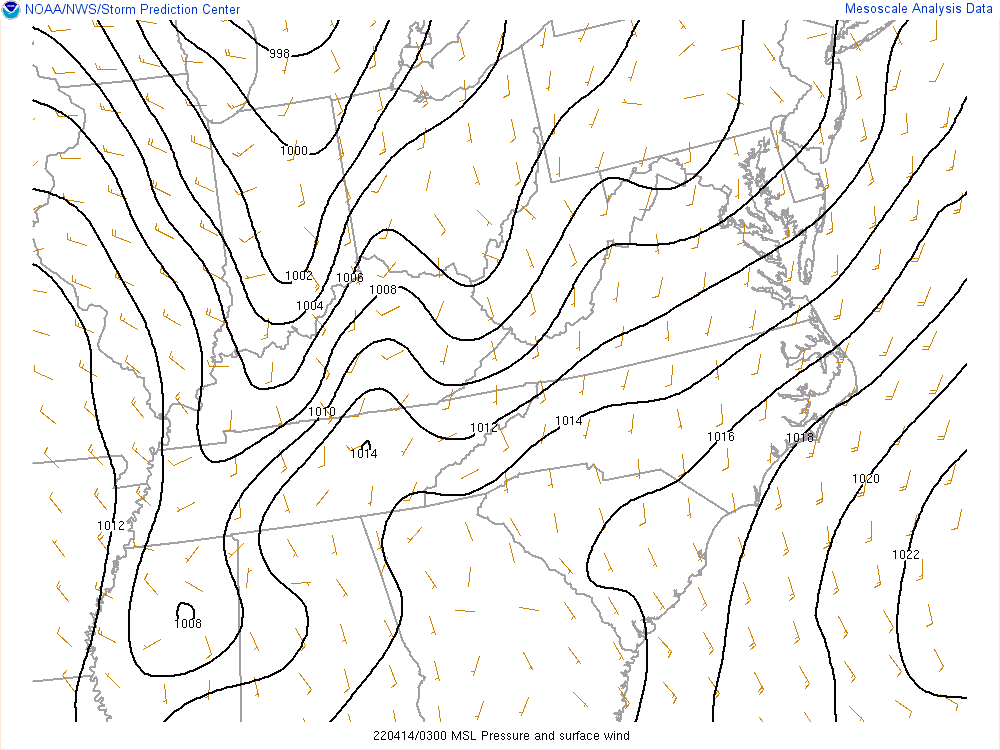
Synoptic summary.
 |
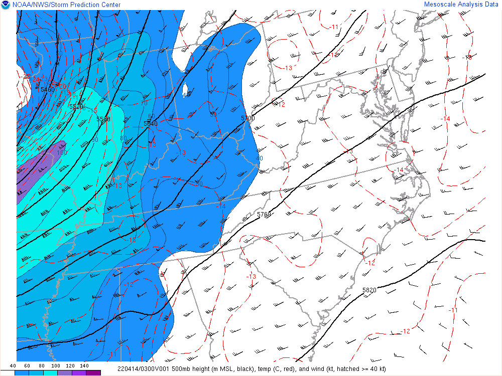 |
| Figure 1: Mean Sea Level Pressure Analysis | Figure 2: 500mb Analysis |
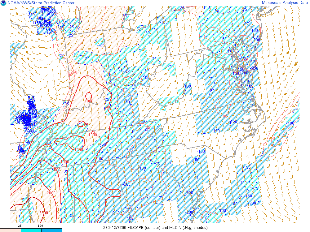
Near-storm environment summary.
 |
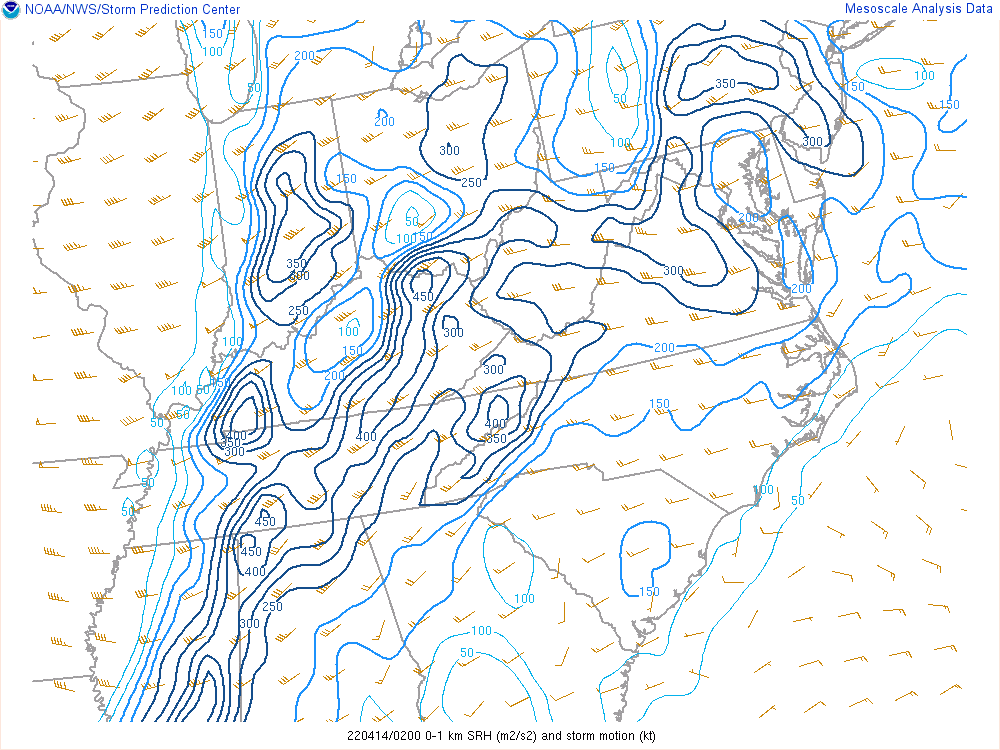 |
| Figure 3: Mixed Layer CAPE | Figure 4: 0-1km Storm Relative Helicity |
 |
Media use of NWS Web News Stories is encouraged! Please acknowledge the NWS as the source of any news information accessed from this site. |
|

