
Catastrophic Super Typhoon Bavi's eyewall has reached Rota and is expected to bring dangerous winds, heavy rainfall and storm surge to Guam, Rota, Tinian and Saipan. A Typhoon Warning remains in effect. Heavy to excessive rainfall will continue to bring a flooding threat from coastal Mid-Atlantic to southern New England through Monday. Read More >
HEADLINE
The first significant taste of summer is on tap for next week...as heat index values exceed 100 degrees for the first time this year.
DISCUSSION
A series of short-wave troughs currently over the Northern Rockies/Northern Plains will track eastward and temporarily flatten the prevailing upper ridge across the Ohio River Valley over the next couple of days. This will push a weak cold front southward into the region, with most models suggesting it will become stationary across northern Illinois on Friday, June 5th into Saturday, June 6th. The airmass will initially be quite dry: however, as increasing moisture flowing northward from the Gulf interacts with the slowly approaching boundary, scattered showers and thunderstorms will be possible both days. The greatest probability for rainfall will focus along and north of the I-72 corridor where a few of the thunderstorm cells may be capable of gusty winds and small hail late Friday.
The weak front will gradually dissipate and/or lift back northward late in the weekend. At the same time, a cut-off upper low currently over northwest Mexico will get shunted northeastward in response to a deep trough digging west of the Rockies. As the low pivots into the Midwest, it will have much deeper moisture to work with and will produce widespread showers and thunderstorms late Sunday through Tuesday. While predicting exact rain totals with convection is quite difficult, it appears most locations will pick up between 0.25 and 0.75 of much-needed rainfall. Higher amounts will be likely in a few spots where stronger storms are able to develop.
As the western CONUS trough deepens, it will help create a strengthening downstream ridge of high pressure over the Plains and Midwest by the middle of next week. As a result, rain chances will go DOWN and temperatures will go UP. As temperatures climb into the 90s and dewpoints reach the lower 70s thanks to the early week rainfall, heat index values will likely exceed 100 degrees across at least parts of central Illinois beginning Tuesday, June 9th and lingering through the end of the week.
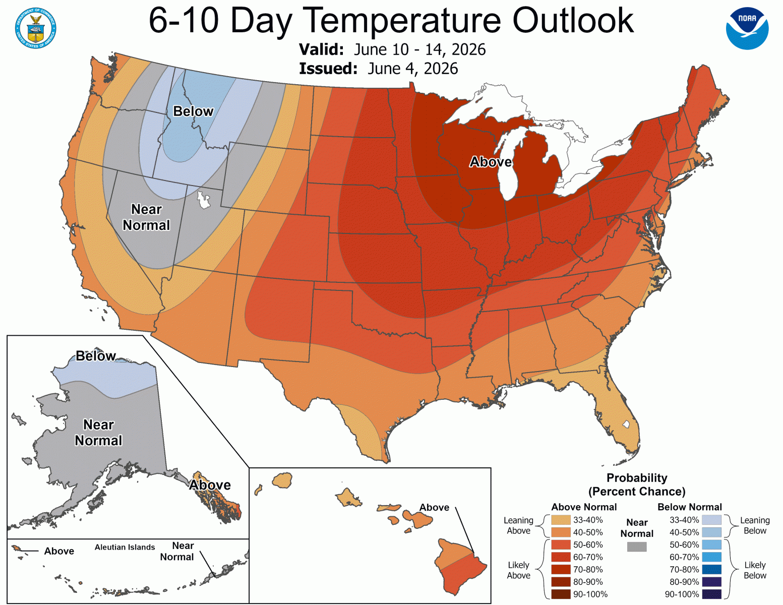
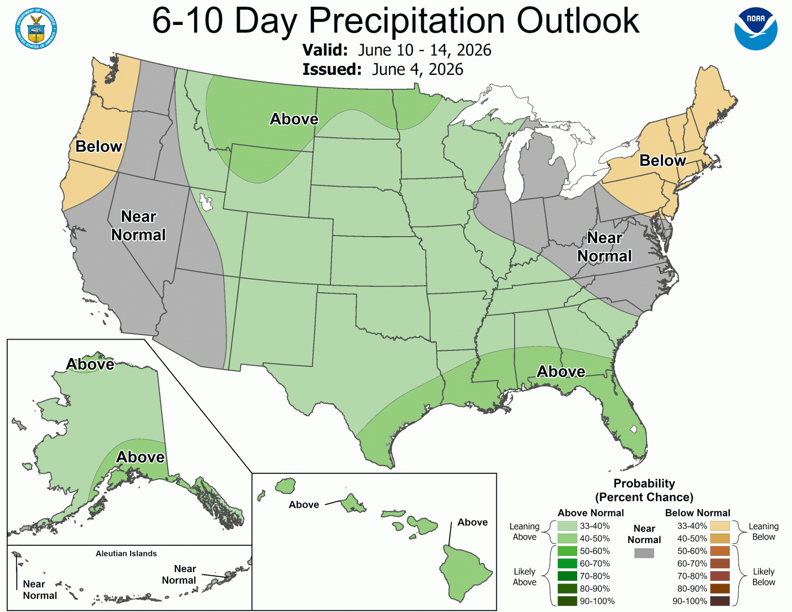
The latest 6-10 day outlooks (June 10-14) from the Climate Prediction Center (CPC) suggest ABOVE normal temperatures and NEAR normal precipitation across central Illinois.
Issued: 6/4/26

