Central Illinois
Weather Forecast Office
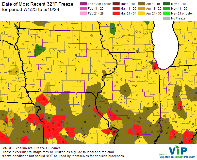
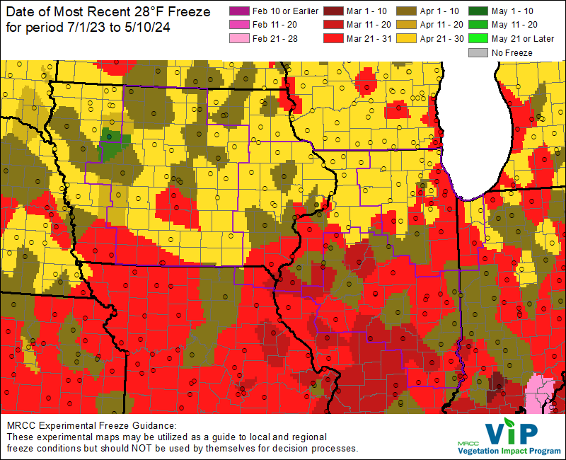
While unseasonably mild weather spurred early growth around the region, it is important to remember that freezing temperatures typically occur well into April over central and southeast Illinois. Much of the area will usually see the last freeze around mid April, with hard freezes (lows of 28°F or colder) still possible through the first several days of the month.
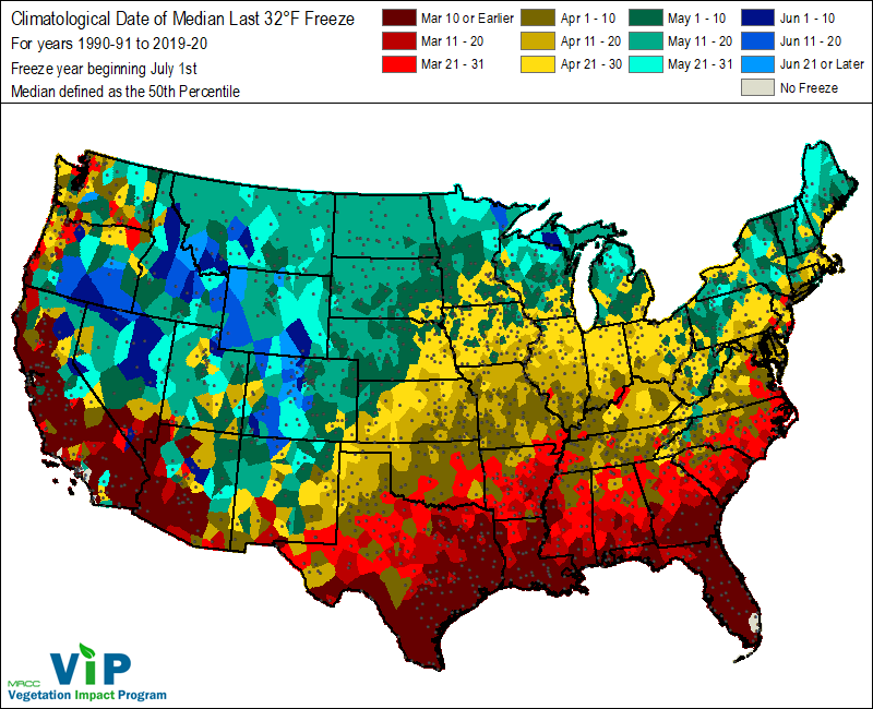
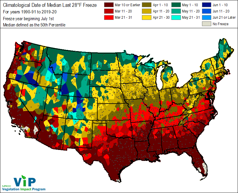
The following graphics are courtesy of the Midwestern Regional Climate Center. An interactive map is also available at https://mrcc.purdue.edu/freeze/freezedatetool .
US Dept of Commerce
National Oceanic and Atmospheric Administration
National Weather Service
Central Illinois
1362 State Route 10
Lincoln, IL 62656
217-732-7321 (forecast recording) or 217-732-3089
Comments? Questions? Please Contact Us.

