|
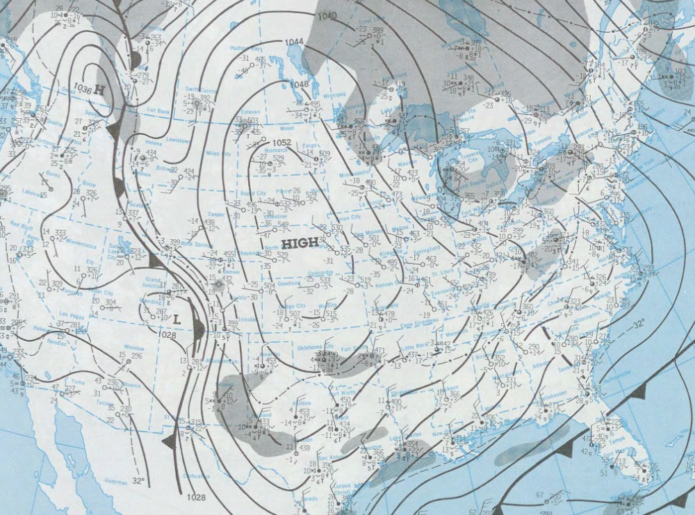
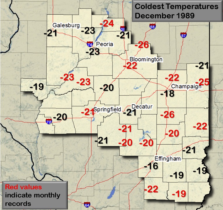
December of 1989 featured several surges of Arctic air into the central and eastern United States beginning around mid month and lasting until Christmas. This Arctic outbreak was a historic event, with many locations establishing monthly or all-time record lows. Sub-freezing temperatures extended across much of the southeast U.S. with considerable damage to citrus crops in Florida and south Texas (newspaper reports indicated "nearly total destruction" of the citrus industry across the north half of Florida). Dallas had $25 million damage caused by broken water pipes that froze in the cold, along with subsequent production losses due to failures at manufacturing plants. Many other locations across the southeast U.S. had damage from frozen pipes as well. The cold weather resulted in snow and sleet falling as far south as central Florida just before Christmas, and parts of northern Florida had its first White Christmas on record. As an area of low pressure moved northeast across Florida, the cold weather resulted in the largest snowstorm in history on the southeast U.S. coast, with totals in excess of a foot along the Atlantic coast of North and South Carolina. Some of the coldest weather occurred from the 21st through the 23rd. The image at right shows the surface map from the morning of the 22nd. A massive high pressure area (central pressure of 1055 millibars or 31.15 inches) had settled into the central Plains, where temperatures in Nebraska were as low as -42F at Scottsbluff and -39F at Valentine. (Note that a massive warmup followed in the Nebraska panhandle, with highs the next day in the lower 40s!) By the next morning, temperatures were in the single digits as far south as Houston. Freezing temperatures occurred as far south as Miami on Christmas Eve and Christmas Day (even Key West, Florida, tied its December record low of 44 degrees). Across central Illinois, most areas saw temperatures bottom out colder than 20 below zero on the 22nd and 23rd (see map below). Wind chills in parts of the state ranged from 50 to 60 below zero (near 40 below zero using the current wind chill scale). |
 |
 |
Monthly Record Lows Set:
Miscellaneous Records:
|