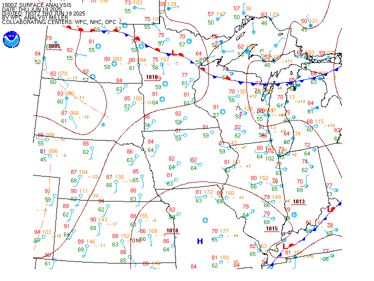
| Midwest Surface Map |
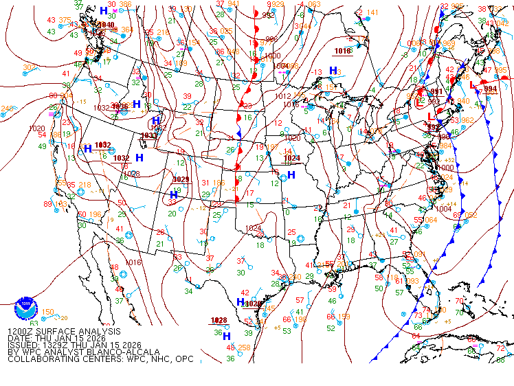
National Surface Map |
 |
 |
Click on Surface Map to enlarge.
For an explanation on decoding this map, click here
High-resolution surface maps are also available.
Maps are courtesy of the Weather Prediction Center
Central Illinois Mesonet Observation Map
Current Hourly Weather Conditions
Illinois State Weather Roundup
Lincoln, IL (ILX) Upper Air Sounding
Upper Air Soundings across the U.S.
Site-Specific Observations:
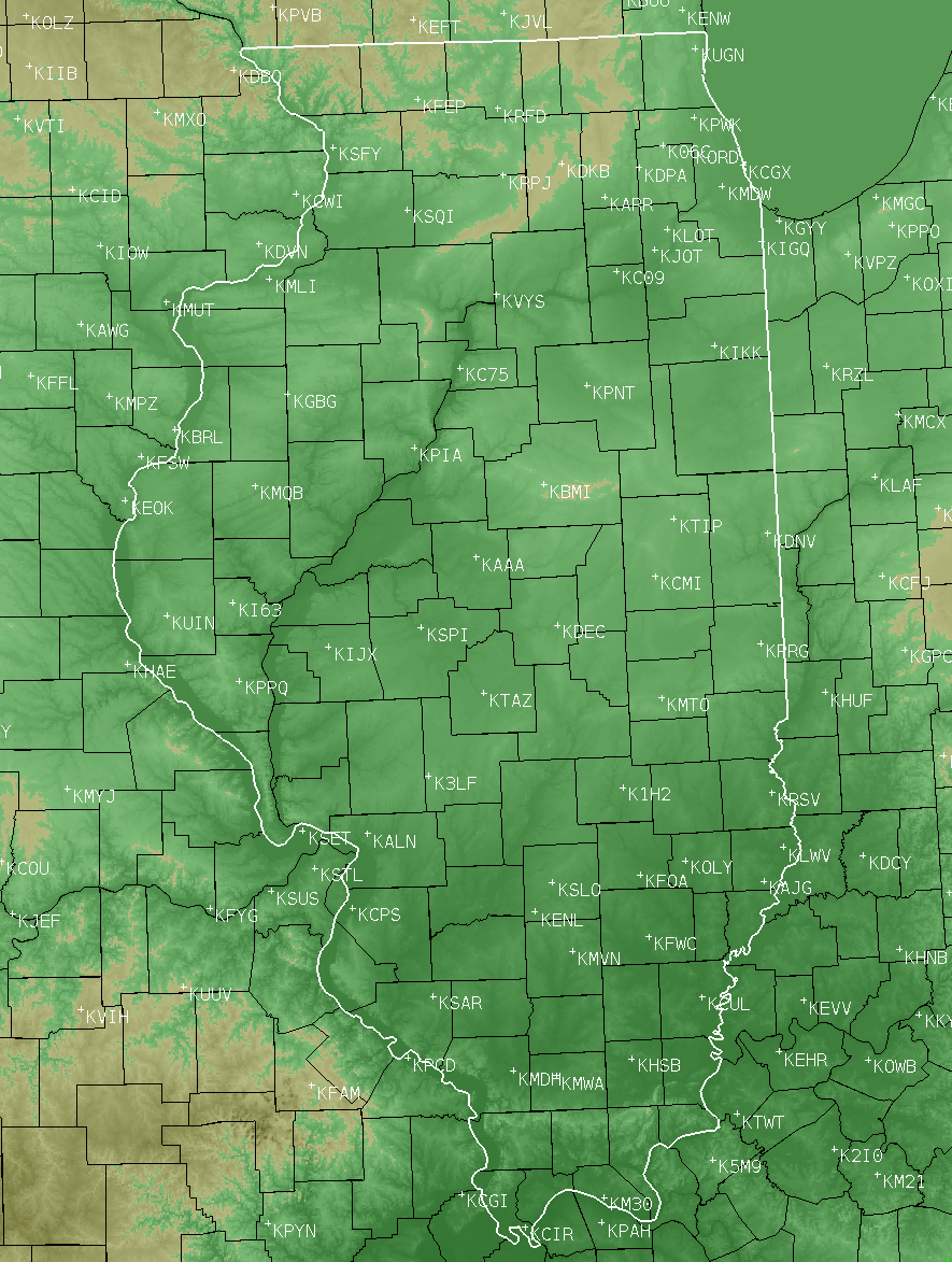
The following airport observations are in decoded format. Select the station identifier below the map. If you need to have the encoded observations, click on "Raw Observations" after selecting the airport link below.

- K06C -- Schaumburg Regional Airport
- K1H2 -- Effingham, Effingham County Regional Airport
- K3LF -- Litchfield Municipal Airport
- KAAA -- Lincoln, Logan County Airport
- KAJG -- St. Francisville, Mt. Carmel Municipal Airport
- KALN -- Alton, St. Louis Regional Airport
- KARR -- Chicago-Aurora Municipal Airport
- KBMI -- Central Illinois Regional Airport at Bloomington-Normal
- KBLV -- Belleville, Scott AFB (MidAmerica St. Louis Airport)
- KC09 -- Morris Municipal Airport
- KC75 -- Lacon, Marshall County Airport
- KCIR -- Cairo Regional Airport
- KCMI -- Champaign-Urbana, University of Illinois- Willard Airport
- KCPS -- Cahokia, St. Louis Downtown Airport
- KCUL -- Carmi Municipal Airport
- KDEC -- Decatur Airport
- KDKB -- De Kalb, Taylor Municipal Airport
- KDNV -- Danville, Vermilion Regional Airport
- KDPA -- West Chicago, DuPage Airport
- KENL -- Centralia Municipal Airport
|
- KFEP -- Freeport, Albertus Airport
- KFOA -- Flora Municipal Airport
- KFWC -- Fairfield Municipal Airport
- KGBG -- Galesburg Municipal Airport
- KHSB -- Harrisburg-Raleigh Airport
- KI63 -- Mount Sterling Municipal Airport
- KIGQ -- Lansing Municipal Airport
- KIJX -- Jacksonville Municipal Airport
- KIKK -- Greater Kankakee Airport
- KJOT -- Joliet Regional Airport
- KLOT -- Romeoville, Lewis University Airport
- KLWV -- Lawrenceville-Vincennes Int'l Airport
- KM30 -- Metropolis Municipal Airport
- KMDH -- Carbondale/Murphysboro, Southern Illinois Airport
- KMDW -- Chicago, Midway Int'l Airport
- KMLI -- Moline, Quad City Int'l Airport
- KMQB -- Macomb Municipal Airport
- KMTO -- Mattoon, Coles County Municipal Airport
- KMVN -- Mount Vernon Airport
- KMWA -- Marion, Veterans Airport of Southern Illinois
-
|
- KOLY -- Olney-Noble Airport
- KORD -- Chicago, O'Hare Int'l Airport
- KPIA -- General Downing - Peoria Int'l Airport
- KPNT -- Pontiac Municipal Airport
- KPPQ -- Pittsfield, Penstone Municipal Airport
- KPRG -- Paris, Edgar County Airport
- KPWK -- Wheeling, Chicago Executive Airport
- KRFD -- Chicago/Rockford Int'l Airport
- KRPJ -- Rochelle Municipal Airport
- KRSV -- Robinson, Crawford County Airport
- KSAR -- Sparta Community Airport
- KSFY -- Savanna, Tri-Township Airport
- KSLO -- Salem-Leckrone Airport
- KSPI -- Springfield, Abraham Lincoln Capital Airport
- KSQI -- Sterling/Rock Falls, Whiteside County Airport
- KTAZ -- Taylorville Municipal Airport
- KTIP -- Rantoul National Aviation Center
- KUGN -- Waukegan National Airport
- KUIN -- Quincy Regional Airport
- KVYS -- Peru, Illinois Valley Regional Airport
|
Some caveats about this data:
-
This data has not been quality controlled, and should be considered preliminary. CERTIFIED climate data is available from the National Centers for Environmental Information or from the Midwestern Regional Climate Center.
-
Lack of data for a period of time may be the result of a communications failure, and the observations may still be available from one of the centers above.
-
Weather described as "fair" means that no clouds were observed below 12,000 feet. This is a limitation of most automated stations, which make up nearly all observations in the list.
-
Sky conditions give the general state of the sky, and the height of each cloud layer. Heights are given in hundreds of feet (e.g. 120 is 12,000 ft; 012 is 1,200 ft., 001 is 100 ft.). State of the sky is divided into SKC (sky clear), CLR (clear below 12,000 ft), FEW (2/8 or less cloud cover up to that height), SCT (3/8 through 4/8 of cloud cover up to that height), BKN (5/8 through 7/8 of cloud cover up to that height), OVC (sky cloudy), and VV (vertical visibility -- clouds obscured by precipitation or obstructions to vision).
-
Weather "in the vicinity" indicates within 5 to 10 miles of the station.


