Central Illinois
Weather Forecast Office
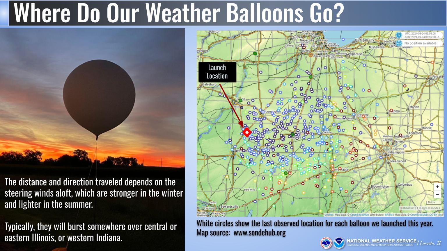
We recently made a social media post on Tuesday about our morning weather balloon, and there were a couple inquiries about where they go.
Using a website called SondeHub (www.sondehub.org), which tracks the type of instrument packages we use via local receivers, we plotted the last known location for each of our weather balloons this year. In this image, the cooler shades (blues) show locations closer to the ground, while the warm (red/orange) shades are fairly high up and show more uncertainty. Why? The balloons typically pop at a height over 100,000 feet, and the instrument package (which is quite light) does not drop straight down and remains subject to the winds aloft.
The distance traveled will depend on the steering winds aloft, which tend to be stronger in the winter and lighter in the summer. However, typically they will land in either central or eastern Illinois, or western Indiana. The farthest one this year appears to have traveled to the northeast corner of Indiana north of Fort Wayne.
US Dept of Commerce
National Oceanic and Atmospheric Administration
National Weather Service
Central Illinois
1362 State Route 10
Lincoln, IL 62656
217-732-7321 (forecast recording) or 217-732-3089
Comments? Questions? Please Contact Us.

