Central Illinois
Weather Forecast Office
* Illinois State Record Low -36 at Congerville, 1/5/1999
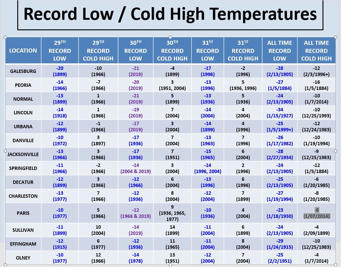
New Record Lows Set in Central Illinois...
Record Lows set on Jan 30th...
Peoria... -20 in 2019 (old record -12 in 1966)
Lincoln... -19 in 2019 (old record (-12 in 1936)
Springfield... -14 Tied Record Low in 2004 & 2019
Urbana... -17 in 2019 (old record -13 in 1936)
Normal... -21 in 2019 (old record -15 in 1966)
Galesburg... -21 in 2019 (old record -13 in 1966)
Sullivan... -14 in 2019 (old record -13 in 2004)
Paris... -12 Tied Record Low in 1966 & 2019
Altona low temperature of -32 on Jan 30, 2019
Bloomington IL airport had a wind chill of -53 at 6 am on Jan 30, 2019
US Dept of Commerce
National Oceanic and Atmospheric Administration
National Weather Service
Central Illinois
1362 State Route 10
Lincoln, IL 62656
217-732-7321 (forecast recording) or 217-732-3089
Comments? Questions? Please Contact Us.

