National Weather Service United States Department of Commerce

Nor'Easter Continues to Bring Heavy Rain and Coastal Impacts; Nolo Continues to Impact Hawaii

The nor’easter will weaken tonight, easing beach conditions and coastal flooding, though locally heavy rain will continue in parts of the Mid-Atlantic and New England into Monday. Hurricane Nolo continues to bring strong winds and large waves to Hawaii. A multi-day rain event will return to the Four Corners region Monday and expand to the south-central U.S. by midweek. Read More >

July Precipitation Highlights:
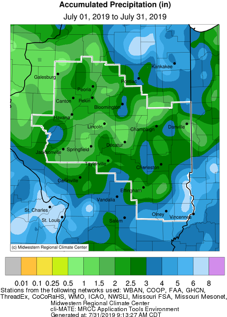
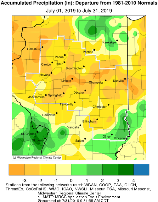
  • As is typical during mid-summer, rainfall was hit and miss over much of the area.  Well below normal rainfall was reported over most of central Illinois, where some locations were 2-3" below normal.  Springfield recorded only 0.52" of rain, which set their 5th driest July (since 1879).  The lack of widespread rainfall resulted in "abnormally dry" conditions developing over much of the area by late month, according to the U.S. Drought Monitor.  More frequent rainfall over far southeast Illinois produced above normal totals, southeast of a Flora to Casey line.


July Temperature Highlights:

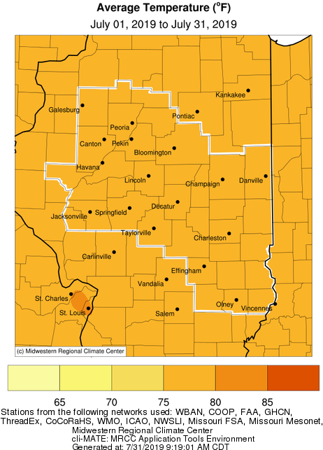
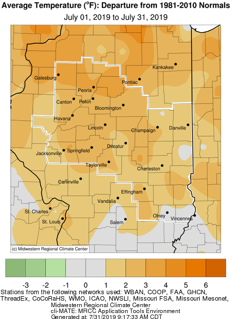
  • Temperatures were well above normal across the area in July.  Monthly averages of 2 to 3 degrees above normal were common.  A stretch of hot and humid weather from the 18th-20th saw highs reach the mid 90s, with dew points in the mid 70s to around 80 degrees.  This produced peak heat indices of 110-115 degrees.  Record warm lows in the upper 70s were set over parts of central Illinois on the 19th.


July Climate Statistics:
 

City

Precipitation
 

Departure from Normal Average Temperature
 
Departure from Normal

Charleston

3.59" -0.88" 78.7 +2.5
Danville

1.28"

-3.39" 77.0 +1.9

Decatur

1.12" -2.86" 77.7 +1.2
Effingham 2.39" -2.04" 78.8 +2.4

Flora

5.01" +1.01" 80.0 +2.9

Galesburg

1.25" -2.99" 77.9 +3.3

Havana

1.46" -2.45" N/A N/A

Jacksonville

2.50" -1.36" 78.1 +1.0

Lincoln

1.22" -3.84" 76.7 +1.7

Normal

3.80"

-0.36" 77.0 +2.6

Olney

5.08" +0.75" 77.7 +1.3

Paris

2.30" -2.13" 76.1 +0.6

Peoria

1.91" -1.94" 78.4 +2.9
Springfield

0.52"

-3.42" 78.2 +2.4
Taylorville 2.89" -0.84" N/A N/A

Tuscola

2.59" -2.17" 77.3 +1.8

Urbana

3.38" -1.32" 77.3 +2.4


The following links are the monthly climate summaries for area cities. Only the summaries for Peoria, Springfield, and Lincoln are considered "official", meaning they are the station of record for their respective locations. The other summaries are "supplemental", meaning another location in the area is the official climate station for the city.

  • Peoria -- Peoria International Airport
  • Springfield -- Abraham Lincoln Capital Airport
  • Lincoln -- National Weather Service Office
  • Champaign -- University of Illinois-Willard Airport
  • Decatur -- Decatur Airport
  • Lawrenceville -- Lawrenceville-Vincennes International Airport
  • Mattoon -- Coles County Memorial Airport

Climate data for other cities is available at http://w2.weather.gov/climate/xmacis.php?wfo=ilx