Overview
|
On February 28th, there were 16 tornadoes reported across Illinois. Several tornadoes north of I-72 were the farthest north occurring tornadoes in February on record for the state. In southern Illinois, 4 tornadoes were reported, two of which were strong, long-track tornadoes. This particular web page will focus on the reports in central Illinois. Tornado reports from other parts of the state are available at the following links:
|
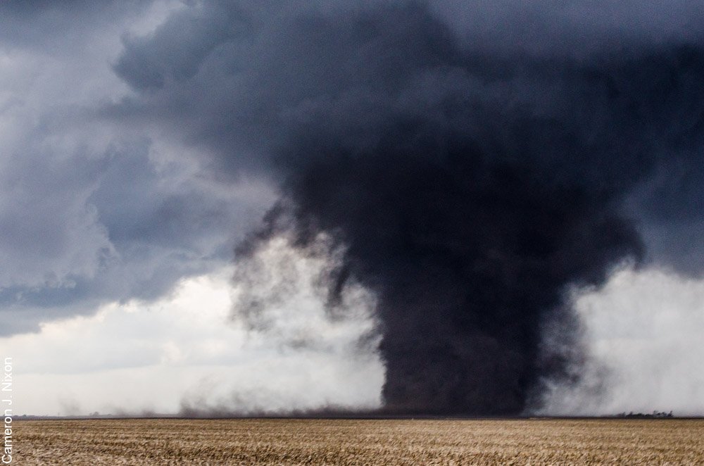 Washburn tornado photo by Cameron Nixon |
Tornadoes:
|
Castleton Tornado
|
||||||||||||||||
|
Dunlap Tornado
Track Map 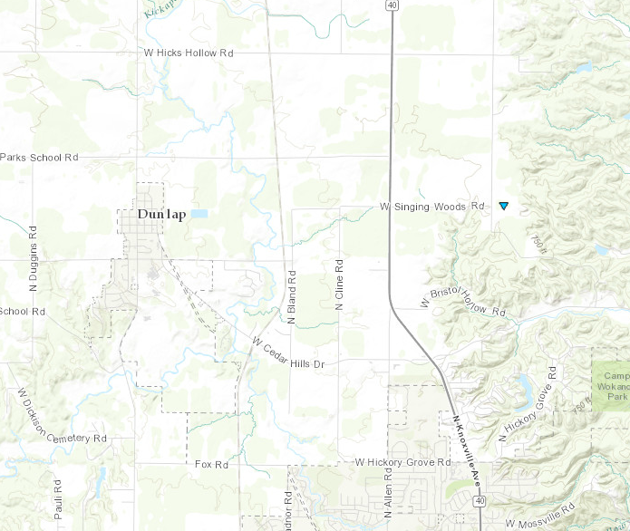 
|
||||||||||||||||
|
Rome Tornado
|
||||||||||||||||
|
Washburn-Rutland Tornado
|
||||||||||||||||
The Enhanced Fujita (EF) Scale classifies tornadoes into the following categories:
| EF0 Weak 65-85 mph |
EF1 Moderate 86-110 mph |
EF2 Significant 111-135 mph |
EF3 Severe 136-165 mph |
EF4 Extreme 166-200 mph |
EF5 Catastrophic 200+ mph |
 |
|||||
Warning Log
The Storm Prediction Center issued Tornado Watch #42 for much of northern and central Illinois at 3 pm, a little over 2 hours before the Washburn tornado.
Warnings issued by the Lincoln NWS office. "Lead time" indicates the number of minutes between the warning issuance, and the first severe weather report for the area.
| Warning Type | Counties | Valid Time | Notes |
|---|---|---|---|
| Severe Thunderstorm | Northern Stark | 3:35 pm - 4 pm | No severe reports |
| Severe Thunderstorm | Northern Knox | 3:50 pm - 4:16 pm | Lead time: 20 minutes |
| Severe Thunderstorm | Southern Knox | 4:11 pm - 4:47 pm | No severe reports |
| Severe Thunderstorm | Morgan, southeast Scott | 4:33 pm - 5:02 pm | Lead time: 7 minutes |
| Severe Thunderstorm | Southern Stark, northern Peoria, western Marshall | 4:44 pm - 5:35 pm | Lead time: 14 minutes |
| Tornado | Northwest Woodford, northeast Peoria, southwest Marshall | 5:05 pm - 5:30 pm | Lead time: 21 minutes |
| Tornado | Northeast Woodford, southeast Marshall | 5:28 pm - 6 pm | Extension of previous warning |
| Severe Thunderstorm | Southeast Marshall | 5:32 pm - 6 pm | No severe reports |
| Tornado | Central Christian | 5:36 pm - 6 pm | Wall cloud, but no severe reports |
| Severe Thunderstorm | Shelby | 6:27 pm - 6:55 pm | Lead time: 18 minutes |
| Severe Thunderstorm | Northwest Coles, southwest Douglas, southeast Moultrie | 6:54 pm - 7:04 pm | No severe reports |
| Severe Thunderstorm | Richland, Jasper, Clay | 7:38 pm - 8:45 pm | Lead time: 23 minutes |
| Tornado | Southeast Clay, Richland | 8:34 pm - 9:15 pm | No severe reports |
| Tornado | East central Richland, southeast Crawford, northern Lawrence | 9:04 pm - 9:45 pm | No severe reports |
| Tornado | Central Cass, south central Schuyler | 9:29 pm - 9:52 pm | Quarter size hail 16 minutes after issuance, but no tornado |
| Severe Thunderstorm | McLean | 10:44 pm - 11:30 pm | Lead time: 9 minutes |
Photos & Video:
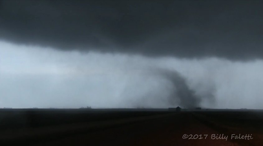
Storm Photos
 |
 |
 |
|
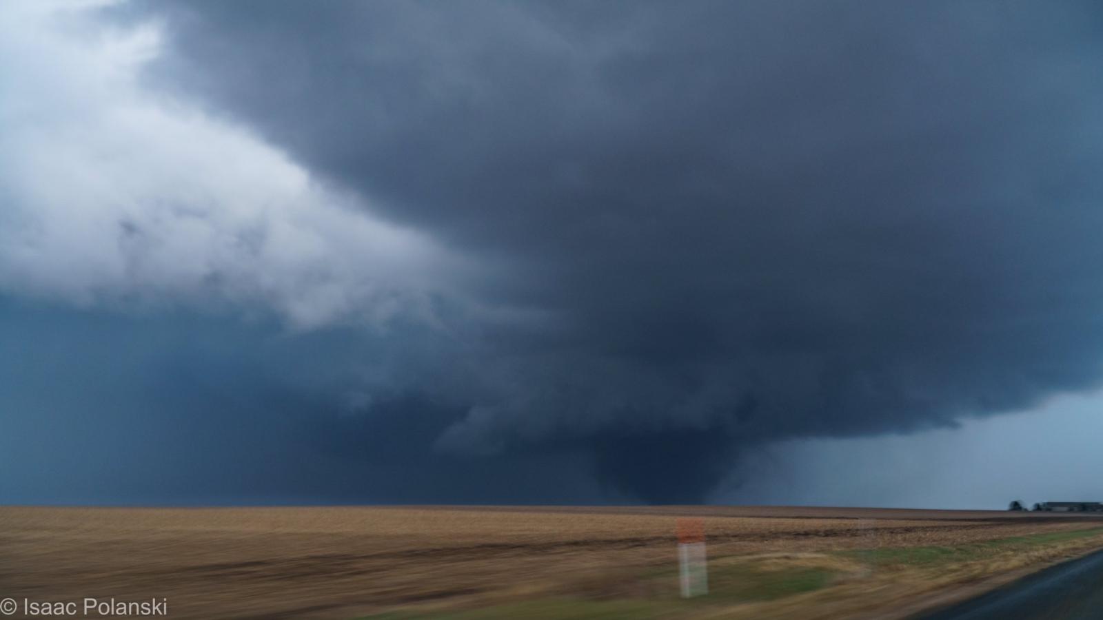
| Near Washburn (Isaac Polanski) |
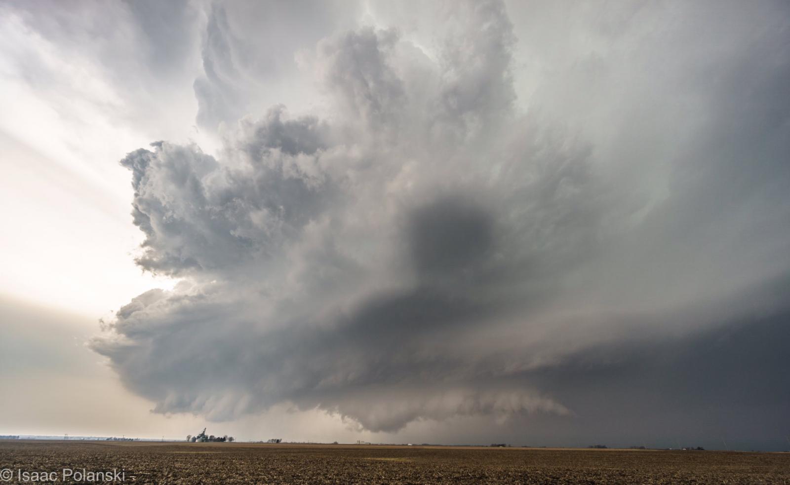
Near Washburn (Isaac Polanski) |
Rutland (Billy Faletti) |
Caption (source) |
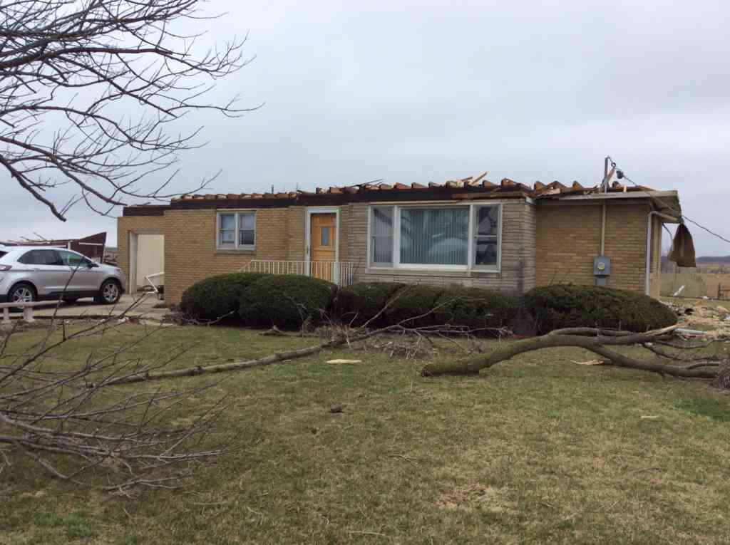
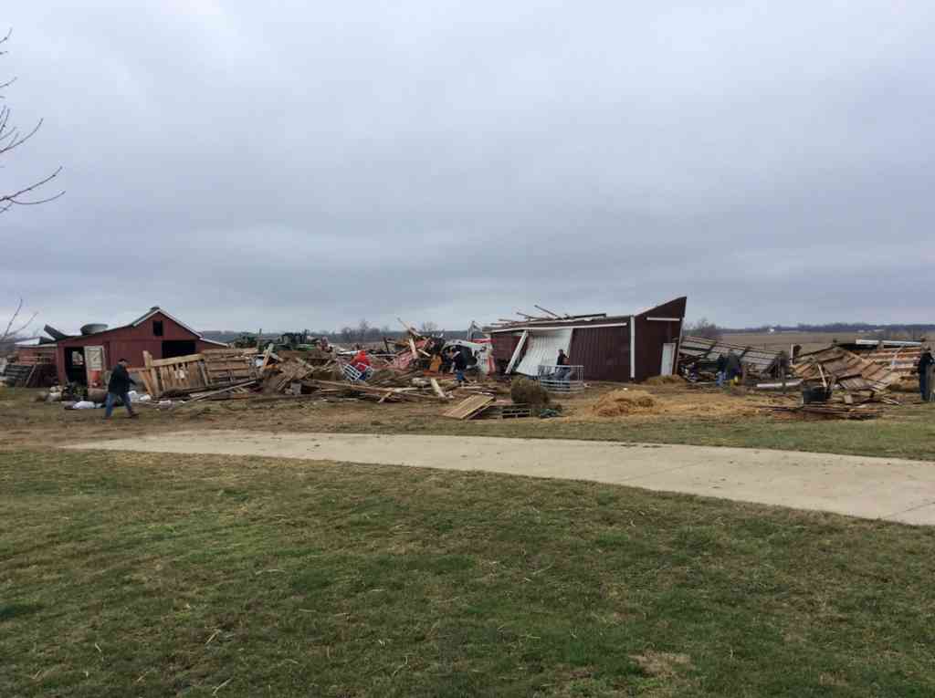
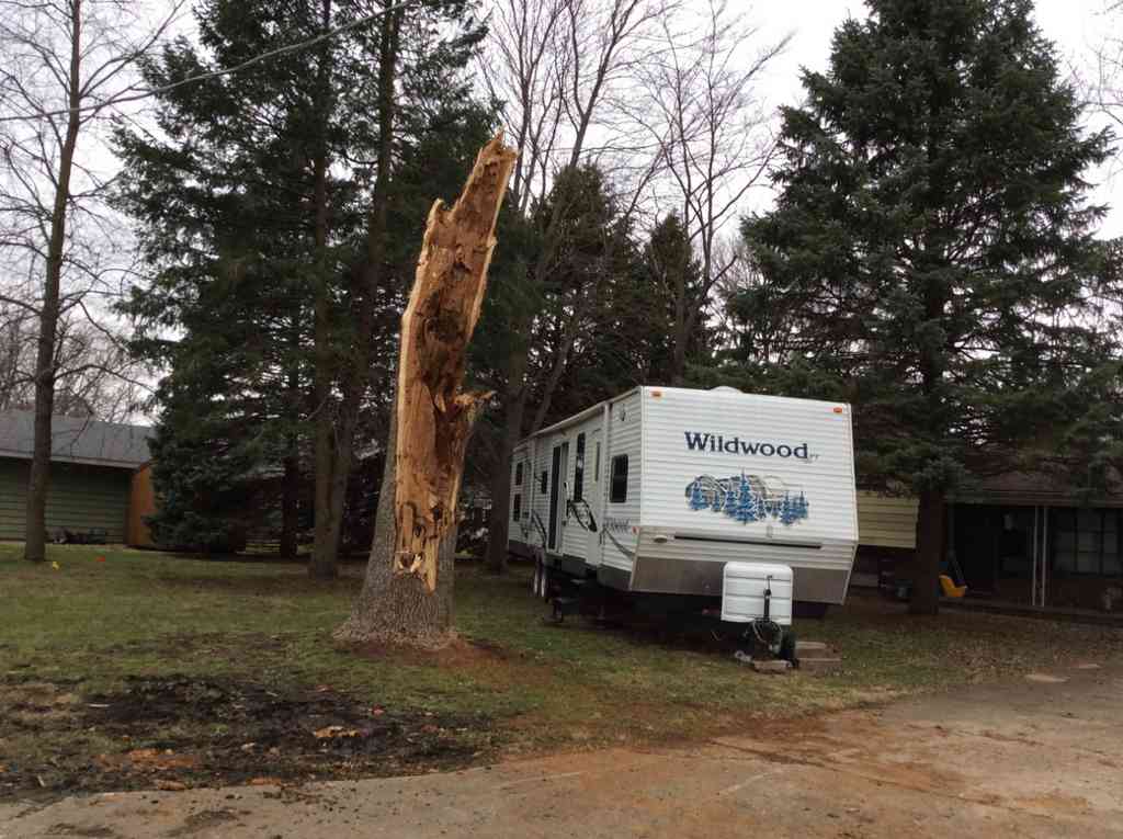
Damage Photos
 |
 |
 |
 |
| West of Washburn (NWS photo) |
Washburn (NWS photo) |
West of Washburn (NWS photo) |
Rutland (NWS photo) |
Radar:
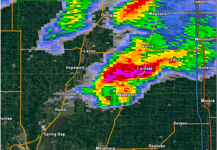 |
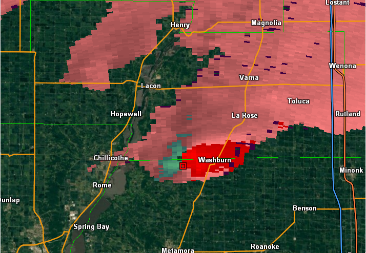 |
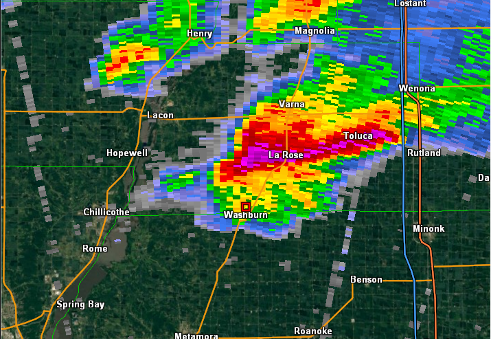 |
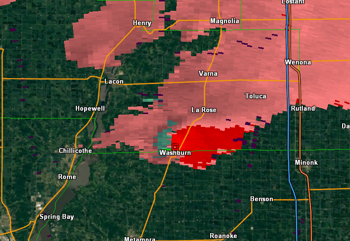 |
| Reflectivity at 5:26 pm | Storm Relative Motion at 5:26 pm | Reflectivity at 5:31 pm | Storm Relative Motion at 5:31 pm |
Mesocyclone Tracks
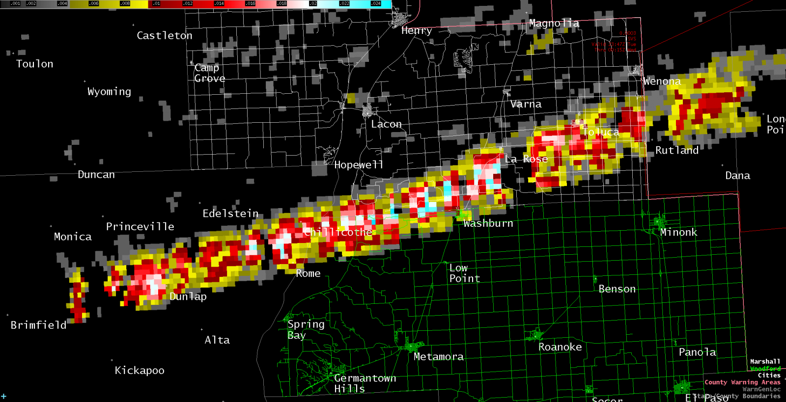 |
The graphic above is a compilation of the parent mesocyclone's track across the area. This particular storm started to show intensification across northern Peoria County, before producing the tornado as it moved over far northern Woodford County. The mesocyclone weakened shortly after entering La Salle County.
Storm Reports
In addition to the tornado, the following storm reports were received. An interactive map is available at this link.
..TIME...   ...EVENT...      ...CITY LOCATION...     ...LAT.LON...
..DATE...   ....MAG....      ..COUNTY LOCATION..ST.. ...SOURCE....
            ..REMARKS..

0318 PM     HAIL             ALTONA
02/28/2017  E0.75 INCH       KNOX               IL   COOP OBSERVER

0410 PM     HAIL             ALTONA
02/28/2017  E1.25 INCH       KNOX               IL   COOP OBSERVER

0440 PM     HAIL             ALSEY
02/28/2017  E1.75 INCH       SCOTT              IL   LAW ENFORCEMENT

0445 PM     HAIL             5 N YATES CITY
02/28/2017  E1.00 INCH       KNOX               IL   FIRE DEPT/RESCUE

0445 PM     HAIL             4 WNW BRIMFIELD
02/28/2017  E0.75 INCH       PEORIA             IL   COUNTY OFFICIAL

            CORNER OF I74/RT78

0458 PM     HAIL             PRINCEVILLE
02/28/2017  E1.75 INCH       PEORIA             IL   EMERGENCY MNGR

0504 PM     HAIL             4 S LAWN RIDGE
02/28/2017  E1.00 INCH       PEORIA             IL   EMERGENCY MNGR

0515 PM     HAIL             CHILLICOTHE             40.92N 89.50W
02/28/2017  E1.00 INCH       PEORIA             IL   EMERGENCY MNGR

0645 PM     HAIL             SHELBYVILLE             39.41N 88.80W
02/28/2017  E1.75 INCH       SHELBY             IL   MESONET

0754 PM     HAIL             2 S XENIA               38.61N 88.64W
02/28/2017  E0.88 INCH       CLAY               IL   EMERGENCY MNGR

0801 PM     HAIL             S XENIA                 38.64N 88.64W
02/28/2017  E1.00 INCH       CLAY               IL   EMERGENCY MNGR

0807 PM     HAIL             3 SE XENIA              38.61N 88.60W
02/28/2017  E1.25 INCH       CLAY               IL   EMERGENCY MNGR

0920 PM     HAIL             GILSON                  40.87N 90.20W
02/28/2017  E0.88 INCH       KNOX               IL   FIRE DEPT/RESCUE

            TIME ESTIMATED BY RADAR.

0925 PM     TSTM WND GST     SMITHFIELD              40.47N 90.29W
02/28/2017  E50.00 MPH       FULTON             IL   EMERGENCY MNGR

0925 PM     TSTM WND GST     CUBA                    40.49N 90.19W
02/28/2017  E50.00 MPH       FULTON             IL   EMERGENCY MNGR

            EOC REPORTS 45-50 MPH.

0938 PM     HAIL             S RUSHVILLE             40.12N 90.57W
02/28/2017  E0.88 INCH       SCHUYLER           IL   EMERGENCY MNGR

            SMALL TREES LIMBS DOWNED AS WELL.

0945 PM     HAIL             BEARDSTOWN              40.01N 90.43W
02/28/2017  E1.00 INCH       CASS               IL   TRAINED SPOTTER

1004 PM     TSTM WND GST     PEKIN                   40.57N 89.63W
02/28/2017  M45.00 MPH       TAZEWELL           IL   EMERGENCY MNGR

1009 PM     TSTM WND GST     1 WNW TREMONT           40.53N 89.51W
02/28/2017  M58.00 MPH       TAZEWELL           IL   EMERGENCY MNGR

            TAZEWELL COUNTY EOC MEASURED.

1012 PM     HAIL             OAKFORD                 40.10N 89.97W
02/28/2017  M1.00 INCH       MENARD             IL   PUBLIC

1015 PM     TSTM WND GST     EUREKA                  40.72N 89.28W
02/28/2017  E44.00 MPH       WOODFORD           IL   PUBLIC

            WITH PEA SIZED HAIL.

1021 PM     TSTM WND GST     GOODFIELD               40.63N 89.27W
02/28/2017  E50.00 MPH       WOODFORD           IL   TRAINED SPOTTER

1025 PM     TSTM WND DMG     1 ESE DEER CREEK        40.62N 89.31W
02/28/2017                   WOODFORD           IL   EMERGENCY MNGR

            SEMI BLOWN OVER ON I74

1053 PM     HAIL             2 E BLOOMINGTON         40.48N 88.94W
02/28/2017  E0.88 INCH       MCLEAN             IL   PUBLIC

1053 PM     TSTM WND GST     2 E BLOOMINGTON         40.48N 88.94W
02/28/2017  E60 MPH          MCLEAN             IL   MESONET

            NEAR INTERSECTION OF IRELAND GROVE AND TOWANDA BARNES
            ROADS

1100 PM     HAIL             2 E BLOOMINGTON         40.48N 88.94W
02/28/2017  E0.88 INCH       MCLEAN             IL   MESONET

1105 PM     HAIL             4 ESE BLOOMINGTON       40.46N 88.90W
02/28/2017  E0.75 INCH       MCLEAN             IL   PUBLIC
1205 AM     TSTM WND GST     DECATUR AIRPORT         39.83N 88.87W
03/01/2017  M52 MPH          MACON              IL   ASOS

1226 AM     HAIL             PHILO                   40.00N 88.16W
03/01/2017  M0.88 INCH       CHAMPAIGN          IL   EMERGENCY MNGR

1218 AM     HAIL             1 SW HOOPESTON          40.46N 87.68W
03/01/2017  E0.88 INCH       VERMILION          IL   EMERGENCY MNGR

1245 AM     HAIL             SULLIVAN                39.60N 88.61W
03/01/2017  E0.75 INCH       MOULTRIE           IL   TRAINED SPOTTER

1245 AM     TSTM WND GST     3 S DANVILLE            40.10N 87.62W
03/01/2017  M50 MPH          VERMILION          IL   EMERGENCY MNGR

            RECORDED AT EMA HEADQUARTERS.

1245 AM     TSTM WND DMG     DANVILLE                40.14N 87.62W
03/01/2017                   VERMILION          IL   EMERGENCY MNGR

            EM REPORTS MULTIPLE POWER LINES AND LARGE TREE LIMBS
            DOWNED THROUGHOUT THE CITY.
Climatology
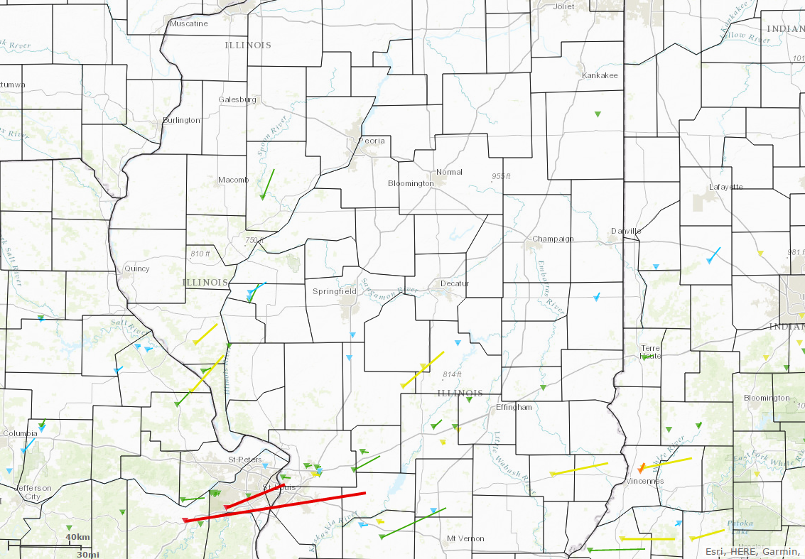
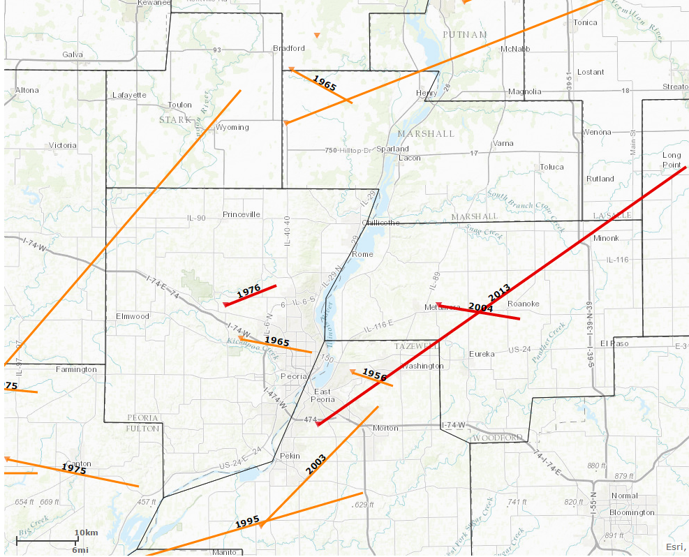
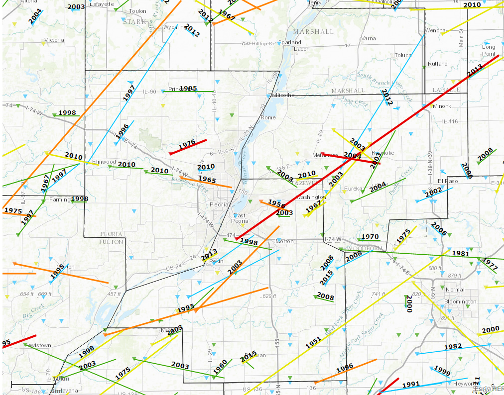
The following graphics are from the Midwestern Regional Climate Center's Tornado Tracks tool.
 |
 |
 |
| February tornadoes since 1950 |
F-3/EF-3 (orange) and F-4/EF-4 (red) tornadoes since 1950 |
All tornadoes since 1950. Intensity in order from lowest (F-0) to highest (F-5): blue, green, yellow, orange, red, purple. |
While not unheard of, February tornadoes are very rare across central Illinois. Since 1950, only 4 tornadoes have occurred across areas of Illinois north of I-72 (first image), but none around Woodford or Marshall Counties. Zooming in the general area of Woodford County in the second image (Washburn is highlighted in yellow), a handful of F-3/EF-3 or F-4/EF-4 strength tornadoes have been observed since 1950, but none along the immediate track of this tornado. The closest approach was the Washington EF-4 tornado of November 17, 2013. Looking at all observed tornadoes in the area since 1950 (3rd image), the area along the Woodford/Marshall County border (near the Washburn tornado track) has seen very little tornado activity overall.
 |
Media use of NWS Web News Stories is encouraged! Please acknowledge the NWS as the source of any news information accessed from this site. |
 |