Catastrophic Super Typhoon Bavi's eyewall has reached Rota and is expected to bring dangerous winds, heavy rainfall and storm surge to Guam, Rota, Tinian and Saipan. A Typhoon Warning remains in effect. Heavy to excessive rainfall will continue to bring a flooding threat from coastal Mid-Atlantic to southern New England through Monday. Read More >
Overview
|
A Mesoscale Convective System (MCS) tracked across areas from eastern Iowa into western Ohio Sunday night and Monday morning, July 14-15, 2024. This caused an extensive area of wind damage across areas mainly north of I-74 in Illinois, along with five tornadoes in Marshall County. |
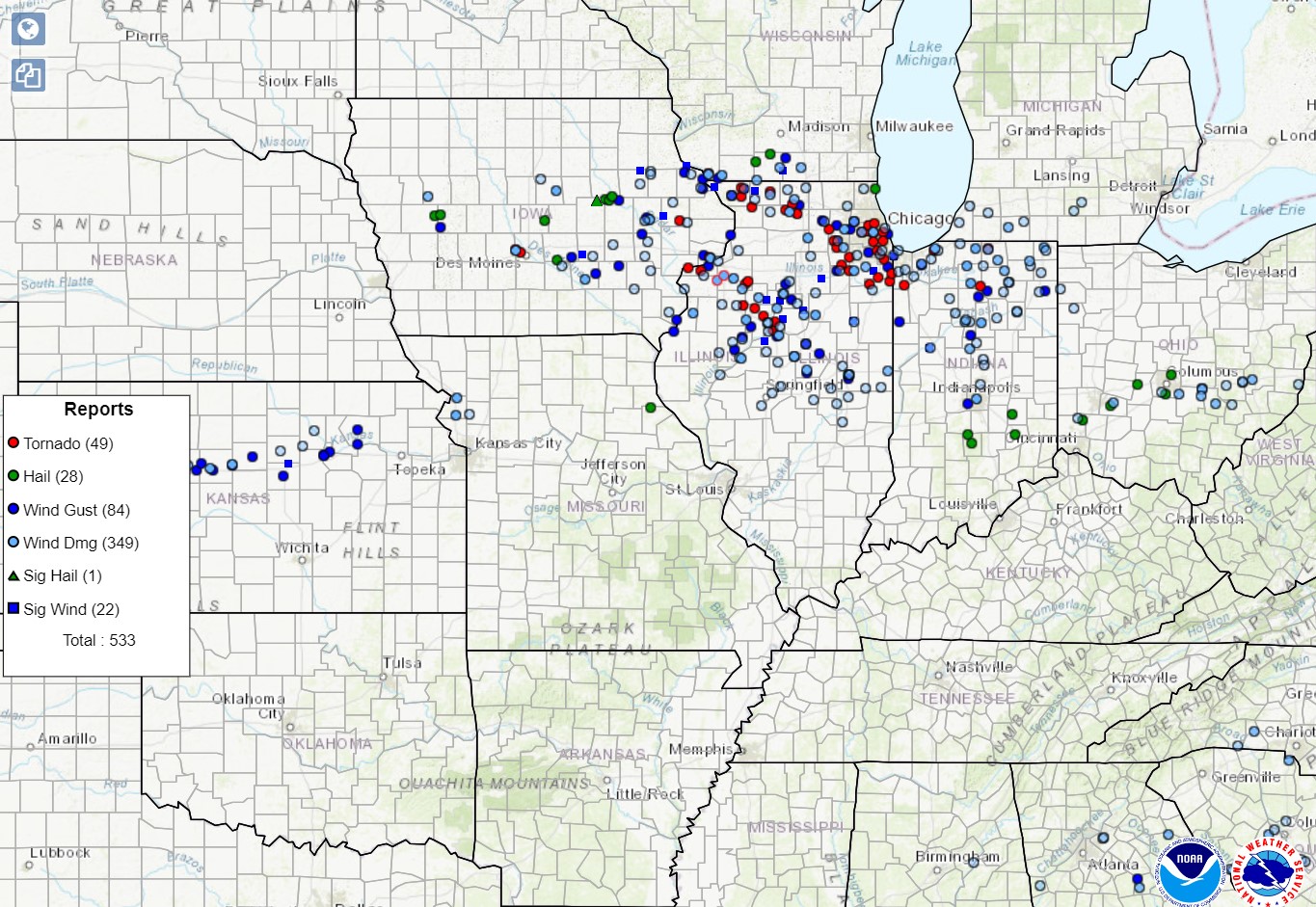 Storm reports through 7 am Monday, July 15 |
Tornadoes
|
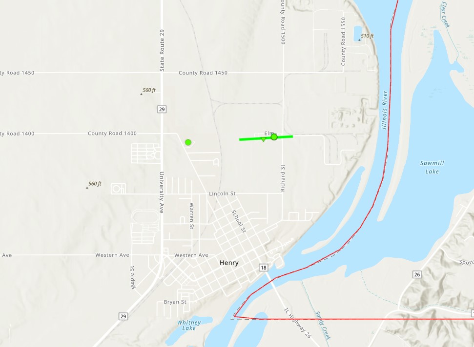
Henry Tornado
|
||||||||||||||||
|
||||||||||||||||
|
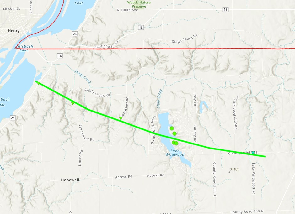
Lake Wildwood Tornado
|
||||||||||||||||
|
||||||||||||||||
|
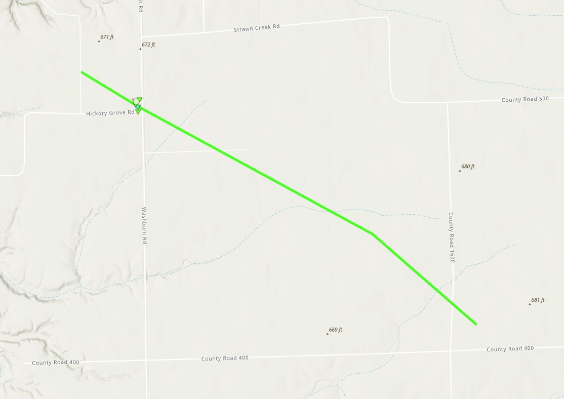
Lacon Tornado
|
||||||||||||||||
|
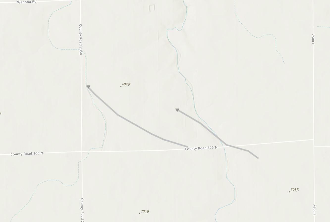
Varna Tornadoes
|
||||||||||||||||
The Enhanced Fujita (EF) Scale classifies tornadoes into the following categories:
| EF0 Weak 65-85 mph |
EF1 Moderate 86-110 mph |
EF2 Significant 111-135 mph |
EF3 Severe 136-165 mph |
EF4 Extreme 166-200 mph |
EF5 Catastrophic 200+ mph |
 |
|||||
Wind & Hail:
Add a written summary or simply an LSR map in this section. If writing an extensive report, you can break the report down into wind and hail below (otherwise delete).
Wind
Insert summary here.
| Caption | Caption | Caption | Caption |
Hail
Insert summary here.
| Caption | Caption | Caption | Caption |
 |
Media use of NWS Web News Stories is encouraged! Please acknowledge the NWS as the source of any news information accessed from this site. |
|