Overview
|
Severe thunderstorms produced tornadoes and heavy rain in parts of east central Illinois during the evening of Friday, September 9th, 2016. Four tornadoes occurred within a one hour period between 6:30 pm and 7:30 pm. The strongest tornado was rated an EF2 in southeast Champaign County south of the towns of Sidney and Homer. |
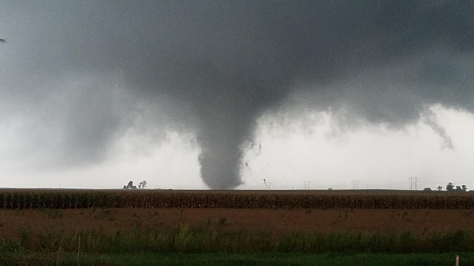 Tornado south-southeast of Sidney. Photo Courtesy of Jeff Frame |
Tornadoes:
|
Tornado #1: 3.6 miles south of Sidney to 2.5 miles south of Homer
|
||||||||||||||||
|
||||||||||||||||
|
Tornado #2: 1.4 miles south of Casey
|
||||||||||||||||
|
||||||||||||||||
|
Tornado #3 -- 3.5 miles south of Bismarck to 2.4 miles south of Bismarck
|
||||||||||||||||
|
||||||||||||||||
|
Tornado #4 - 2 miles southwest of Catlin
|
||||||||||||||||
The Enhanced Fujita (EF) Scale classifies tornadoes into the following categories:
| EF0 Weak 65-85 mph |
EF1 Moderate 86-110 mph |
EF2 Significant 111-135 mph |
EF3 Severe 136-165 mph |
EF4 Extreme 166-200 mph |
EF5 Catastrophic 200+ mph |
 |
|||||
Radar:
Radar Images
 |
 |
 |
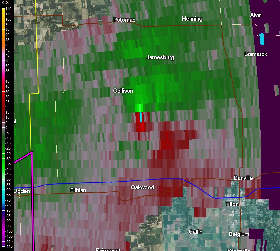 |
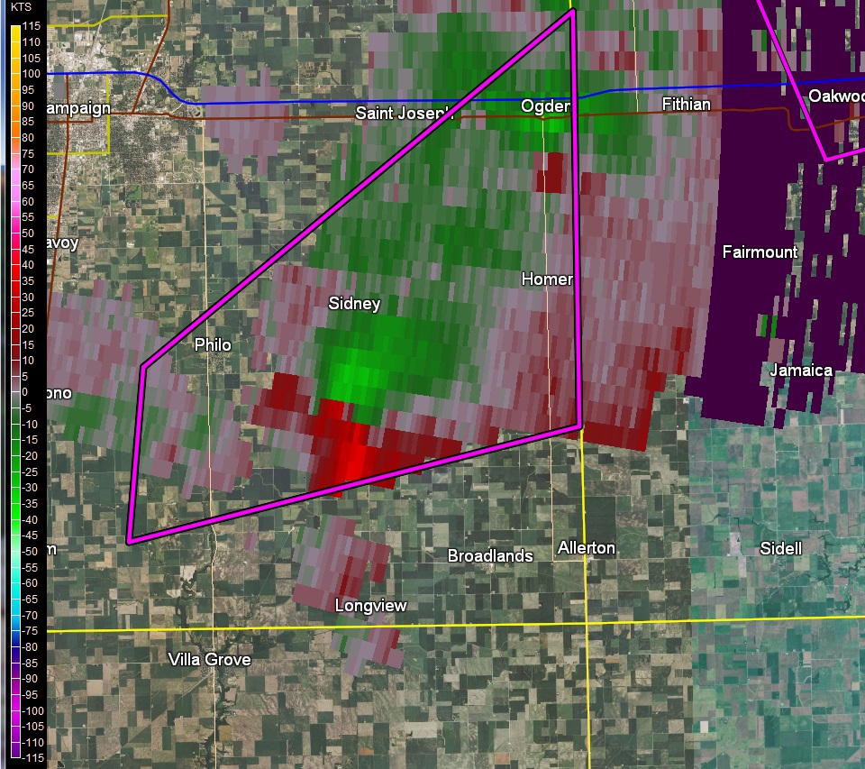
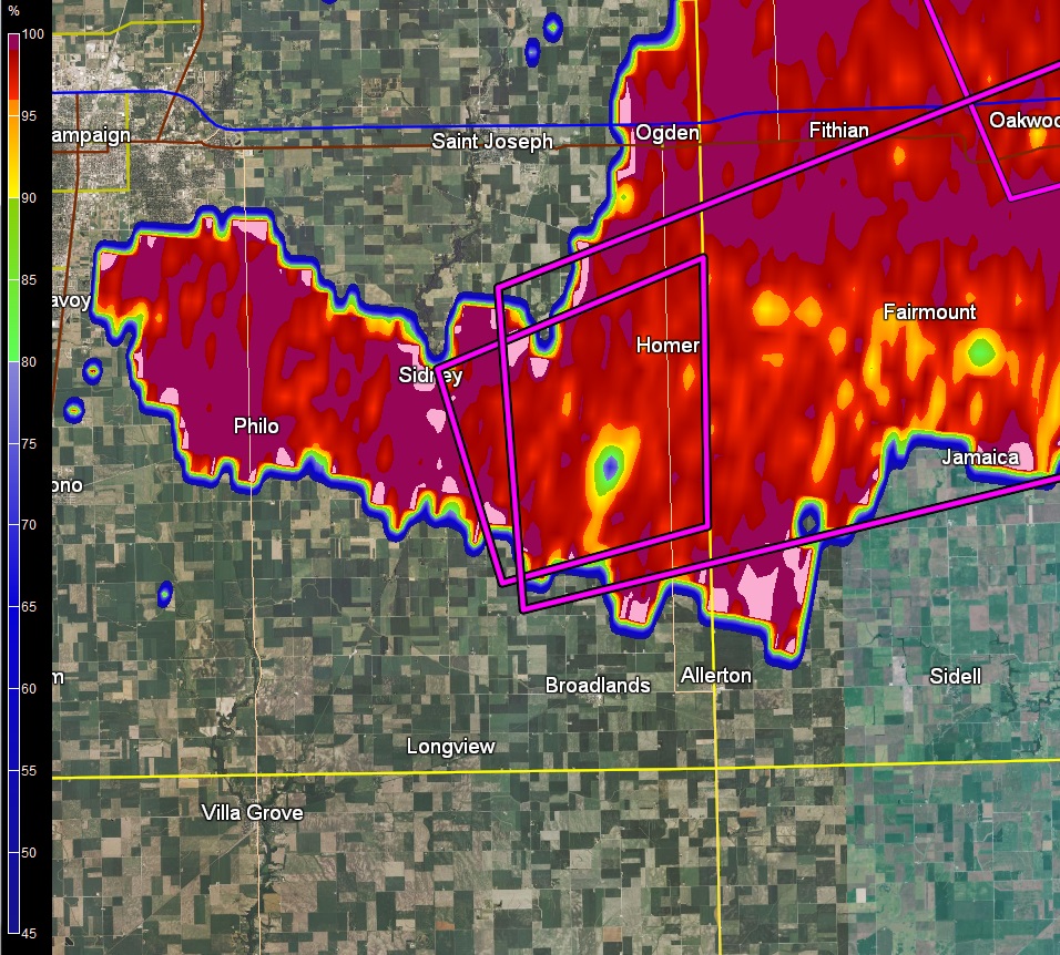
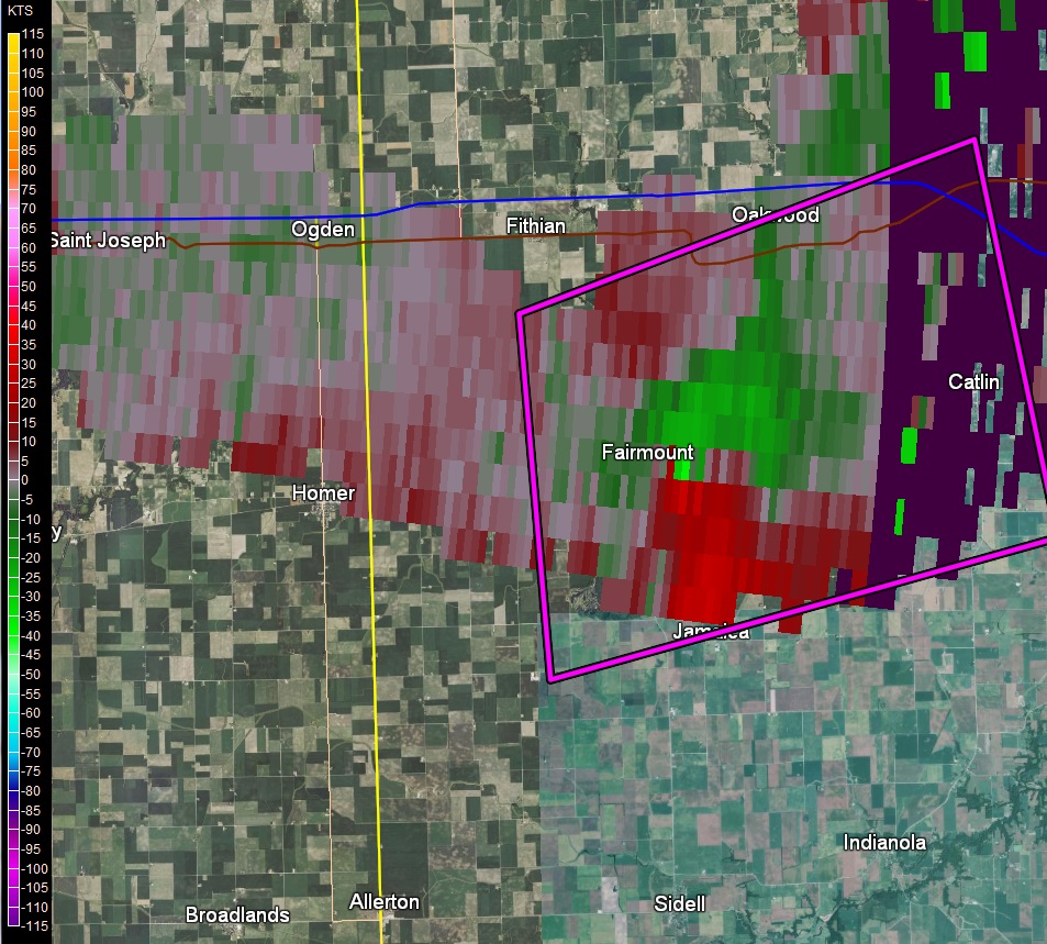
| Circulation seen on radar south of Sidney at 6:32 pm, just before tornado touchdown | Tornado debris signature southwest of Homer (blue circle) at 6:44 pm | Circulation seen on radar just east of Fairmount at 7:04 pm, which led to Catlin tornado | Circulation seen on radar southeast of Collison at 6:20 pm, which led to Bismarck tornado |
Warning Timeline
| Time Issued | Tornado Warning Location | Expiration Time | Reports |
|---|---|---|---|
| 6:09 pm | Southeast Champaign County | 6:45 pm | Tornado touchdown 3.4 miles south of Sidney at 6:33 pm Warning issued 24 minutes before touchdown |
| 6:23 pm | Southern Clark and southeast Cumberland Counties |
7:15 pm | Tornado touchdown 1.4 miles south of Casey at 6:44 pm Warning issued 21 minutes before touchdown |
| 6:25 pm | Northeast Vermilion County | 7:00 pm | Tornado touchdown 3.5 miles south of Bismarck at 6:34 pm Warning issued 9 minutes before touchdown |
| 6:44 pm | Southwest Vermilion and southeast Champaign Counties | 7:15 pm | Tornado touchdown 2 miles southwest of Catlin at 7:13 pm Warning issued 29 minutes before touchdown
|
| 7:15 pm | Southeast Vermilion County | 7:45 pm | No additional tornado reports |
| 7:17 pm | Northeast Clark County | 8:00 pm | No tornado reports |
Area Tornado History
 |
 |
 |
| Champaign County tornadoes since 1950 | Clark County tornadoes since 1950 | Vermilion County tornadoes since 1950 |
Southern Champaign County has a history of tornadoes, with several strong tornadoes reported since 1950. While none took a similar track to this particular tornado, there were 3 that have affected the general area:
Clark County tornadoes have been more sporadic, with only 9 reported since 1950, and none since 2007. Weak tornadoes have occurred near Casey in 1982, 1985, and 1990, with the latter (June 2, 1990) producing $25,000 damage.
In Vermilion County, several stronger tornadoes have affected areas near Bismarck over the years. The closest ones:
 |
Media use of NWS Web News Stories is encouraged! Please acknowledge the NWS as the source of any news information accessed from this site. |
 |